
씽발라바튼 여행 가이드

Þingvallavatn (anglicised to Thingvallavatn, ‘the Lake of the Fields of Parliament’) is a rift valley lake located roughly forty-minutes drive from Iceland’s capital city, Reykjavík.
This location is perfect to visit on a self drive tour.
Features of Thingvallavatn
Þingvallavatn is partially within the boundaries of Þingvellir National Park, Iceland’s oldest National Park and only one with UNESCO World Heritage Site status.
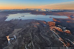
Covering an area of 84 square kilometres (32 square miles), Þingvallavatn is the largest natural lake in Iceland with its greatest depth measuring at 114 metres (374 feet). Þingvallavatn is situated on the Mid-Atlantic Rift, on a part of the ridge known as the Reykjanes Ridge.
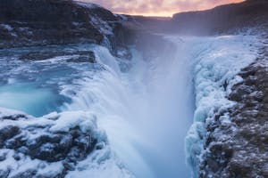
The lake has only one outflow, the river Sog.
Of particular note to biologists and fishermen are the four morphs of Arctic Char that inhabit the lake. The lake’s char are an excellent example of species evolving to fit and adapt to a secluded environment; over ten thousand years, one species of Char has transformed into four different-sub branches. Other fish in the lake include the the Brown Trout and the Three-Spine Stickleback.
History and Geology
Þingvallavatn takes its name from the historical founding of the Alþingi, which occurred in 930 AD at what is now known as Þingvellir National Park. Þingvellir literally translates to ‘Fields of Parliament’.
The Alþingi was the first democratically elected representative parliament in world history (examples such as Ancient Athens were direct, not representative, democracies); Icelanders used to travel by foot or horseback simply to congregate at Þingvellir where they would hear the latest laws and judgements of the island.
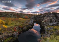
Þingvellir National Park is also notable for its geology. Given its position on the Mid Atlantic Ridge, the park is one of the only places on the planet where visitors can see both the North American and Eurasian tectonic plates standing exposed from the earth.
Footpaths allow you to get up close and personal to the plates, standing right where the ancient settlers once did. In between the tectonic plates lies fields of dried volcanic rock, blanketed with a thick, yet fragile layer of Icelandic moss.
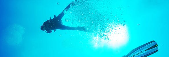
Scuba Diving in Thingvallavatn
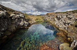
Scuba diving around Þingvallavatn revolves around two sites, Silfra Fissure and Davíðsgjá (David’s Crack), the former being one of the most popular spots on the planet for snorkelling and underwater exploration.
Silfra Fissure is situated between the North American and Eurasian tectonic plates and is filled with crystal-clear glacial water originating from the Langjökull ice cap. The water measures at between two degrees Celsius all year round, with a slight current preventing the fissure from ever freezing over.
Davíðsgjá is found within Þingvallavatn and is often considered the darker and more dramatic cousin of Silfra Fissure, resembling the gorge formation so prevalent across the Mid Atlantic Rift.
Only certain tour operators provide tours into Davíðsgjá, so make sure to do some research beforehand if you are looking to access this dive site during your time in Iceland.


아이슬란드 최대의 여행 마켓플레이스를 휴대폰에 다운로드하여 전체 여행을 한 곳에서 관리하세요
휴대폰 카메라로 이 QR 코드를 스캔하고 나타나는 링크를 누르면 아이슬란드 최대 여행 시장이 내 손 안에! 다운로드 링크가 포함된 SMS나 이메일을 받으려면 전화번호나 이메일 주소를 추가하세요


