South Coast Day Tour with Waterfalls & Jokulsarlon Glacier Lagoon with Transfer from Reykjavik
Description
Summary
Description
Join this day tour to visit the crown jewel of Iceland, Jökulsárlón Glacier Lagoon. As one of the most stunning places in Iceland, you’ll stand in awe watching the magnificent blue icebergs, catch a glimpse of some resting seals and wander through the famous diamond beach. This tour is perfect for those wanting to visit this beautiful and unique attraction while exploring the best spots of the spectacular South Coast.
On your journey to Jökulsárlón Glacier Lagoon, you will get to visit plenty of amazing natural sights. See countless waterfalls cascading majestically down towering cliff faces, meadows of quintessential farmland sprawling to the shores of the Atlantic, mountainous glacier tongues protruding through gaps in the terrain, and gentle rivers that slice through the landscape. You’ll visit a number of the best natural attractions in Iceland and cross a mixture of landscapes, from mountains and volcanoes to lava fields.
On top of all that, you will traverse the black sand deserts of Skeiðarársandur and Sólheimasandur. You will also pass through the charming fishing village of Vik, explore the waterfalls Seljalandsfoss and Skógafoss and even the highly famous Vatnajökull National Park, which hosts Europe’s largest glacier, Vatnajökull glacier.
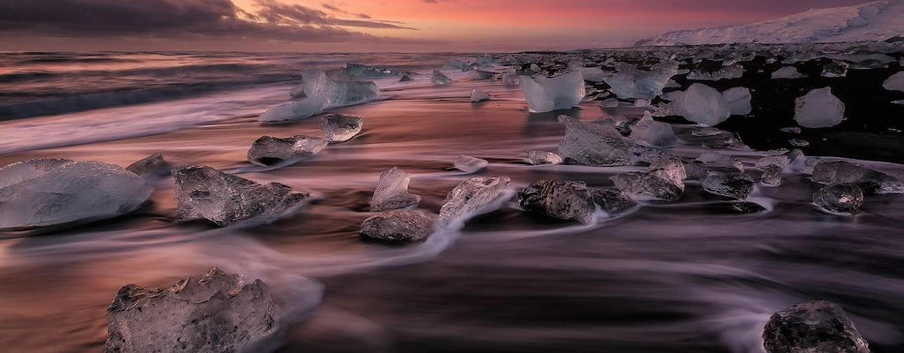
At Jökulsárlón, you’ll get plenty of time to watch and get some great photos of the diamond blue icebergs that move gracefully through the water on the way out to sea. You’ll also be able to see the giant glacier wall of Breiðamerkurjökull which creaks and crumbles as more icebergs drift into the lagoon. Many of you might recognise the glacier from such films as Tomb Raider and James Bond: Die Another Day. It’s the perfect location to watch one of nature’s most significant movements in a quiet and pristine setting.
Watch as the icebergs slowly knock into each other and regularly flip over in the deep waters. This experience is made all the more perfect by happy seals playing together in the water and moving across different icebergs. You can also check out the shoreline, where the icebergs shift off into the sea from the diamond beach, creating fantastic photo opportunities. The variety of shapes, colours and movements of the ice will leave you with a great selection of pictures and memories of Iceland.
So what are you waiting for? Don’t delay in booking this fantastic day tour across the beautiful landscapes of South Iceland, finally arriving at the tour highlight, Jökulsárlón Glacier Lagoon.
Check availability by choosing a date and book your Iceland adventure.
Included
Activities
What to bring
Good to know
You will stop at all the main attractions in South Iceland between Seljalandsfoss and the glacier lagoon Jökulsárlón
Verified reviews
Similar tours


Download Iceland’s biggest travel marketplace to your phone to manage your entire trip in one place
Scan this QR code with your phone camera and press the link that appears to add Iceland’s biggest travel marketplace into your pocket. Enter your phone number or email address to receive an SMS or email with the download link.


