Goldener Kreis mit Kerid & Blaue-Lagune-Tour mit Eintrittskarten & Abholung von Reykjavik
Beschreibung
Zusammenfassung
Beschreibung
Diese Tour führt dich an einem einzigen Tag zu fünf der beliebtesten und beeindruckendsten Naturattraktionen in Island. Der Goldene Kreis und die Blaue Lagune sind definitiv die wichtigsten Sehenswürdigkeiten für jeden Island-Reisenden. Bei dieser Tour kannst du beides am selben Tag auf angenehme, einfache und entspannende Weise erleben: Dieses Tour-Paket beinhaltet auch den Eintritt zum Kerid-Vulkankrater und Eintrittskarten für die Blaue Lagune, sodass du nichts weiter organisieren musst. Und keine Sorge, du wirst genug Zeit haben, um die großartigen Naturwunder an jedem Ort zu genießen.
Die Tour startet in Reykjavík und deine erste Station ist der Thingvellir-Nationalpark. Dies ist einer der Schätze Islands, sowohl aufgrund seiner Bedeutung in der isländischen Geschichte als auch wegen seiner erstaunlichen Schönheit. Thingvellir ist ein UNESCO-Weltkulturerbe und war von 930 bis 1798 der Sitz des isländischen Parlaments. Zu den vielen Attraktionen in Thingvellir gehört, dass sich hier die eurasische und amerikanische Tektonikplatte treffen und du mit jedem Fuß auf einem der beiden Kontinente stehen kannst!
Als Nächstes steht ein Besuch des beliebten Geysirgebietes auf dem Programm. Heiße Quellen sind ein besonderes Naturmerkmal Islands und der große Geysir ist in der ganzen Welt zu einem Symbol für Island geworden. Heute steht sein Nachbar Strokkur im Mittelpunkt, der alle paar Minuten ausbricht und das kochend heiße Wasser in eine Höhe von bis zu 20 Metern spuckt – und so ein spektakuläres Naturschauspiel bietet. In der Gegend von Geysir kannst du auf Wunsch Mittagessen oder Snacks kaufen.
Der Gullfoss, oder der goldene Wasserfall, ist der König der isländischen Wasserfälle. Seine unglaubliche rohe Kraft und Schönheit werden dir den Atem rauben, wenn das Wasser unerbittlich über 32 Meter in eine zerklüftete Schlucht hinabstürzt.
Thingvellir, Gullfoss und Geysir bilden den traditionellen Goldenen Kreis. Um diese Tour noch spannender zu gestalten, besuchst du auch den Kerid-Vulkankrater. Der 55 Meter tiefe Krater ist über 3.000 Jahre alt und eine einzigartige, farbenfrohe Kreation der isländischen Natur.
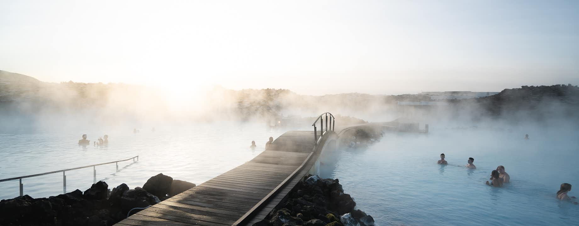
Nachdem du die großartigen Naturschauspiele genossen hast, ist es Zeit, zur berühmten Blauen Lagune zu fahren, wo du dich im natürlich heißen Wasser entspannen und die großartigen Einrichtungen dort genießen kannst. Die Blaue Lagune ist meist lange im Voraus ausverkauft. Da diese Tour jedoch die Komfort-Eintrittskarten enthält, kannst du dich auf einen fantastischen Tag in Island freuen, sobald du diese Tour gebucht hast.
Reserviere deinen Platz jetzt, bevor die Tour ausgebucht ist, denn sie ist sehr beliebt und führt dich zu den besten Attraktionen in Island.
Inklusive
Karte
Aktivitäten
Was du mitbringen solltest
Gut zu wissen
Diese Tour dauert bis zu 11 Stunden. Die Mahlzeiten sind nicht inbegriffen, es wird jedoch eine Mittagspause und eine Kaffeepause am Nachmittag eingelegt.
Kundenbewertungen
Ähnliche Touren


Lade Islands größten Reisemarktplatz auf dein Handy, um deine gesamte Reise an einem Ort zu verwalten.
Scanne diesen QR-Code mit deiner Handykamera und klicke auf den Link, der erscheint, um Islands größten Reisemarktplatz in deine Tasche zu laden. Füge deine Telefonnummer oder E-Mail-Adresse hinzu, um eine SMS oder E-Mail mit dem Download-Link zu erhalten.


