Self-drive economico di 10 giorni dell'Islanda | La Ring Road e la penisola di Snæfellsnes
Descrizione
Riassunto
Descrizione
Sfrutta al massimo il soggiorno in Islanda con questo tour self-drive di 10 giorni. Un'avventura durante la quale scoprirai le numerose meraviglie naturali che l'Islanda può offrire e le attrazioni di cui non conoscevi l'esistenza. Prenota questo conveniente pacchetto self drive e risparmia sul giro completo dell'Islanda lungo la Rong road e la penisola di Snæfellsnes.
Viaggia seguendo la Ring Road e attraversa innumerevoli meraviglie naturali, come le cascate del sud, gli affascinanti villaggi di pescatori dell'est, la natura ultraterrena del nord e i leggendari ghiacciai dell'ovest .
Sei tu a guidare, quindi puoi decidere dove andare e quando partire. Non ci sono guide turistiche, quindi puoi goderti i posti senza. Sei libero di trascorrere tutto il tempo che desideri, in ogni punto.
Durante la fase di prenotazione avrai la possibilità di aggiungere numerose escursioni all'itinerario, per esempio fare snorkeling tra due continenti nel Parco Nazionale di Thingvellir, navigare nella stupenda laguna glaciale di Jokulsarlon, avventurarti in un vulcano o fare una passeggiata a cavallo nella campagna islandese.
Quindi non esitare. Viaggia nel paese, risparmia e crea la vacanza perfetta self-drive di 10 giorni. Controlla la disponibilità, scegliendo una data.
Inclusi
Destinazioni
Mappa
Attrazioni
Attività
Dettagli di viaggio
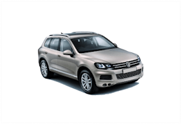
Auto
Auto


Small car


Medium car


Premium car

Large car
SUV
Personalizza il tuo itinerario
Giorno 1 - Reykjavik
Giorno 1 - Reykjavik
- Reykjavik - Giorno di arrivo
- More
Ritira l'auto all'aeroporto internazionale di Keflavik, prima di raggiungere l'alloggio nel centro di Reykjavik. In rotta verso la capitale dell'Islanda, potresti fare una sosta alla Laguna Blu. Questa spa di fama mondiale è nota per le acque curative, gli azzurri vivaci e i trattamenti di lusso. L'atmosfera ultraterrena è data dal fatto che si trova nel mezzo di un campo di lava ricoperto da muschio. Se aggiungi la Laguna Blu, l'esperienza verrà organizzata in base al volo. Se non hai tempo o non vuoi approfittarne oggi, puoi sempre aggiungerla a un altro giorno. Il consulente di viaggio la organizzerà per te. Se hai del tempo libero, c'è ancora molto da vedere e da fare a Reykjavik e nella penisola di Reykjanes. Dopo esserti sistemato in hotel, goditi uno dei centri cittadini più vivaci d'Europa. Esplora i musei, le gallerie, i ristoranti e i bar, a tuo piacimento. Trascorri la notte nella bellissima Reykjavik.
Esperienze
Alloggio
Giorno 2 - Informazioni sull'Islanda sudoccidentale
Giorno 2 - Informazioni sull'Islanda sudoccidentale
- Informazioni sull'Islanda sudoccidentale
- More
- Parco Nazionale di Thingvellir
- Cascata Gullfoss
- Area geotermica di Geysir
- Cratere Kerid
- More
Il secondo giorno visiterai il famoso Circolo d'Oro. Il percorso include il Parco Nazionale di Thingvellir, storicamente e geograficamente significativo, le sorgenti termali dell'area geotermica di Geysir e la magnifica cascata di Gullfoss. Thingvellir è la prima tappa della giornata. Questo parco nazionale è il luogo in cui, più di mille anni fa, venne fondato il parlamento islandese, Althingi; il che lo rende il più antico parlamento ancora in funzione al mondo. Il parco si trova in una fossa tettonica tra due placche tettoniche che si stanno allontanando, spaccando il paesaggio circostante. Infatti, anche nel resto della regione troverai numerose crepe e fessure, prodotte dalla deriva dei continenti. Una di queste fessure, Silfra, si trova nel lago Thingvallavatn e puoi scegliere di fare un tour di snorkeling nelle acque cristalline di questo canyon, dove avrai l'opportunità di nuotare tra due continenti. La prossima tappa è l'area geotermica di Geysir, sede di pozze di fango ribollenti, dove si trova la sorgente omonima, formatasi 10.000 anni fa, e Strokkur, che erutta ogni 5-10 minuti, creando colonne d'acqua alte 49-66 piedi (15-20 m). L'ultima tappa del percorso è la maestosa cascata Gullfoss. Alimentato dal secondo ghiacciaio più grande dell'Islanda, Langjokull, il fiume Hvita scorre verso sud prima di buttarsi in una gola di 32 m (105 piedi), creando questa splendida cascata. Qui puoi fare un emozionante tour in motoslitta sulla calotta glaciale del ghiacciaio di Langjokull. Se preferisci qualcosa di un po' meno movimentato, puoi fare un giro a cavallo nella valle di Reykjadalur. Sulla strada per la città di Hvolsvollur, dove trascorrerai la notte, puoi fermarti al pittoresco lago del cratere Kerid per ammirare le sue acque blu zaffiro che contrastano con le rocce rosse di lava.
Esperienze
Alloggio
Giorno 3 - Informazioni sull'Islanda sudorientale
Giorno 3 - Informazioni sull'Islanda sudorientale
- Informazioni sull'Islanda sudorientale
- More
- Cascata Seljalandsfoss
- Cascata Skogafoss
- Spiaggia di sabbia nera di Reynisfjara
- Faraglioni di Reynisdrangar
- Riserva naturale di Skaftafell
- Svartifoss
- More
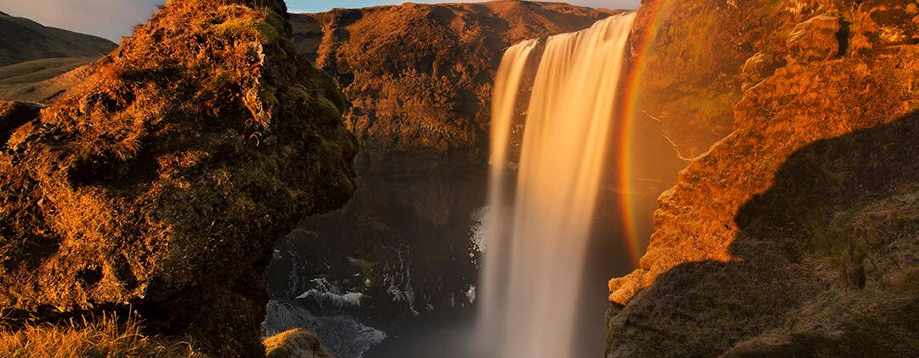
Oggi viaggerai lungo la costa meridionale dell'Islanda, famosa per le cascate, i vulcani, i ghiacciai e la bellissima costa. La prima tappa della giornata è la cascata Seljalandsfoss. Un sentiero ti condurrà dietro l'acqua, così potrai osservare il paesaggio da una diversa prospettiva. La prossima fermata è Skogafoss, una delle cascate più grandi d'Islanda con una larghezza di 82 piedi (25 m) e un dislivello di 197 piedi (60 m). Nelle giornate di sole potresti vedere un doppio arcobaleno formarsi nella nebbia. Mentre viaggi tra le cascate, guiderai vicino al famigerato ghiacciaio Eyjafjallajokull. Il vulcano sotto questo ghiacciaio ha causato l'interruzione di tutto il traffico aereo in Europa quando è eruttato nel 2010. Se lo desideri, puoi sfruttare questa opportunità per visitare una grotta di ghiaccio naturale a Myrdalsjokull. Partendo al mattino dal villaggio di Vik, questo tour ti porterà all'interno del ghiacciaio per vedere tutte le meraviglie. Potresti anche fare una rinfrescante escursione sul ghiacciaio di Myrdalsjokull, di Solheimajokull, o un'emozionante corsa in motoslitta. Vik si trova più a sud dei ghiacciai ed è il luogo perfetto per fermarsi, rilassarsi e fare rifornimento prima di proseguire il viaggio. Vicino c'è la spiaggia di sabbia nera di Reynisfjara, nota per le scogliere scure, le colonne esagonali di basalto e le strutture vulcaniche alte 217 piedi (66 m) che si ergono direttamente dall'oceano. Un'altra tappa è l'area di Skaftafell, nel Parco Nazionale di Vatnajokull, un paradiso di flora verde che cresce tra sabbie nere e un ghiacciaio bianco. Troverai numerosi sentieri escursionistici che conducono a luoghi meravigliosi, come la cascata Svartifoss, d'ispirazione per l'architettura della famosa chiesa di Hallgrimskirkja a Reykjavik. Se non hai scelto escursioni in mattina, potresti terminare la giornata con un'escursione sul ghiacciaio nella riserva naturale di Skaftafell. Successivamente, andrai nell'alloggio vicino alla laguna glaciale di Jokulsarlon (non preoccuparti, domani avrai tempo per esplorare la laguna).
Esperienze
Alloggio
Giorno 4 - Informazioni sui fiordi orientali
Giorno 4 - Informazioni sui fiordi orientali
- Informazioni sui fiordi orientali
- More
- Jokulsarlon
- Spiaggia dei Diamanti
- Vestrahorn
- Hengifoss
- Foresta Hallormsstadaskogur
- Vopnafjordur
- More
Puoi iniziare la giornata esplorando uno dei luoghi più famosi d'Islanda, la laguna glaciale di Jokulsarlon. Qui vedrai enormi iceberg che si sono staccati da un ghiacciaio vicino e che galleggiano tranquillamente nella laguna. Puoi optare per un giro in barca per avvicinarti agli iceberg e alle foche che giocano. Se guidi ancora un po', arrivi alla spiaggia dei Diamanti, dove il ghiaccio brilla alla luce del sole sulla sabbia nera, ricordando le pietre preziose. Dirigiti verso i fiordi orientali, oltrepassando magnifiche montagne e villaggi di pescatori, prima di raggiungere la città di Egilsstadir, dove trascorrerai la notte. La città si trova sulle rive del fiume Lagarfljot, dove si dice che viva un mostro simile a un serpente.
Esperienze
Alloggio
Giorno 5 - Informazioni sul nord-est
Giorno 5 - Informazioni sul nord-est
- Informazioni sul nord-est
- More
- Fiordo e valle di Borgarfjordur Eystri
- Area del lago Myvatn
- More
Oggi ti dirigerai verso le meraviglie naturali dell'area di Myvatn. Il lago è il quarto più grande dell'Islanda e presenta numerosi isolotti, alcuni dei quali sono pseudocrateri. Un'esplosione di vapore formò questi crateri circa 2.500 anni fa, quando la lava calda attraversò la superficie bagnata. Nelle vicinanze si trova l'area di Dimmuborgir, un vasto campo di formazioni laviche dalla forma strana e di grotte mistiche. Secondo la leggenda, qui sprofondò Lucifero quando fu esiliato dal cielo. Oggi hai diverse opzioni. Puoi fare un'escursione fino al bordo del vulcano di Hverfjall e fino all'area geotermica di Namafjall, con pozze di fango bollente e sorgenti fumanti. Dopo, puoi fare un bagno rilassante nelle acque dei bagni naturali di Myvatn prima di dirigerti verso l'alloggio nella regione di Myvan.
Esperienze
Alloggio
Giorno 6 - Informazioni sull'Islanda settentrionale
Giorno 6 - Informazioni sull'Islanda settentrionale
- Informazioni sull'Islanda settentrionale
- More
- Cascata Godafoss
- Canyon di Asbyrgi
- Cascata Dettifoss
- More
Se desideri esplorare ancora l'area di Myvatn, è la tua occasione. Puoi anche guidare nel canyon di Jokulsargljufur per dirigerti verso Dettifoss, la cascata più potente d'Europa, e il mitico canyon di Asbyrgi, con la forma di zoccolo dovuta al cavallo di Odino. Quando sei pronto, puoi dirigerti verso la città di Husavik, sulla baia di Skjalfandi, conosciuta come la capitale islandese di whale watching. Ci sono circa 24 specie di balene nella baia, quindi è il luogo perfetto per scoprire la vita marina del paese. Puoi anche osservare le pulcinelle di mare. Se desideri un po' di relax, puoi visitare i bagni GeoSea di Husavik. Queste spa sono diverse dalle altre: l'acqua proviene direttamente dall'oceano. Quindi puoi rilassarti e goderti la vista del paesaggio naturale. Puoi anche guidare a Eyjafjordur e visitare i minuscoli villaggi di contadini e pescatori, o fare un'escursione sulla montagna Sulur prima di tornare all'alloggio a Akureyri, dove trascorrerai la notte.
Esperienze
Alloggio
Giorno 7 - Informazioni sul nord-ovest
Giorno 7 - Informazioni sul nord-ovest
- Informazioni sul nord-ovest
- More
- Holar i Hjaltadal
- More
Il settimo giorno avrai più tempo per esplorare la Capitale del Nord, Akureyri. Puoi visitare uno dei giardini botanici più settentrionali del mondo o fare whale watching. Poi ti dirigerai verso Skagafjordur, la casa dei cavalli. Qui puoi conoscere l'amichevole cavallo islandese e puoi fare un giro in suo compagnia. Dopo viaggerai più a nord, attraverso la zona montuosa di Trollaskagi, fino all'antico villaggio di pescatori di Siglufjordur. Questa città storica è il luogo in cui troverai il Museo dell'era dell'aringa, il più grande museo marittimo d'Islanda. Nel villaggio di Hofsos, puoi rilassarti in una delle più belle piscine geotermiche del paese e goderti la vista mozzafiato del fiordo e delle sue isole prima di dirigerti verso l'alloggio a Saudarkrokur.
Esperienze
Alloggio
Giorno 8 - Snaefellsnes
Giorno 8 - Snaefellsnes
- Snaefellsnes
- More
- Strati basaltici e rovine di Borgarvirki
- Pila rocciosa di Hvitserkur
- Monte Kirkjufell
- Snaefellsjokull
- Scogliere di basalto di Londrangar
- Frazione di Budir
- More
La penisola di Snaefellsnes racchiude praticamente tutti i paesaggi dell'Islanda. Puoi vedere le case colorate della città portuale Stykkisholmur o guidare fino al campo di lava di Berserkjahraun, dove troverai il bellissimo lago Selvallavatn. Poi, puoi dirigerti più lontano, per vedere il possente ghiacciaio Snaefellsjokull. Come l'Eyjafjallajokull e il Myrdalsjokull, la calotta glaciale di questo ghiacciaio copre un vulcano attivo, utilizzato come ingresso nel leggendarioromanzo classico di fantascienza di Jules Verne "Viaggio al centro della Terra". Vicino al ghiacciaio si trova la spiaggia di ciottoli neri di Djupalonssandur, dove troverai quattro antiche "pietre di misurazione". Queste pietre hanno pesi diversi e venivano usate per testare i giovani, per vedere se erano abbastanza forti da diventare pescatori. Inoltre puoi visitare due piccoli borghi chiamati Hellnar e Arnarstapi prima di tornare all'alloggio sulla penisola di Snaefellsnes.
Esperienze
Alloggio
Giorno 9 - Reykjavik
Giorno 9 - Reykjavik
- Reykjavik
- More
- Sito storico di Reykholt
- Cascate Hraunfossar e Barnafoss
- Fattoria e chiesa di Borg a Myrum
- More
Il nono giorno, esplorerai l'Islanda occidentale e la città di Borgarnes, sede della mostra sugli insediamenti islandesi. Qui puoi imparare tutto su uno degli eroi più famosi della saga islandese, Egill Skallagrimsson. Da Borgarnes, puoi raggiungere Deildartunguhver, la sorgente termale più potente d'Europa, e le due cascate, Hraunfossar e Barnafoss. Puoi fare un tour nel colorato mondo sotterraneo della grotta lavica di Vidgelmir, una delle grotte più grandi d'Islanda. Oppure puoi optare per un tour nel ghiacciaio di Langjokull, attraverso un tunnel di ghiaccio artificiale, mentre una guida esperta ti racconta tutto, da come si sono formate le gallerie ai pericoli che bisogna affrontare. Dopo essere tornato a Reykjavik, puoi trascorrere la giornata esplorando la città o puoi fare un tour in cui scendi nella camera magmatica ora vuota del vulcano Thrihnukagigur. Trascorrerai l'ultima notte nella capitale.
Esperienze
Alloggio
Giorno 10 - Reykjavik
Giorno 10 - Reykjavik
- Reykjavik - Giorno di partenza
- More
- Kleifarvatn
- Krysuvik
- Gunnuhver
- More
L'ultimo giorno, lascerai l'auto all'aeroporto di Keflavik e tornerai a casa. Per coloro che hanno un volo tardi in giornata e scelgono di visitare la Laguna Blu, concluderai il soggiorno rilassandoti prima di dirigerti verso l'aeroporto. È il luogo perfetto per rilassarsi grazie alle calde acque ricche di minerali e ai ricordi che hai creato durante l'incredibile avventura che hai intrapreso nella terra del fuoco e del ghiaccio. Se il volo è in ritardo, ci sono molte cose da fare a Reykjavik: l'esperienza delle balene d'Islanda e FlyOver Iceland sono particolarmente consigliate. Ti auguriamo un piacevole viaggio.
Esperienze
Cosa portare
Utile da sapere
I tour con macchina a noleggio iniziano a Reykjavík o all'aeroporto internazionale di Keflavik. È richiesta una patente di guida valida e un'esperienza su strada di un anno. Tieni presente che il tuo itinerario potrebbe essere riorganizzato per adattarsi meglio alla data e all'ora di arrivo. Sebbene sia estate, il clima islandese può essere molto imprevedibile. Porta un abbigliamento adeguato.
Video
Recensioni
Pacchetti vacanze simili


Scarica sul tuo telefono il mercato di viaggi più grande d'Islanda per gestire l'intero viaggio in un unico posto
Scansiona questo codice QR con la fotocamera del telefono e premi il link che appare per aggiungere il mercato di viaggi più grande d'Islanda in tasca. Aggiungi il tuo numero di telefono o l'indirizzo e-mail per ricevere un SMS o un'e-mail con il link per il download.


