


Opis
Podsumowanie
Opis
Spędź urlop na Islandii, docierając do najpiękniejszych miejsc na zachodzie i południu wyspy, podróżując w ramach tej spokojnej, samodzielnej wycieczki objazdowej. To idealne rozwiązanie dla wszystkich, którzy chcą spędzić niezapomniane wakacje w jednym z najbardziej niesamowitych krajów na świecie!
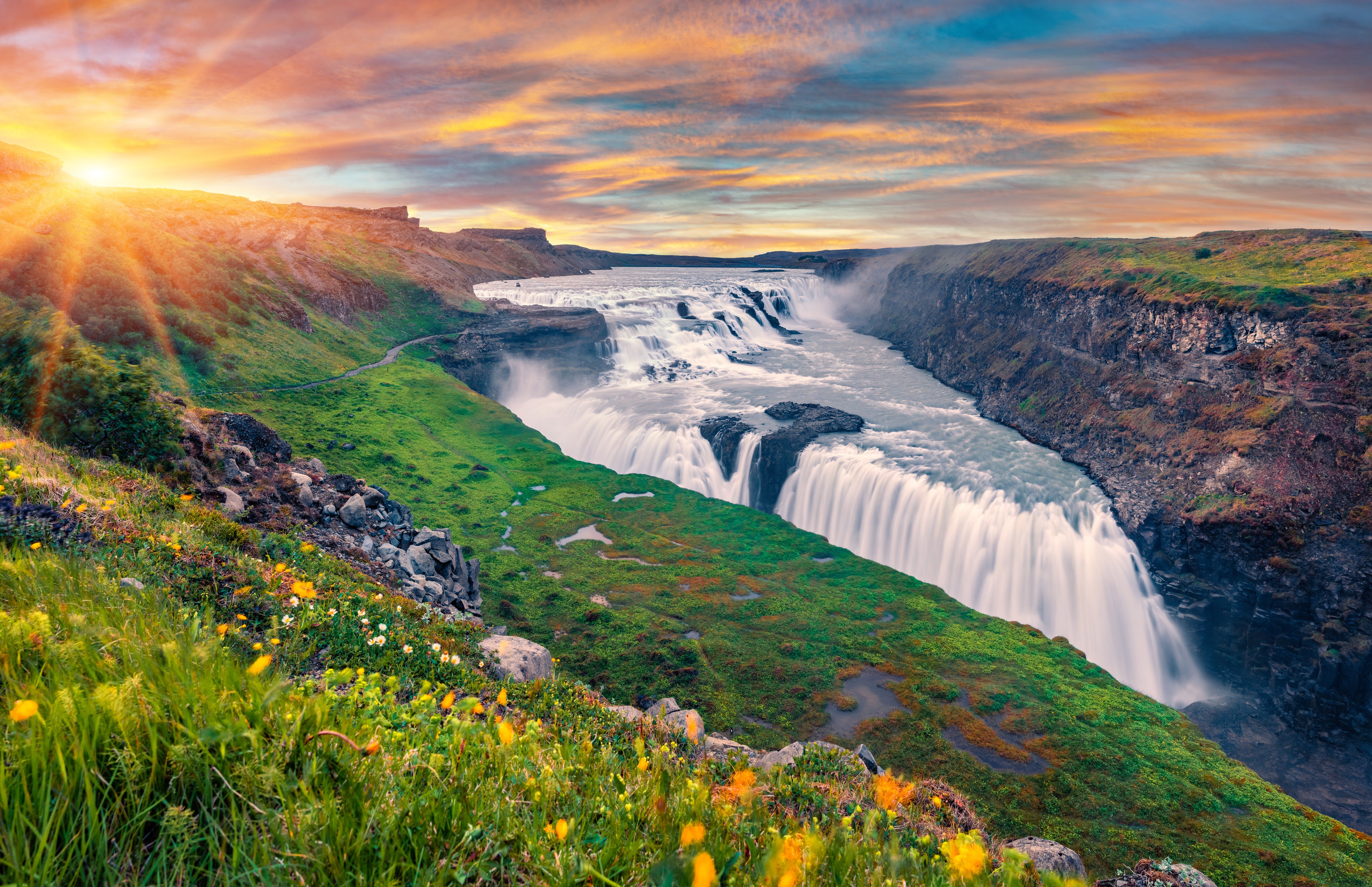
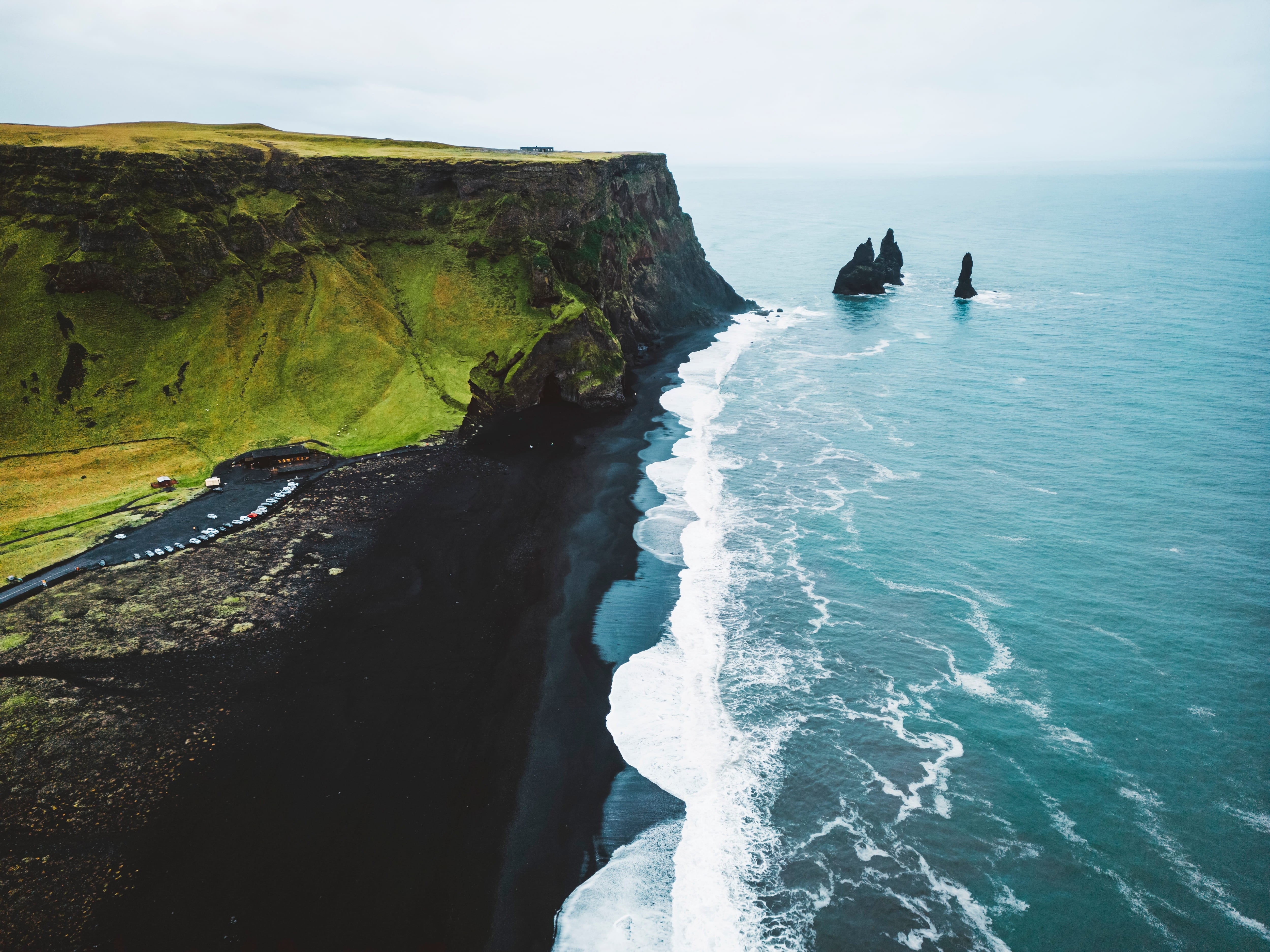
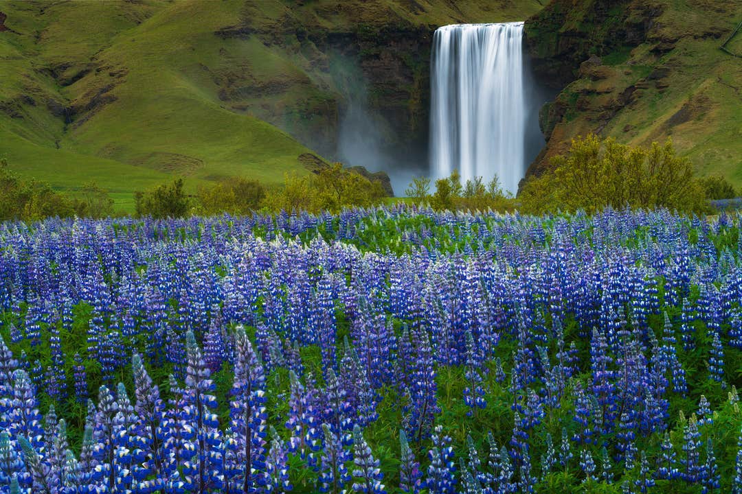
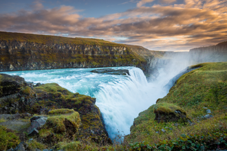
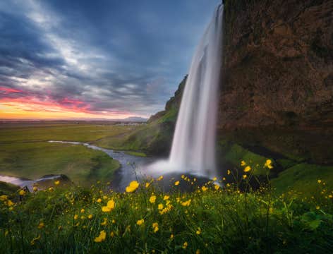
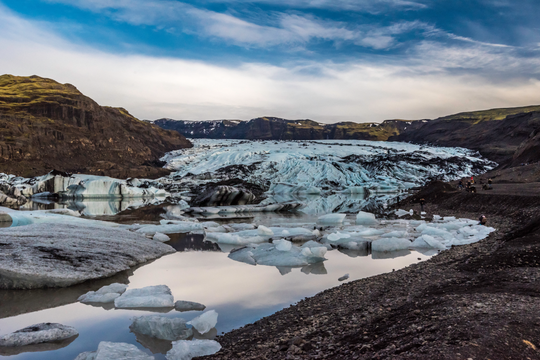
Podczas tej 8-dniowej wycieczki będziesz mieć dużo czasu na zwiedzanie Złotego Kręgu i atrakcji na południowym wybrzeżu Islandii, w tym laguny lodowcowej Jokulsarlon, malowniczych wodospadów, czarnych plaż i miasteczek rybackich.
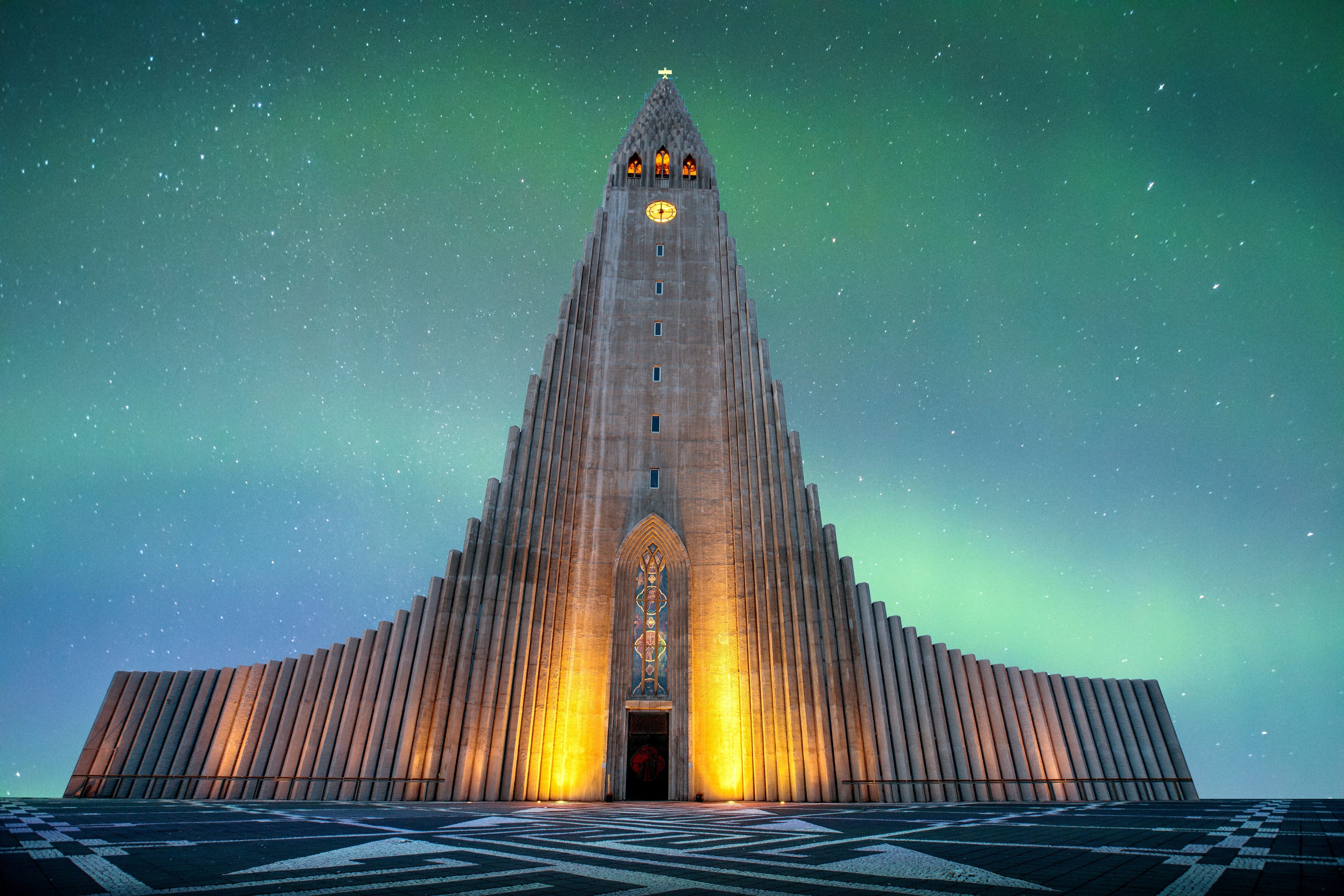
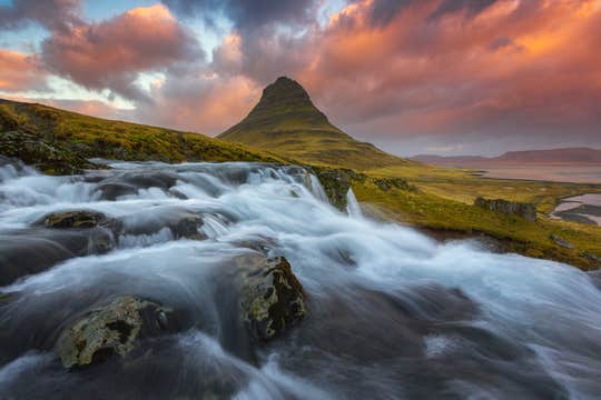
Plan tej wycieczki objazdowej zakłada również czas w Reykjaviku oraz wybranie się na półwysep Snaefellsnes, często nazywany „Islandią w miniaturze” ze względu na wyjątkowo zróżnicowane krajobrazy.
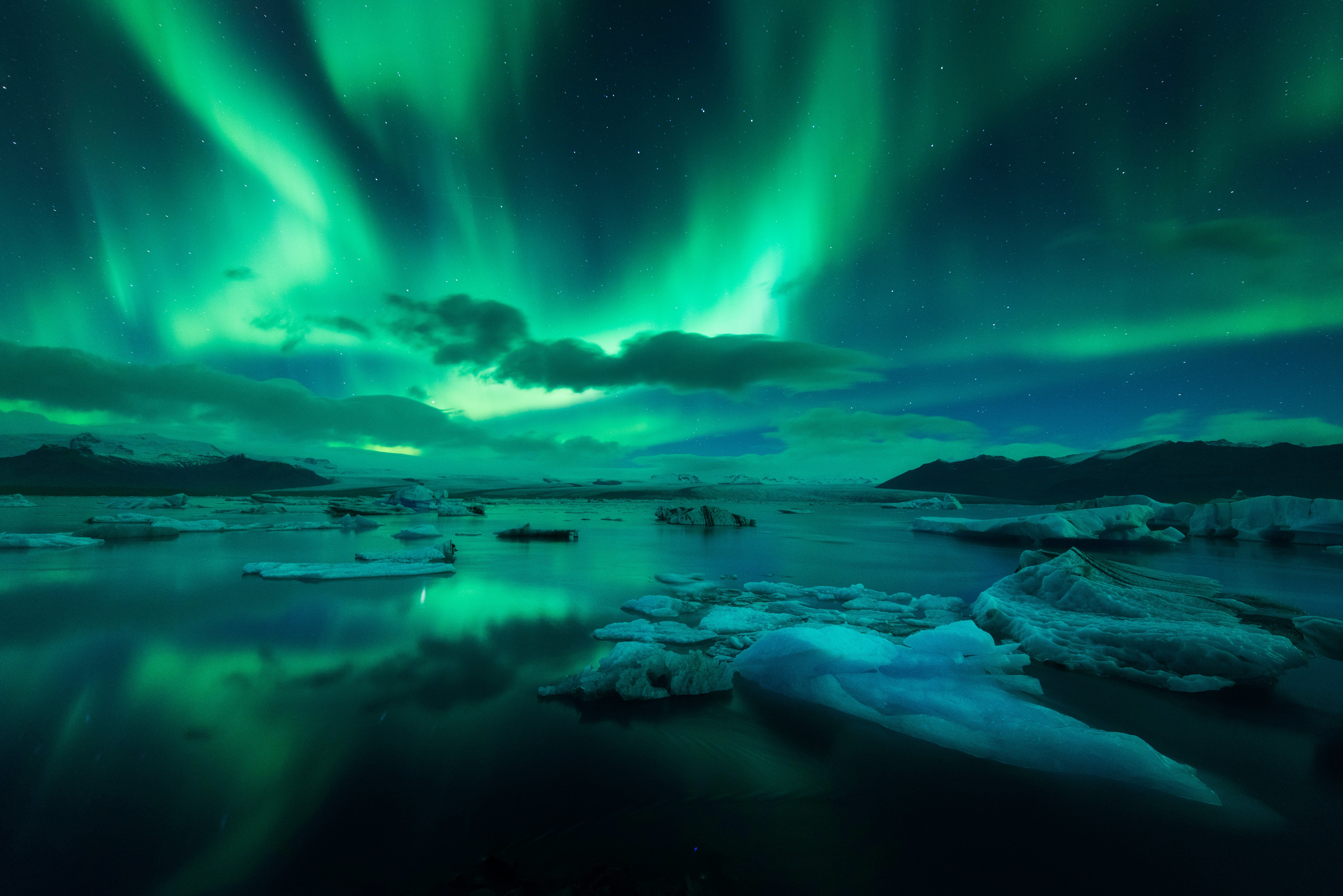
W trakcie swojej podróży odwiedzisz wszystkie trzy parki narodowe i będziesz mieć wystarczająco dużo czasu, aby je spokojnie eksplorować. Te wczasy na Islandii zakładają spokojną wycieczkę objazdową w trakcie białych nocy, dzięki czemu możesz w pełni wykorzystać długie dni i zwiedzać również wieczorami.
Rezerwując tę wycieczkę, unikniesz spędzania tygodni na układaniu idealnego planu zwiedzania Islandii. Zajęliśmy się już tą częścią wyjazdu, aby oszczędzić Ci wszelkich kłopotów. Udostępniliśmy również tę wycieczkę w atrakcyjnej cenie.
Organizowanie podróży może wydawać się ekscytujące, ale istnieje ryzyko, że przegapisz niektóre z najlepszych atrakcji. Pozwalając nam zająć się planowaniem, dopilnujemy, aby wszystkie najważniejsze miejsca, które musisz zobaczyć podczas samodzielnej wycieczki, zostały uwzględnione. Oczywiście, przy każdej atrakcji spędzisz tyle czasu, ile chcesz.
Zamiast objechać kraj dookoła i pobieżnie przyglądać się atrakcjom, spędzisz dwie noce na obszarze trasy Złotego Kręgu oraz dwie na południowym wybrzeżu.
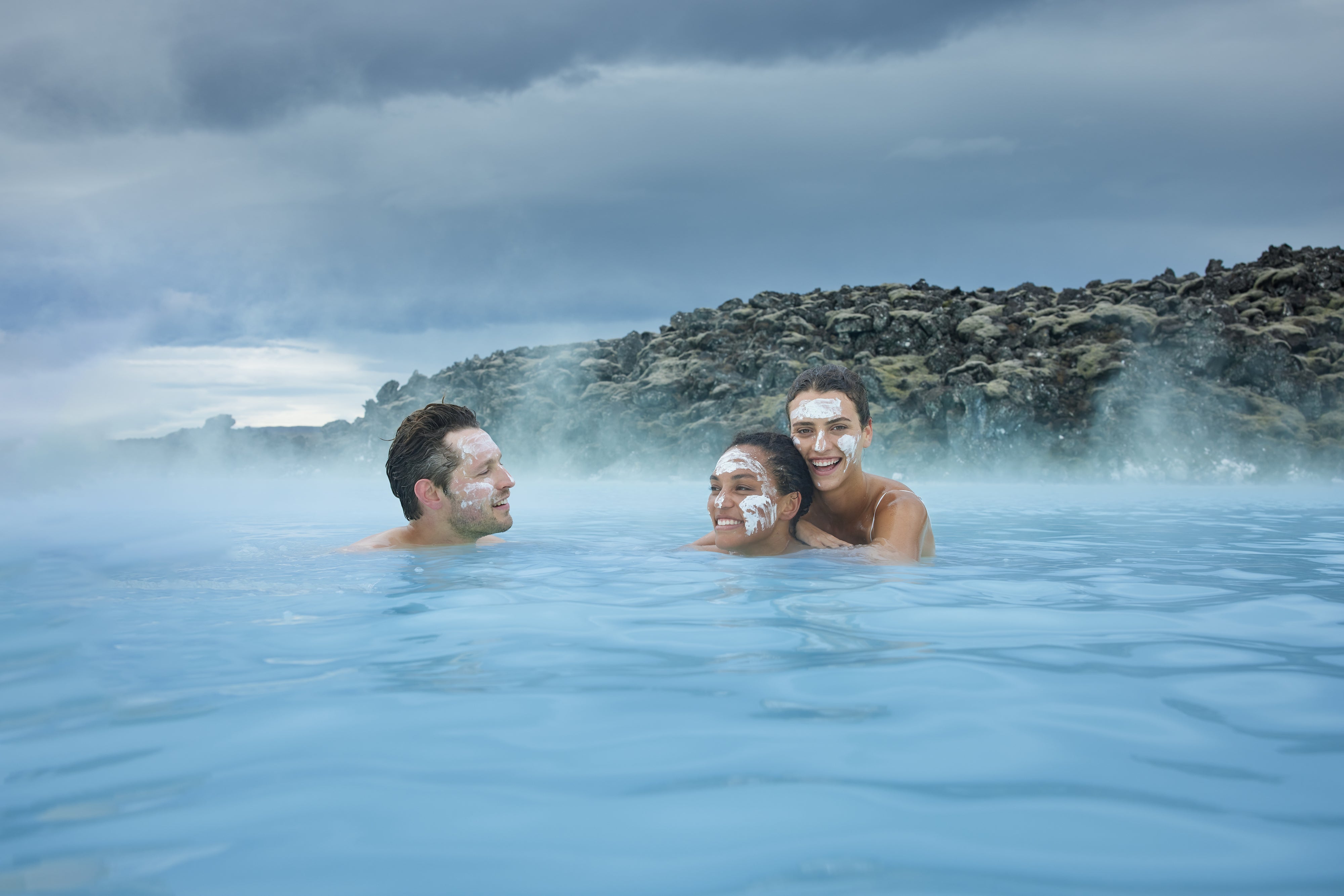
Aby pomóc Ci w pełni poznać każdą lokalizację, możesz zarezerwować dodatkowe wycieczki, takie jak wędrówki po lodowcu, odkrywanie jaskiń lodowcowych i relaks w nowoczesnych ośrodkach spa. Inne opcje obejmują odkrywanie głębin wulkanicznych jaskiń lawowych Islandii, obserwowanie wielorybów i ptaków oraz snorkeling między kontynentami.
Możesz także podnieść poziom adrenaliny, jadąc skuterem śnieżnym przez lodowiec! Te dodatkowe przystanki sprawiają, że ludzie uwielbiają tę ośmiodniową letnią samodzielną wycieczkę, która zdobyła wysokie oceny i pozytywne recenzje. Jest to również jedna z najłatwiejszych wycieczek, idealna dla gości w każdym wieku. Co najlepsze, są one dostępne w obniżonej cenie, jeśli zarezerwujesz je od razu.
Oprócz kontroli i elastyczności podczas wycieczki otrzymasz również niezbędne wsparcie, którego możesz potrzebować. Nasze pakiety są wyposażone w opiekę osobistego agenta podróży, z którym możesz skontaktować się o każdej porze, siedem dni w tygodniu.
Jeśli chcesz anulować wyjazd z jakiegokolwiek powodu, możesz to zrobić bezpłatnie na 24 godziny przed rozpoczęciem wycieczki i otrzymać pełny zwrot kosztów.
Zarezerwuj tę ośmiodniową wycieczkę po zachodniej i południowej Islandii już teraz! Sprawdź jej dostępność, wybierając datę.