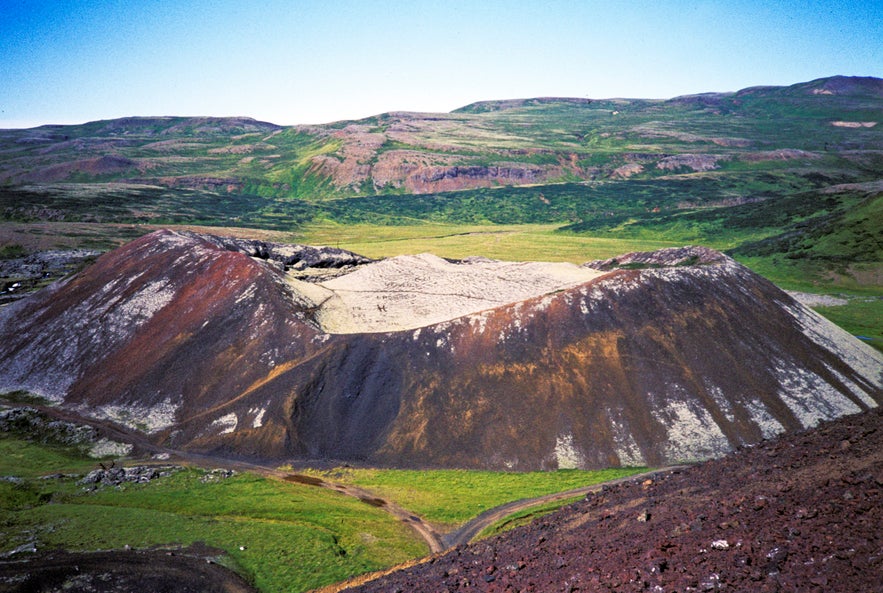
Ljósufjöll is a central volcano and fissure vent system, located on the Snæfellsnes peninsula’s volcanic zone in West Iceland.
Learn about and see more of this region on a tour of the Snaefellsnes Peninsula.
Miksi sisältöömme voi luottaa
Guide to Iceland on Islannin luotetuin matkailusivusto ja auttaa vuosittain miljoonia matkailijoita. Kaikki sisältömme on paikallisten asiantuntijoiden kirjoittamaa ja tarkastamaa – he tuntevat Islannin läpikotaisin. Voit luottaa siihen, että saat meiltä ajankohtaista, paikkansapitävää ja luotettavaa matkailutietoa.
Photo from Wikimedia, Creative Commons, by H. Grobe. No edits made.
Geology and History
The system’s length is approximately 90 kilometres (56 miles), and its highest point is at 988 metres (3,421 ft) above sea level. Ljósufjöll reaches from the lava field Berserkjahraun to the university village Bifröst and its volcanic Grábrók craters. The eruption that created the system dates back to the 12th Century and proclaimed the lives of about 80 people, including Magnús Einarsson, then the bishop of Skálholt.
The system contains cinder cones and is furthermore the largest Quaternary rhyolitic outcrop in the entire volcanic zone. The central volcano of Ljósufjöll is highly silicic, which causes its light colouration and sparked the system’s namesake, but Ljósufjöll translates to Mountains of Light.


