Величественный Лаунгйёкюдль, также известный как «Длинный ледник», — второй по величине ледник Исландии. Ледник Лаунгйёкюдль поражает захватывающими пейзажами и предлагает множество активных развлечений — вот всё, что нужно знать для планирования поездки.
Лаунгйёкюдль — второй по величине ледник Исландии, расположенный в 150 километрах от Рейкьявика. Здесь доступны различные туры на Лаунгйёкюдль, такие как катание на лыжах, пешие прогулки и снегоходы, а также посещение искусственных ледяных туннелей Into the Glacier.
Почему нам можно доверять
Guide to Iceland — самая надёжная туристическая платформа в Исландии, которой ежегодно пользуются миллионы путешественников. Весь наш контент пишется и проверяется местными экспертами, отлично знающими Исландию. Мы гарантируем точные, актуальные и достоверные советы для вашего путешествия.
Добраться сюда очень просто. Помимо организованных туров из Рейкьявика, вы можете доехать на арендованной машине во время захватывающего самостоятельного путешествия. Читайте дальше, чтобы узнать всё об этом удивительном месте.
Кратко о главном
-
Для любителей приключений: Помимо того, чтобы просто любоваться красотой Лаунгйёкюдль, здесь можно покататься на снегоходах, отправиться в поход, заняться лыжным спортом или отправиться в тур на внедорожнике.
-
Ближе к природе: Искусственный туннель, прорубленный сквозь вершины Лаунгйёкюдля, позволяет путешественникам увидеть ослепительно голубой лёд в самом центре ледника.
-
Лучшее время для посещения: Летние месяцы (июнь-август) отличаются более стабильной погодой для экскурсий и самостоятельных поездок, а зимой здесь особенно популярны снегоходы и ледяные пещеры.
Почему Лаунгйёкюдль — обязательный пункт для посещения
 Лаунгйёкюдль возвышается над компактной группой гор, образованных древними вулканическими извержениями, вершины которых можно увидеть с некоторых точек ледника. Под ним находятся три активные вулканические системы, включая ту, что питает геотермальную зону Хвераведлир в Центральных Нагорьях.
Лаунгйёкюдль занимает около 953 квадратных километров на западе Исландии, а его самая высокая точка находится на севере ледника. Эта вершина поднимается примерно на 1450 метров над уровнем моря. Единственный ледник, который больше Лаунгйёкюдля, — это Ватнайёкюдль, который является не только самым крупным ледником Исландии, но и всей Европы.
В сравнении с другими вулканическими регионами Исландии Лаунгйёкюдль считается спокойным. За последние 10 000 лет здесь произошло всего 32 извержения.
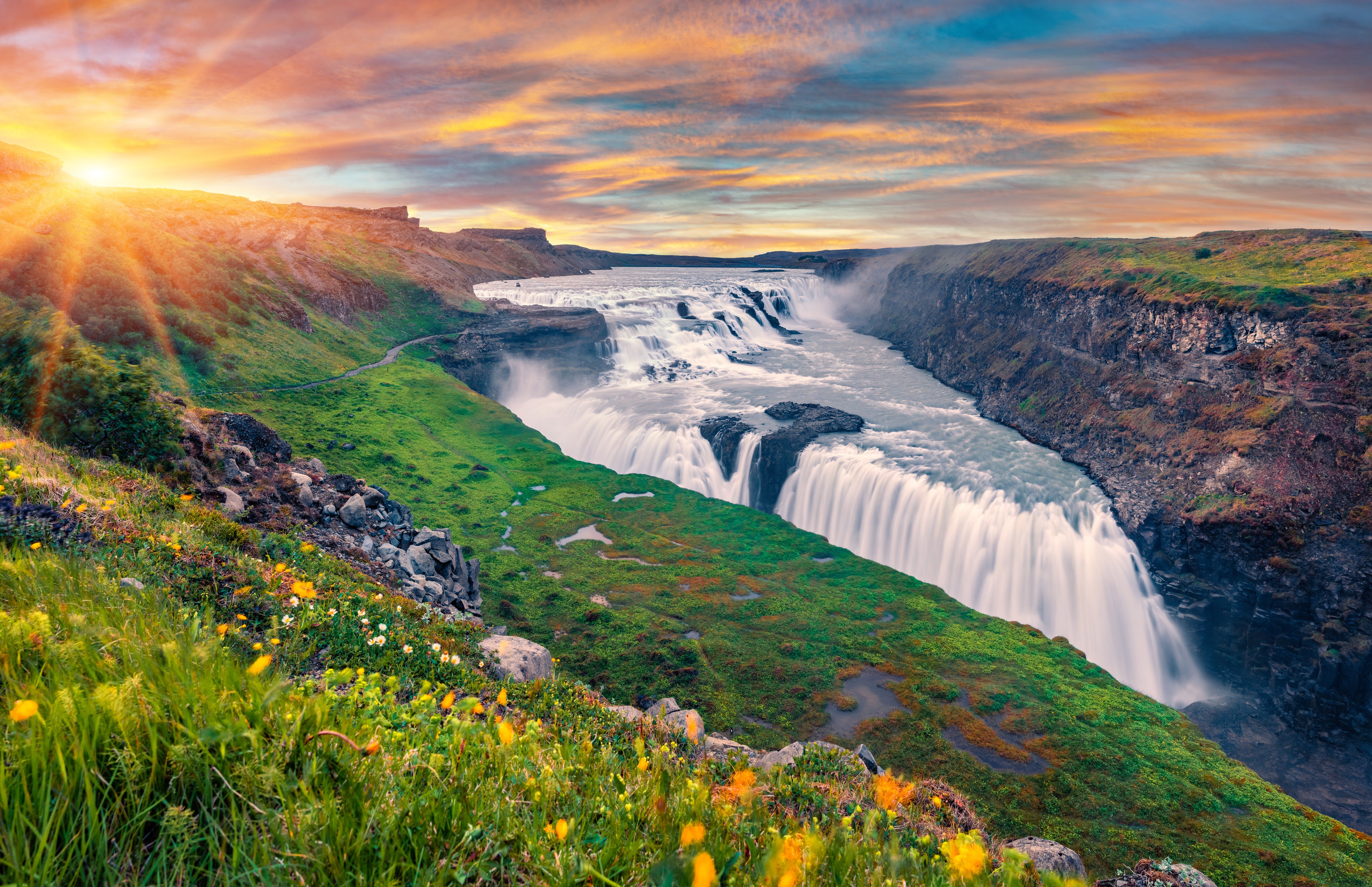
Помимо того, что ледник безопасен для посещения, талая вода Лаунгйёкюдля создаёт несколько самых известных природных достопримечательностей на популярном туристическом маршруте Золотое кольцо.
-
Воды ледника питают реку Хвитау, которая образует знаменитый водопад Гюдльфосс.
-
Талые воды Лаунгйёкюдля проходят через окружающие лавовые поля, а затем по подземной реке поступают к геотермальному источнику Гейсира.
-
Подземные воды Лаунгйёкюдля также формируют множество чистейших родников в национальном парке Тингведлир.
Благодаря длительной фильтрации вода здесь становится одной из самых чистых в мире. Поэтому ледник заслуживает отдельной благодарности за то, что разлом Сильфра признан одним из лучших мест для сноркелинга и дайвинга в мире.
Как добраться до Лаунгйёкюдля
 Лаунгйёкюдль находится в Нагорьях, и две главные дороги, соединяющие север и юг Исландии, проходят рядом с ним. Дорога Кальдидалюр тянется на север от национального парка Тингведлир до района Хусафедль.
Дорога Кьяльвегюр проходит восточнее Лаунгйёкюдля и западнее ледника Хофсйёкюдль. Она начинается у водопада Гюдльфосс на юге и ведёт через живописную геотермальную зону Хверавеллир на север.
Второй по величине ледник Исландии находится примерно в 150 километрах от Рейкьявика, дорога на арендованной машине занимает около часа, однако зимой рекомендуется брать внедорожник 4x4. Также можно выбрать пакетный тур, многодневную экскурсию с гидом или однодневный тур на Лаунгйёкюдль с включённым трансфером.
Однодневные туры на Лаунгйёкюдль с гидом
 Если вы предпочитаете организованный отдых и ограничены во времени, однодневные туры с гидом предлагают разные варианты транспорта и активностей.
-
Тур по Золотому кольцу и снегоходы: За один день вы увидите все главные достопримечательности Золотого кольца и прокатитесь на снегоходе по Лаунгйёкюдлю.
-
Тур по ледяному туннелю: В этом уникальном туре путешественники любого возраста и уровня подготовки могут исследовать ледник пешком.
-
Тур по ледяной пещере и снегоходы: Если не можете выбрать, как лучше познакомиться с ледником, обратите внимание на этот комбинированный четырёхчасовой тур.
-
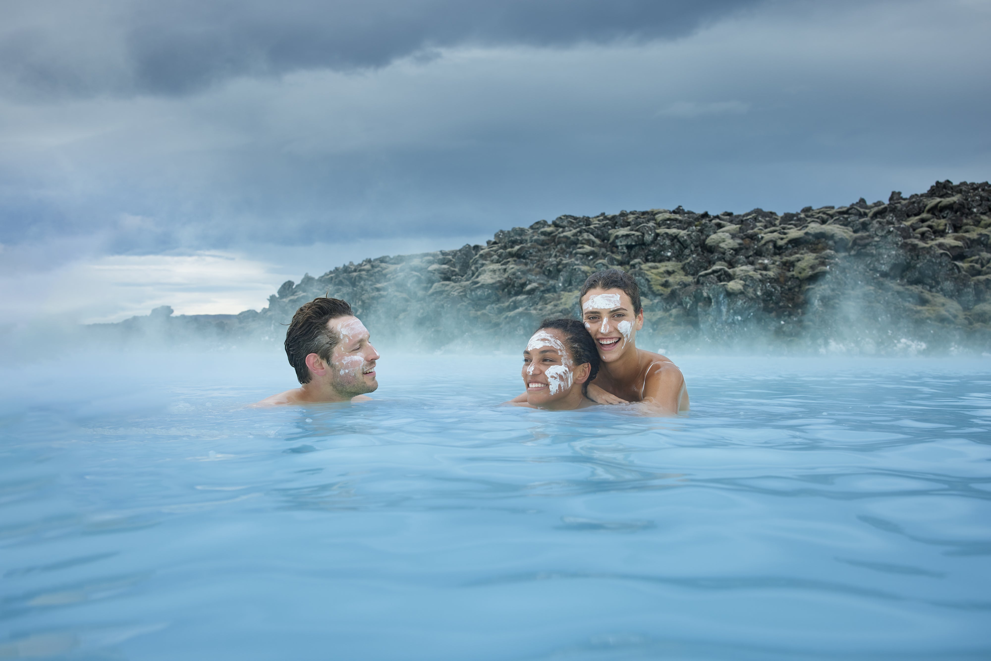
Тур на супер-джипе: После поездки из Рейкьявика на супер-джипе и катания на снегоходе по Лаунгйёкюдль вы сможете расслабиться в Тайной Лагуне — самом старом природном бассейне Исландии, который находится в деревне Флудир.
-
Тур Into the Glacier: После поездки на специальном внедорожнике вы попадёте внутрь ледника через искусственный туннель.
Самостоятельные туры на Лаунгйёкюдль
 Путешественникам, которые любят исследовать страну в своём ритме, подойдут самостоятельные туры с остановкой на Лаунгйёкюдль.
-
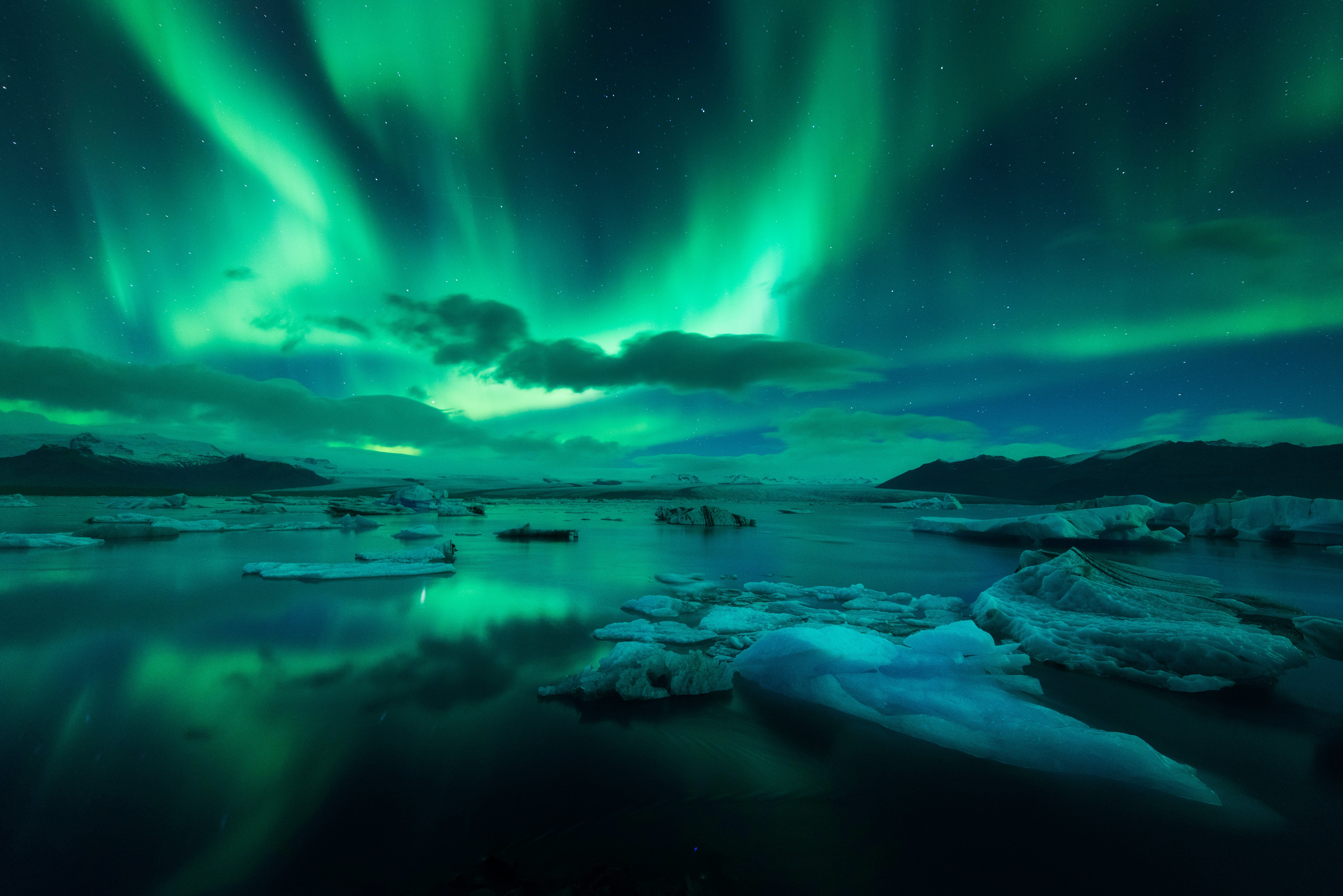
5-дневный зимний тур за северным сиянием: Посетите все главные достопримечательности Исландии, включая Лаунгйёкюдль, и отправьтесь на поиски идеального вида на северное сияние.
-
8-дневный летний тур по Кольцевой дороге: Для любителей приключений — возможность добавить катание на снегоходах по Лаунгйёкюдль к этому самостоятельному путешествию.
-
10-дневный тур по Кольцевой дороге: Вы исследуете Лаунгйёкюдль в рамках этого насыщенного тура, который включает самые популярные места на Кольцевой дороге и полуострове Снайфедльснес.
Пакетные туры с Лаунгйёкюдлем
 Чтобы не думать о транспорте и проживании, выберите пакетные туры.
-
5-дневный летний пакет: Посетите незабываемые места Золотого кольца и Южного побережья в рамках этого насыщенного тура.
-
6-дневный тур за северным сиянием: Этот тур наполнен яркими впечатлениями, включая возможность покататься на снегоходах по Лаунгйёкюдль.
Многодневные туры с гидом по Лаунгйёкюдлю
 Многодневные туры с гидом — отличный вариант для тех, кто впервые в Исландии, а также для опытных путешественников, желающих открыть для себя новые места.
-
8-дневный летний тур по Кольцевой дороге: Откройте для себя самые красивые места страны вместе с опытным гидом.
-
9-дневный зимний тур за северным сиянием: В этом туре по лучшим местам Исландии есть возможность заняться сноркелингом в разломе Сильфра, который питается талыми водами Лаунгйёкюдля.
Погружение «Внутрь ледника» на Лаунгйёкюдле
 Недалеко от самых высоких вершин Лаунгйёкюдля смелые путешественники могут найти искусственный ледяной туннель. Его спроектировал и построил геофизик и кандидат в президенты Ари Трёйсти Гвюдмюндссон, чтобы гости могли исследовать это природное чудо изнутри.
Посетители проходят под толстой ледяной шапкой Лаунгйёкюдля, любуясь насыщенным голубым цветом льда и узнавая больше о строении и красоте ледника. Это единственное место в мире, где можно испытать подобное.
Где остановиться рядом с Лаунгйёкюдлем
 Мы рекомендуем гостям ледника выбирать стильные и уютные варианты размещения в близлежащих деревнях Рейкхольт и Хусафетль.
-
Гостевой дом Gamli Baer: Уютная атмосфера и общение с путешественниками со всего мира в этом B&B в Хусафетле.
-
Fosshotel Reykholt: Современный отель с рестораном и спа в маленькой деревне Рейкхольт, которая славится своей историей.
Часто задаваемые вопросы о Лаунгйёкюдле
 О леднике Лаунгйёкюдль всегда можно узнать что-то новое.
Сколько лет Лаунгйёкюдлю?
Считается, что Лаунгйёкюдлю от 50 000 до 100 000 лет. Есть данные, что за время ледниковых периодов он неоднократно увеличивался и уменьшался.
Тает ли Лаунгйёкюдль из-за изменения климата?
Да, как и многие ледники в Исландии и по всему миру, Лаунгйёкюдль сокращается из-за повышения температуры и изменения климата. За последние десятилетия ледник значительно уменьшился в объёме и площади.
Какие животные встречаются рядом с Лаунгйёкюдлем?
Сам ледник практически лишён живой природы из-за суровых условий, но в окрестностях можно встретить арктических лисиц, северных оленей и различных птиц, например, белую куропатку. В близлежащих реках и озёрах водится рыба.
Можно ли отправиться в поход по Лаунгйёкюдлю?
Да, для желающих доступны пешие туры с гидом по леднику. Сложность маршрутов разная: от лёгких прогулок по краю ледника до более сложных восхождений к вершине.
Ваше приключение на Лаунгйёкюдле ждёт вас
 Будь то захватывающие виды или покорение склонов, поездка на Лаунгйёкюдль — обязательный пункт в путешествии по Исландии. Здесь найдутся туры для любого уровня подготовки и интересов — как с гидом, так и самостоятельные. А ещё только здесь можно исследовать ледник изнутри!