


Описание
Обзор
Описание
Собирайте чемоданы и отправляйтесь в мир «Песни льда и пламени» — Вестерос. Этот шестидневный маршрут по Золотому кольцу, Южному побережью и полуострову Снайфедльснес позволит вам побывать на съёмочных локациях самых драматичных сцен культового сериала HBO «Игра престолов», а также совершить поход по леднику в национальном парке Ватнайёкюдль.
Вы пройдёте по следам Арьи и Пса, увидите ключевые достопримечательности Золотого кольца и даже посетите место, где Дети леса создали первого Белого ходока.
Бронируя этот тур, вам не придётся тратить недели на планирование идеального маршрута по Исландии — мы уже сделали это за вас. В программу включены все самые важные и знаковые места, чтобы вы ничего не упустили, а стоимость тура остаётся максимально выгодной.
Самостоятельная организация путешествия может казаться заманчивой, но есть риск пропустить лучшие локации. Доверив планирование нам, вы получите тщательно продуманный маршрут со всеми ключевыми остановками и впечатлениями.
Этот тур подойдёт даже самым требовательным путешественникам — проживание и экскурсии включены, а с момента прилёта и до отъезда вы будете под надёжной опекой. В ваш пакет входит персональный тревел-консультант, доступный 24/7, что гарантирует спокойный и беззаботный отдых.
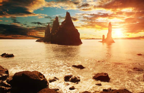
Вы посетите самые известные места Исландии, многие из которых стали съёмочными площадками Вестероса по обе стороны Стены. Среди них — Тингведлир, сыгравший роль Кровавых Врат, и Восточного Дозора у моря, расположенный на пляже Рейнисфьяра с чёрным песком.
Вы также почувствуете себя «к северу от Стены», отправившись в поход по леднику Соульхеймайёкюдль.
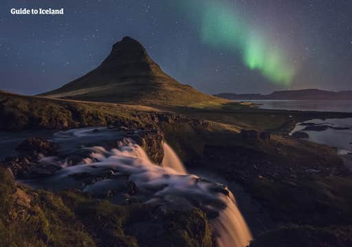
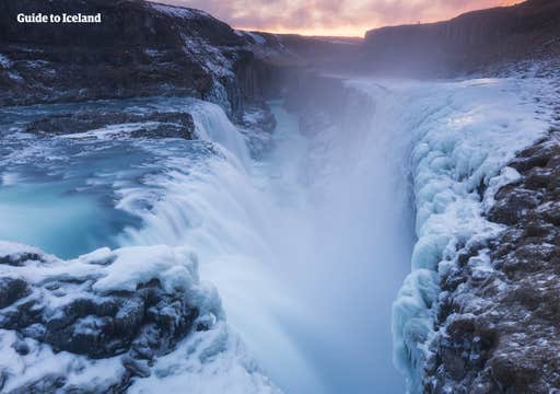
В программе тура — Золотое кольцо, ледниковая лагуна Йёкюльсарлоун, гора Киркьюфетль и другие культовые места. По желанию вы сможете добавить ещё больше адреналина: посещение Голубой лагуны, снегоходную экскурсию по леднику или снорклинг в кристально чистых водах расщелины Сильфра.
Именно благодаря таким возможностям этот летний тур получил высокие оценки и множество положительных отзывов.
Это путешествие, которое не должен пропустить ни один настоящий фанат! Заточите свой валирийский клинок, наполните флягу элем и отправляйтесь по Королевскому тракту… точнее, по великолепному Южному побережью Исландии.
Проверьте доступность и выберите дату, чтобы отправиться в это легендарное приключение.


