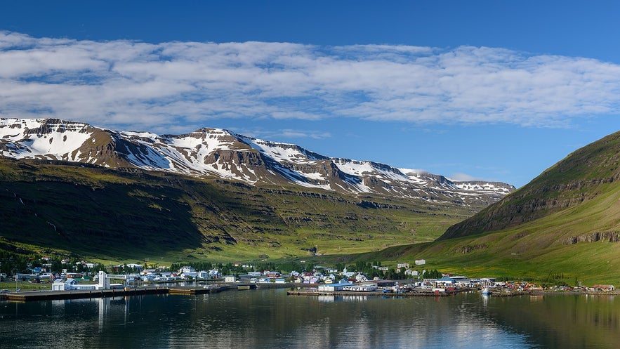
Seydisfjördur er en by med omkring 668 indbyggere i det østlige Island, som ligger i det inderste hjørne af fjorden af samme navn.
Udforsk denne region på en kør-selv-ferie i Island, og hvis du planlægger at blive i denne charmerende by, skal du sørge for at booke overnatning i Seydisfjördur.
Derfor kan du stole på vores indhold
Guide to Iceland er den mest pålidelige rejseplatform i Island, der hjælper millioner af besøgende hvert år. Alt vores indhold er skrevet og gennemgået af lokale eksperter, der kender Island ud og ind. Du kan stole på, at vi giver dig præcise, opdaterede og pålidelige rejsetips.
Byen er omgivet af sneklædte bjerge og vandfald og de mest fremtrædende naturlige vartegn er Bjólfur (1085 m) mod vest og Strandartindur (1010 m) mod øst, som begge er en del af Islands syv-tinde-vandretur.
Økonomi
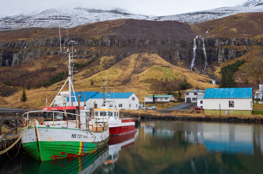
Seydisfjördurs hovedøkonomi har primært været fiskeindustrien gennem hele dens historie, men den har oplevet øget turisme i de senere år. Byen har en stor havn, og herfra sejler færgen Norröna til Færøerne og Danmark.
Seydisfjördur tilbyder mange tjenester til rejsende, herunder overnatningsmuligheder, og er blevet stadig mere populær på grund af sin årlige LungA-kunstfestival.
Kultur og historie
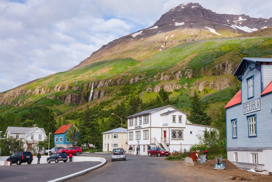
Bygden Seydisfjördur begyndte at udvikle sig til et handelscenter i 1848, da byens indbyggere fandt deres rigdom i "havets sølv": sild. Den lange beskyttende fjord gav fiskerne i Seydisfjördur en fordel i forhold til deres naboer, hvilket fik byen til at vokse til en af de mest velstående byer i Østisland. De unikke, flerfarvede træbygninger, som gør Seydisfjördur så genkendelig, blev bygget i denne periode af norske købmænd og hvalfangere. Ruinerne af deres hvalfangst ved Vestdalseyri kan stadig besøges langs Seydisfjördurs kyst.
I nyere tid var Seydisfjördur en base for de allierede styrker under Anden Verdenskrig. Det eneste angreb, der er registreret ud for Island, var på den britiske olietanker El Grillo ("Fårekyllingen"), som lå for anker i fjorden. Efter at være blevet kraftigt bombarderet af tyske jagerfly, der var udstationeret i Norge, besluttede El Grillos kaptajn at sænke skibet. El Grillo blev sænket uden tab af menneskeliv og ligger nu på bunden af fjorden. Vraget er nu et populært sted blandt dykkere.
Islands ældste kraftværk ligger i nærheden af byen Seydisfjördur.
Byen har en levende kulturscene. Der er en bolig i byen, som er dedikeret til kunstneren Dieter Roth. Derudover har Seydisfjördur også et kunstatelier, et telekommunikationsmuseum, et kunstcenter, en af de to biografer i Østisland og, som nævnt, den årlige LungA-festival.
Kunstfestivalen LungA finder sted i midten af juli. Det er en fejring af kunst for unge. Festivalens navn er en kombination af det islandske ord for 'kunst' (lista) og ordet for 'ung' (ungur) og byder på workshops, udstillinger, et modeshow og koncerter. Mange af Islands bedste musikere har deltaget i festivalen.
Natur og omegn
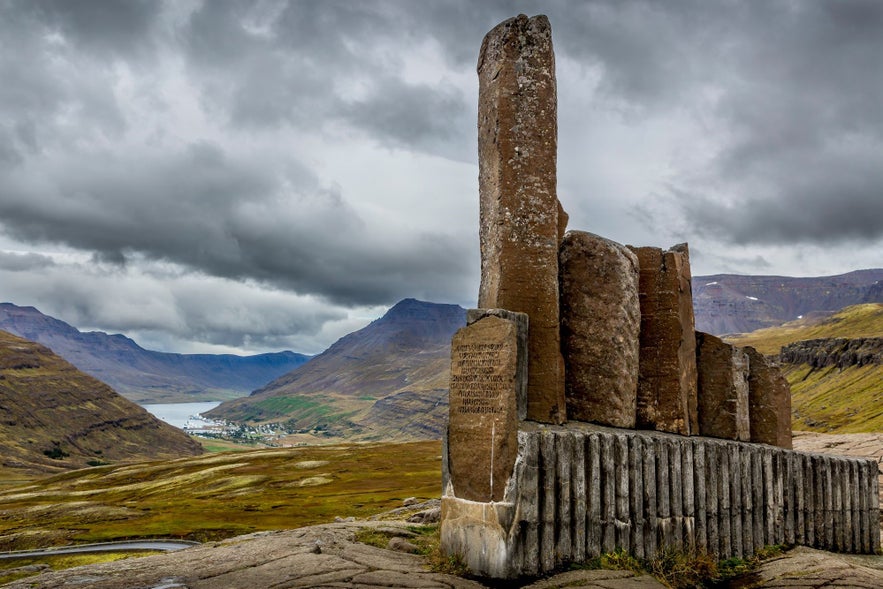
Seydisfjördur er omgivet af utrolig natur, herunder bjerge, vandfald og smuk havudsigt. Omkring 17 kilometer fra byen ligger naturreservatet Skalanes, som er et knudepunkt for videnskabelig og naturbevarende udforskning. Dette reservat, der dækker over 1200 hektar, er kendt for sit mangfoldige dyreliv med 47 fuglearter, fire arter af islandske pattedyr og over 150 plantearter.
Rensdyr vandrer rundt i området, og sæler og marsvin holder til ved kysterne. Her findes over 90 arkæologiske steder, de fleste fra den ovennævnte krig. Naturreservatet har også et charmerende pensionat.
De mange forskellige habitater, som reservatet dækker - ferskvandsvådområder, tidevand, klipper, enge - har tiltrukket forskere fra udlandet, hvilket gør Skálanes til det perfekte eksempel på internationalt og akademisk samarbejde. Udviklingen på Skálanes er sket inden for så vidtrækkende discipliner som arkæologi, antropologi, lingvistik og miljøbeskyttelse, for blot at nævne nogle få.
Geografi
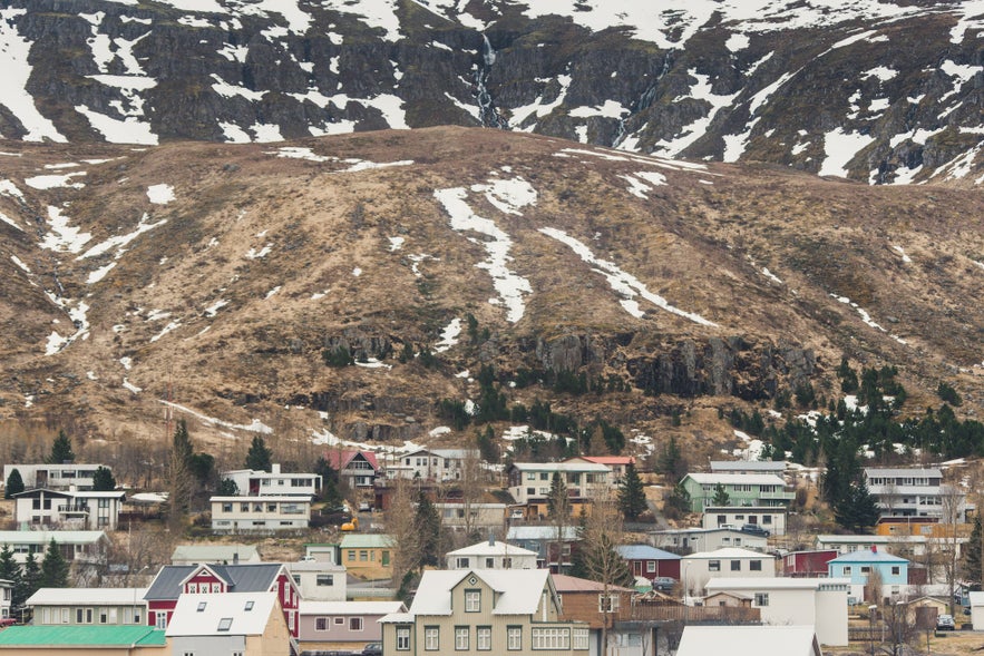
Seydisfjördurs stejle dale gør byen udsat for laviner. I 1885 dræbte en lavine 24 mennesker, hvilket gjorde det til den værste lavinetragedie i det unge lands historie. Et mindesmærke for de døde står nu i byen, bygget af bjælkerne fra en ødelagt fabrik. For nylig, i 1996, knuste en lavine en anden lokal fabrik. Heldigvis kom ingen til skade. Siden er der blevet bygget lavinedæmninger, nogle helt op til 20 meter høje, omkring byen.


