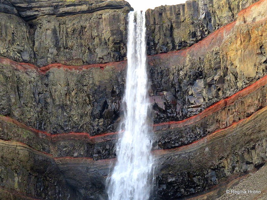
Hengifoss is a waterfall that runs from the river Hengifossá in the municipality of Fljótsdalshreppur in East Iceland. At 128 metres (420 feet) it is the third tallest waterfall in the country.
The trail leading up to the waterfall is one of the most popular hiking routes in all of East Iceland, but visitors can reach the falls from the nearby parking lot by hiking for approximately 50 minutes.
Why You Can Trust Our Content
Guide to Iceland is the most trusted travel platform in Iceland, helping millions of visitors each year. All our content is written and reviewed by local experts who are deeply familiar with Iceland. You can count on us for accurate, up-to-date, and trustworthy travel advice.
Visit this incredible waterfall while on a self drive tour in Iceland.
Geography
The waterfall is surrounded by layers of basaltic strata. In between the basaltic layers are thin layers of red clay. Geologists have also discovered fossilised trees within the layers, evidential of much warmer periods during the tertiary period. Further down the waterfall’s river, Hengifossá, is another, smaller waterfall known as Litlanesfoss, which hikers should pass on their way from the parking lot up to Hengifoss. The river eventually runs into the famous Lake Lagarfljót, home to the mythological sea wyrm Lagarfljótsormur.


