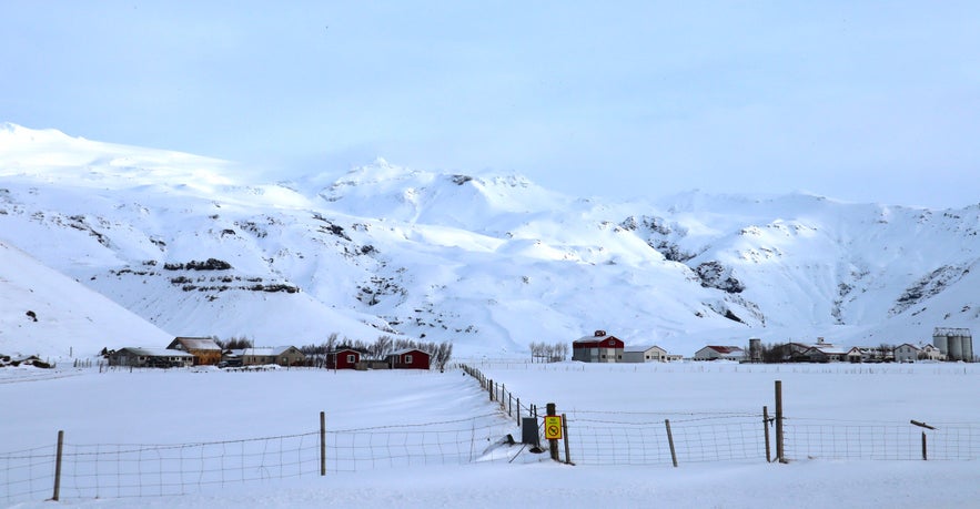
Gletsjervulkanen Eyjafjallajökull er berygtet over hele verden for at skabe kaos i flytrafikken i 2010 og for at gøre tv-værter forvirrede, når de forsøgte at udtale den. Den er 1.651 meter høj og er et af de mest dominerende træk ved sydkysten.
Eyjafjallajökull kan ses på mange ture på sydkysten. Denne seks-dages feriepakke og denne 10-dages sommer-kør-selv-ferie er blot to eksempler på de mange ture, der kommer forbi Eyjafjallajökull. Dem, der lejer en bil, kan rejse sydpå for at se den på egen hånd.
Derfor kan du stole på vores indhold
Guide to Iceland er den mest pålidelige rejseplatform i Island, der hjælper millioner af besøgende hvert år. Alt vores indhold er skrevet og gennemgået af lokale eksperter, der kender Island ud og ind. Du kan stole på, at vi giver dig præcise, opdaterede og pålidelige rejsetips.
Geografi

Eyjafjallajökulls gletsjer er cirka 100 kvadratkilometer stor, hvilket gør den til landets sjettestørste. Den ligger tæt på den fjerdestørste, Mýrdalsjökull, som også skjuler en anden berygtet vulkan, denne hedder Katla.
Eyjafjallajökulls udbrud var enormt og forstyrrende, men det blegner i forhold til Katlas potentiale. Den er langt mere eksplosiv og ligger under meget tykkere is, og et udbrud her under ugunstige vindforhold kan få verdensomspændende konsekvenser.
Magmakamrene mellem disse to mægtige vulkaner er forbundet, og desværre for os bliver et udbrud ved Eyjafjallajökull som regel efterfulgt af et udbrud ved Katla inden for et årti.
Eyjafjallajökull har mange gletsjerudløb, hvoraf det mest berømte er Gígjökull. Der løber mange floder fra dens smeltevand, og en af dem falder ned i det smukke vandfald Seljalandsfoss på sydkysten, som det er muligt at komme hele vejen rundt om.
Udbrud
Eyjafjallajökulls seneste udbrud var uden tvivl det mest berømte i Islands historie (selvom æren egentlig burde tilfalde Laki, hvis udbrud i 1783-4 forårsagede en askesky så stor, at Europa blev ramt af en hungersnød, som mange historikere mener førte til den franske revolution). Den 27. marts 2010 begyndte magma at boble op under overfladen, og den 14. april begyndte aske at vælte op fra toppen.
800 mennesker blev evakueret, ikke af frygt for magma, men for lige så farlige oversvømmelser fra gletsjere, som tidligere har lagt islandske byer øde. Dyr blev beordret til at blive holdt inde, og folk med åndedrætsbesvær fik at vide, at de også skulle holde sig inden døre.
Flytrafikken i hele Europa blev indstillet, da asken om aftenen den 15. april allerede var over Storbritannien, Skandinavien og dele af Tyskland. Feriegæster var fanget, mens de ventede på nyt, og de endte med at sidde fast i otte dage; i Skotland og Irland var der endda flyvninger, der blev forsinket i maj på grund af eftervirkningerne.
Heldigvis kom ingen til skade, selv om asken menes at have forårsaget luftvejsproblemer for nogle i den sydlige del af landet. Mange gårde blev også ødelagt af asken og oversvømmelserne, og nogle landmænd kæmper stadig med at komme på fode igen.
Siden bosættelsen i 874 har Eyjafjallajökull også været i udbrud i 900, 1612 og fra 1821 til 1823. Sidstnævnte frigav en enorm mængde fluor, som menes at have påvirket knoglesundheden hos både mennesker og dyr på det tidspunkt.
Eyjafjallajökull i dag
Eyjafjallajökull er nu helt sikker at besøge og kan ses på de fleste ture på sydkysten i klart vejr. I byen Hvolsvöllur er der et besøgscenter om vulkanen, som fokuserer på oplevelsen hos en familie, hvis gård, Þorvaldseyri, var en af de mange, der blev ødelagt af oversvømmelserne, lavaen og asken.
Det er meget usandsynligt, at Eyjafjallajökull kommer i udbrud igen lige foreløbig, da der er flere hundrede år mellem hvert udbrud, men som nævnt kan nabovulkanen Katla begynde at rumle...


