
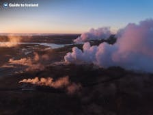
Путеводитель: Fontur Peninsula

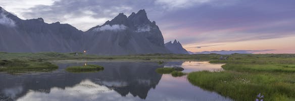
The Fontur peninsula, also called Langanesfontur, is a thin strip of land at the end of the Langanes peninsula in Northeast Iceland. It is known for its rugged cliffs, picturesque coastline, and birdwatching opportunities.
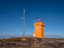
There is a lighthouse here called Langanesviti lighthouse which helps ships and boats navigate safely around the cliffs, especially during foggy or dark conditions.
Because of its stunning views and surroundings, the Fontur peninsula is a great place to stop off during a self-drive tour. This one-week summer self-drive tour of the Ring Road and Golden Circle or this seven-day self-drive tour of the complete Ring Road are examples of itineraries that provide opportunities to visit the Fontur peninsula when you are in Northeast Iceland. Those renting a car during their trip can also explore it.
Photo above from Flickr, by Brian Gratwicke. No edits made.
Physical Features of the Fontur Peninsula

Photo from Flickr by Brian Gratwicke. No edits made.
The Fontur peninsula offers fantastic opportunities for birdwatching. During the summer, as it is their breeding season, you may see seabirds like guillemots, kittiwakes, and fulmars. These birds nest in the sheer cliffs, which are around 164-230 feet (50-70 meters) high.
The lighthouse here was first built in 1910, and many ships had been wrecked nearby before this. The one there now was built in 1950 and is approximately 31 feet (9.5 meters) tall. There is a rift in the cliffs here called Engelskagja which translates to “the English gorge.
It is said that English sailors from a shipwrecked boat climbed up here to safety, but they all died of exposure, aside from the captain.
From the Fontur peninsula, you will get epic views of the endless North Atlantic Ocean. It’s a an excellent place to stop for lunch or a short walk while exploring the Langanes peninsula.

Photo from Flickr by Brian Gratwicke. No edits made.
How to get to the Fontur Peninsula
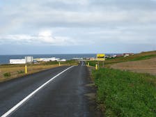
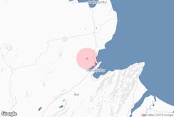
The Fontur peninsula is situated in a remote corner of Northeast Iceland. The best way to get there is by car. The nearest large town is Husavik, a fishing town and the whale-watching capital of Iceland.
From Husavik, take Route 85 to Fjardarvegur in Langanesbyggd and continue for about 97.5 miles (157 kilometers). Then take the Langanesvegur road.
The road to the Fontur Peninsula is a windy gravel road so be sure your vehicle is suitable before attempting the drive.
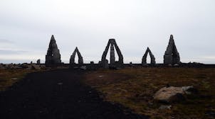
Attractions Near to the Fontur Peninsula
The Fontur peninsula is in a remote part of Northeast Iceland, and so there are not many nearby attractions. While you’re in the area, you could spend time exploring the rest of the Langanes peninsula.

Photo from Wikimedia Commons by Bernd Thaller. No edits made.
The peninsula is known for its dramatic cliffs, abundant birdlife, and wild landscapes. It offers opportunities for birdwatching, with colonies of puffins, guillemots, and other seabirds nesting along its rugged coastline.
Visitors can explore its pristine nature trails, enjoy breathtaking ocean views, and experience a sense of tranquility amidst its isolated beauty.
The Langanes peninsula also holds cultural significance, with remnants of old fishing villages and historical sites dotting its shores.
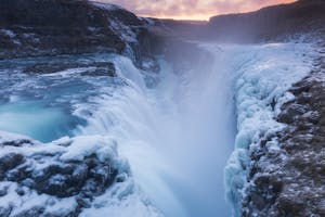
The Jokulsargljufur river canyon, around 103 miles (165 kilometers) from the Fontur peninsula, is also worth a visit. It is a spectacular natural wonder carved by the powerful Jokulsa a Fjollum river.

Photo from Wikimedia Commons by Bernd Thaller. No edits made.
With towering cliffs reaching up to 328 feet (100 meters) high, the canyon offers breathtaking vistas and geological formations.
Located in the Vatnajokull National Park, visitors can explore hiking trails and marvel at the basalt rock formations and waterfalls that the canyon has created.
Популярные туры: Fontur Peninsula
Невероятный 5-дневный зимний отпускной пакет в Исландии под северным сиянием с ледяными пещерами и Голубой лагуной
Захватывающий 6-дневный пакетный тур по Исландии с северным сиянием и ледяными пещерами
Невероятный 2-дневный тур по южному побережью Исландии с походом на ледник и посещением ледниковой лагуны Йёкюльсаурлоун
Достопримечательности рядом с вами


Популярные категории


Загрузите приложение крупнейшего туристического портала Исландии на свой телефон, чтобы управлять всей поездкой в одном месте.
Отсканируйте этот QR-код с помощью камеры телефона и нажмите на появившуюся ссылку, чтобы всегда иметь доступ к крупнейшему туристическому порталу Исландии в своем кармане. Введите свой номер телефона или адрес электронной почты, чтобы получить SMS или электронное письмо со ссылкой на скачивание.


