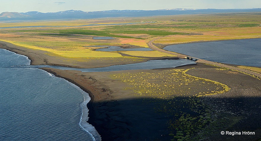
Hringsbjarg cliff is 60 metre's tall towering cliff on the east side of the Tjörnes peninsula in North-East Iceland. From the cliff, you will find a spectacular view of Fjallahöfn and the vast plains of the Kelduhverfi county, which divide the Tjörnes peninsula and Öxarfjörður fjord.
During the puffin season in Iceland, this is an excellent location to watch this delightful bird with the colourful beak and orange feet.
Top photo: the view from Hringsbjarg cliff
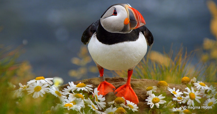
Puffins are so cute
An observation platform has been put up on Hringsbjarg cliff and some railings, but I remember standing on this cliff before the railings were put up, thinking about how courageous people were standing on the edge of the cliff.
Now it is much safer for people to stop here. You will find parking spots and information signs just above the observation platform.
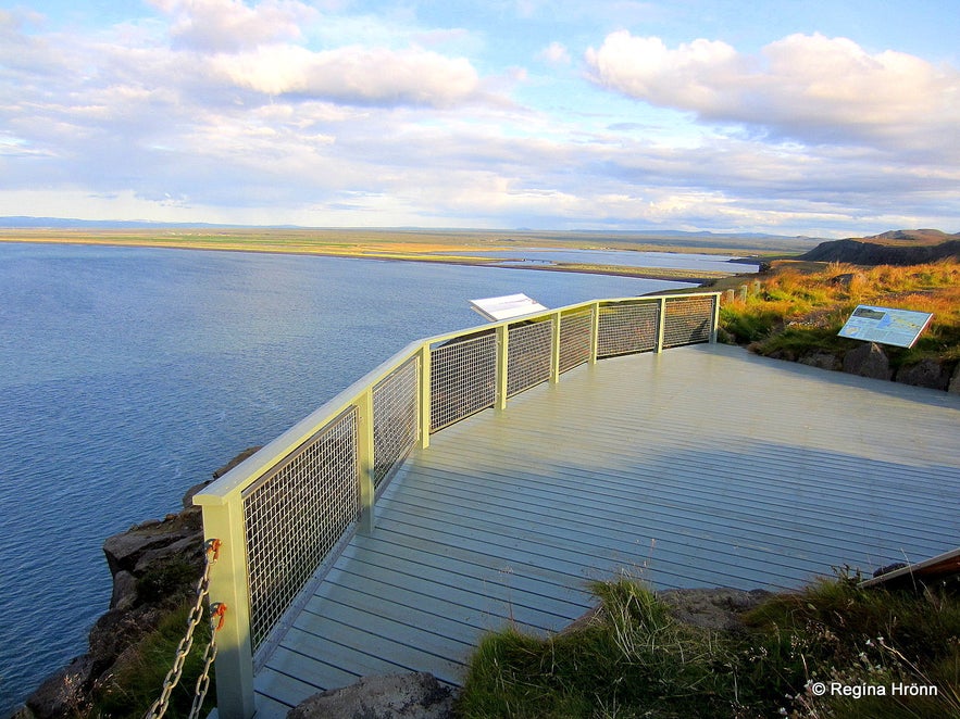
The observation platform at Hringsbjarg cliff
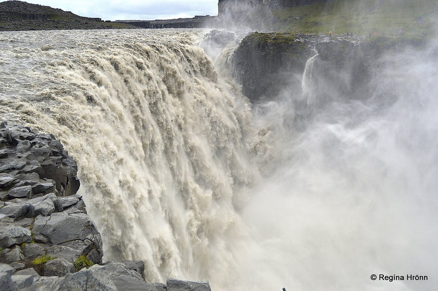
I love how varied this area is, the very rugged Jökulsárgljúfur with my favourite spot in Iceland, Ásbyrgi canyon, and a bit further east the raging glacial river Jökulsá á Fjöllum - the second longest river in Iceland, which creates the most powerful waterfall in Iceland, Dettisfoss.
This massive glacial river has its source in Vatnajökull glacier, the biggest glacier in Europe, and its delta can be seen by Kelduhverfi county and Öxarfjörður. One cannot see this far on top of the Hringsbjarg cliff, but make sure to check it out when visiting the Jökulsárgljúfur glacial canyon.
Dettifoss as seen from the east bank
When you find yourself standing on top of Hringsbjarg cliff you will either have just visited Jökulsárgljúfur and Ásbyrgi and if you are anything like me, then you will still be in awe over the rugged beauty of this area.
Or you will be coming from Húsavík and have yet to visit Jökulsárgljúfur and Ásbyrgi - prepare to be amazed, there is a reason why I visit this area every year and it still manages to blow my mind every year :)
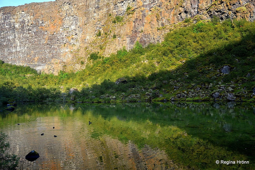
Botnstjörn pond in Ásbyrgi - the capital city of the Icelandic elves
It is better to reach the view platform when driving from Húsavík, as it is located almost immediately as you drive up on Hringsbjarg cliff, so I am sure that a lot of people coming from Àsbyrgi, and being in Iceland for the first time, miss this observation platform.
The view from here is just amazing, especially on sunny days, so don't miss it. Do bring binoculars as this is an excellent location for bird watchers.
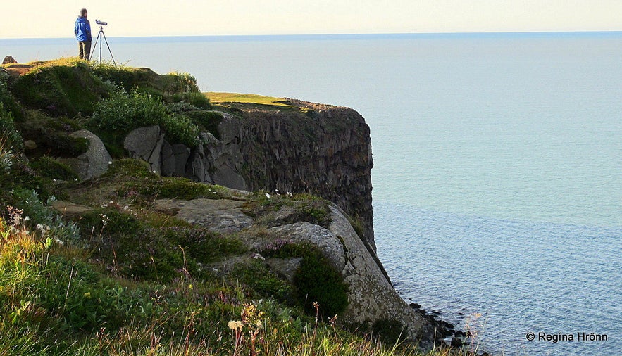
Birdwatching on Hringsbjarg cliff
The swampy plains are rich in birdlife and from Hringsbjarg you will see lakes and lagoons and rivers. One of the lakes in Kelduhverfi is called Skjálftavatn or Lake Earthquake.
It was named appropriately as this 9 km² lake got created in a big earthquake on the 13th of January 1976. This earthquake is called the Kópasker Earthquake and measured a whopping 6.3 on the Richter Scale.
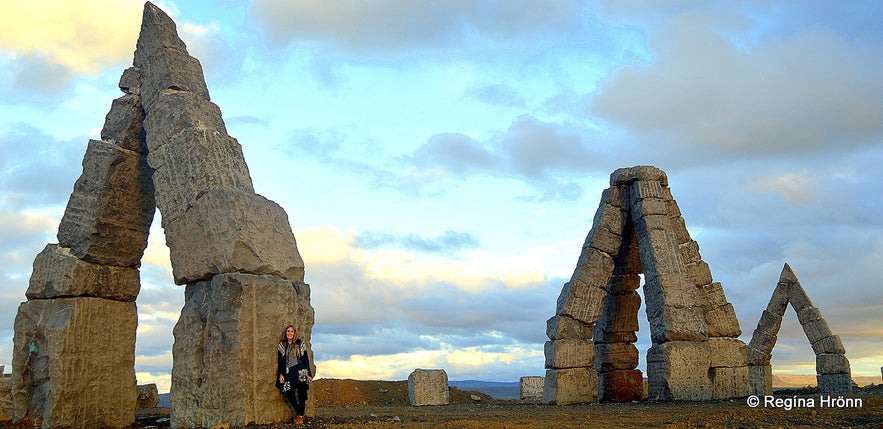
From the cliff you will have a view of Melrakkaslétta plain - the Arctic fox plain, a less visited area of Iceland, but so worth the detour. The main attraction on Melrakkaslétta is the Arctic Henge, but there is so much more to see.
The Arctic Henge on Melrakkaslétta
I love the peace and quiet of Melrakkaslétta and once spent 3 days there exploring this beautiful area of Northeast-Iceland
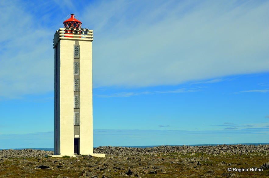
On Melrakkaslétta plain you will find one of the northernmost spots on the mainland of Iceland, Hraunhafnartangi, but I have added a special travel-blog on that beautiful spot, where I created my own Arctic Circle and stepped over it :)
Hraunhafnartangi - one of the northernmost spots of Iceland
On the very popular Diamond Circle tour, a stop is made at Hringsbjarg, where there are colonies of puffins during their nesting season in Iceland from April until mid-August. I joined this tour beginning of August so we managed to see a lot of puffins.
I adore this beautiful bird with the colourful beak. One of the best locations for meeting the puffin is at Látrabjarg in the Westfjords, where it is so tame that you can get very close to it.
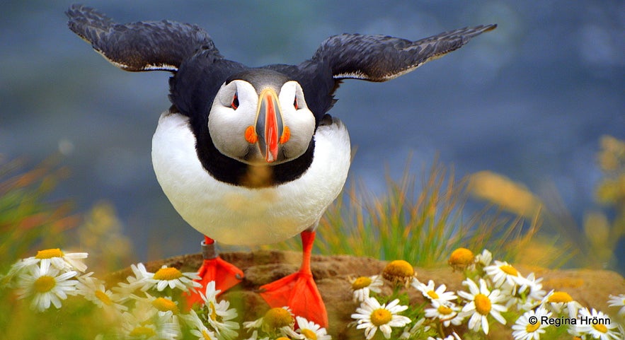
The cute puffin is so popular both amongst Icelanders and our foreign visitors that we sometimes refer to it as the symbol of Iceland.
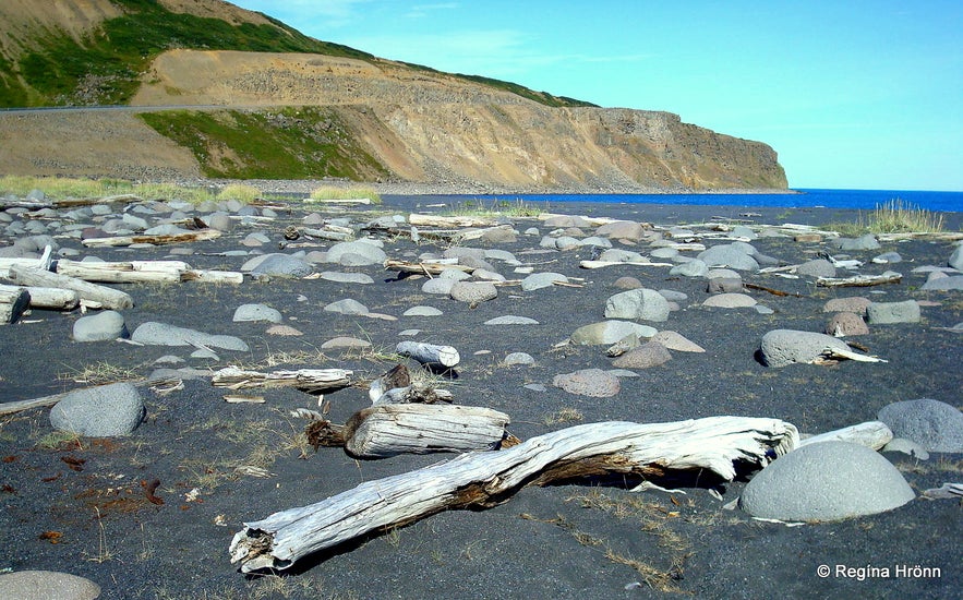
The driftwood beach - Fjallahöfn
Driftwood on Fjallahöfn beach
By road 85, just as you descend from Hringsbjarg, or ascend on Hringsbjarg depending on the direction you are coming from, you will see a beach filled with driftwood. It is fun parking here and walking down to the beach. You can see the beach in my photo above with the backdrop of Hringsbjarg cliff.
I love driftwood beaches and driftwood in Iceland was a valuable asset for Icelanders through the centuries, seeing that we don't have many forests in my country.
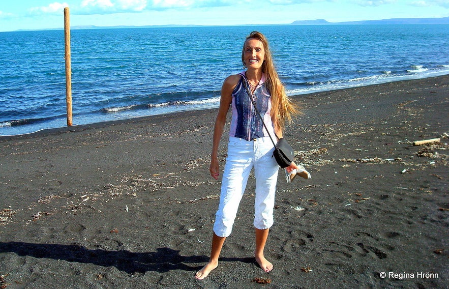 Visiting the Fjallahöfn beach on a sunny summer day - 20 degrees C (the following day I woke up in a tent in Ásbyrgi in 7 degrees C and heavy rain!)
Driftwood was especially valuable for remote areas in Iceland, just imagine getting this present from the sea! The driftwood was used instead of coal and of course for making furniture and construction. The salt in the sea makes the wood very hard and good for that kind of stuff. It is now mainly used for making fences in Iceland.
The driftwood in the north of Iceland comes from Siberia and driftwood is much more common here in the north than in other areas of Iceland. I have also seen beaches in the Strandir area in the Westfjords, which are covered in driftwood. It takes the driftwood some 4-5 years to reach Iceland and on the way here it has been around the North Pole!
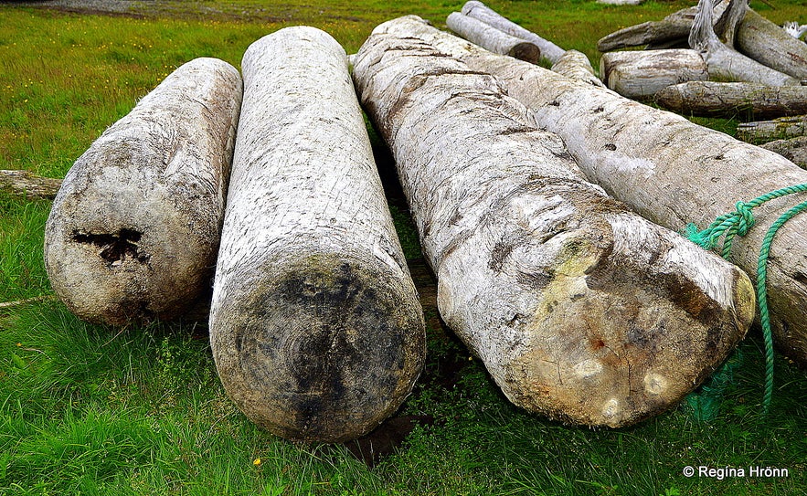
Driftwood in Strandir, which is the easternmost part of the Westfjords - and a poor little dead fox under one of the trees
It is quite interesting walking on the beach being surrounded by driftwood, thinking about where it has come from and where it has been. The photos I have added of the beach are from my visit to the driftwood beach on a sunny day in August when the temperatures soared to 20 degrees C, which is not common in Iceland.
I was in 7th heaven being in this beautiful area on such a fantastic day.
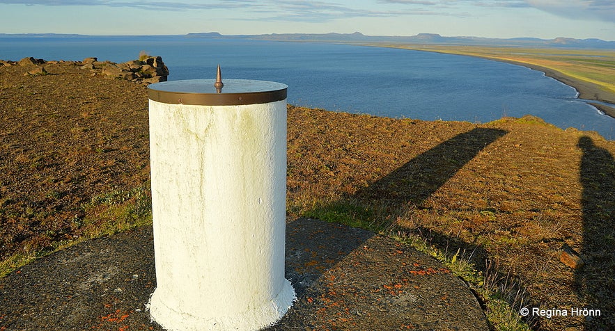
The view-dial at Imbuþúfa in Kelduhverfi
The view-dial at Imbuþúfa
You will find another lovely observation-spot on Hringsbjarg, with a beautiful panoramic view of this vast area.
This spot is called Imbuþúfa. On top of the hill, which is 132 meters above sea level, you will find a view-dial, made by my father-in-law Jakob Hálfdanarson in 1980, and erected in 1981 by the Youth Association Leifur Heppni or Leif the Lucky.
The view-dial is a copper plate on a molten tube with a time of three hours (eyktir). The view-dial shows the names and height of the mountains in the surrounding area.
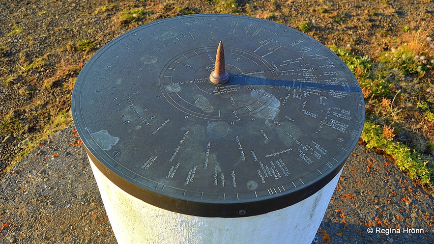
The view-dial at Imbuþúfa
The first guest, which the Youth Association invited to see the view-dial was Vigdís Finnbogadóttir, our President at the time.
I have a special interest in view-dials seeing that the instigator of the view-dials in Iceland was my husband's great-uncle and namesake, Jón Víðis, and my father-in-law took over the making of the view-dials after his uncle's death. So I seek them out wherever I travel in my country.
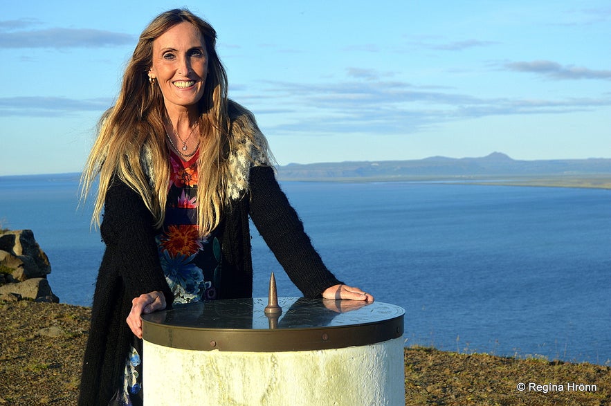
By the view-dial at Imbuþúfa
They are so varied and beautiful, some are old and some are brand-new. And the view from them all, apart from a handful of them, like the one in Jónasarlundur in Hörgárdalur, is excellent.
The view from here is absolutely amazing, especially on a sunny day like on the day when I visited Hringsbjarg and took most of the photos.
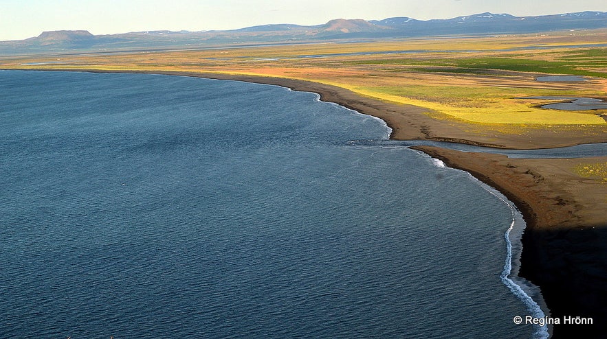
The view from Hringsbjarg cliff
Imbuþúfa is said to be haunted, just so you know. Its strange-sounding name derives from a ghost haunting this area, Imba. The story goes that Imba was travelling in this area during a snowstorm. She didn't know that she had reached the edge of the cliff and fell to her death.
Imba is said to have haunted this area after her tragic death. I have seen Imba being mentioned in some articles, but have not been able to find more about her in our folklore.
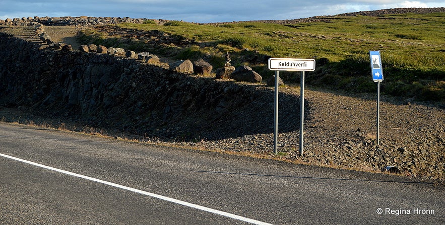
The blue view-dial sign by the road 85
From road 85 you will find a gravel road just opposite the Hringsbjarg observation point leading to the top of Imbuþúfa. Follow the sign Kelduhverfi and then the sign hringsjá which is the Icelandic term for a view-dial. It is some 100 metres from the main road.
Hringsbjarg is right in between Ásbyrgi and Húsavík in North-Iceland. From Húsavík follow road 85 heading north for 35 km. From Ásbyrgi, follow road 85 heading towards Húsavík for 30 km. To reach this area you can rent a car in Reykjavík or Akureyri and explore it by yourself.
Here you can see the location on Hringsbjarg on the map. GPS: 66°08'17.1"N 16°56'57.0"W
Have a lovely time exploring Iceland :)

