Inolvidable Paseo de 3 Horas en Trineo de Perros con Traslado desde Reikiavik
Descripción
Resumen
Descripción
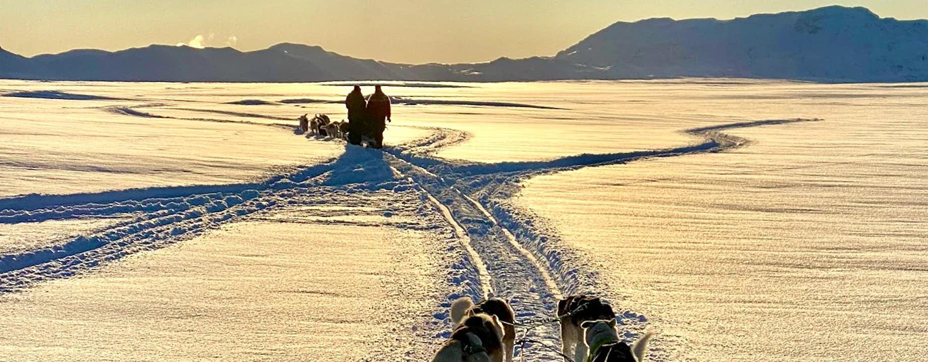
Contempla el maravilloso paisaje islandés de la manera más divertida posible: montado en un trineo tirado por perros. La excursión perfecta para los amantes de la naturaleza, los animales y la aventura.
La excursión comienza cuando te recojan en Reikiavik y te lleven en un corto y panorámico viaje hasta el lugar de inicio de la actividad.
Una vez en el campamento base, podrás saludar a los perros con los que compartirás esta aventura. La mayoría son perros de Groenlandia, pero también conocerás algún husky siberiano o de Alaska. Tu guía, llamado musher (conductor de trineos), te informará sobre la historia de las distintas razas y sobre los trineos de perros en general.
En cuanto conozcas a los perros, comprobarás lo bien cuidados que están. Todas estas razas disfrutan del ejercicio que supone tirar de un trineo, y poseen además una mentalidad de grupo, lo que significa que disfrutan también del trabajo en equipo con un objetivo común. Puedes estar seguro de que todos los participantes en esta excursión, humanos y animales, se lo van a pasar genial.
Una vez preparados los perros y tú, dará comienzo la verdadera aventura. Tras subir al trineo, saldrás disparado a través de un impresionante paisaje de amplios campos y onduladas colinas. Y si la excursión es en verano, o no hay nada de nieve, no hay problema. El musher colocará ruedas en el trineo y la excursión seguirá.
Este recorrido por la maravillosa naturaleza islandesa dura aproximadamente una hora. Asimismo, tendrás la oportunidad de parar para hacer fotos y disfrutar del increíble paisaje a tu alrededor.
No te pierdas esta oportunidad de vivir la bella naturaleza islandesa. Disfruta de un emocionante paseo y conoce a estos increíbles animales. Elige tus fechas para comprobar la disponibilidad. El precio se actualizará al seleccionar el total de participantes.
Incluido
Mapa
Atracciones
Actividades
Qué llevar
Conviene saberlo
Para poder realizar esta excursión debes pesar un máximo de 95 kg y estar en buena forma física (IMC <30). Esta excursión no es apta para mujeres embarazadas.
La recogida comienza 2 horas antes del inicio de la excursión. La hora de recogida es la que aparece en el calendario al hacer la reserva.
El tiempo en Islandia es muy imprevisible, por lo que no se puede garantizar que haya nieve. En caso de no haber nieve, la excursión se realizará sobre terreno seco, en un trineo con ruedas.
Reseñas verificadas
Excursiones similares


Descarga la mayor plataforma de viajes a Islandia en tu móvil para gestionar tu viaje al completo desde un solo sitio
Escanea este código QR con la cámara de tu móvil y pulsa en el enlace que aparece para añadir la mayor plataforma de viajes a Islandia a tu bolsillo. Indica tu número de teléfono o dirección de correo electrónico para recibir un SMS o correo electrónico con el enlace de descarga.


