
Description
Résumé
Description
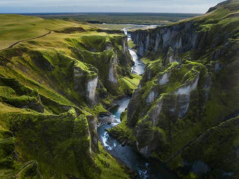
Embarquez pour un voyage inoubliable à travers les sites les plus spectaculaires et les trésors cachés de l’Islande grâce à ce forfait vacances estival de cinq jours soigneusement conçu. Cet itinéraire vous garantit de découvrir le meilleur de l’Islande, y compris Reykjavik, le Cercle d'Or, la Côte Sud, le Blue Lagoon et la magnifique lagune glaciaire de Jokulsarlon.
Laissez-nous gérer chaque détail, de votre arrivée à votre départ, pour que vous puissiez pleinement vous concentrer sur votre aventure.
Ce forfait tout compris rendra votre voyage simple, avec tout qui sera organisé pour vous au meilleur rapport qualité-prix. Votre séjour comprendra quatre nuits dans des hôtels soigneusement sélectionnés, alliant confort et commodité. Le transport et toutes les excursions les mieux notées seront inclus, vous laissant tout le temps nécessaire pour profiter pleinement de chaque lieu extraordinaire.
Un agent de voyage personnel sera disponible 24h/24 et 7j/7 pour vous garantir un accompagnement sans faille tout au long de votre séjour. Vous recevrez également un itinéraire détaillé couvrant à la fois les incontournables et les joyaux cachés de l’Islande.
Une fois la réservation effectuée, l’itinéraire restera entièrement personnalisable, vous permettant d’adapter l’expérience à vos envies, avec la possibilité d'une annulation gratuite et d'un remboursement intégral.
Ce voyage vous promet des expériences incroyables du début à la fin, avec des visites guidées expertes à travers les paysages les plus spectaculaires de l’Islande. Vous explorerez le Cercle d'Or et la Côte Sud, visitant des sites emblématiques comme le Parc national de Thingvellir, la zone géothermique de Geysir et la puissante cascade de Gullfoss. Le tout, en découvrant des histoires fascinantes grâce à votre guide expérimenté.
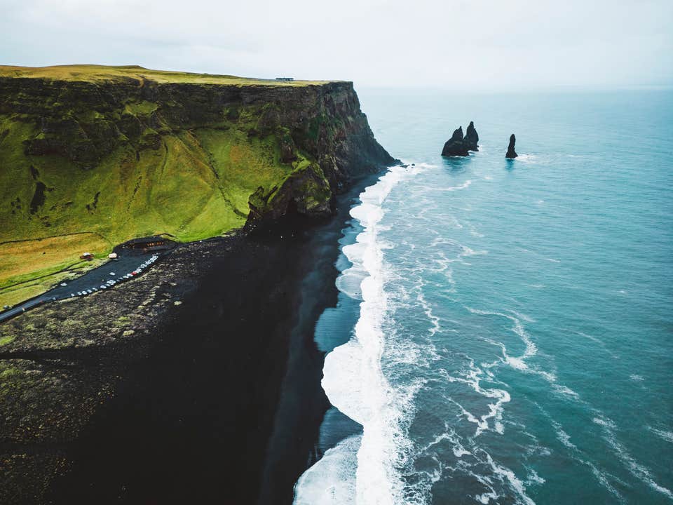
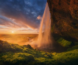
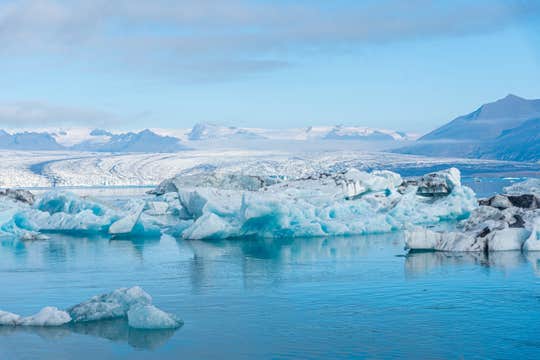
Admirez Seljalandsfoss et Skogafoss, où l’eau chute de manière spectaculaire depuis de hautes falaises, et promenez-vous sur le sable noir de la plage de Reynisfjara. L'un des moments forts de votre voyage sera la visite de la lagune glaciaire de Jokulsarlon, où d’immenses icebergs dérivent dans des eaux d’un bleu saisissant avant de venir s’échouer sur la Plage de Diamants.
Vos guides experts donneront vie à chaque lieu, partageant avec vous des informations sur la géologie, l’histoire et le folklore unique des lieux, rendant chaque arrêt encore plus mémorable.
Si vous souhaitez ajouter encore plus d’aventure, ce forfait propose une gamme d’activités optionnelles pour personnaliser votre expérience.
La randonnée sur glacier au Solheimajokull vous permettra d’explorer des formations de glace impressionnantes et des crevasses profondes. Une balade à cheval près de la cascade de Gullfoss vous offrira une escapade paisible à travers les paysages géothermiques de l’Islande. À vous de choisir ce qui vous fait envie.
Pour les amateurs de sensations fortes, une virée en motoneige sur le glacier Langjokull permettra de vivre une expérience exaltante sur des étendues enneigées avec des vues à couper le souffle.
Si vous préférez la détente, ne manquez pas une visite au célèbre Blue Lagoon, où vous pourrez vous relaxer dans des eaux géothermiques riches en minéraux, entourées d’un champ de lave spectaculaire.
Pour ceux qui veulent s’immerger dans la culture vibrante de Reykjavik, plusieurs activités sont possibles ; vous aurez notamment le choix entre l’observation des baleines depuis le vieux port, la dégustation de la cuisine islandaise lors d’un food tour, ou encore une immersion dans l’univers des aurores boréales à l'Aurora Centre.
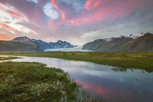
Votre aventure comprendra trois nuits au cœur de Reykjavik, où vous aurez le temps de savourer la gastronomie islandaise, d’explorer des musées fascinants et de vous détendre dans de charmants cafés. Une nuit sera également passée dans le Parc national de Vatnajokull, vous offrant l’opportunité de vous immerger dans la nature sauvage et intacte de l’Islande.
Les longues journées de l’été islandais offrent de nombreuses heures de jour ; cela vous donnera plus de temps pour explorer le pays, capturer des photos incroyables et créer des souvenirs inoubliables.
Réservez votre forfait de voyage dès maintenant pour bénéficier du meilleur tarif. Commencez à planifier votre aventure estivale ultime en Islande sans attendre !


