
Descrizione
Riepilogo
Descrizione
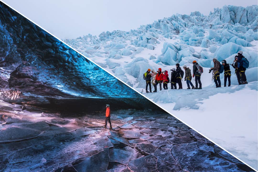
Unisciti a noi per un'indimenticabile camminata sul ghiacciaio e tour nella grotta di ghiaccio in Islanda! Cammina sul Vatnajokull, il ghiacciaio più grande d’Europa, ed entra in una grotta di ghiaccio blu formata naturalmente. Un’avventura straordinaria che pochi hanno la fortuna di vivere.
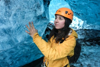
Il tuo viaggio inizia nel parcheggio principale della laguna del ghiacciaio Jokulsarlon, dove incontrerai la tua guida esperta e riceverai ramponi, casco e piccozza. Non è richiesta alcuna esperienza precedente sul ghiacciaio: basta portare con sé spirito d’avventura e voglia di affrontare una camminata gratificante.
La camminata sul ghiacciaio inizia con una passeggiata di 20 minuti verso il ghiacciaio, attraversando paesaggi affascinanti come rocce deformate, linee di muschio che segnano dove un tempo arrivava il ghiaccio e una laguna con gli ultimi resti di ghiaccio sciolto.
Una volta arrivati a Falljokull, uno degli affluenti più suggestivi del Vatnajökull, la guida ti insegnerà come camminare sul ghiaccio e ti fornirà un rapido briefing sulla sicurezza. Da qui partirai per una camminata di tre ore sul ghiacciaio, attraversando paesaggi mozzafiato.
Lungo il percorso vedrai profondi crepacci, brillanti mulini glaciali, i cosiddetti “topi dei ghiacciai” ricoperti di muschio e imponenti cascate di ghiaccio. L’itinerario è pensato per essere accessibile alla maggior parte dei livelli di forma fisica, e la guida manterrà un ritmo rilassato per permetterti di godere ogni panorama.
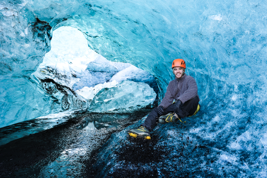
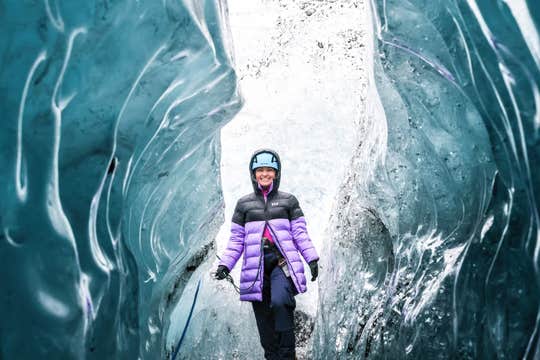
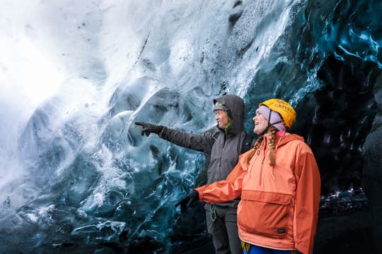
Il momento clou del tour è la spettacolare grotta di ghiaccio blu, dove le intense sfumature di ghiaccio creano un’atmosfera surreale e magica. Le grotte di ghiaccio in Islanda sono il luogo ideale per scattare foto indimenticabili, quindi assicurati di avere telefono o fotocamera carichi e pronti.
Questa camminata sul ghiacciaio e tour nella grotta di ghiaccio in Islanda è perfetta per chi cerca un’avventura con una sfida fisica moderata, paesaggi spettacolari, scoperte affascinanti e ricordi che dureranno per sempre.
Prenota ora per assicurarti il tuo posto nel tour sul ghiacciaio più emozionante d’Islanda ed esplora i paesaggi più spettacolari del Parco Nazionale Vatnajokull! Controlla subito la disponibilità scegliendo una data.


