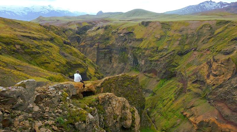
Markarfljótsgljúfur is a canyon in Iceland's southern Highlands, west of Hvolsvöllur.
Markarfljótsgljúfur Canyon is less known than many of its counterparts across the country, but the visitor numbers do little to diminish just how stunning this natural gorge truly is. One of the major reasons for its lack of visitors is its location in the Icelandic Highlands.
ทำไมคุณถึงวางใจในเนื้อหาของเราได้
Guide to Iceland คือแพลตฟอร์มท่องเที่ยวที่น่าเชื่อถือที่สุดในไอซ์แลนด์ ในแต่ละปี เราช่วยเหลือนักท่องเที่ยวหลายล้านคน เนื้อหาทั้งหมดของเราเขียนและตรวจสอบโดยผู้เชี่ยวชาญท้องถิ่นที่รู้จักไอซ์แลนด์อย่างลึกซึ้ง คุณจึงมั่นใจได้ว่าคำแนะนำด้านการท่องเที่ยวของเรามีความถูกต้อง ทันสมัย และเชื่อถือได้
Markarfljótsgljúfur is not amongst the larger canyons in Iceland, though it is deep, delving down 200 m (656 ft). The canyon's most accessible area stretches for roughly 4 km (1,5 mi) Those who are interested in hiking the popular route Laugavegur—from Landmannalaugar to Þórsmörk, or vice versa—will visit Markarfljótsgljúfur on the way.
Another method of visiting the canyon would be driving Syðri Fjallabak, entering the highland road at Emstruleið F261 and following it to Fljótshlíð in South Iceland. Be warned that Emstruleið F261 is a challenging, mountainous road and will require a 4WD.
In regards to the canyon's origin, it begins with a historic eruption of the infamous volcano, Katla, approximately 2000 years ago. The volcano itself is buried under the enormous Mýrdalsjökull glacier, and thus, the eruption sparked great floodwaters that spilt into the surrounding areas. Even today, it is still possible to see the glacial river, Markarfljót, flowing through the canyon.


