Landmannalaugar is a vast region of colorful rhyolite mountains, geothermal hot springs, and rugged lava fields that lies in Southern Iceland and is one of the country’s most breathtaking destinations. Read on to plan your Landmannalaugar adventure and experience the untamed beauty of Iceland’s Highlands.
Many visitors join Landmannalaugar tours or Highland tours to explore this remote area safely during the short summer season. Guided trips, like a 5-day hiking tour from Landmannalaugar to Thorsmork, offer scenic viewpoints, hidden springs, and mountain trails without the stress of driving on rough F-roads.
Why You Can Trust Our Content
Guide to Iceland is the most trusted travel platform in Iceland, helping millions of visitors each year. All our content is written and reviewed by local experts who are deeply familiar with Iceland. You can count on us for accurate, up-to-date, and trustworthy travel advice.
For a more independent journey, you can rent 4x4 vehicles that can handle the Highland terrain and plan your own route with self-drive tours. Keep reading to learn how to reach Landmannalaugar, where to stay, and what to expect when exploring Iceland’s magnificent Highlands.
Quick Facts About Landmannalaugar
-
Location: Fjallabak Nature Reserve in Iceland’s Southern Highlands, about 110 miles (180 kilometers) east of Reykjavik
-
Access: Reachable only by 4×4 vehicles via F208 or F225 mountain roads (open late June to mid-September)
-
Best known for: Colorful rhyolite mountains and a natural geothermal hot spring
-
Main activities: Hiking, bathing in hot springs, photography, and camping
-
Facilities: Mountain hut, campsite, basic toilets, and limited food service
-
Elevation: Around 2,000 feet (600 meters) above sea level
-
Nearby highlights: Laugavegur Trail, Hekla Volcano, Thorsmork Valley
-
Managed by: Environment Agency of Iceland (Umhverfisstofnun)
The Stunning Natural Landscape of Landmannalaugar
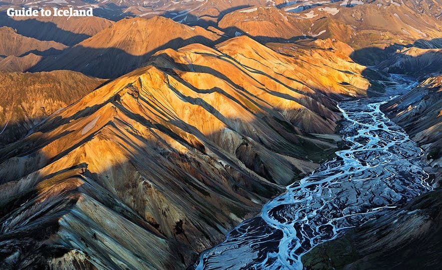
Landmannalaugar is one of Iceland’s most colorful geological areas. The region sits beside the black Laugahraun Lava Field, which was created during an eruption in 1477. Beneath the surface, heat still rises from the Earth’s crust, forming the steam vents and hot springs that make this Highland valley so unique.
The surrounding mountains are made of rhyolite, a volcanic rock rich in silica that cools slowly and traps minerals. This slow cooling and the area’s geothermal heat have given the rock its vivid colors. Iron, sulfur, and copper create reds and yellows, while silica and other minerals add greens and blues.
Over time, wind and rain have exposed these colorful layers, turning the Highlands into a natural mosaic of red slopes, golden ridges, and blue-green streaks. Today, Landmannalaugar’s rhyolite hills are one of the best examples of Iceland’s volcanic landscape shaped by both fire and water.
Top Hiking Trails in Landmannalaugar
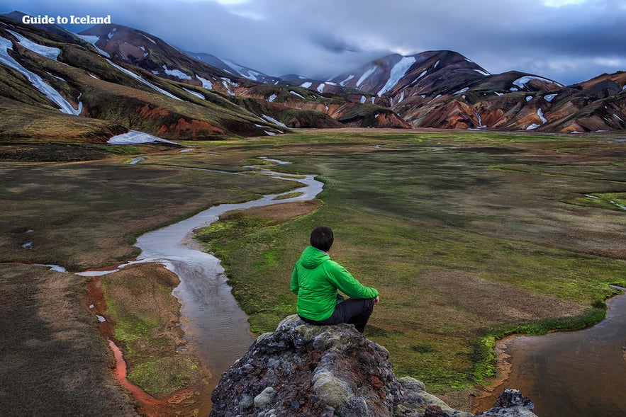 Landmannalaugar is one of Iceland’s best areas for hiking. The region’s colorful mountains, steaming vents, and black lava fields make every Landmannalaugar trail a unique experience. Visitors should always bring a swimsuit and a towel, as natural hot springs can appear unexpectedly along the hiking trails.
Hiking tour in Landmannalaugar is popular among both casual walkers and experienced adventurers who want to explore the Icelandic Highlands. Begin early in the day and bring layers for quick weather changes. Trails can become slippery after rain or geothermal mist, and temperatures often fall quickly in the afternoon.
Below is a quick overview of the most popular Landmannalaugar hiking trails, with their distances, duration, and highlights to help you choose the route that best fits your time and skill level.
| Trail | Distance | Duration | Difficulty | Highlights |
|---|---|---|---|---|
| Laugavegur Trail (to Thorsmork) | 34 miles (55 km) | 3–4 days | Challenging | Iceland’s most famous trek |
| Blahnukur (Blue Peak) | 3 miles (5 km) | 2–3 hrs | Moderate | Summit views over rhyolite slopes |
| Brennisteinsalda Loop | 4 miles (6.5 km) | 2–3 hrs | Moderate | Sulfur vents, red and yellow ridges |
| Laugahraun Lava Field | 2 miles (3 km) | 1–1.5 hrs | Easy | Lava formations, hot spring access |
Laugavegur Trail Start Point
Landmannalaugar marks the northern end of the Laugavegur Trail, one of Iceland's most popular hiking trails. This route continues 34 miles (55 kilometers) south toward Thorsmork, the "Valley of Thor," ending at the Skogafoss Waterfall. It is known for its scenery of rhyolite mountains, black volcanic plains, and glacial rivers.
You can join a 6-day hiking tour from Landmannalaugar to Thorsmork, allowing you to pace yourself and fully experience the changing landscapes along the way. There are even specialized options, such as an all-women Laugavegur Trail hiking tour, for those seeking a female-led or women-only expedition.
Blahnukur Volcano Hike
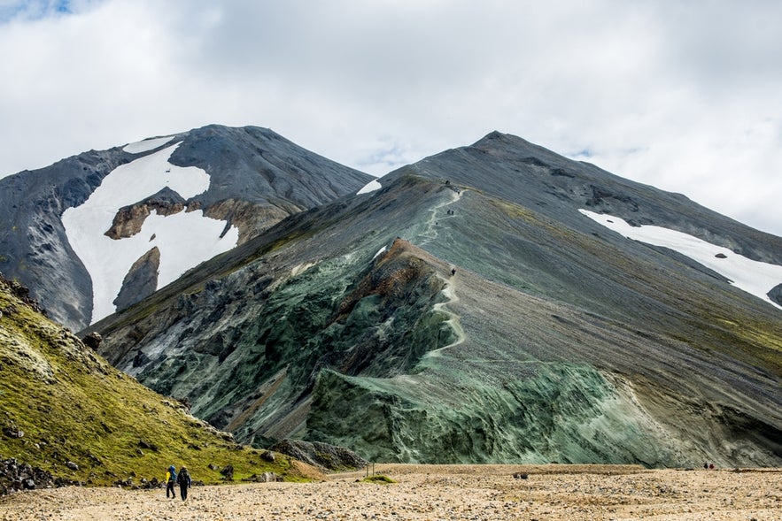 The Blahnukur Volcano hike is a short but steep trail that climbs Iceland’s Blue Peak, one of the most iconic sights in Landmannalaugar. The mountain is made of volcanic ash and dark lava, giving it a deep blue-gray color.
The trail begins near the Landmannalaugar Campsite and rises about 940 meters (3,084 feet) over 3 miles (5 kilometers) round trip. Most hikers complete it in two to three hours. The climb is considered moderate in difficulty and is a short, rewarding adventure with unforgettable scenery.
At the summit, the view stretches across the Landmannalaugar Hiking Area, revealing red and yellow rhyolite slopes, black lava fields, and distant snow-covered peaks. On clear days, hikers can even see up to five glaciers from the top, which makes it one of the most panoramic viewpoints in the Highlands.
Brennisteinsalda Loop Trail
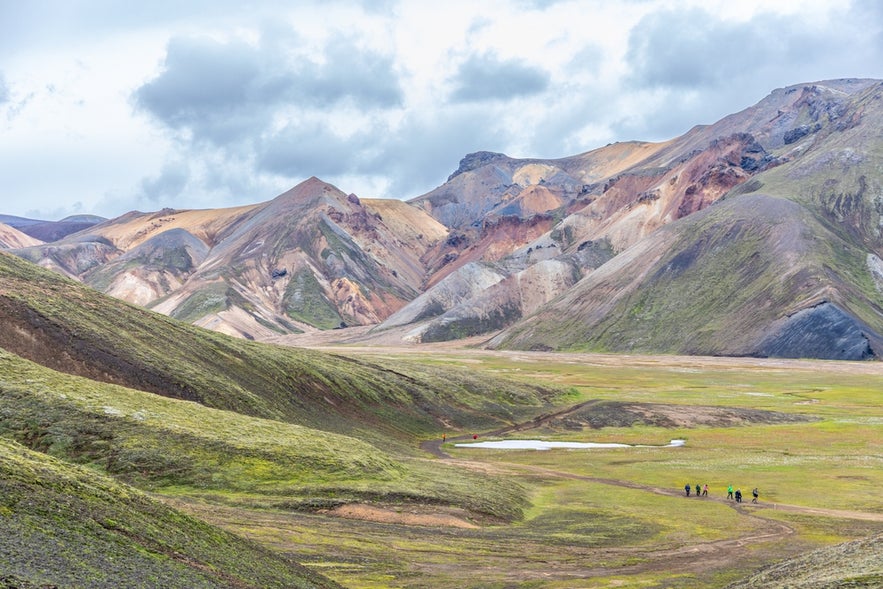 The Brennisteinsalda hike circles the mountain, often called the Landmannalaugar Sulfur Mountain. It earned the nickname “Sulphur Wave,” which captures its colorful hues. The route passes through red slopes, green moss, and yellow sulfur ridges, with steam vents and bubbling mud pools along the way.
This loop is about 4 miles (6.5 kilometers) long and takes two to three hours to complete. It is rated moderate in difficulty. Many hikers combine it with the Laugahraun Lava Field Trail for a half-day hike that shows the area’s geothermal activity and wide range of colors.
Laugahraun Lava Field Trail
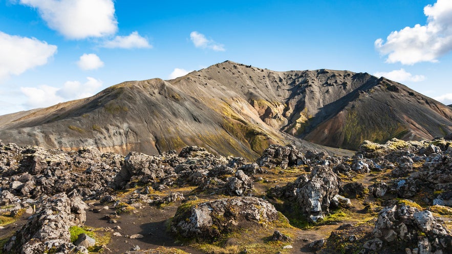 The Laugahraun Lava Field trail is one of the easiest hikes in Landmannalaugar and a great option for first-time visitors. The path crosses ancient black lava formations created during the 1477 eruption that shaped the valley. It also passes near the famous Landmannalaugar Hot Spring.
This easy route covers about 2 miles (3 kilometers) and takes one to one and a half hours to finish. It offers close-up views of lava textures, small geothermal vents, and colorful hillsides. The trail connects with others in the area, including the Brennisteinsalda Loop, which makes it a good warm-up walk before tackling longer routes.
Landmannalaugar Hot Springs
Tucked beside the Laugahraun Lava Field, the Landmannalaugar Hot Spring is one of Iceland’s most famous geothermal pools. Warm groundwater from underground vents mixes with cooler mountain streams to create a steady temperature of 97 F to 104 F (36 C to 40 C).
The area has been known for its natural geothermal baths for centuries, which is why it's called “The People’s Pools.” In earlier times, settlers crossing the barren Highlands stopped here to rest and recover before continuing their journey.
Today, visitors can join a Landmannalaugar hiking and hot spring tour, which combines scenic walks through colorful rhyolite landscapes with a soothing dip in the natural pools. The pool remains natural and easy to access, offering a calm setting where steam rises against a backdrop of moss and lava.
What To Expect at the Hot Springs
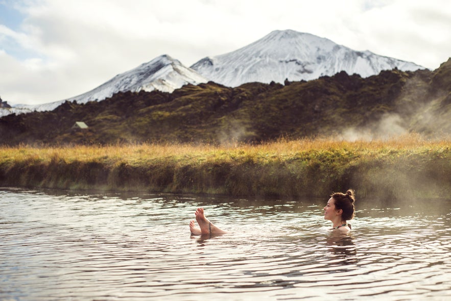 The Landmannalaugar Geothermal Pool sits at the edge of the lava field near the main campsite. It is a natural, unmarked pool surrounded by grassy banks and dark volcanic rock. The spring can comfortably fit 10 to 20 people, and the water stays warm even on cold or windy days.
You can change clothes inside the nearby mountain hut before walking along the wooden path to the pool. The water feels warmer near the lava rocks where the spring enters and cooler toward the outer edges. Bring sandals for the rocky bottom and a towel for drying off afterward.
Pro tip: The best time to visit is early morning or late evening when the light is soft and the area is quieter.
How To Get to Landmannalaugar
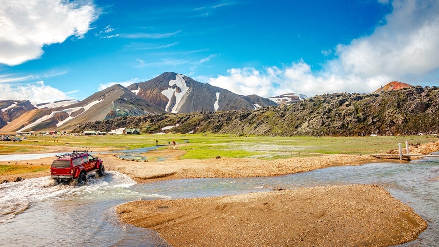 Landmannalaugar lies deep inside Iceland’s Fjallabak Nature Reserve and can only be reached by a 4×4 vehicle on F-roads, which are gravel mountain routes. Travelers can drive to Landmannalaugar, take the Highland Bus, or join a guided Super Jeep tour from Reykjavik or nearby towns.
Each route into the Highlands offers a different experience. Some roads are smoother and more scenic, while others are rougher with multiple river crossings. Understanding the main access routes and travel options helps you choose the safest and most convenient way to reach Landmannalaugar.
Driving to Landmannalaugar by 4x4
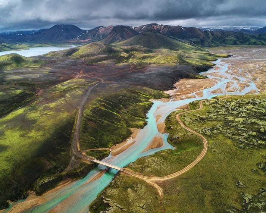
Driving to Landmannalaugar is not a regular road trip. The Highlands are remote and reached only by unpaved mountain tracks meant for high-clearance 4×4 vehicles. These roads cross gravel, sand, and rivers, so small cars and campervans are not allowed.
The main access routes, F208 and F225, are open only in summer, usually from late June to mid-September. Conditions change quickly with rain and river levels, so check updates for road status and weather conditions in Iceland before you go.
Best Routes From Reykjavik to Landmannalaugar
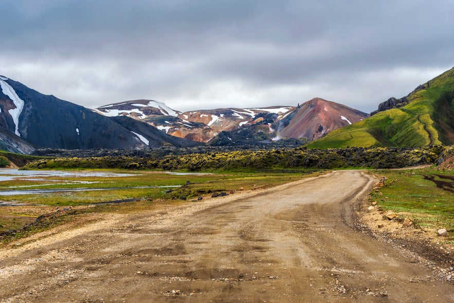 There are three main routes from Reykjavik to Landmannalaugar, each offering a different mix of scenery, driving time, and road conditions. All routes require a 4x4 vehicle and are open only in summer when the Highland roads are accessible.
| Route | Distance | Drive Time | Difficulty | Best For | Highlights |
|---|---|---|---|---|---|
| F208 North (via Road 26) | 112 miles (180 km) | 4 hours | Easy–Moderate | First-time Highland drivers | Thjorsardalur Valley, views of Hekla Volcano |
| F225 Landmannaleid | 115 miles (185 km) | 4.5 hours | Moderate | Travelers seeking scenic backroads and light river crossings | Hekla Volcano, volcanic plains, remote Highlands |
| F208 South (via Vik or Kirkjubaejarklaustur) | 155 miles (250 km) | 5–6 hours | Difficult | Experienced 4x4 drivers who are used to deep river crossings | Eldgja Canyon, Fjallabak Nature Reserve, lava fields |
F208 North (via Road 26 and F208)
The northern route to Landmannalaugar starts from Reykjavik, following Route 1 (Ring Road) east before turning onto Road 30 near the town of Selfoss. From there, continue on Road 32 toward Thjorsardalur Valley, then join Road 26 until you reach the F208 turnoff leading south into the Highlands.
The total drive is about 112 miles (180 kilometers) and takes roughly 4 hours in good conditions. The final stretch, known as Sigolduleid, winds through volcanic hills and gravel plains dotted with geothermal vents.
Along the way, you can make a short stop at Blahylur Lake, a crater lake formed inside a dormant volcano, before reaching the Landmannalaugar Campsite.
Most 4x4 rental vehicles can handle this route safely, so it’s ideal for first-time visitors heading to Landmannalaugar as part of a Golden Circle or South Iceland itinerary. It’s the best choice for travelers who prefer a smoother Highland drive with fewer deep river crossings.
F225 Landmannaleid (via Road 26 and F225)
This route begins the same way as F208 North, starting from Reykjavik along Route 1 (Ring Road) to Selfoss, then following Road 30, Road 32, and Road 26. After roughly 93 miles (150 kilometers), you’ll turn onto F225 Landmannaleid, which cuts directly through the Highlands to reach Landmannalaugar.
The total drive from Reykjavik is around 115 miles (185 kilometers) and takes about 4.5 hours. F225 passes close to Hekla Volcano and offers open views of volcanic plains, mountain ridges, and colorful lava formations. However, this route includes medium-depth river crossings.
This option suits travelers looking for a more adventurous and less crowded drive into the Highlands. Those who have already explored the Golden Circle or the South Coast will appreciate its access to Iceland’s remote interior landscapes.
F208 South (via Vik or Kirkjubaejarklaustur)
The southern approach to Landmannalaugar is the most challenging but also the most dramatic route. You can start from Reykjavik by driving east along Route 1 (Ring Road) toward Vik or Kirkjubaejarklaustur, then turn inland onto F208 North from either town.
The total distance is about 155 miles (250 kilometers) and usually takes 5 to 6 hours, depending on weather and road conditions. This route passes through Iceland’s remote interior and deep river crossings, which makes it suitable only for experienced drivers in high-clearance 4x4 vehicles.
Travelers often combine this route with stops at Eldgja Canyon, Fjallabak Nature Reserve, or Fjadrargljufur Canyon before reaching Landmannalaugar. It’s best suited to those who have driven on F-roads before and want to experience the Highlands’ raw, untamed landscapes.
Preparing for Highlands Driving
-
Check your vehicle: Only high-clearance 4×4 vehicles are permitted on F-roads. Inspect your tires, brakes, and spare before leaving the main road. Make sure your tank is full and your tools are in the car.
-
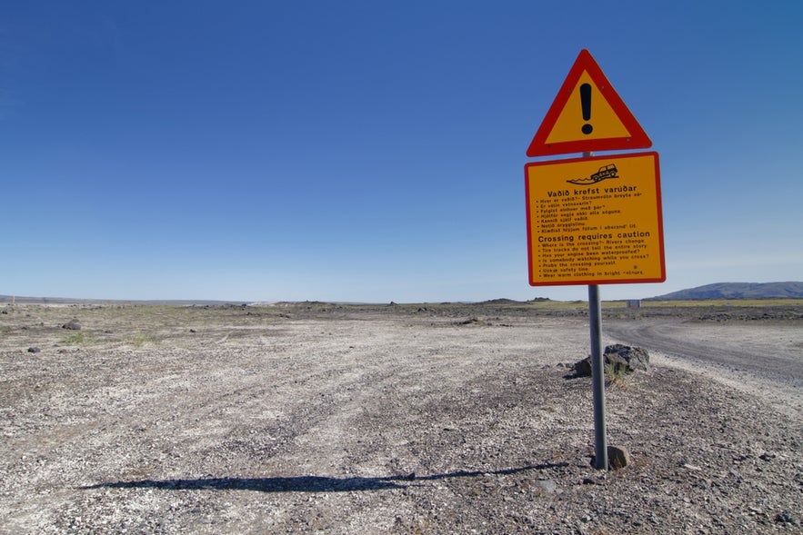
Understand F-roads: F-roads are marked with an F followed by a number, such as F208 or F225. They are unpaved mountain tracks with gravel, soft sand, and uneven ground, so drive slowly and keep both hands on the wheel to stay in control.
-
Fuel and supplies: The Hrauneyjar Highland Center is the last reliable fuel stop before entering the highlands. Once you pass it, there are no gas stations, stores, or repair services. Bring enough water and food for the day.
-
Pack for remote travel: Mobile coverage is limited or unavailable in some highland areas. Carry warm clothing and a first-aid kit. A GPS or an offline map is useful if you lose signal.
-
Cross rivers safely: Choose the line where the flow is calmest and smoothest, and avoid spots that churn or appear muddy. Watch other vehicles if possible to gauge depth. Use low gear, drive slowly in a straight line, and do not stop midstream. If the water looks deep or fast, wait or turn back.
-
Drive with caution: Conditions in the Highlands can change quickly with rain or fog. Adjust your speed and keep a safe distance from other vehicles. If a road looks unsafe, wait until conditions improve.
Parking at Landmannalaugar
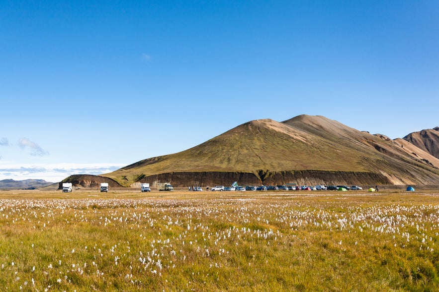 During the summer period, from late June to mid-September, travelers driving to Landmannalaugar in a private or rental car between 9 AM and 4 PM are required to book a parking space and pay a service fee. Reservations are available only through the Parka website or app, and on-site staff are not authorized to process bookings.
There are a total of 140 parking slots daily, and they tend to sell out most days of the summer, so it’s wise to reserve early if you plan to arrive during busy hours. You may complete your booking without a license plate number, but it must be added later before your visit.
If weather conditions are poor, reservations for that day stay valid for two additional days. Visitors arriving outside peak hours may park without a reservation, but the same service fee applies. If payment is not completed, a digital invoice will be issued to the registered vehicle owner.
Highland Bus to Landmannalaugar
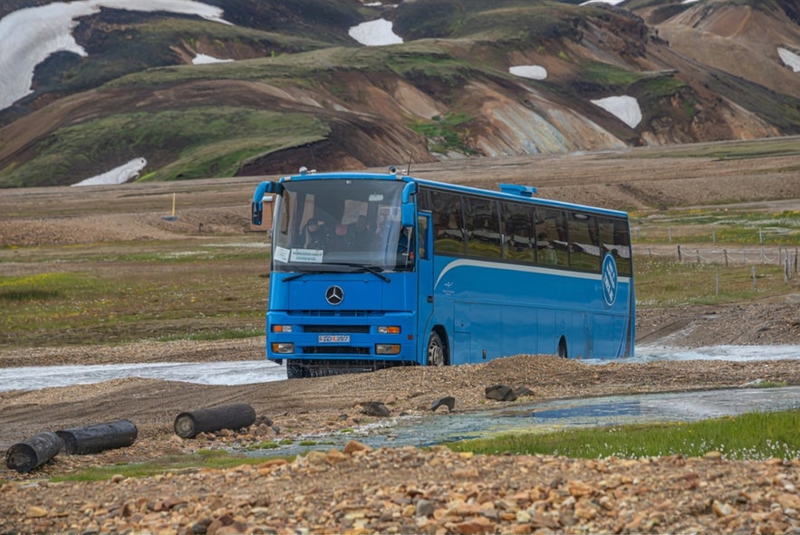
The service usually operates from mid-June to early September, depending on road openings and weather. Travel time from Reykjavik is about 4 to 5 hours, with short rest stops along the way.
Here are a few options:
-
Highland Bus Transfer From Landhotel Hella to Landmannalaugar
-
Highland Bus Transfer From Landmannalaugar to Landhotel Hella
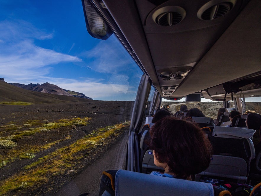
What To Expect on the Journey
-
Comfort and safety: Highland buses are equipped with raised chassis and strong suspension to handle gravel and river crossings safely.
-
Stops and routes: Most routes include short stops at Selfoss, Hella, and sometimes at scenic viewpoints such as Hrauneyjar Highland Center or Sigoldugljufur Canyon.
-
Luggage and gear: You can bring hiking backpacks, camping gear, and large luggage. Storage is available under the bus or in a trailer for bulky equipment.
-
Bring food, water, and warm layers: The bus passes through remote terrain with no stores or services between stops. Weather can change quickly, even in summer, so dress in layers and pack snacks and water.
-
Tickets and booking: Many hikers book one-way rides to start the Laugavegur Trail and continue to Thorsmork or Skogar. Reserve early since buses often sell out in July and August.
Guided Super Jeep Tour to Landmannalaugar
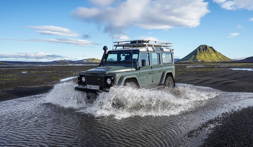 A guided Super Jeep tour is the most adventurous way to reach Landmannalaugar without driving yourself. These specialized off-road vehicles are built for rough F-roads and river crossings, taking you deep into the Icelandic Highlands in comfort and safety.
Here are some of the best options:
-
Landmannalaugar Super Jeep Tour With Pickup From the South Coast or Reykjavik: A full-day adventure through Iceland’s rugged Highlands with photo stops at craters, lava fields, and colorful rhyolite mountains.
-
Adventurous 12-Hour Super Jeep Tour to Landmannalaugar & Hekla Volcano: Explore the dramatic landscapes around Mount Hekla and the geothermal valleys of Landmannalaugar on a guided 12-hour Super Jeep safari designed for thrill-seekers.
-
Scenic 12-Hour Super Jeep Tour of Landmannalaugar From Reykjavik: A full-day journey from Reykjavik featuring rugged off-road driving, panoramic views, and time to hike or soak in the natural hot springs.
-
Super Jeep & Hiking Tour of Landmannalaugar & Waterfalls From Reykjavik: Combines off-road exploration with guided hiking and visits to hidden waterfalls, offering a perfect balance of adventure and nature photography.
-
Private Jeep Tour to Landmannalaugar From Hvolsvollur: A customizable private tour from Hvolsvollur, ideal for small groups or families who want a personal off-road experience in the Icelandic Highlands.
Of course, like many of Iceland’s destinations, you can also explore Landmannalaugar on a helicopter tour, which offers an exciting adventure and stunning views.
Where To Stay or Camp in Landmannalaugar
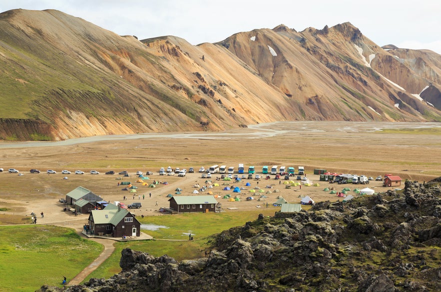 Accommodation in Landmannalaugar is limited, but you have several options depending on your comfort level and travel style. You can stay directly in the Highlands at the mountain hut or camping area, or book a guesthouse or lodge within an hour’s drive.
Mountain Huts and Camping Area
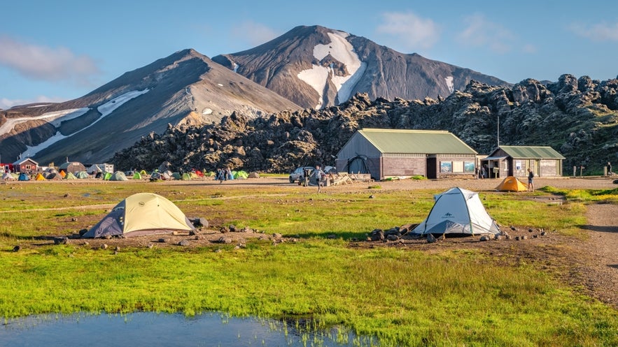 The Iceland Touring Association operates the Landmannalaugar Hut. It’s large, comfortable, and accommodates 78 guests across two floors.
The ground floor features a large sleeping area with bunk beds and a fully equipped kitchen with all necessary utensils. Upstairs, there is one small dormitory and three larger rooms, offering plenty of shared sleeping space.
A patio connects the main hut to a toilet and shower house, and there is also a charcoal grill available outdoors for guest use. The wardens live in a nearby hut beside the facilities, providing assistance and maintaining the site.
The camping area sits close to the toilet house and is set on gravel ground. Those who don’t have their own gear can arrange to rent camping equipment before arriving in Landmannalaugar.
Nearby Guesthouses and Lodges
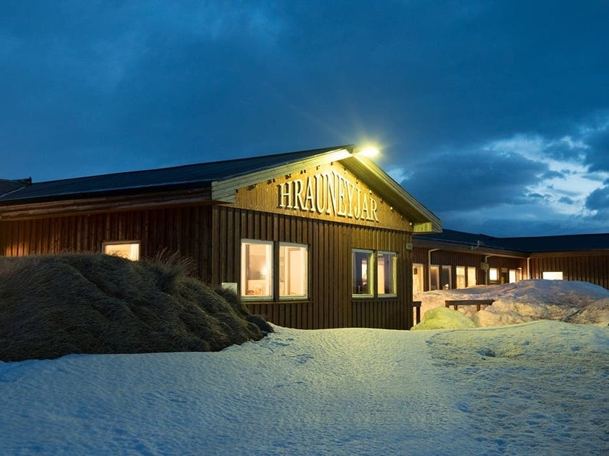 If you prefer more comfort, several guesthouses and lodges near Landmannalaugar offer warm beds, private rooms, or meal services. These are great options for travelers who want easy access to the Highlands in a quieter, more relaxed setting.
-
The Highland Center Hrauneyjar: Located about 19 miles (30 kilometers) from Landmannalaugar. It offers rooms with private bathrooms, a restaurant, and Wi-Fi. It’s a popular stop for Highland day trips and tours.
-
Holaskjol Cabin: Around 24 miles (39 kilometers) from Landmannalaugar, this rustic cabin offers a kitchen, grill, toilet, and separate shower hut. It’s ideal for travelers who want something more comfortable than camping but still close to Highland hiking routes.
-
Landhotel in Hella: A modern, full-service hotel located near Road 26 in Landborgir, about an hour and a half from Landmannalaugar. It features private rooms, a restaurant, spa and sauna, Wi-Fi, and free parking.
Best Time To Visit Landmannalaugar
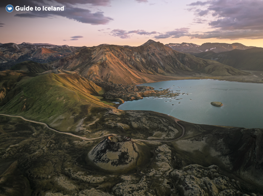 The best time to visit Landmannalaugar is during summer in Iceland, from late June to early September, when the F-roads are open and travel conditions are safe. Facilities such as the campsite, mountain huts, and Highland bus service operate only during the season.
Daytime temperatures range from 5 C to 15 C (41 F to 59 F), with colder mornings and evenings. The weather can change quickly, so it is important to bring warm and waterproof clothing even in summer. Outside this period, the roads are closed because of snow, river flooding, and unpredictable weather.
In June and July, daylight lasts up to 20 to 22 hours per day, which is ideal for hiking, camping, and photography. By late August and early September, the Highlands begin to cool, and the colorful rhyolite mountains sometimes appear Yes. The Landmannwith a light layer of snow, creating striking contrasts for photographers.
FAQs About Landmannalaugar
Here are the answers to some of the most common questions about visiting the Landmannalaugar.
When does Landmannalaugar open for the season?
Landmannalaugar is open only during summer, usually from late June to early September. The exact dates depend on snowmelt and weather, as the F-roads remain closed in winter.
Do I need a 4x4 to reach Landmannalaugar?
Yes. Only 4x4 vehicles are allowed on the F208 and F225 roads leading to Landmannalaugar. Smaller cars must stop before the final river crossing, where a shuttle bus runs to the campsite.
How do I get to Landmannalaugar from Reykjavik?
You can drive a 4x4 from Reykjavik via Route 26 and F208 North or F225, which takes about 4 to 5 hours. You can also take a Highland Bus or guided Super Jeep tour during the open season.
Can I camp in Landmannalaugar?
Yes. Camping is allowed only in the designated campsite managed by the Environment Agency of Iceland. The site has toilets, showers, and a warden's office, but no shops or restaurants.
Are the hot springs in Landmannalaugar free to use?
Yes. Bathing in the Landmannalaugar Hot Spring, known as The People’s Pool, is free.
Do I need to reserve parking at Landmannalaugar?
Yes. During summer (typically from late June to mid-September), travelers driving private or rental cars to Landmannalaugar between 9 AM and 4 PM must reserve a parking space and pay a service fee.
What are the best hikes in Landmannalaugar?
Popular trails include the Blahnukur Volcano Trail, Brennisteinsalda Loop, and the start of the Laugavegur Trail to Thorsmork Valley. Hikes range from short one-hour loops to multi-day Highland treks.
Plan Your Trip to the Icelandic Highlands
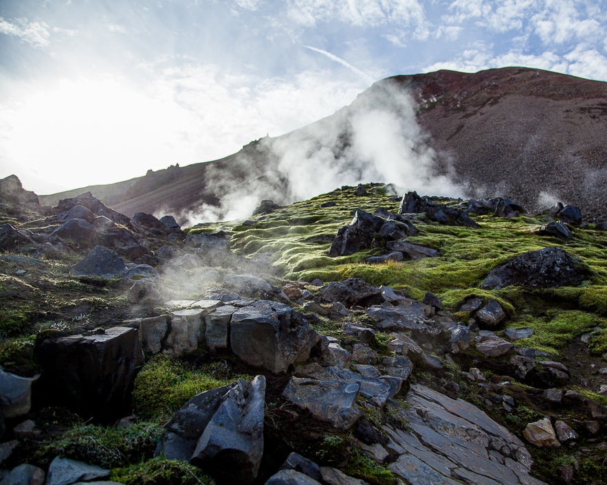 Now that you know everything about Landmannalaugar, you can start planning your adventure in the Icelandic Highlands. You can join a guided Landmannalaugar tour or create a complete Highlands itinerary that includes scenic routes, hot springs, and mountain trails.
If you prefer to drive yourself, a Landmannalaugar self-drive tour gives you the freedom to explore other Highland highlights and set your own pace. Use the route details, accommodation options, and parking rules above to organize a smooth and rewarding Highlands itinerary.
Plan ahead, book key services in advance, and check road and weather conditions before setting out. With the proper preparation, you can experience Landmannalaugar and the Icelandic Highlands at their very best.


