소개
요약
소개
아이슬란드 남부 해안(South Coast)을 따라 떠나는 2일간의 겨울 투어에서 장엄한 풍경과 짜릿한 빙하 동굴을 경험해 보세요. 노련한 가이드가 셀야란드스포스(Seljalandsfoss)와 스코가포스(Skogafoss) 같은 드라마틱한 폭포, 신비로운 검은 모래 해변 레이니스피야라(Reynisfjara), 그리고 아이슬란드의 보석이라 불리는 요쿨살론(Jokulsarlon) 빙하호수까지 안내해 드립니다.
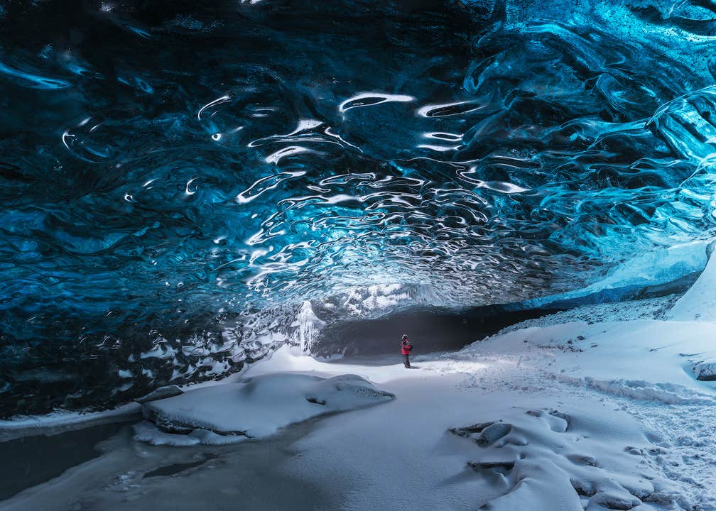
이 여정의 하이라이트는 단연 유럽 최대 빙하 바트나요쿨(Vatnajokull) 아래 자리한 푸른 얼음 동굴을 탐험하는 시간이 될 거예요. 빙하가 움직이면서 얼음 동굴은 계속 새로운 모습으로 바뀌기 때문에, 언제 방문하더라도 단 한 번뿐인 특별한 경험을 하실 수 있습니다. 얼음 동굴은 계절과 조건에 따라 이용이 제한적이니, 이 기회를 놓치지 마세요!
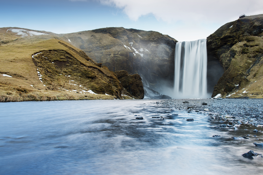
링로드(Ring Road)를 따라 여정을 이어가다 보면 아이슬란드에서 가장 아름다운 폭포 두 곳을 만날 수 있습니다. 셀야란드스포스에서는 폭포 뒤편으로 들어가 물안개와 물보라를 가까이에서 느껴볼 수 있고, 스코가포스에서는 거대한 물줄기 속에서 햇빛에 반짝이는 무지개를 발견할지도 모릅니다!
이어서 찾는 레이니스피야라 해변은 검은 모래사장과 우뚝 솟은 현무암 기둥, 그리고 거세게 부딪히는 대서양 파도로 유명합니다. 극적인 풍경과 다른 세상 같은 바위 절경은 전 세계 여행객들의 발길을 사로잡기에 충분하지요.
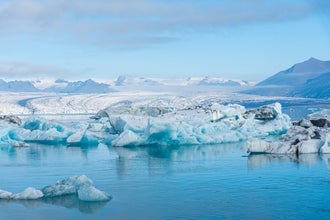
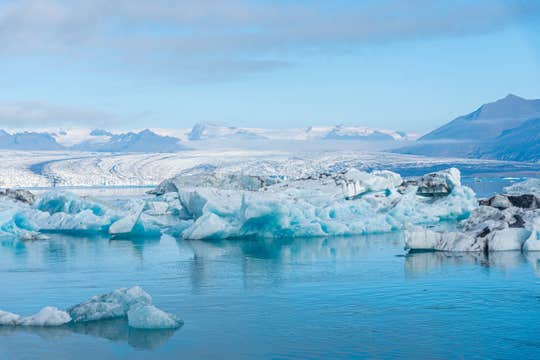
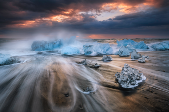
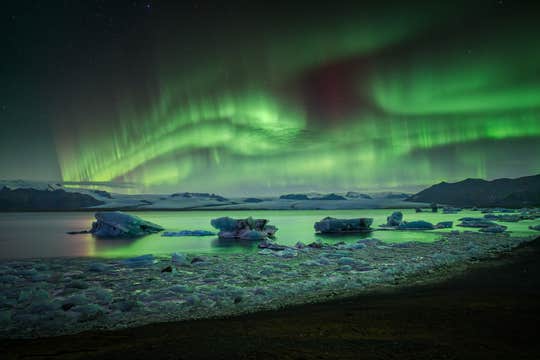
레이니스피야라를 지난 뒤에는 매력적인 마을 비크(Vik)에서 잠시 쉬어갈 수 있습니다. 주변 경치를 감상하고 가벼운 간식을 즐긴 뒤 다음 목적지로 향할 텐데요. 이어 도착하는 곳은 요쿨살론 빙하호수입니다. 거대한 빙산들이 고요한 물 위를 유영하며 마법 같은 장면을 연출하는 곳이에요. 조금만 걸으면 다이아몬드 해변(Diamond Beach)이 기다리고 있습니다. 검은 모래 위로 흩어진 투명한 얼음 조각들이 햇빛을 받아 반짝이는 모습을 두눈 가득 담아보세요.
투어 내내 숙련된 가이드가 함께하기 때문에 더욱 안전하고 편안하게 즐기실 수 있습니다. 가이드는 현지의 역사, 지질, 전설까지, 흥미로운 이야기를 전해 주어 여행의 깊이를 더해 드립니다. 이동편은 전부 준비되어 있으니, 오로지 눈앞의 풍경에만 집중하시면 됩니다!
또한, 아늑하고 편안한 숙소에서의 1박이 포함되어 있어 둘째 날에도 편안하게 아침을 맞이하실 수 있습니다. 따뜻한 환대와 푸짐한 식사, 훌륭한 서비스가 기다리고 있어요. 빙하 동굴 탐험을 위한 헬멧과 아이젠도 제공되니, 따뜻한 옷과 튼튼한 하이킹 부츠, 그리고 카메라만 챙겨오세요. 1인당 휴대 가방 1개를 지참할 수 있으며, 추가 짐은 레이캬비크의 사무실에 안전하게 보관해 드립니다.
레이캬비크 내 픽업 및 복귀 서비스도 포함되어 있어 한층 더 편리합니다. 모든 준비는 저희가 맡을 테니, 잊지 못할 추억만 잔뜩 안고 돌아가세요!
눈부신 크리스탈 얼음 동굴과 매혹적인 요쿨살론 빙하호수를 포함한 이 2일간의 남부 해안 투어로 이번 겨울을 특별하게 완성해 보세요. 지금 바로 날짜를 선택해 예약 가능 여부를 확인하실 수 있습니다.


