
소개
요약
소개
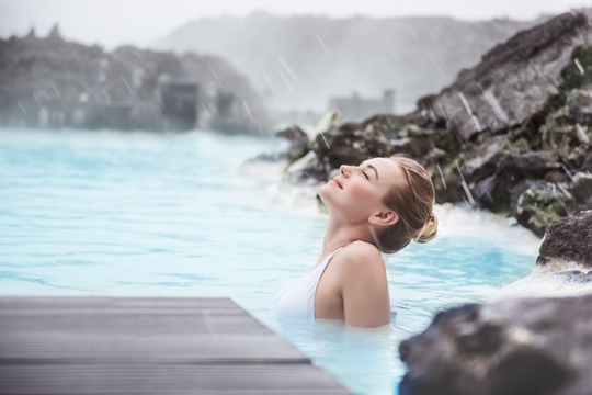
여름철, 6일간의 아이슬란드 렌트카 여행 패키지로 이 나라의 가장 아름다운 명소들을 자유롭게 탐험해보세요. 블루라군(Blue Lagoon)의 따뜻한 온천에서 여정을 시작해, 활기 넘치는 수도 레이캬비크(Reykjavik)를 거쳐, 골든 서클(Golden Circle)과 아이슬란드 남부 해안(South Coast)의 절경을 따라 요쿨살론(Jokulsarlon) 빙하호수까지 달리는 멋진 여정이 기다리고 있습니다.
이 여행은 자유로운 속도로 아이슬란드를 경험하고 싶은 분들에게 완벽한 선택입니다. 숙소, 이동, 추천 경로까지 모두 세심하게 준비돼 있으니, 그저 운전대를 잡고 여행을 즐기기만 하세요! 일정에는 아이슬란드 하면 누구나 떠올릴 만한 대표 명소뿐만 아니라, 숨은 보석 같은 특별한 풍경들도 포함돼 있습니다.
직접 운전하는 로드 트립이 처음이라도 걱정하지 마세요. 여정은 현지 여행 전문가들이 직접 설계했으며, 세심하게 계획된 동선과 정차 시간, 놓치기 쉬운 숨은 절경들까지 포함돼 있으니까요. 물론 모든 일정은 마음대로 조정할 수 있습니다. 어디에 오래 머물고 어디를 건너뛸지, 나만의 속도로 아이슬란드를 누벼보세요.
공항에서 바로 렌트카를 픽업할 수 있어 편리합니다. 또한, 여행 중 머물게 될 5박의 숙소는 예산과 취향에 맞게 선택할 수 있어요. 여행 중 궁금한 점이 생기면 언제든 연락할 수 여행 상담원이 24시간 함께할 거예요.
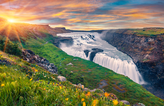
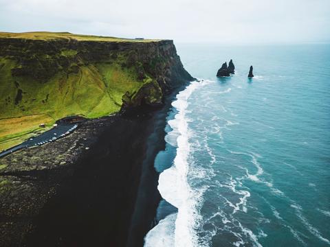
6일 동안 셀야란드스포스(Seljalandsfoss)와 스코가포스(Skogafoss) 같은 폭포들, 지각판 균열과 고대 의회터를 볼 수 있는 씽벨리르(Thingvellir) 국립공원, 스트로쿠르(Strokkur) 간헐천, 굴포스(Gullfoss) 폭포, 그리고 유명한 레이니스피야라(Reynisfjara)의 검은 모래 해변까지 아이슬란드의 자연이 만들어낸 수많은 보물들을 만나보세요.
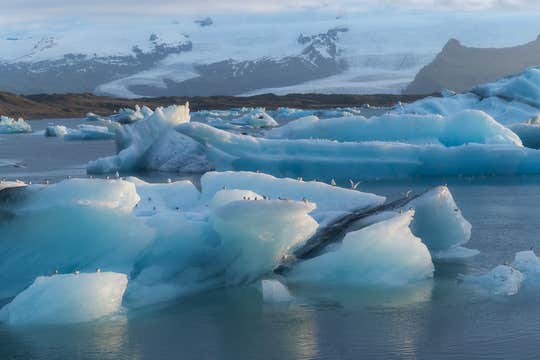
이 여정의 하이라이트는 단연 요쿨살론 빙하호수라 할 수 있습니다. 유럽 최대의 빙하에서 떨어져 나온 빙산들이 호수를 떠다니는 모습은 언제 봐도 감탄을 자아냅니다. 가끔은 빙산 조각 위에서 낮잠을 즐기는 바다표범도 만나볼 수 있고요.
여름의 아이슬란드는 백야 덕분에 하루가 훨씬 깁니다. 해가 지지 않는 늦은 저녁, 황금빛으로 물든 풍경 속에서 천천히 사진을 찍고 여유로운 산책을 즐기며 시간을 훨씬 효율적으로 사용할 수 있어요. 하루를 더 길게, 더 풍성하게 누릴 수 있다는 건 여름 여행객의 특권이라 할 수 있습니다!
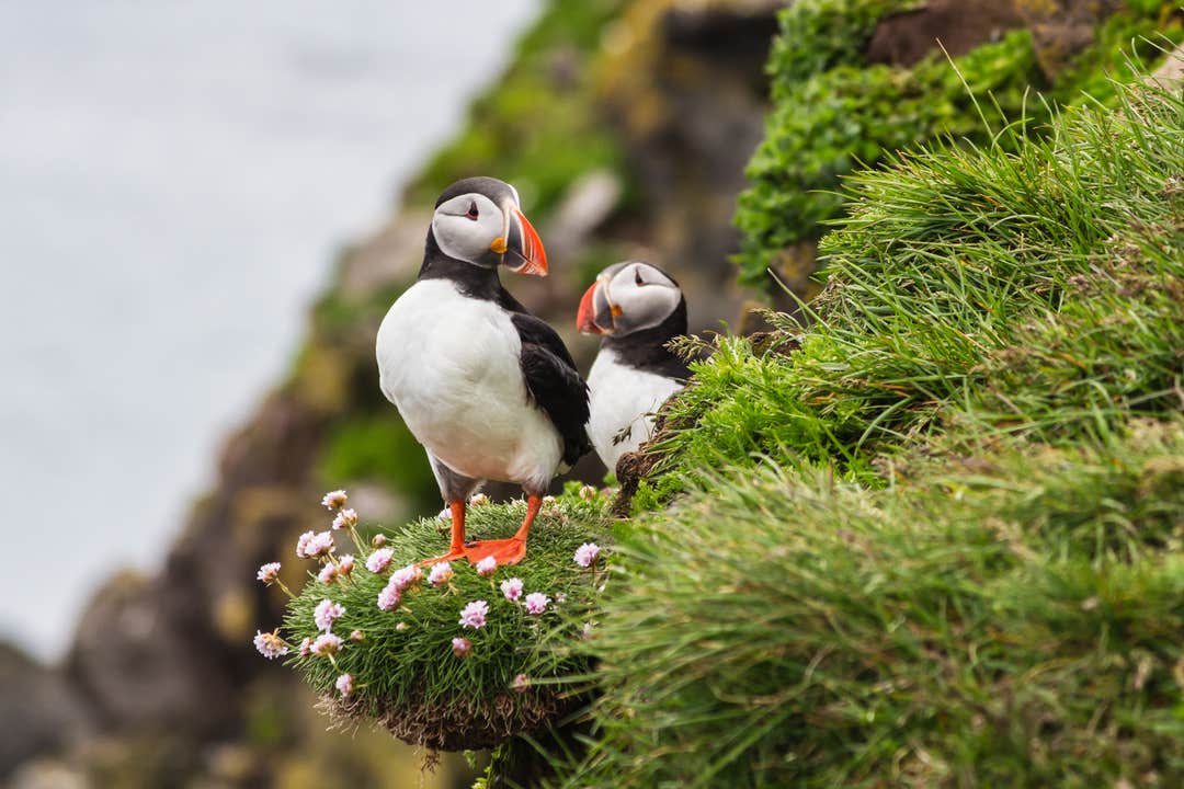
게다가 다양한 옵션 액티비티를 추가해 맞춤형 일정을 즐길 수 있습니다. 빙하 하이킹, 얼음 동굴 탐험, 화산 내부의 마그마챔버 탐험, 퍼핀 관찰, 스노클링, 승마, 스노모빌까지, 모험을 사랑하는 분들에겐 더할 나위 없는 완벽한 기회예요.
이 투어는 많은 여행객들이 선택하는 인기 상품일 뿐만 아니라, 가격 대비 만족도도 매우 높고, 유연한 예약 조건까지 갖추고 있습니다. 일정이 바뀌더라도 출발 24시간 전까지는 전액 환불이 가능하니, 부담 없이 계획해보세요.
거대한 폭포, 웅장한 빙하, 그리고 아이슬란드 특유의 대자연이 기다리는 6일간의 여름 로드 트립. 지금, 원하는 날짜를 선택하고 잊지 못할 여정을 시작해보세요.


