소개
요약
소개
아이슬란드에서의 잊지 못할 겨울 여행을 원하시나요? 7일간의 렌터카 여행으로 스나이펠스네스(Snaefellsnes) 반도, 골든 서클(Golden Circle), 그리고 남부 해안(South Coast)의 아름다운 절경을 모두 만나보세요! 아이슬란드의 대표 명소는 물론, 대부분의 여행자가 놓치고 가는 숨겨진 보석까지 모두 담았습니다.
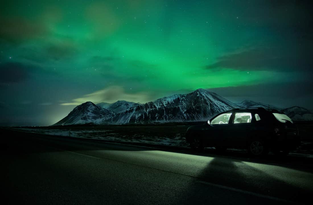
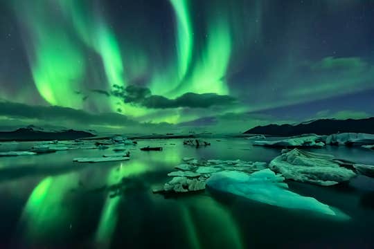
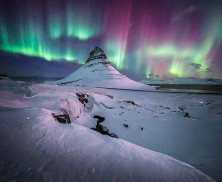
이 여행은 오로라 시즌에 맞춰 진행되므로, 가장 경이로운 자연현상 중 하나로 꼽히는 오로라를 직접 볼 수 있는 완벽한 기회를 제공합니다. 도시의 불빛에서 멀리 떨어진 어두운 풍경 속에서 밤하늘을 수놓는 오로라를 만날 수 있는 최고의 기회를 놓치지 마세요!
패키지에는 겨울 도로 주행에 적합한 렌터카와 6박 숙박 등 도착부터 출발까지 모든 것이 준비되어 있습니다. 현지 전문가가 엄선한 숙소는 뛰어난 위치와 편안함을 자랑하며, 렌터카 여행을 더욱 수월하게 만들어줄 거예요.
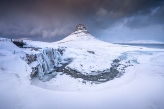
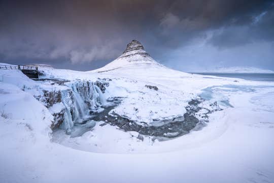
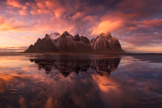
첫 여정은 스나이펠스네스 반도로 시작됩니다. 이 지역은 화산암 지대, 절벽 해안, 그리고 눈부신 스나이펠스요쿨(Snaefellsjokull) 빙하로 유명해 '아이슬란드의 축소판'이라고 불리기도 해요. 검은 모래 해변과 드라마틱한 해안 풍경이 어우러져 감탄을 자아냅니다.
이어지는 골든 서클에서는 아이슬란드의 대표적인 자연 경관을 만날 수 있습니다. 간헐천이 분출하고, 굉음을 내며 떨어지는 굴포스(Gullfoss) 폭포를 감상하고, 유라시아와 북아메리카 두 지각판이 만나는 씽벨리르(Thingvellir) 국립공원의 대지의 갈라짐을 직접 눈으로 확인해보세요.
그다음은 이틀간 남부 해안을 따라 모험을 이어갑니다. 스코가포스(Skogafoss) 폭포의 장대한 물줄기를 체험하고, 레이니스피야라(Reynisfjara)의 검은 모래 해변을 걸어보세요. 요쿨살론(Jokulsarlon) 빙하호수에 들러, 빙산이 부서져 바다로 흘러가는 장관도 꼭 놓치지 마시고요.
겨울에만 방문이 가능한 푸른 얼음 동굴도 빠질 수 없겠지요? 마치 빙하 속 보석 같은 이 동굴은 얼음 벽 사이로 스며드는 푸른빛이 반짝이며, 빙하의 심장을 들여다보는 듯한 특별한 경험을 선사합니다.
잊지마세요, 이 여행은 내가 주인공이 되는 여행입니다! 원하는 속도로 운전하고, 마음 가는 대로 멈추며, 여행 일정을 자유롭게 꾸며보세요. 예약 전후로 전체 일정도 손쉽게 변경할 수 있어 더욱 유연하게 여행을 설계할 수 있습니다.
더 풍성한 여행을 원하신다면 다양한 옵션 액티비티도 선택할 수 있어요. 실프라(Silfra)에서 지각판 사이를 스노클링하거나, 빙하 위를 달리는 스노모빌, 심지어는 휴화산 마그마 챔버로 내려가는 모험까지! 반대로 휴식을 원한다면 블루라군(Blue Lagoon)의 온천이나 스카이 라군(Sky Lagoon)의 인피니티 풀에서 몸과 마음을 녹여보는 것도 좋겠지요.
아이슬란드의 역사와 문화를 가까이에서 느끼고 싶다면 바이킹 도보 투어나 현지 요리 미식 투어를 통해 색다른 체험을 즐겨보세요.
여행 중에는 24시간 지원 가능한 전담 여행 상담원이 항상 대기 중이라, 일정 변경이나 현지 팁, 액티비티 예약 등 필요한 것이 생기면 언제든지 도움을 받을 수 있습니다.
이 패키지는 꼼꼼하게 짜인 겨울 렌터카 여행 일정을 저렴한 가격으로 제공하므로, 경비를 아끼면서도 최고의 경험을 누릴 수 있습니다. 출발 24시간 전까지는 무료 취소와 전액 환불도 가능하니 안심하고 예약하실 수 있어요.
지금 바로 예약하고, 아이슬란드의 겨울 속으로 떠나보세요. 스나이펠스네스 반도, 골든 서클, 남부 해안을 여행하고, 오로라도 찾아 떠나는 7일간의 특별한 여행을 직접 경험해보세요. 오늘 날짜를 선택해 예약 가능 여부를 확인해보세요.


