
소개
요약
소개
아이슬란드의 신비로움을 가득 품고 있는 골든 써클로 여행을 떠나볼까요! 씽벨리르(Thingvellir) 국립 공원, 강력한 굴포스(Gullfoss) 폭포 및 게이시르(Geysir) 간헐천에 방문해보세요! 오후 시간을 이용해 골든 써클을 방문하는 투어입니다.
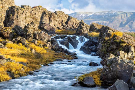
골든 서클 투어를 하는 동안, 농경지와 저 멀리 보이는 산꼭대기, 흐르는 강물과 멋진 계곡 등 그림 같은 자연의 감동적이고 아름다운 풍경을 감상하게 됩니다. 아이슬란드 자연의 이 아름다움을 한 순간도 놓치지 않도록 카메라를 준비해 두시고요.
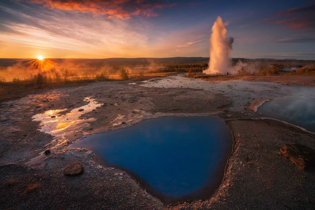
첫번째로 향할 곳은 게이시르 및 스토쿠르(Strokkur) 간헐천이 있는 게이시르 지열 지역입니다. 게이시르는 더 이상 분출되지 않지만 스토쿠르(Strokkur)는 여전히 강력한 간헐천으로 4-8분마다 분출이 일어나며 평균 높이가 15-20미터에 이르고 심지어는 40미터까지 올라가는 경우도 가끔 있습니다. 그 순간을 카메라로 담아 보세요.
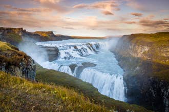
다음 행선지는 래프팅으로 유명한 크비타(Hvita)강에 위치한 강력한 굴포스 폭포입니다. 이 폭포는 높이가 32미터이며 물이 아래로 쏟아져 내릴 때 얼굴에 물방울을 느낄 정도로 폭포에 가까이 다가갈 수 있습니다. 이 굴포스는 아이슬란드에서 가장 유명한 폭포로, 단연 최고 비경 중 하나이기도 합니다.폭포에서 들려오는 천둥 같은 굉음을 무엇으로 묘사할 수 있을까요? 운이 좋으면 무지개도 볼 수 있습니다!
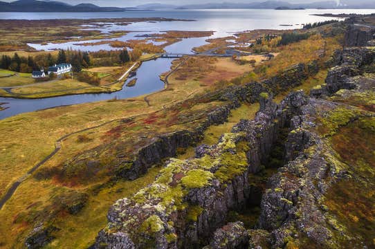
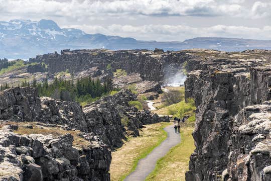
마지막으로 향할 곳은 씽벨리르 국립공원입니다. 이곳은 대서양 중앙 해령에 위치한 유네스코 세계 문화유산 보호지역입니다. 이 곳에서는 유라시아 대륙과 아메리카 대륙 사이를 걷게 됩니다. 지금은 레이캬비크에 위치한 아이슬란드 국회인 알씽기(Althingi)가 처음 세워진 곳이기도 합니다. 특히 흥미로운 곳은 북아메리카 판의 동쪽 경계를 나타내는 인상적인 알마나갸(Almannagja) 협곡입니다.
아이슬란드에서 가장 아름다운 자연, 역사, 문화 유적지에 모두 가 볼 수 있는 가장 인기있는 아이슬란드 대표 명소 골든써클 투어, 우측 상단의 날짜를 선택하고 지금 예약하세요!


