The Magical Snæfellsnes Peninsula in West-Iceland - Part III - Gufuskálar, Hellissandur & Ólafsvík

This is part III on my travels around the magical Snæfellsnes peninsula and a direct continuation of my travel-blog the Magical Snæfellsnes Peninsula Part II. There is just so much to see and do here that I have created 5 travel-blogs on my journey around the peninsula. I love Snæfellsnes and want to show you all it has to offer :)
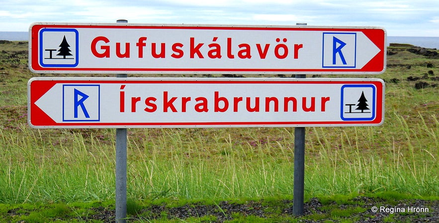
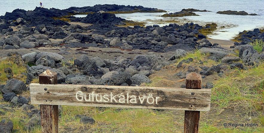
In my last travel-blog, I showed you the area from Lóndrangar volcanic plugs to Öndverðarnes, the westernmost point of the Snæfellsnes peninsula. We are now driving on road 574 towards Hellissandur village. There are several points of interest on the way. Let's turn left onto a paved road by these 2 signs: Gufuskálavör and Írskrabrunnur.
Írskrabrunnur - the Well of the Irish 
Írskrabrunnur - the Well of the Irish on Snæfellsnes peninsula
We are going to explore both of these locations on the sign, but first, we visit the Írskrabrunnur - the Well of the Irish and turn left by a fork in the road.
Írskrabrunnur - the Well of the Irish is quite an old well on the west side of Snæfellsnes, which dates back to the Settlement of Iceland in the year 874 give or take a few years.
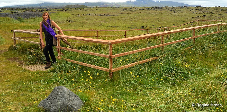
Írskrabrunnur - the Well of the Irish
The Well of the Irish was the water supply in this area, Gufuskálar, for centuries until it got buried under sand and lost from sight from 1948-1989.
I refer to my travel-blog about Gufuskálar & Írskrabrunnur well for a lot more information on this area and how it was found again after being hidden for a long time.
Gufuskálar & Írskrabrunnur - the Well of the Irish on Snæfellsnes Peninsula in West Iceland
Írskrabrunnur - the Well of the Irish on Snæfellsnes peninsula
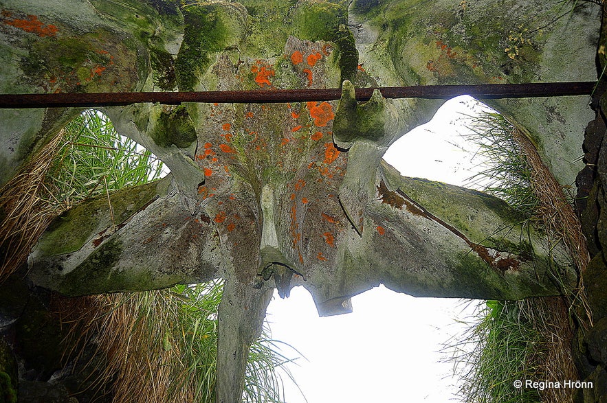
There is a fence around the well now to protect it and 16 steps leading down into the well. You will notice a huge whalebone in the opening - the story of which you can read in my side-blog.
Let's now have a look at Írskrabyrgi or the Shelter of the Irish, which is just a few meters away from the Irish well. The stacking of the lava rocks is very even with an entrance to it. We don't know what it was used for, maybe a church?
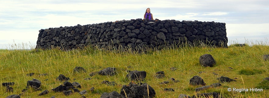
The Shelter of the Irish
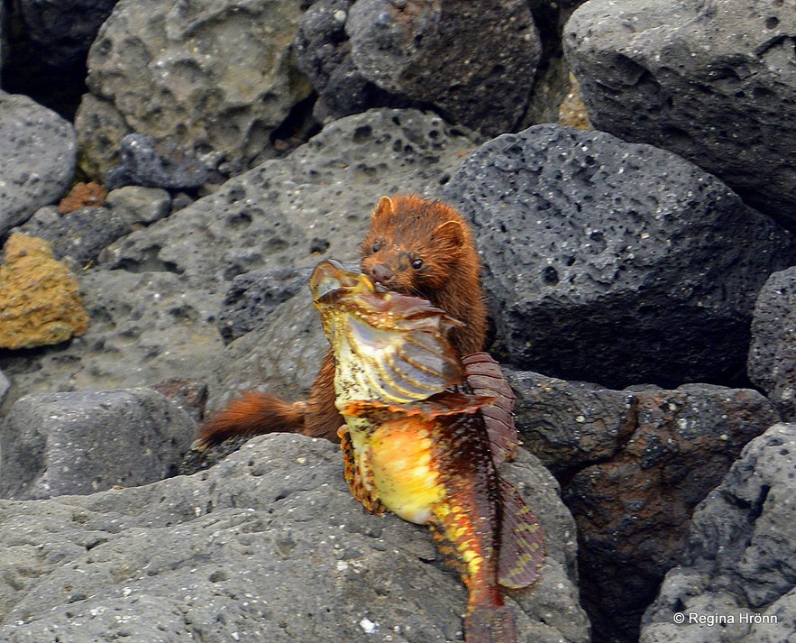
From the Shelter of the Irish, there is a good view of the shoreline and the sea. I spotted "something" running on the rocky beach.
I zoomed in on it and it and it turned out to be a small mink carrying a fish much bigger than itself! Minks are not native to Iceland, they escaped from mink farms, and are now a part of Iceland's wildlife.
A mink I spotted
Now let's go back to the car and drive to the fork in the road and choose the road to Gufuskálavör. There are 700 meters or a 10-minute walk from the Well of the Irish to Gufuskálavör.
Here you can see the location of the Well of the Irish on the map.
Gufuskálavör landing
Gufuskálavör landing
At Gufuskálavör you will find an old fishing station dating back to the 14th and 15th centuries. Here are the ruins of fishermen's huts, fish storage huts, and farm ruins.
Down by the beach, you will see wakes in the stones as the keels of the rowboats left grooves behind. I have written a lot more information about Gufuskálavör in a side-blog.
A rock by the sea is a monument for the last woman living at Gufuskálar, Elínborg Þorbjarnardóttir (1860-1947), but she lived here from 1898 until 1946.
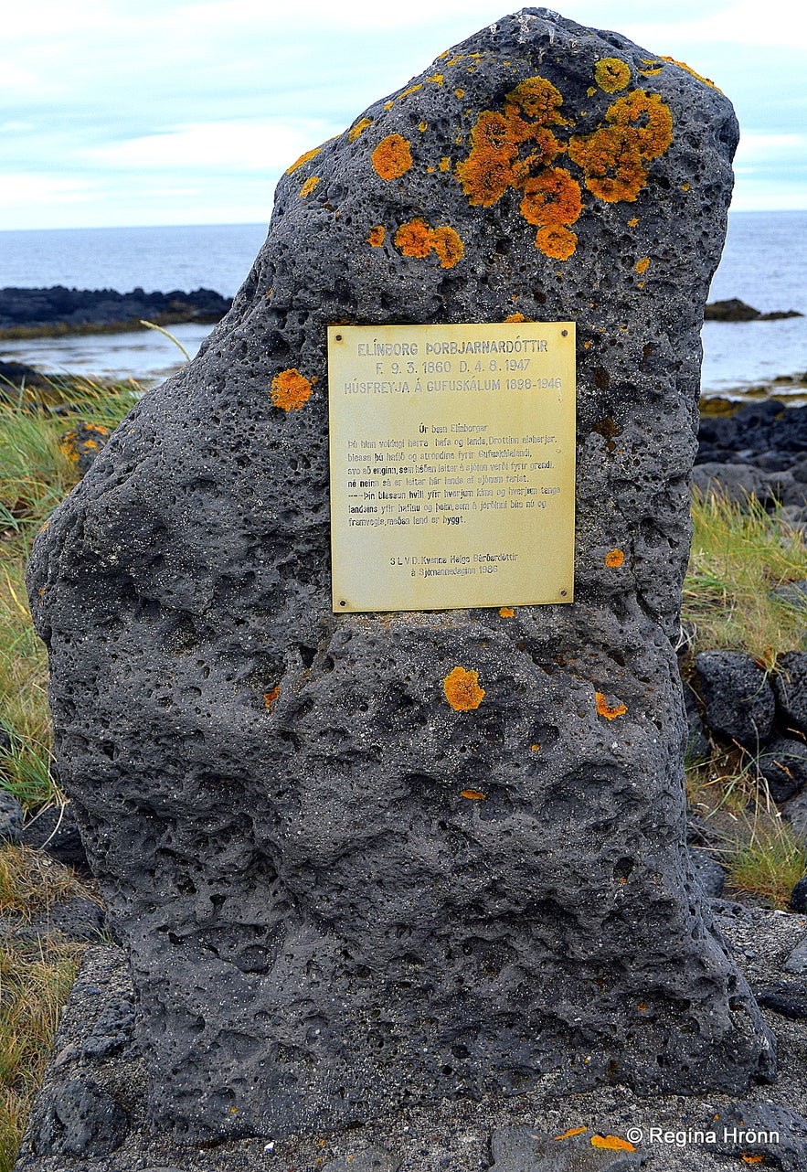
A monument at Gufuskálar
Remains of old fishermen's huts were discovered inside a sandy hill at Gufuskálar with human habitation signs in the layers of the debris.
A turned chessman from the 14th-15th century, made of bone, was discovered in the oldest layer of the debris. These antiquities are very close to the sea so there is a real danger that the sea might erode them, making us lose these important historical remains :(
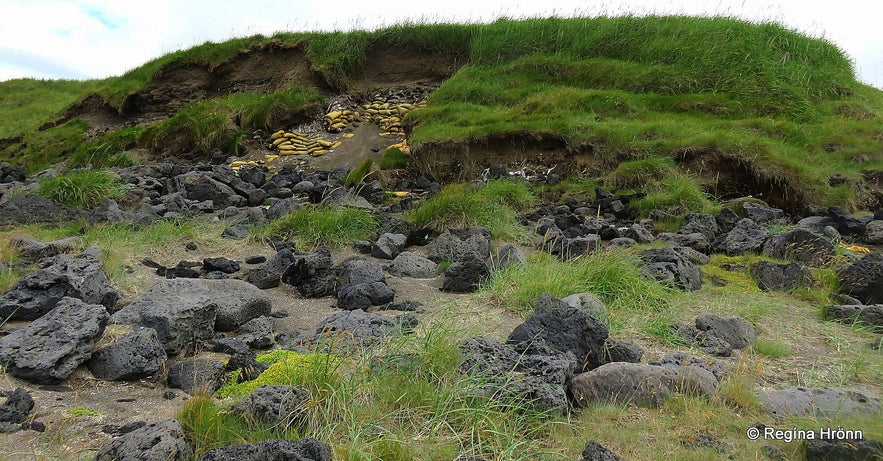
Gufuskálar ruins
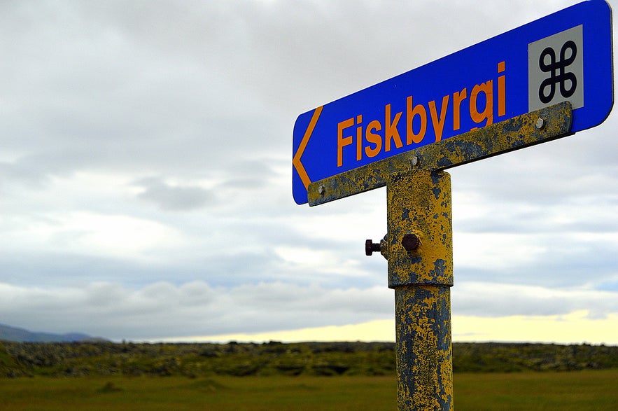
Now let's check out the old Fiskbyrgi - the fish drying sheds of Gufuskálar - which are located on the other side of road 574 much further away from the sea. Drive back to road 574 and look for this sign below.
There you turn right and drive up a short gravel road where you can leave your car.
Fiskbyrgin á Gufuskálum - the Fish Drying Sheds at Gufuskálar
Fiskbyrgin á Gufuskálum - the Fish Drying Sheds at Gufuskálar
Above Gufuskálar you will see a sign Fiskbyrgi meaning fish drying sheds. These fish drying sheds are old and made of lava rocks, of which there is plenty in this area below the Snæfellsjökull glacier.
There are information signs by the parking lot and a path leading through the lava field up to a fish drying shed. It is so strange walking in this area amongst the myriad of old fish drying sheds and thinking about the vibrant fishing community which now belongs to the past.
I am so glad that the fish drying sheds were left here and not destroyed - they are of great cultural importance to us as they are really old, 500-700 years old or even older, which is old for Iceland - they were protected in 1969. There are some speculations that they might not have been fish drying sheds, but prayer chapels of the Irish.
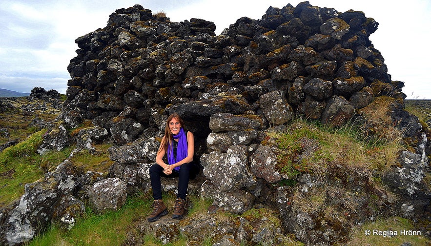
Fiskbyrgin á Gufuskálum - the Fish Drying Sheds at Gufuskálar
The path led me up to the fish drying shed in the photo above. These sheds are like little cottages really and blend in perfectly with the landscape. These sheds are protected antiquities so let's be careful here.
It is forbidden to enter them as they are not safe and protected, but you can have a peek inside on your hands and knees.
I only visited this one fish drying shed, but there are some 150-200 others dotted around the lava field (they were counted as being 167 by Skúli Alexandersson). These old fish drying sheds seem to be the most extensive and best-preserved antiquities of this sort in Northern Europe.
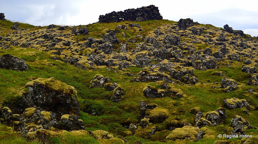
Fiskbyrgin á Gufuskálum - the Fish Drying Sheds at Gufuskálar
It is believed that most of these sheds date back to the 15th or 16th century, but back then stockfish was Iceland's biggest export to both England and the towns of the Hanseatic League.
You can maybe see holes in the rocks in my photo above, but these holes let the wind blow through the sheds, which kept the fish from rotting and helped with the process of drying the fish.
You may also notice that the walls are leaning towards the top of the shed. This building method is called "borghleðsla" in Icelandic.
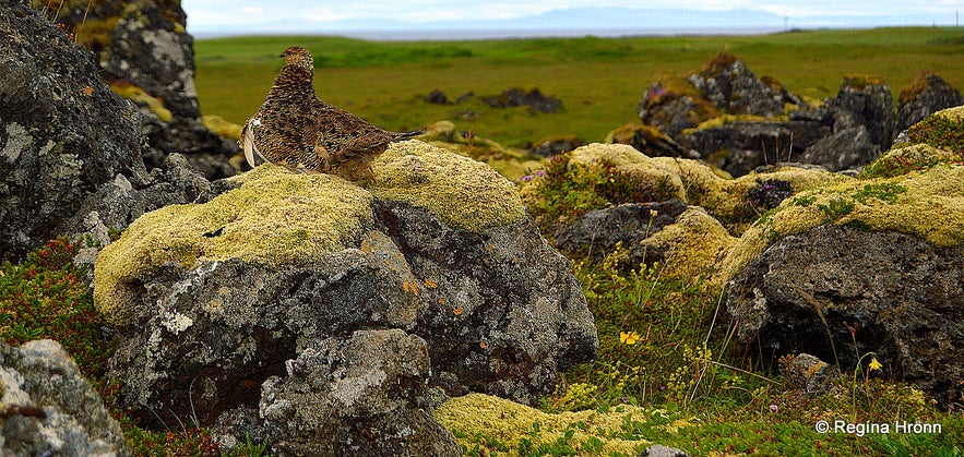
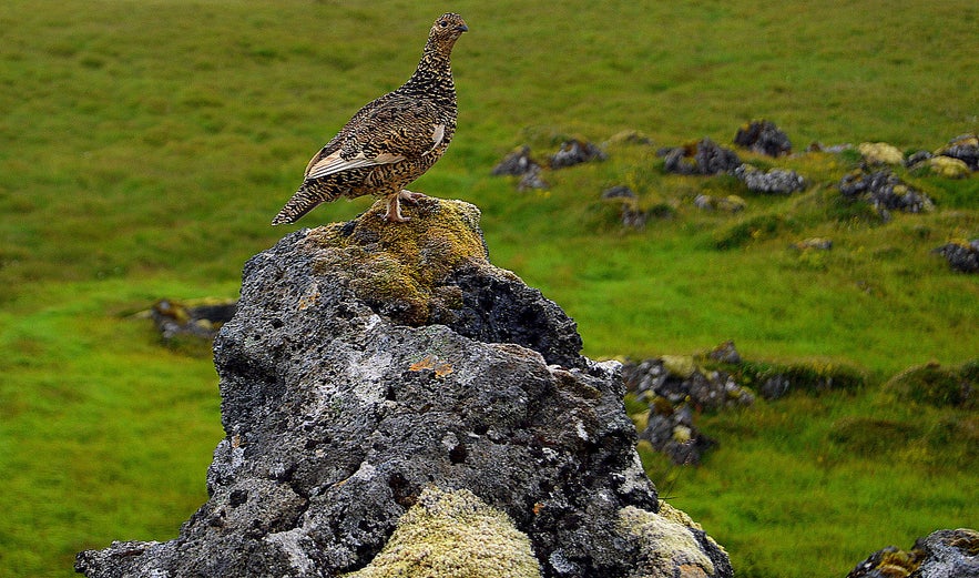
A ptarmigan leading me away from its chicks
It is easy to access these sheds and only a 5-10 minute walk up to the one into which I had a peek. Let's keep to the path as this is a lava field with many hidden holes covered by moss.
It is easy to break one's leg in such lava fields - we Icelanders are warned of this danger from a very early age and I want to pass this warning on to our foreign visitors.
I saw a ptarmigan hiding in the lava field with many chicks that blended so well into the landscape. They got startled when I walked by them and the chicks ran all over the place while their mother tried to lure me away from them.
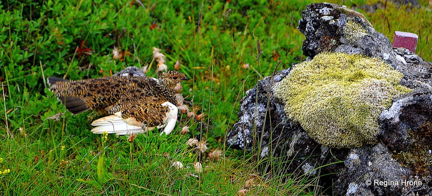
The ptarmigan pretending to be injured
I followed her so she wouldn't think that I was going to hurt her chicks and I found it so cute when she looked for me when I stopped.
She had hidden behind a lava rock and then stretched her neck and I could see her looking for me wondering why I didn't follow her. So cute and as not to scare her I kept following her :)
I both respect and feel sorry for the ptarmigan. This bird stays in Iceland the whole year round and changes colour according to the season - in the summertime, it is dappled, but in wintertime, it becomes white to blend in with the snow.
At this point the ptarmigan felt that I was at a safe distance from its chicks
The reason I feel sorry for the ptarmigan is that it stands out if there is not enough snow for it to hide - also when it is going through the change it is half white and half dappled and doesn't blend in at all.
A lovely bird, which is hunted for the traditional Christmas dinner.
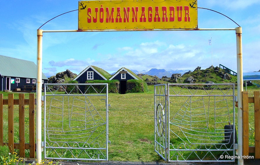
Hellissandur Village & the Maritime Museum in the Fishermen's Garden
Sjómannagarður park and museum
Hellissandur is one of the villages on the north side of the Snæfellsnes peninsula. Until now we have not encountered a proper village, as it were, but now we have reached the first of five villages on the peninsula.
Hellissandur used to be a big fishing centre and in the year 1700, there were some 60 seasonal fishermen's huts here.
The population of Hellissandur and the small village next to it, Rif, which we are going to explore next, is now combined at around 544.
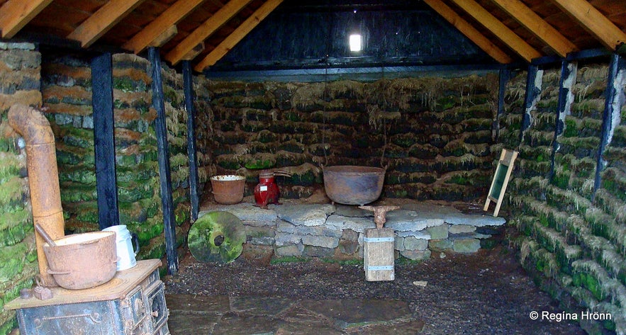
Hellissandur Village & the Maritime Museum in the Fishermen's Garden
Almost every town and village in Iceland has got a museum of its own. Hellissandur's museum is the Fisherman's Garden and Maritime Museum, which you will see on your right-hand side as you enter the village.
You can read about this interesting museum in my travel-blog on the Fisherman's Garden in Hellissandur.
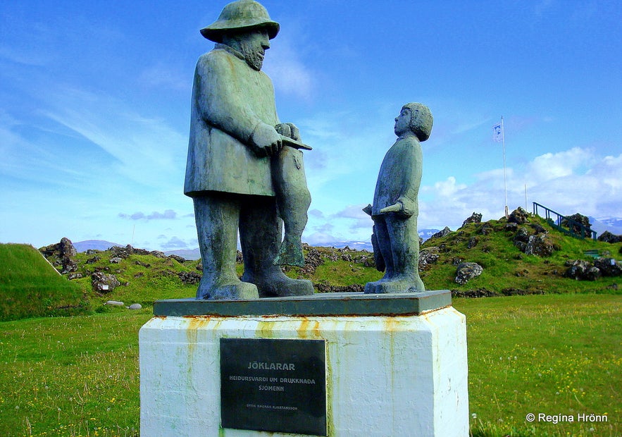
Hellissandur Village & the Maritime Museum in the Fishermen's Garden - the statue Jöklarar by Ragnar Kjartansson
Here you can see the location of Hellissandur on the map. Now, since leaving Reykjavík, we have driven for around 195 km, not to count the detours we have made.
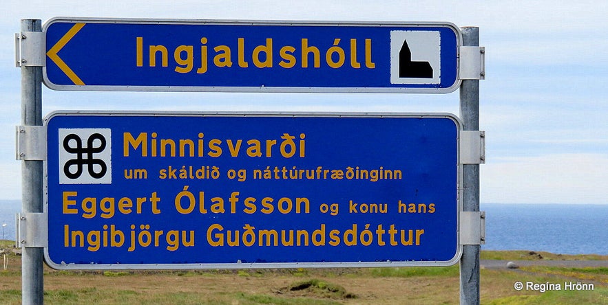
Next let's have a look at one historic place, Ingjaldshóll, before visiting the small village of Rif. Midway between these two villages you turn right from road 574 and drive up Ingjaldshólskirkja road by the sign below ;)
Ingjaldshóll
The Ingjaldshóll sign
Ingjaldshóll on the Snæfellsnes peninsula is one of the historic sites in Iceland - it is a former settlement manor and an assembly.
Christopher Columbus seems to have stayed at Ingjaldshóll during the winter of 1477-78. It is believed that he was here to get tips and info from the Vikings, Leif the Lucky, and co, who had already discovered America, before going on his journey west.
The current church at Ingjaldshóll is the oldest concrete church in the world!
I have written a side-blog about the historical Ingjaldshóll with a lot more information on this historic site.
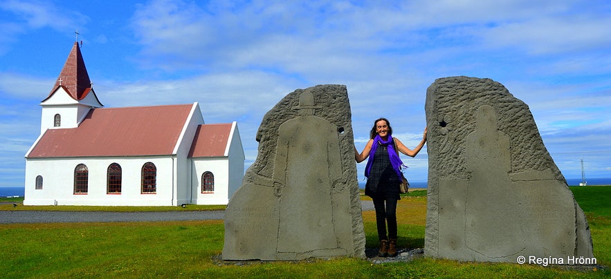
At Ingjaldshóll
Here you can see the location of Ingjaldshólskirkja church on the map and if you zoom out you will see that it is located right between Hellissandur and Rif.
The Village Rif and Björnssteinn Stone
Björnssteinn stone
Rif is one of the small villages in the northern part of the Snæfellsnes peninsula - in between Hellissandur, which is only 2 km away, and Ólafsvík villages.
Rif is a very small village, but it was once one of the main trading ports on the peninsula and you will still see many fishing boats here in the harbour. Even though this village is very small now, it is still a historic site.
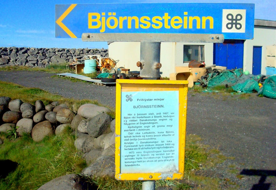
There is one place in Rif which is declared as protected - the Björnssteinn stone. The story behind this stone is that in 1467, on this spot, Björn the Rich Þorleifsson (around 1408-1467) was beheaded by English merchants.
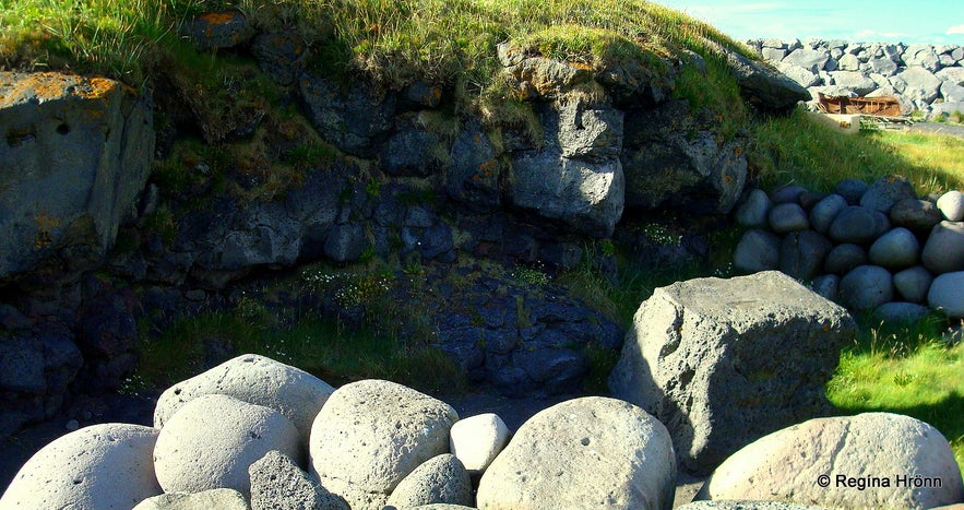
Björnssteinn stone
In 1455 Björn and his wife Ólöf the Rich Loftsdóttir from Skarð, who were the richest couple in Iceland during their time, were on a tour when they were kidnapped by Scottish pirates and brought to Scotland. The Danish King, Christian I, paid their ransom and appointed Björn the governor of Iceland, a seneschal, and a knight of the Danish king.
Björn was given the task of preventing the illegal English trade in Iceland, which he and his wife performed diligently. So diligently that the English ended up beheading Björn at Rif. His body is then supposed to have been cut into 7 pieces, which were salted into barrel-like herrings.
The barrel was then sent to his wife Ólöf the Rich.
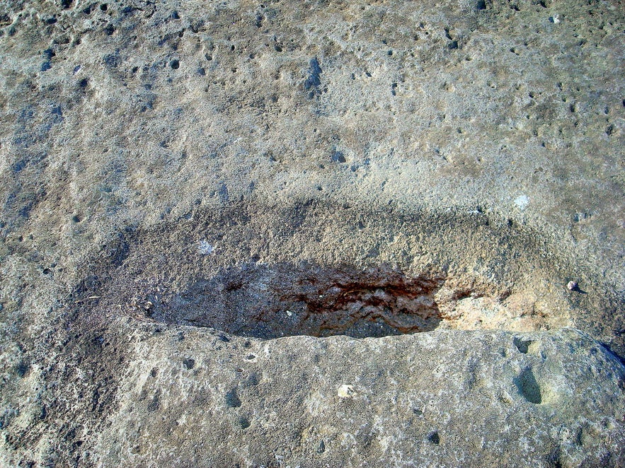
Björnssteinn stone
Ólöf the Rich revenged the death of her husband and famous are her words: "Eigi skal gráta Björn bónda, heldur safna liði..." - meaning "Shed no tears for my husband Björn, but gather men..." I think almost every Icelander off age knows this quote. Björn was not the only one to be beheaded as 7 of his men were killed as well.
You will see the place where Björn was beheaded and a dent in the stone made by the axe - see my photo above. The Björnssteinn stone was unearthed by the locals, which then stacked a stone wall around it. I found this information in a Research Report of the Department of Archaeology of the National Museum of Iceland.
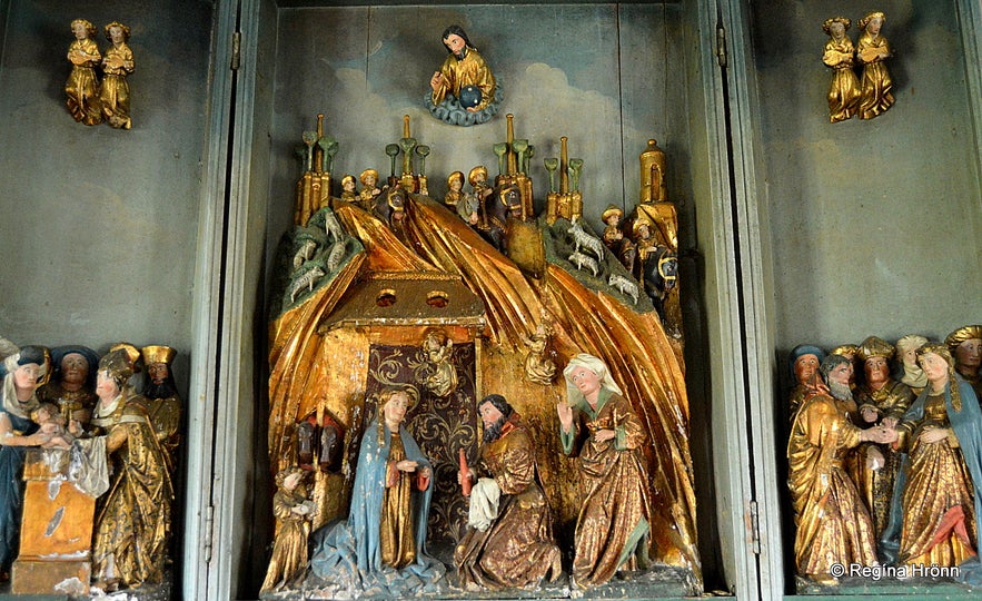
Ólöf as depicted in the alabaster artwork from the 15th century at Skarðskirkja church on Skarðsströnd in West-Iceland
Ólöf, who by now had become the richest person in Iceland, revenged her husband and waged a war on the English traders in Iceland.
She imprisoned 50 Englishmen and kept them in a lodge opposite her mansion at Skarð and used them as slaves.
She forced them to build a fence all around Skarð and a pavement of rock, which can still be seen at Skarð. She then had them killed. In 1473 the Danish king Christian I forbade the English to sail to Iceland or trade with the Icelanders without special permission from the king.
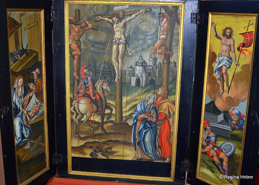
The triptych at Skarðskirkja church
I have written about Ólöf the Rich in my travel-blog about Fellsströnd and Skarðsströnd. When I was visiting Skarð at Skarðsströnd the farmer showed us the church at Skarð and told us this story. Ólöf was for sure a force to be reckoned with.
The farmer at Skarð told us that Björn is apparently buried on the south side of the church beneath a rock. It is well worth visiting the off-the-beaten-path Skarðsströnd and Fellsströnd, which is referred to as the Golden Saga Circle of Iceland.
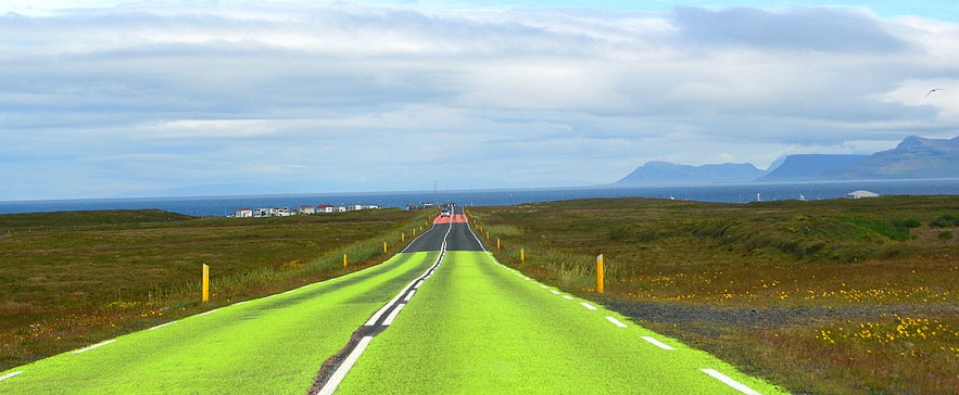
The road by Rif
If you are travelling here by Rif in the summertime be warned that there is a large Arctic tern colony in this area, my least favourite Icelandic migrating bird, - and the Arctic terns sit on the road and only fly up when the car is about to hit them. One has to be careful as to not hit the chicks as they cannot fly away and only run.
As you can see in my photo above then the part of road number 574 leading to Rif has been painted bright green and bright red to deter the Arctic tern from resting on the road - and thus lower the risk of the bird being run over by passing cars.
I have seen many a chick being run over. They are grey, fluffy, and very cute, but then they turn into a lean bird, which thinks it is a fighter plane and fearlessly attacks you.
I shot this video of the Arctic tern attacking us in the Westfjords of Iceland
Here you can see the location of Rif on the map. Now let's drive further along road 574 towards another bigger village close by, Ólafsvík village, which is located 10 km away from Hellissandur and thus some 8 km away from Rif.
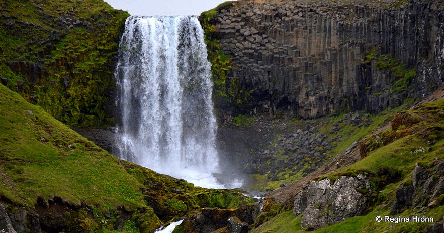
Svöðufoss waterfall
Svöðufoss waterfall
On the way to Ólafsvík just outside of Rif, you will notice a pretty waterfall. Its name is Svöðufoss waterfall and you can drive close to it and walk to an observation platform.
The observation platform by the river gives a good view of Svöðufoss, but it is still a bit far away. I would love to be able to get closer to the waterfall, but that is not an option. I am grateful that at least a platform and a picnic area have been put up so that we can enjoy Svöðufoss.
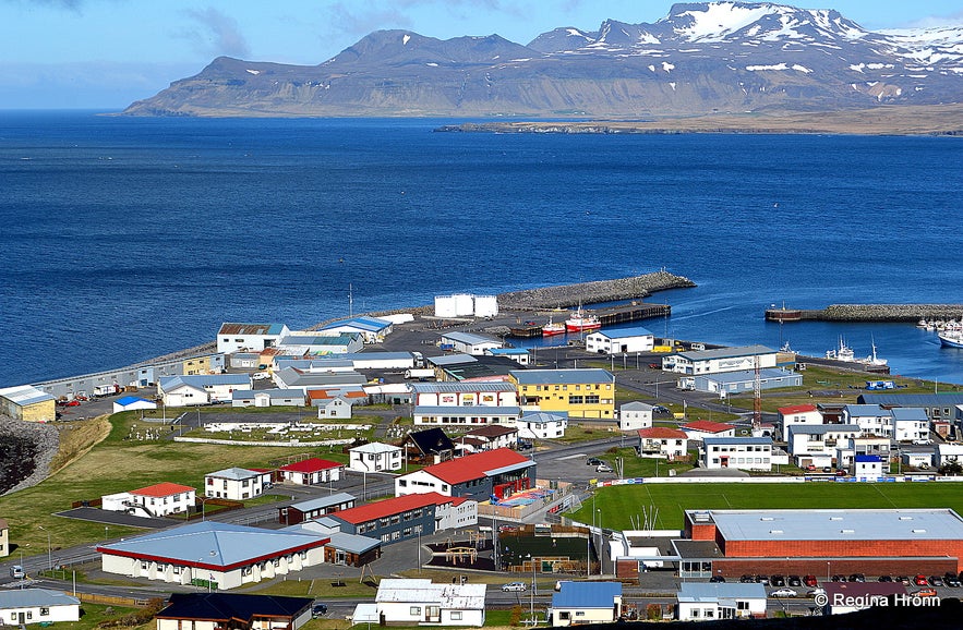
Ólafsvík town
Ólafsvík village on the Snæfellsnes peninsula
The next place we are going to visit on the north side of the Snæfellsnes peninsula is called Ólafsvík. Ólafsvík is a lovely little fishing town with a population of around 1,000.
An old storehouse, dating back to 1844, in the centre of the town, is now a museum and an Information Centre. Do pay it a visit.
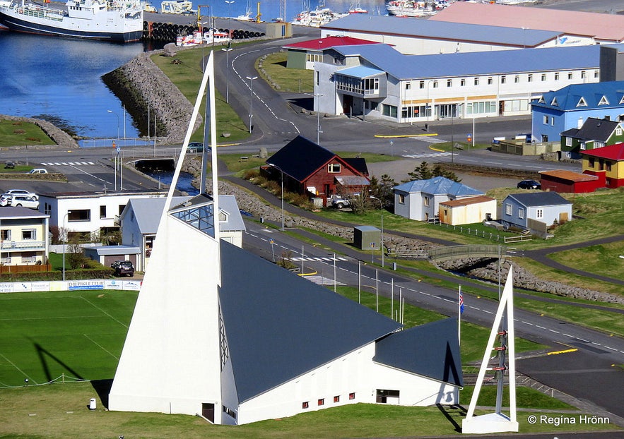
Ólafsvikurkirkja church Ólafsvík village on the Snæfellsnes peninsula
The landmark of Ólafsvík is to me the white modern-looking church - it looks like a ship, but if you look at it from above it looks like outspread salted cod!
As in other fishing villages in Iceland, there is a monument in remembrance of fishermen and the ones lost at sea. I call these monuments the heart of each village and always pay them a visit.
I have written a side-blog about Ólafsvík village & the beautiful bridal veil Bæjarfoss falls with a lot more information about this area.
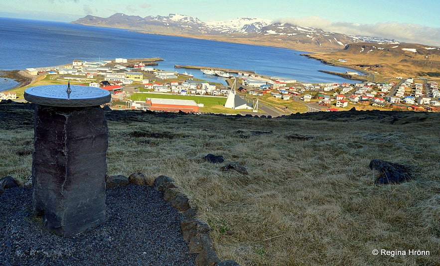
The view-dial above Ólafsvík village
I would recommend a short hike up to Bæjarfoss waterfall which has a drop of 50 meters. Above Ólafsvík town you will also find a view-dial by which there is a fantastic view of Ólafsvík and the surrounding area.
Bæjarfoss is quite a beautiful waterfall, which looks like a thin bridal veil.
Here you can see the location of Ólafsvík on the map.
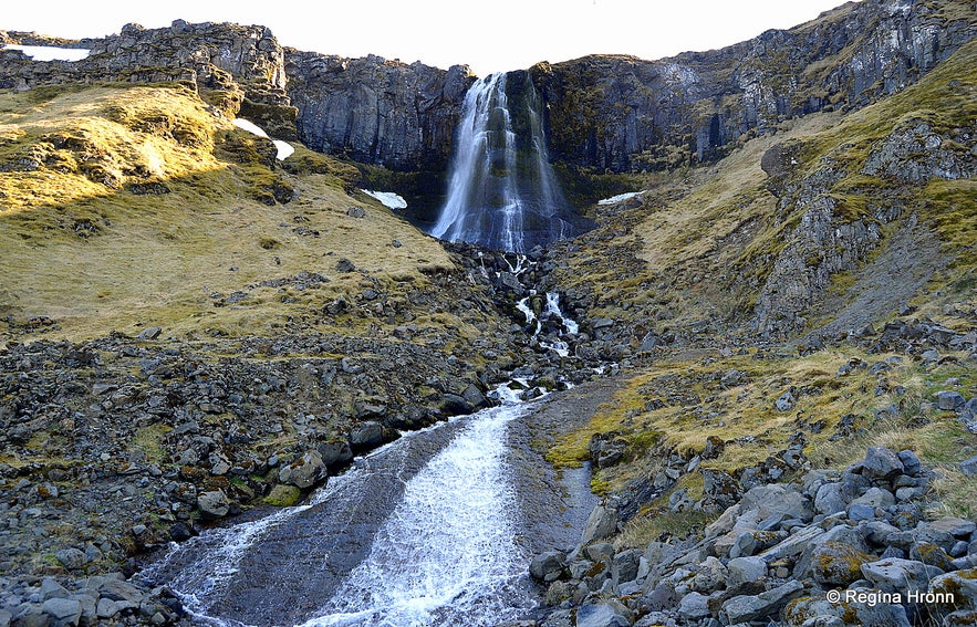
Bæjarfoss waterfall - I must go back and get better photos
By now Útnesvegur road 574 joins the main road on the Snæfellsnes peninsula, the Snæfellsnes road number 54. So now we have finished our "detour" around the westernmost parts of the Snæfellsnes peninsula.
Remember that we left road 54 on the southern part of our tour of Snæfellsnes and turned to Búðir? Our next stop will be at the historical Fróðá.
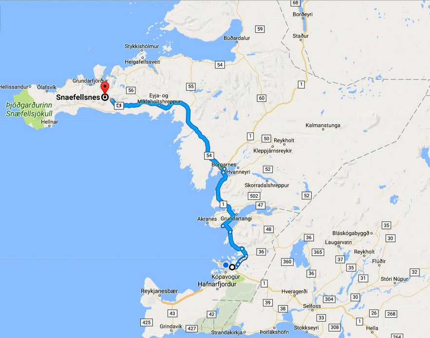
To reach Snæfellsnes it is best to rent a car in Reykjavík and drive up here in a couple of hours.
You can continue travelling with me if you like and read my next travel-blog about the Magical Snæfellsnes Peninsula in West Iceland - Part IV, which is a continuation of my travels on the Snæfellsnes peninsula in chronological order.
I hope you are enjoying reading my series on the Snæfellsnes peninsula, I know they are really long and detailed, so I hope you haven't given up by now ;)
Here are links to all of the Snæfellsnes travel-blogs in this series:
The Magical Snæfellsnes peninsula - part I
The Magical Snæfellsnes peninsula - part II
The Magical Snæfellsnes peninsula - part III
The Magical Snæfellsnes peninsula - part IV
The Magical Snæfellsnes peninsula - part V
The Magical Snæfellsnes peninsula - Arnarstapi and Hellnar
Have a lovely visit to the beautiful Snæfellsnes peninsula :)
Inne ciekawe blogi
Gorące źródła - Hrunalaug
Z czego słynie Islandia? Zorza polarna, wulkany, lodowce, gejzery i oczywiście gorące źródła! Hruni, a właściwie Hrunalaug to gorące źródło w malowniczym otoczeniu, znajdujące się w w pobliżu miejscowCzytaj więcejPolowanie na Zorzę
Zobaczenie zorzy polarnej to marzenie wielu osób. Zorza jest dla mnie czymś magicznym i niepowtarzalnym, zachwyca mnie za każdym razem. Czy faktycznie tak ciężko ją dostrzec? Otóż nauczyłam się, że niCzytaj więcejO pisaniu na Guide to Iceland
Mam wrażenie, że na Islandii bardzo wiele rzeczy staje się jasnych. Chodzi o podejście do świata, do własnej osoby, do innych, którzy realnie wpływają na Twoje życie. Islandia zmusza swoją surowościCzytaj więcej

Pobierz największą platformę turystyczną na Islandii na telefon i zarządzaj wszystkimi elementami swojej podróży w jednym miejscu
Zeskanuj ten kod QR za pomocą aparatu w telefonie i naciśnij wyświetlony link, aby uzyskać dostęp do największej platformy turystycznej na Islandii. Wprowadź swój numer telefonu lub adres e-mail, aby otrzymać wiadomość SMS lub e-mail z linkiem do pobrania.
