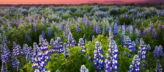
This is the final part of my I-V part series of travel blogs, where I invite you on a tour with me of the magical Snæfellsnes peninsula in West Iceland.
There is so much to see and do that one travel blog wasn't enough, and the whole trip around the Snæfellsnes peninsula ended up filling five travel blogs!
Plus, side blogs about interesting locations, which I wanted to tell you more about. I hope you enjoy travelling with me around this beautiful peninsula :)
Top photo: By Snæfellsjökull
Stykkishólmur - the largest town on the Snæfellsnes peninsula

Stykkishólmur town on Snæfellsnes
In my last travel blog: The Magical Snæfellsnes Peninsula in West Iceland - Part IV, we had just left the historical and sacred Mt. Helgafell, where you can get 3 wishes fulfilled, and had driven just a couple of km further on road 58 to visit Stykkishólmur town.
Stykkishólmur is the biggest town on the Snæfellsnes peninsula and is often called the capital of the west, with a population of around 1,285 (2025).
It is the centre for trade, service, and transport in this area, and here you will find the only Bónus discount supermarket on the peninsula.

Stykkishólmur town
Danish traders owned some of the old houses in Stykkishólmur, and every year in August, there is a Danish town festival in Stykkishólmur called Danskir dagar or Danish days.
The inhabitants have put their pride into preserving the old houses and have done a great job - walking in the centre of town is like walking in another era.
The oldest house in Stykkishólmur is the Norwegian house, which dates back to 1832.
In 2011, Stykkishólmur received the EDEN award as a European Destination of Excellence, with the words that Stykkishómur is "a fascinating town". I totally agree with this, it is a beautiful town.
If you want to stay in Stykkishólmur, then there are various good choices in and around Stykkishólmur: Best Stykkishólmur accommodation. I have stayed in Stykkishómur on several occasions.

One of the hotels in Stykkishólmur is in a former convent - Fransiskus hotel.
As in every village and town in Iceland, there is a good swimming pool in Stykkishólmur.
What makes this swimming pool special is that the water has been certified by the Institut Fresenius, which specialises in environmental certification.
They say the water is good for people with exoskeletal problems.
I especially like soaking in their hot seatub.
Stykkishólmskirkja church

Stykkishólmskirkja church
The church in Stykkishólmur reminds me of a modern time sculpture.
The church stands on a hill and is spectacular in itself - it is the landmark of Stykkishólmur town. It seats 300 people. 
The beautiful altarpiece in Stykkishólmskirkja church
It was consecrated in 1990, and inside the church, you will find the most beautiful altarpiece of the Virgin Mary holding baby Jesus.
The older, more conventional church was built in 1879 and is located in the centre of town by the old houses.

Stykkishólmskirkja church - the older one - is in the centre of Stykkishólmur
The newer church has always been open when I have visited, but the old church has always been closed.
One of my best friend's father was the minister in the old church.
The Norwegian House - the oldest house in Stykkishólmur

The Norwegian House in Stykkishólmur
The Norwegian house is a very nice district museum by the harbour in Stykkishólmur and in my opinion one of the pearls of this lovely town.
It is the oldest house in Stykkishólmur, built in 1832 by Árni Ó. Thorlacius (1802-1891), a prominent entrepreneur in Stykkishólmur at the time.
Árni had wood imported from Norway for the house.

The Norwegian House
The Norwegian House is 500 square metres and was the first two-storey home in Iceland and one of the 3 largest homes in Iceland at the time, so you can see that it is quite a historical house, and I am glad that it was preserved in such a lovely manner.
The district museum shows you a reconstruction of this gentleman's home - it is exceptionally well made, and you feel like you have just popped in for a visit.
Just imagine the size and grandeur of this beautiful house at a time when most Icelanders lived in turf houses!
After the owner died, the house was used for multiple purposes, and 4 families lived in it at one point.

Inside the Norwegian house in Stykkishólmur
On the ground floor, you will find a museum store, Krambúðin, where girls dressed in costumes from this time assist you.
Visiting the Norwegian House is like stepping back in time, a very lovely visit. In Reykjavík, where I live, you can visit Árbæjarsafn museum for a similar experience.
The museum is located at Hafnargata 5.
The Library of Water

The Library of Water
The Library of Water at Stykkishólmur is a one-of-a-kind museum - and a very interesting one. It is situated on a hill with a stunning view of the harbour on one side and the town of Stykkishólmur on the other side.
The exhibition was created by the American artist Roni Horn and is now a permanent sculpture installation.
What makes it so very special is the constellation of 24 glass columns, which contain glacial water gathered from glaciers around Iceland, for example. the glacial tongues of Vatnajökull, Hofsjökull, Langjökull, and Snæfellsjökull - jökull being the Icelandic word for a glacier.

The Library of Water
Each column is dedicated to a single glacial source, and you can see on a chart in the museum which column contains the water from which glacier.
The columns make a beautiful reflection, and watching the village and the street through them creates a very special sensory experience.
I have visited the Library of Water both in the summertime and in the wintertime. It is equally beautiful, but seeing the houses through the columns is better in daylight.
 Photo taken in the summer of 2025
The Library of Water is located at Bókhlöðustígur 17. You can buy tickets at the Norwegian house, where you will receive the code for the key box. Nowadays, people visit the Library of Water on their own.
Æðasetur Íslands

Æðasetur Íslands
In Stykkishólmur, you will find Æðarsetur Íslands - the Icelandic Eider-Centre, where you will be able to get acquainted with the eider ducks of Iceland.
In Breiðafjörður fjord, you will find the largest eider-duck nesting site in Iceland and one of the world's most extensive eiderdown farming, so it is fitting to have an Eider-Centre here in Stykkishólmur.
At the centre, you will find various eiderdown duvets for sale, but these duvets are the best.

I picked up a big heap of eiderdown and could not believe how light it actually is!
Æðarsetur Íslands is located at Frúarstígur 6 in Stykkishólmur.
View-dials in Stykkishólmur

By the view-dial on Bókhlöðuhöfði in Stykkishólmur
In my travel blogs, I often show you view-dials in Iceland, of which there are around 90+ now.
The first one was erected in 1938 on Valhúsahæð in Seltjarnarnes by Jón J. Víðis, who was the instigator of view-dials in Iceland and designed 23 view-dials in his lifetime.
My father-in-law, Jakob Hálfdanarson, took over from his uncle, Jón Víðis.
 The view-dial on Bókhlöðuhöfði in Stykkishólmur
One of the view-dials in Stykkishólmur is by Vatnasafnið - the Library of Water on Bókhlöðuhöfði. It was erected in 1987 and is a square, thin copper plate.
It shows a time of 3 hours, along with the names and heights of nearby mountains.
We don't know who designed it.

By the view-dial on Vatnsás in Stykkishólmur - the pillar is very tall
The other view-dial is on Vatnsás close to Fosshotel Stykkishólmur. That one was erected in 1986.
I always show you photos of me by the view-dials to demonstrate how tall the pillars are, and this view-dial's pillar is very tall.
The view-dial is a round, thin copperplate showing a time of 3 hours and the names and height of the surrounding mountains.

There is a lovely view from the view-dial on Vatnsás in Stykkishólmur
We also don't know who designed this one.
It would be good to know who the designer is, so if anybody who reads my travel blog knows who the designer of these view-dials is, please get in touch with me :)
Súgandisey island

Súgandisey island Stykkishólmur
By the harbour stands the basalt island Súgandisey, and shelters the town from the northern wind.
Súgandisey is connected to land by a road by the harbour, so you can walk or drive to it and park by the harbour and walk up some stairs that lead you up this beautiful cliff.
Other stairs take you further up, where you can rest on a bench and have a look at Stykkishólmur from high up.

By the lighthouse on Súgandisey island
At the top of Súgandisey, you will find a lighthouse offering an even better view.
This lighthouse was once located at Grótta in Seltjarnarnes, part of the Great Reykjavík area, but was later moved to Súgandisey.
For many years, Seatours offered a boat tour of Breiðafjörður Bay. I joined the boat tour 3 times and have written an additional travel blog about that boat tour.
But, in 2025, Seatours changed owners, and these very popular boat tours are no longer available :(,

Súgandisey island - the view of Stykkishólmur
But the ferry takes you across Breiðafjörður fjord to Flatey island and the Westfjords:
Baldur Ferry from the Snaefellsnes Peninsula to the Westfjords | Via Flatey Island
Baldur Ferry from the Westfjords to the Snaefellsnes Peninsula | Via Flatey Island

The ferry Baldur
That Viking Sushi Adventure used to take you on a 2-hour and 15-minute-long trip on Breiðafjörður bay with its wonderful, innumerable islands, Breiðafjarðareyjar, or the Islands of Breiðarfjörður.
The islands are among the 3 innumerable things in Iceland.

Breiðafjarðareyjar islands
The islands are so many that some of them even have the same name, but I have heard the number 2,700, although I prefer to think of them as being innumerable ;)
The boat sailed straight up to some islands for bird-watching, and we saw a lot of kittiwakes, shags, and puffins. And awesome columnar basalt in various forms, depending on which island we were visiting.
The columnar basalt is riffled in one of the islands, and it is often referred to as the Bookshelves of God.

The view of Súgandisey island and Stykkishólmur from the boat
We were shown the hiding place of Eiríkur rauði, or Eirik the Red, the father of Leif the Lucky, who is said to have discovered America.
And you will see an island with a boulder in a rift in the rocks. The boulder was thrown there by a giantess living at the time at Mt. Helgafell. She has now been turned into stone on top of Kerlingarskarð pass
You can read about her story in my travel blog:
Kerlingarskarð Pass in Snæfellsnes in West Iceland - the Folklore of the Giantess & her Fiancé

The fruit of the ocean
These islands were populated, and here on Hrappsey Island was even the first printery in Iceland.
But as the story goes with the Vikings, there is also one rock in Breiðafjörður bay where people were hung and left to hang for months as a warning to others to behave right.
These islands are for sure filled with history. We were told many stories about life in the old days on the islands by an excellent guide.
Now, this is what some call the highlight of the tour of the Breiðafjarðareyjar islands - the throwing out of the net. This was actually quite exciting when two members of the crew threw a net into the ocean, and we waited for the catch of the day!

The fruit of the ocean
Everybody on the boat watched as the net was drawn in to see what they had caught.
The catch was quite impressive: beautiful purple sea-urchins, red and orange starfish, scallops, crabs, and all kinds of shells and conches - to sum it up: the Fruit of the Ocean.
The crew opened the sea urchins and scallops and offered them to the group, fresh and raw, free of charge. Sea-urchin roe, which you can see in my photo above, is considered to be a delicacy and an aphrodisiac.

Sipping white wine on the boat tour
Stykkishólmur is 172 km from Reykjavík if you drive through the Vatnaleið mountain pass on road 56, which I will show you on our way back.
Þingvellir at Þórsnes - the site of the old Þórsnessþing parliament

Þingvallaborg, which is believed to be the site of the old Þórsnessþing parliament
The settler of this area, Þórólfur mostrarskegg, named the peninsula, where Stykkishólmur is located, and the surrounding area Þórsnes, the peninsula of Þór (the god of thunder).
He also established a district parliament, Þórsnessþing parliament, which was moved to Þingvellir after the original site of the parliament was desecrated with blood.
There had been a fight about where to use the toilet (do nr. 2) while attending the parliament. A skerry, Dritsker, was used for that purpose as the parliament grounds were not to be desecrated.
After a battle about this, where blood was shed, the parliament was moved.

Þórssteinn rock at Þingvellir
The quarter parliament site is called Þingvellir, like the main parliament site at Þingvellir, which was established in 930, and people from all over Iceland attended.
Don't confuse these 2 Þingvellir locations - I have heard that tourists have followed their GPS to the wrong Þingvellir!
At Þingvellir, you will find the Þórssteinn rock.
In the 10th chapter of Eyrbyggja Þórssteinn rock is described: "There is yet to be seen the Doom-ring, where men were doomed to the sacrifice. In that ring stands the Stone of Thor over which those men were broken who were sacrificed, and the colour of the blood on that stone can still be seen."
Þórssteinn rock - contemplating the fate of the men who were punished and lost their lives here
We asked the owner of Þingvellir farm for permission to have a look at Þórssteinn rock and the old parliament grounds of Þórsnessþing. I must say that I got quite moved when standing by the rock, thinking about what happened here in the olden times.
Since my visit to Þingvellir in the summer of 2020, Þingvellir has been sold to a new owner. Always ask for permission before visiting this site, as it is on his farm.
Mt. Drápuhlíðarfjall

The view from my hike on Mt. Drápuhlíðarfjall
When driving in this area, you will for sure notice the golden Mt. Drápuhlíðarfjall.
If the sun is shining, it becomes very apparent; less so when it is overcast, or there is a shadow on the mountain.
I have been asked about hikes up the mountain, so I went to check it out and hiked for a short distance up the mountain.
Mt. Drápuhlíðarfjall is 527 m tall, made of rhyolite and basalt, and it gets its golden colour from the rhyolite.

A colourful rock at Mt. Drápuhliðarfjall, Snæfellsnes
I remember when I was younger that it was very popular to use colourful rocks from Mt. Drápuhliðarfjall to make fireplaces and put on walls in homes.
It is now forbidden to remove rocks from the mountain.
I have heard that there is also lignite in the mountain and even gold, but I didn't go that far up the mountain, or maybe I didn't notice it, as the mountain is very colourful.

Having a picnic at Mt. Drápuhlíðarfjall in the summer of 2020
There is an easy 10-minute hike to the mountain's roots. In one place, we went through moorland, but stepping stones had been placed on the path to make it easier to cross that wet part of the hike.
We spent half an hour by the mountain and had a picnic by the colourful rocks which lit up in the sunshine.
Vatnaleið and the waterfalls in the Fossá river

Road signs on the Snæfellsnes peninsula - follow the Borgarnes road sign if you want to drive back to Reykjavík via Vatnaleið
If you will not be taking the ferry across Breiðafjörður to visit the Westfjords, then you can continue travelling with me back to Reykjavík. So, let's take a left turn at the intersection by road 56 in the direction of Borgarnes and Reykjavík and drive through Vatnaleið or the Route by the Lakes.
Vatnaleið is a shortcut, as it were, from the north part of the Snæfellsnes peninsula, close to Stykkishólmur town, and down to the south part of the peninsula.

The picnic area on Vatnaleið
Vatnaleið mountain pass replaced Kerlingarskarð pass, which is now closed to traffic. This route was opened on November 2nd, 2001, and takes you through the heath of Snæfellsnesfjallgarður with 3 beautiful lakes.
The lakes are called Baulárvallavatn, Hraunsfjarðarvatn, and Selvallavatn, and there is angling in all of them.
See my travel blog about Kerlingarskarð pass and learn about the giantess in the mountain:
Kerlingarskarð Pass in Snæfellsnes in West-Iceland - the Folklore of the Giantess & her Fiancé

Waterfalls in the Fossá river on the Vatnaleið route
On a sunny day, it is so nice to stop by the beautiful viewing spot with chairs and tables made from basalt columns.
From here is a breathtaking view of the lakes, volcanoes, and the vast lava field.
This is one of my favourite places here on the Snæfellsnes peninsula, and my former secret place, as it were, is hidden away here.
I am so glad that Vatnaleið was opened, as it gave me access to these beautiful, hidden waterfalls.

The upper waterfall in the Fossá river - sheep rest on the ledge behind the waterfall
If you go down the hill, you will find these waterfalls in the river Fossá in two parts.
The upper part has a path behind it, and the lower waterfall is wonderful for a picnic, where you can be totally at peace in a very tranquil place. Or that is what it used to be like.
Now that I have told some tour guides about my secret place, they have added it to their itineraries, and why not? It's a beautiful place to visit.
I could spend a whole day here, especially if the weather is as beautiful as it was on the days I took these photos.

Visiting the waterfall very early in the morning back in 2010
These waterfalls don't seem to have a name; they are just called Foss in the Fossá river, as far as I know.
Foss in Fossá means Waterfall in Waterfall river, but there are many waterfalls in Iceland with that name. I have now seen that someone renamed Foss Kindafoss or Sheep Waterfall, but that is a made-up name, a lovely name though :)
I understand why, as sheep seek shelter behind the upper waterfall. If you look closely at my photo above, you will see a sheep with her two lambs resting on the ledge behind the waterfall.

The lower waterfall in the Fossá river, where I used to go for a picnic
And now the name Selvallafoss seems to be the name many people are calling Foss. The lake is called Lake Selvallavatn, and the farm is Selvellir, so it might be logical to call it by this names.
But it remains nameless on the Icelandic maps I use, like Landmælingar Íslands - National Land Survey of Iceland.
Here is the location of Vatnaleið on the map. After visiting the waterfalls, we will drive across the 16 km of heath.

Vegamót
At the intersection of roads 56 and 54, you will see the Vegamót gas station and restaurant on your right-hand side, and you can stop there for coffee or an overnight stay in Hotel Snæfellsnes.
I recently had a look at their rooms, and they are very lovely.
Now let's turn left for Reykjavík to close the circle of the Snæfellsnes peninsula. There is one more stop on the way.
Landbrotalaug hot spring

Landbrotalaug hot spring
Landbrotalaug is one of Iceland's hidden natural hot springs. It is off the beaten path, but still on our way back from the circle we have made around the Snæfellsnes peninsula.
I am not going to give directions to it as too much traffic will destroy this area, so let's leave it to the locals. I just wanted to include it in my unofficial guide to what I find interesting on the Snæfellsnes peninsula.
You can find directions to the pool on other websites, but when I saw that the sign "Heit laug - hot spring" had been spray-painted black, I figured the pool was getting too many visitors.

On the way to Landbrotalaug hot spring
Landbrotalaug is only 1x1 m big and about 1.50 m deep, with about 35-40°C hot water. Only around 4 people can fit into Landbrotalaug at any given time, as it is so small.
It was occupied when I got there, 4 people were already soaking in it, and more were on the way, so I didn't get to dip into it this time around. It is heavenly being alone here in nature, soaking in a natural hot spring.
If you decide to visit this hidden-away hot spring, then you will have to tiptoe on these rocks in my photo above. As this is pure nature, there are no changing facilities, so you will have to undress, leave your clothes on the ground, then put on a bathing suit.
It seems like the wind blew away somebody's panties, as this is what I saw on my way back to the car ;)

Panties blowing in the wind
By now, we have reached the boundaries of the Snæfellsnes peninsula and Mýrar, where the Eldborg crater stands like a guard on the boundaries. See also my travel blog about the hike on top of Eldborg:
A Hike to the perfectly shaped Eldborg Scoria Crater on Snæfellsnes in West Iceland.
Eldborg is 38 km from Borgarnes, and on your way to Reykjavík, you will pass through Borgarnes.
A really delightful town with a lot of Viking history, which I have told you about in my travel blog about the Viking settlers from the Saga of Egill:
The Saga of the Viking Egill Skallagrímsson & the 9 Cairns in West Iceland

I hope you enjoyed travelling with me around the beautiful Snæfellsnes peninsula in my 5-blog series of the Magical Snæfellsnes peninsula in West Iceland :)
Here are links to all of the Snæfellsnes travel blogs in this series:
The Magical Snæfellsnes peninsula - part I
The Magical Snæfellsnes peninsula - part II
The Magical Snæfellsnes peninsula - part III
The Magical Snæfellsnes peninsula - part IV
The Magical Snæfellsnes peninsula - part V
The Magical Snæfellsnes peninsula - Arnarstapi and Hellnar
Have a lovely time visiting the magical Snæfellsnes peninsula, and thank you for travelling with me around this beautiful peninsula, which is so close to my heart :)

Hi, my name is Regína and I was born and raised here in Iceland. Since 2013 I have written 320 travel blogs about various interesting places to visit in Iceland. I hope you enjoy reading my travel-blog :)