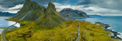
Obszar: 
The Blue Lagoon is a geothermal spa found on the Reykjanes Peninsula in southwest Iceland. The Blue Lagoon is the single most popular visitor attraction in Iceland, drawing people in from across the world. It is located approximately fifteen minutes drive from Keflavík International Airport, or a thirty minutes drive from Reykjavík, the country’s capital.
History
People first began bathing in the waters beside Svartsengi power plant in 1981, quickly realising that it had amazing healing qualities for the skin (the original lagoon was a result of a project of the power plant in 1976).
People, such as those suffering from psoriasis, found the waters immediately soothing for their condition. News quickly spread of this miraculous lagoon, and by 1987, the first swimming facilities were officially opened.
Today
The reasons as to why the Blue Lagoon is considered to be such a regenerative spot is because the water is rich in silica and sulphur. This is greatly complemented by the fact that the Blue Lagoon also operates a Research and Development facility, finding cures and remedies for skin ailments using the mineral-rich water.
The temperature in the bathing and swimming area is very comfortable, and averages 37–39° C (98–102° F). The Blue Lagoon also boasts the LAVA Restaurant, the Blue Café and the Lagoon Spa, from where you can buy a range of cocktails, health products, delicious meals and book an in-water massage. Saunas, steam rooms and a small waterfall are also on the premises.
For all of these reasons and more, the Blue Lagoon is considered to be one of the most enjoyable and romantic spots in the country. It is surrounded by a plethora of fantastic volcanic landscapes and sports a stunning aquamarine colour in the water, as well as rising pillars of steam that only add to the spa’s fantastic ambience. Guests can also enjoy silica face masks and massages. Most visitors to the Blue Lagoon will arrive there either on their first or last day in the country due to its proximity to the airport.
Błękitna Laguna, The Golden Circle is a 300 km route to the 3 most popular natural attractions in Iceland. The Golden Circle consists of Geysir, Gullfoss and Thingvellir.
See this for Golden circle tours.
Geysir area
Geysir is a geyser that gives its name to hot springs all over the world. But although Geysir itself is not active anymore the area features spectacular hot springs such as the powerful Strokkur (spouting a vast amount of water every 10 minutes, regularly about 15-20 meters into the air), Smidur and Litli-Strokkur.
Gullfoss waterfall
The 'Golden Waterfall', is the second part of the Golden Circle, and one of the most beautiful and powerful waterfalls in Iceland, plummeting 32 meters into the river gorge of the popular rafting river Hvita. It is Iocated about 10 km from Geysir.
Thingvellir national park
The largest attraction of the Golden Circle is Thingvellir National Park. The Icelandic parliament was founded there in 930 and remained until the year 1798.
Today it is a UNESCO World Heritage Site and one of the most important places to visit in Iceland, not just for its historical and cultural values, but for also its magnificent landscape.
Thingvellir is surrounded by a beautiful mountain and volcano range and is the site of a rift valley, where the tectonic plates meet, marking the crest of the Mid-Atlantic ridge.
Of particular note at Thingvellir are the magnificent Almannagja gorge, and the beautiful lake Thingvallavatn, the largest lake in Iceland. The popular Gjabakkahellir lava cave is also in the area.
The fissure Silfra is located by Thingvallavatn, Iceland's largest lake, and is famous for its clear waters and popular for diving and snorkeling, as you can literally swim between continents.
Złoty Krąg, South Iceland is the most popular part of the country and contains some of the most beautiful natural attractions in Iceland, among them the Golden Circle, some of Iceland's most famous active volcanoes as well as the beautiful Jokulsarlon glacier lagoon.
Geography
South Iceland is usually divided into the fertile South Icelandic lowlands between Hellisheidi and Eyjafjallajokull volcano on the one hand - and on the other hand the eastern part with the big volcanic glaciers Eyjafjallajokull and Myrdalsjokull (home of Katla) and flattened sands stretching towards the sea.
The South Icelandic lowlands
The South Icelandic Lowlands stretch nearly 100 km from Hellisheidi in the west towards Eyjafjallajokull in the east as a very flat and fertile farming land. From the shore the lowland stretches about km towards the inland. This is the best agriculture area in Iceland. The whole area is geologically very young, mainly of tuff type, formed during the Ice Age by the lava flows of the numerous volcanoes of the area. The area is indeed surrounded by volcanically active mountains on all sides. The glacier rivers of the area have helped filling the lavas with sand and clay, leaving it more and less smooth and fertile. Very strong earthquakes are found in this area as well.
The most active volcanoes of the area are Hekla and Eyjafjallajokull. No less active and not far off, but on the east side, is Katla, which we’ll adress in the eastern part-section. South of the mainland are the volcanic Westman Islands, famous for the 1973 eruption as well as the eruption in 1963, when Surtsey island was formed. Closely linked to the volcanic activity in the south is the geothermal heat found in many places, the best known being the Geysir area, which forms a part of the famed Golden Circle, which also consists of Gullfoss waterfall , Iceland's most famous waterfall as well as one of its most beautiful, located in the popular rafting river Hvita and Thingvellir National Park, comprising three of Iceland's most beloved natural attractions.
The earthquakes of the area bear witness to the fact that Iceland is still in shape. This is further evidenced by the endless number of fissures in the lavas, fractures in the mountains and certain pieces of lands sinking. The area of Thingvellir is the best known example of this, showcasing the continental drift. Thingvellir is a UNESCO World Heritage Site and the location of the old parliament, Althingi, (now situated in Reykjavik) and one of Iceland's most important sites.
Another of Iceland's most popular attractions is the beautiful Thorsmork valley, situated between Myrdalsjokull and Eyjafjallajokull.
Natural harbour-sites are hardly any on the South shore, due to sand produced by the glacier rivers. A few towns are found in the area, Selfoss being the biggest one, Hveragerdi is another, then there are Hella and Hvolsvollur, all conveniently located by the ring road. By the shore are three fishing villages; Thorlakshofn, Eyrarbakki and Stokkseyri. Thorlakshofn the only one of those that can accommodate modern ships and ferrys. The ferry to the Westman Islands sails from there. A new harbour has been built on the sandy coast opposite the Westman Islands. The whole south shoreline offers some of the most gigantic braker waves that you are likely to see.
Culturewise, in addition to Thingvellir, we reccomend the ancient bishop seat of Skalholt (weekends at Skalholt further offer rich music life). Also, Iceland's most famous saga, Njal's saga takes place in the South lowlands. We further recommend the large reconstructed turfhouse near Stong and the ancient excavated ruins.
For sports, horse riding is popular in the area as well as catching salmon or trout, hiking, and river rafting in Hvita.
The east part of South Iceland.
This is the area south and east of Myrdalsjokull. The volcanic glaciers Eyjafjallajokull (near the border of the eastern and western part) and Myrdalsjokull, dominate the view. The landscape has been shaped by volcanic eruptions and vast sands stretch to the sea. Some agriculture is found here, however, with the farms in a row alongside the mountains. A few large glacial rivers fall down in this area which also has striking waterfalls, such as Skogafoss and Seljalandsfoss.
Eyjafjallajokull is already well known for its 2010 eruption, disturbing air communication all over Europe for many days. Much more serious,however, would be an eruption from Katla, a volcano in the eastern part og Myrdalsjokull.
Katla’s last eruption was in the year 1918, when an enormous flood of water exploded from the glacier in a matter of minutes, threatening the local farmers of the area. Large amounts of ash and muddy material were brought to sea to form a new land of sand, Kotlutangi, later washed away by the sea. No people were killed in this eruption. Eruptions in Katla throughout the ages have further created the vast sand area Myrdalssandur. Sixteen eruptions have been recorded for Katla since 930 at intervals of 13-95 years and the volcano is being closely monitored, as time may draw near to its next eruption.
In the same volcanic system as Katla (geologically speaking), are the Lakagigar craters, northeast of Myrdalsjokull. Those erupted in the years 1783-84; producing the largest amount of lava known in historic times. The ashes hindered the sunlight from reaching down to the surface of Earth, resulting in cold climate over northern Europe.
In this area – what we call the eastern part of South Iceland -, there are many places worth visiting: Solheimajokull is a beautiful glacier in a walking distance (an outlet of Myrdalsjokull); Skogar has a very interesting museum of older time traditions and Skogafoss is only a few km away from there. One of Iceland’s most famous hiking routes, Fimmvorduhals, starts from Skogar. Southwest of the village Vik is one of Iceland’s most spectacular beaches, Reynisfjara. Together with the promontory Dyrholaey, which is the southernmost tip of the mainland of Iceland, it offers a breathtaking view with amazing rock formations, a black pebble beach, an abundance of birds and the powerful waves of the North Atlantic Ocean crashing on the beach.
Further east stretches the world's most vast sand plain, Skeidararsandur. North of the sand is the fascinating Skaftafell preservation area. At its east end, south of Hvannadalshnukur, Iceland's highest peak, is Ingolfshofdi cape, with its rich birdlife, old fishermen's shacks and its lighthouse. Following the shore further east is the incredibly beautiful and ice-filled Jokulsarlon glacier lagoon. Not far off is the region of Sudursveit, featuring the culture center and heritage museum Thorbergssetur, erected in the memory of Icelandic author Thorbergur Thordarson.
South Iceland, 
The Icelandic Highlands cover the major part of the country and many of Iceland’s main natural attractions can be found there. Away from crowds, noise and bustle, the Highlands offer unique silence, serenity, peace and extreme natural beauty.
The Central Highlands
The Central Highlands cover a vast area, all at an altitude of over 500 meters, with numerous mountains reaching a height between 1000 and 2000 meters. Most of these higher mountains are covered by glaciers. Two of the highest mountains in the country (over 2000 m high) are located in Vatnajökull, namely Hvannadalshnúkur (2109 m, located in south Vatnajökull) and Bárðarbunga, a subglacial volcano in northwest Vatnajökull (2000 m).
Three of the largest glaciers in Iceland are located in the Central Highlands. These are Vatnajökull in the southeast (Europe’s largest glacier), Hofsjökull in the centre of Iceland and Langjökull, west of Hofsjökull.
Various highlands paths lie between the glaciers, open for cars around June/July. One of the major ones are Kjölur, connecting south and north Iceland (the road is located between Hofsjökull and Langjökull). Sprengisandur, is another important path, connecting south and north, and located between Hofsjökull and Vatnajökull.
Kaldidalur is a highland path stretching west of Langjökull, from Þingvellir towards the Borgarfjörður district. It then continues further north as Stórisandur.
Remember always that the natural environment that makes up Iceland's Highlands is as delicate as it is enchanting. The slightest damage inflicted upon small areas can cause erosion and irreversible landscape wounds that can easily spread over large areas. When travelling in the Highlands, therefore, visitors must at all times uphold responsible travel etiquette. Driving off roads and designated paths is strictly forbidden and punishable by heavy fines.
The South Highlands
Almost all the mountains south of the glaciers are tuff mountains. They were formed during the Ice Age, as well as the area north of Vatnajokull. Volcanic activity is confined to tuff areas of the country and in the southern Highlands are some of its most active and famous volcanoes, Hekla, Eyjafjallajökull and Katla in Mýrdalsjökull, Iceland’s fourth largest glacier.
Northeast, Central-North and Northwest Highlands
To the northeast are the Lakagígar Craters and in Vatnajökull there are Grímsvötn and Bárðarbunga along with Öræfajokull. North of Vatnajökull, the best-known volcanoes are Askja and Krafla.
The northwest and central-north Highlands consist of ancient basalt formations and it is the same for the mountains of the Eastfjords.
Highland Oases
There are a few oases in the highlands that have unique vegetation and wildlife. The most important of these are Þjórsárver, Nýidalur/Jökuldalur, Herðubreiðarlindir and Eyjabakkar. The pink-footed goose has its main nesting places at Þjórsárver and Eyjabakkar. Þjórsárver was designated as a Ramsar site in 1990. Reindeers reside in the east Highlands.
Highlands, 
Reykjavik is the capital of Iceland and the northernmost capital of a sovereign state in the world.
Despite a small population (120.000 and more than 200.000 in the Greater Reykjavik area), it is a vibrant city that draws an ever increasing number of visitors. It is the financial, cultural and governmental centre of Iceland. It also has a reputation of being one of the cleanest and safest cities in the world.
Geography
The city of Reykjavik is located in southwest Iceland by the creek of the same name. Throughout the ages, the landscape has been shaped by glaciers, earthquakes and volcanic eruptions and the area is geothermal. Much of the current city area area was subglacial during the Ice Age, with the glacier reaching as far as the Álftanes peninsula, while other areas lay under the sea. After the end of the ice age the land rose as the glaciers drifted away, and it began to take on its present form.
The coastline of Reykjavik is set with peninsulas, coves, straights and islands, most notably the island of Videy, and seabirds and whales frequent the shores. The mountain ring as seen from the shore is particularly beautiful. Mount Esja is the highest mountain in the vicinity of Reykjavik and lends its distinct feature to the whole area. This majestic mountain is also highly popular for climbing. Other notable mountains that can be seen from the seaside are Akrafjall and Skardsheidi and on clear days one may even see as far to the legendary Snaefellsjokull glacier, at the end of the Snafellsnes peninsula.
The largest river to run through the city is Ellidaa in Ellidaardalur valley, which is also one of Iceland‘s best rivers for salmon fishing.
Transportation
There are no trains or trams in Iceland, but most people travel by car. The city also operates a bus system. There are two major harbours in town, the old harbour in the centre and Sundahofn in the east. The domestic Reykjavik Airport is located at Vatnsmyrin, not far from the city centre and close to Oskjuhlid and Perlan. The international Keflavik Airport at Midnesheidi heath then lies around 50 km from the city. Cars, jeeps and bicycles can be readily rented in the city and many organized tours are also being offered.
What to See & Do in Reykjavik
The local arts scene is strong in Iceland, with both annual events and single ones, many of whom have hit the international stage. For the annual ones please check our articles Best Annual Events in Iceland and the Top Ten Festivals in Iceland. Major events taking place in Reykjavik include the Iceland Airwaves, Gay Pride, RIFF (The Reykjavik International Film Festival), The Reykjavik Literature Festival, Cultural Night, the Reykjavik Arts Festival, Food & Fun, the Reykjavik Fashion Festival and the Sónar music festival.
Among famous people from Reykjavik are artists Bjork Gudmundsdottir, Sigur Ros, writers Halldor Laxness (born in Laugavegur) and Arnaldur Indridason and mayor Jon Gnarr. For more well-known and fairly-well known Icelanders, check our article on the subject.
You might also want to check our article on some of the many things to see and do in Reykjavik, such as visiting the city‘s many museums, exhibitions and galleries, checking out live music, visiting the Harpa music hall or the theatres, visiting the lighthouse at Grotta, the main shopping street of Laugavegur, visiting the old harbour and the flea market, going on a bird- and whale watching tour or visiting Videy island. We also have a top ten list of things to do.

Make sure to visit the public square of Austurvollur, one of the city‘s most popular gathering places, where you‘ll also find the national parliament, Althingi, the state church a statue of independence hero Jon Sigurdson, as well as cafés, bars and restaurants. Austurvollur was central in the 2008 protests, along with Laekjargata, home to the House of Government. You are also not likely to miss the great church of Hallgrimskirkja that towers over the city from the hill of Skolavorduholt, wherefrom you‘ll get a great view of the city.
Try a walk by the city pond, greet the many birds that frequent the area and visit the city hall, stationed by its banks. The Hljomaskalagardur is a beautiful park that lies by the pond, it ideal for a nice walk and sometimes concerts get held there. Further off is the campus of the university of Iceland, the Nordic house and the Vatnsmyri wetland, a particularly pleasant place, but be mindful of not disturbing the wildlife there and keep to the pathways.
For a nice swim on a warm day, we particularly recommend Nautholsvik beach.
Visit the Laugardalur valley, home to one of the city‘s best swimming pools, as well as the Asmundarsafn gallery, a beautiful botanical garden and a domestic zoo. A walk by the Aegissida beach, with it‘s old fishing sheds, in the west part of Reykjavik also holds a particular charm. The aforementioned Elllidaardalur valley is also a popular resort.
Another place that offers one of the city‘s best (and free) views is Perlan, up in Oskjuhlid hill. The hill itself is a popular resort, with over 176.000 trees and great opportunities for walking and cycling.
Travel to Alftanes to see the president‘s house at Bessastadir, which is also a historical site in it‘s own right, having been the educational centre of Iceland for centuries. Nearby is a beautiful lava field, Galgahraun, well worth a visit, though there is currently an environmental struggle going on as to it‘s future state.
The city is furthermore a short drive from many of Iceland‘s major attractions, most famously the Golden Circle and the Blue Lagoon. In close vicinity you‘ll also find the Heidmork preservation area, a favourite pastime resort of the people of Reykjavik, as well as the Blue Mountains, one of Iceland‘s most beloved skiing venues.
Check our Best of Reykjavik guide further for tips on the best cheap things to do in Reykjavik, some of the best restaurants in the city, happy hours, the top ten value places to eat and our two articles on the famous Reykjavik nightlife; Nightlife in Reykjavik and Nightlife and mating.
Finally, we‘d like to stress that these are only some suggestions of the many things you might check out in Reykjavik. Whatever you choose to do, we hope you‘ll be able to make the most of your visit and we wish you a pleasant stay in our capital.
Reykjavík, 
Landmannalaugar ("The people's pools") is a vast area of stunning and unique beauty, the true heart of Iceland's southern Highlands.
Geology
Landmannalaugar is a truly rare area, both geologically and aesthetically. The area can be found nestled beside the raven-black Laugahraun lava field, a sweeping expanse of dried magma which originally formed in 1477. Landmannalaugar itself is made up of windswept rhyolite mountains, a rock type that creates a full spectrum of dazzling colour on the mountainside. Shades of red, pink, green and golden yellow all change their tone, keeping in movement with the sun rays and creating an area of wilderness that resembles no place else on earth.
Landmannalaugar is primarily known for its natural geothermal baths, hence its name "The People's Pools". For centuries, Landmannalaugar has served as an area of shelter and respite for weary travellers who use these soothing springs as a means to relax after tiring excursions. Today, visitors to the highlands should always bring a swimsuit and towel, just in case one of these naturally occurring hot pools should crop up along the hiking trail.
The most popular road leading to landmannalaugar, Sigölduleið, takes you past multiple stunning natural features, including Bláhylur lake, a magnificent body of water nestled in a dormant volcanic crater.
Hiking
The area marks the northern end of the Laugavegur, one of Iceland's most popular hiking trails. It is also home to many other notable trails, however, including the path onto the mighty Mt. Brennisteinsalda ("Sulphur Wave"). Visitors can also traverse the trail up the Bláhnjúkur ("Blue Peak") volcano, whose summit allows for a sweeping view of up to five glaciers on clear days.
Multiple operators run daily tours to Landmannalaugar from mid-June to mid-September, during which time The Icelandic Touring Association operates a small shop, three camp sites and a mountain hut equipped with sleeping bags and accommodation for up to 80 visitors.
Landmannalaugar, 
Nestled between the glaciers Eyjafjallajökull, Mýrdalsjökull, and Tindfjallajökull is Þórsmörk (Thor's Valley), a nature reserve in the southern Icelandic highlands. Þórsmörk is one of Iceland's most popular hiking destinations.
Strictly speaking, Þórsmörk is a valley and a mountain range between the Krossá, Þröngá, and Markarfljót rivers. Locals, however, often use the name "Þórsmörk" when referring to a much larger region that is composed of the area between Þórsmörk proper, and the Eyjafjallajökull glacier volcano.
Landscapes and Geology
Contrasting vistas of lush oases and roaring glacier rivers cutting through black desert expanses not only make Þórsmörk unique to Iceland but to the entire world. Parts of the valley are rich with moss, fern, and Birchwood, while jagged mountain ridges and ice-capped peaks crown the horizon.
The valley's climate is warmer and calmer than usual in south Iceland, which often causes Þórsmörk's mountains to be cloaked in a veil of mist that materialises when the warm valley air ascends and mixes with the descending cold breath of the glaciers above.
Activities
Þórsmörk's surrounding hills, slopes and mountains are beset with small valleys and gullies that make for some of Iceland's most astonishing hiking routes. Experienced hikers, therefore, have a wealth of trails to trek, varying in distances and difficulty. In fact, Þórsmörk offers two of the most popular trails in Iceland, the Fimmvörðuháls and the Laugavegur.
Fimmvörðuháls is a 30km trail that takes you into the hills beneath the Eyjafjallajökull glacier volcano and to the volcanic craters Magni and Móði, which are still steaming from the eruption of 2010. The 55 km Laugavegur path takes you from Þórsmörk to the Landmannalaugar geothermal area which is home to an incredible wealth of hot springs and rhyolite mountains of vibrant colours. A short but demanding hike from Þórsmörk up Mt.Útigönguhöfði is suitable for those who are looking for stunning views and don't mind a little physical challenge.
Accommodation and How to get there
During winter (October 16th - April 30th) the road into Þórsmörk is impassable. In summer (May 1st - October 15th) a special 4x4 mountain bus runs three times per day from the BSÍ bus terminal in central Reykjavík. Once there you have the choice setting up base in a small hut in Húsadalur valley, a private room or a dormitory in Langidalur valley, or to camp in Þórsmörk's campsite. Please note that the huts, private rooms and dormitories must be booked well in advance.
Þórsmörk, 
Skógafoss is one of the country’s biggest and most beautiful waterfalls with an astounding width of 25 meters (82 ft) and a drop of 60 meters (197 ft). Due to the amount of spray the cascade produces, a rainbow is present any time the sun emerges from behind the clouds.
Located on the Skógá river, this mighty cascade is clearly visible from Route 1 and is an excellent place to stop and stretch the legs while travelling Iceland’s South Coast. The river below Skógafoss holds a large char and salmon population and is thus a favourite spot for fishermen in the summer.
The land underneath the waterfall is very flat, allowing visitors to walk right up to the wall of water. Keep in mind, however, that this will get you drenched. Skógafoss can also be viewed from the top as a steep staircase leads to an observational platform above the cascade.
Geography
Skógafoss is located near the small village of Skógar, south of the Eyjafjallajökull glacier volcano. There you’ll find the Skógasafn folk museum, an open-air museum with both old wooden houses and turf houses, as well as a regional museum with various artefacts from this area.
A part of the Skógasafn Regional Museum is the Museum of Transportation, which showcases the history and evolution of transportation, communication and technologies in Iceland. There, you can see how this nation evolved from the age of the working horse to the digital communications of the 21st century.
The Skógasafn museum also includes a café and a museum shop, and in the village of Skógar, you will find both a hotel and a restaurant.
At the eastern side of Skógafoss, you will find one of Iceland’s most famed hiking routes; the Fimmvörðuháls pass. The 22 km (14 mi) trail takes you along Skógá river, between two glaciers, Mýrdalsjökull and Eyjafjallajökull, before ending in the beautiful Þórsmörk valley.
Folklore
A gold ring is on display at the Skógasafn museum. According to legend, the ring is from a chest that was owned by Þrasi Þórólfsson, one of the first Viking settlers in the area. Folklore states that before his death in 900 AD, Þrasi buried a chest filled with gold in a cave behind Skógafoss waterfall.
Many attempts were made to retrieve the chest after Þrasi’s death, and years later, locals managed to grasp a ring on the side of the chest. As they pulled, the ring broke off, and the treasure was lost forever. The ring was then given to the local church before it made its way to the museum.
Skógafoss, 
Seljalandsfoss is a waterfall, situated on the South Coast of Iceland, with a drop of 60 metres (200 feet).
Due to the waterfall’s close proximity to the Ring Road and impressive natural features, it is one of the most famous and visited falls in the whole country. Majestic and picturesque, the waterfall is one of the most photographed features in the whole of Iceland.
Geology and Surroundings
Seljalandsfoss waterfall, part of the river Seljalandsá, has its origins underneath the glacier volcano Eyjafjallajökull. The cascade of the falls is relatively narrow. However, it used to be wider until a flood in 1976 altered the shape of the cliffs from which the waterfall tumbles. The rainfall during the day of the flood measured 101 millimetres (4 inches), which caused a significant rise in the water levels of rivers in the area. This event caused a new crack to form in the cliffs, that subsequently redirected the width of the falls.
The cliffs themselves are the remnants of a former coastline, which now separates the lowlands from the Highlands of Iceland. The same can be said of Seljalandsfoss’s equally famous neighbour, Skógafoss waterfall.

The most distinguished feature of Seljalandsfoss is a natural pathway that stretches all the way around it. The cliffs behind the falls, therefore, form an accessible cave. Visitors can easily walk this path, although they should be prepared to get dampened due to the perpetual mist of the falls, which also tends to make the rocks of the pathway slippery. During the winter season, it is highly advised not to walk around the falls since the icing makes the walk too hazardous.
However, floodlights have been set up on both sides of the waterfall, which impressively illuminate the scene during dark winter nights. The lights were installed in 2001 due to the growing popularity of the falls as a tourist destination.
After visiting Seljalandsfoss, it is common for visitors to continue north to the waterfall Gljúfrabúi, which is found partially hidden behind a rock face. Because of Seljalandsfoss extreme popularity, Gljúfrabúi is widely considered an additional hidden gem of the scene.
Visitor Centre Controversy
In 2017, it was announced that a visitor’s centre was to be constructed near the falls. The design of the building indicates that it would be 7 metres (23 feet) high and 2,000 square metres (21,500 square feet) in size. Landowners in the area opposed to the idea, proclaiming that the centre would greatly alter the natural appearance of the waterfall’s renowned scenery.
The project has neither been fully approved nor wholly cancelled, with ideas surfacing of either significantly reducing the size of the construction, or moving the visitor centre’s location further away, for instance to the nearby farmstead Brekkuhorn.
Seljalandsfoss in Popular Culture
Along with a multitude of South Iceland’s most famous natural attractions, Seljalandsfoss can be seen in Justin Bieber’s music video for his song ‘I’ll Show You’.
The waterfall was also a featured waypoint during the first leg of the sixth season of The Amazing Race, an American reality TV series.
Seljalandsfoss, 
Geysir is a dormant hot spring in the geothermal area, Haukadalur Valley, found in South Iceland. Making up just one of the attractions along the world famous Golden Circle sightseeing route, alongside Þingvellir National Park and the mighty Gullfoss waterfall, Geysir is most well-known for having lent its name to geysers around the world.
Geography
Though Geysir itself is rarely active these days, Haukadalur Valley boasts a plethora of hot springs, including the powerful Strokkur, Smiður and Litli-Strokkur. Strokkur is, arguably, the country’s most famous hot spring, shooting vast jets of boiling water from twenty metres (65 ft) up to forty metres (130 ft) high. Don’t worry about missing this incredible spectacle of nature as Strokkur erupts every five to ten minutes, just make sure to have your camera ready.
Geysir is much larger, but years can go by between eruptions at Geysir. When it does erupt, the water can shoot up in the air as high as 70 metres (230 ft)!
Just five minutes walk north of Geysir a wealth of fumaroles emanating steam and gas into the cool Icelandic air can be found. Aside from watching the hypnotic pillars of steam, you will also be able to observe the yellow sulphuric stains along the fumaroles themselves, a result of the steam crystallising around the rock bed.
At the southern part of the valley, Þykkuhverir, you‘ll find various bubbling mud pots. These spooky brown cauldrons are actually fumaroles that boil up through the loose ground; after a dry spell, these mud pools are likely to transform into a hardened fumarole.
Nearby Attractions
About 2 km from Geysir is a preserved natural pool called Kúalaug. It has room for 3-5 people at a time, but care should be taken, as the area around the pool is very delicate. The temperature is 39-43°C, depending on where you are positioned in the pool. The water is slightly muddy, as the pool is built on soil, and the bottom is slippery due to algae, so caution is advised when relaxing here.
Haukadalur has also seen a rise in re-forestation in recent times thanks to continued experiments and research in the area. Today, Haukadalsskógur is one of the largest forests in South Iceland, boasting accessible walking paths (also for wheelchair users), fascinating vegetation and The Tree Museum, built in the memory of forester Gunnar Freysteinsson.
History
Haukadalur has been a church site since ancient times and has been inhabited since the Age of Settlement. Given its historic value, it should be noted that scholar, Ari “The Wise“ Thorgilsson, grew up there; it was also where the first pastoral school in Iceland was built. The current wooden church was last rebuilt in 1938 but its architectural style dates back to 1842, making it one of the oldest of its kind in Iceland.
For accommodation, Hotel Gullfoss is approximately 7 km from the Geysir area, and closer still is Hotel Geysir on the other side of the road from the attraction, where you will also find a restaurant, café and a souvenir shop.
Geysir, 
Gullfoss (translated to ‘Golden Falls’) is one of Iceland’s most iconic and beloved waterfalls, found on the Hvítá river canyon in south Iceland. The water in Hvítá river travels from the glacier Langjökull, finally cascading 32m down Gullfoss’ two stages in a dramatic display of nature’s raw power.
Because of the waterfall’s two stages, Gullfoss should actually be thought of as two separate waterfalls. The first, shorter stage of the waterfall is 11m, whilst the second stage is 21m. The canyon walls on both sides of the waterfall reach heights of up to 70m, descending into the 2.5km long Gullfossgjúfur canyon (geologists indicate that this canyon was formed by glacial outbursts at the beginning of the last age.)
In the summer, approximately 140 cubic metres of water surges down the waterfall every second, whilst in winter that number drops to around 109 cubic metres. With such energy, visitor’s should not be surprised to find themselves drenched by the waterfall’s mighty spray-off.
Gullfoss makes up a part of the highly popular Golden Circle tour, alongside Geysir geothermal area and Þingvellir National Park.
History
In the early days of the last century, Gullfoss was at the centre of much controversy regarding foreign investors and their desire to profit off Iceland’s nature. In the year 1907, an English businessman known only as Howells sought to utilise the waterfall’s energy and harboured ambitions to use its energy to fuel a hydroelectric plant.
At the time, Gullfoss was owned by a farmer named Tómas Tómasson. Tómas declined Howell’s offer to purchase the land, stating famously “I will not sell my friend!” He would, however, go on to lease Howells the land, inadvertently beginning the first chapter of Icelandic environmentalism.
It was Tómas’ daughter, Sigríður Tómasdóttir, who would lead the charge. Having grown up on her father’s sheep farm, she sought to get the lease contract nullified, hurriedly saving her own money to hire a lawyer. The ensuing legal battle was an uphill struggle; the case continued for years, forcing Sigríður to travel many times by foot to Reykjavík if only to keep the trial moving. Circumstances became so difficult that Sigríður threatened to throw herself into the waterfall if any construction began.
Thankfully, in 1929, the waterfall fell back into the hands of the Icelandic people. Today, Sigríður is recognised for her perseverance in protecting Gullfoss and is often hailed as Iceland’s first environmentalist. Her contribution is forever marked in stone; a plaque detailing her plight sits at the top of Gullfoss.
Restaurant / Cafe
Besides Gullfoss, visitors can enjoy the views from Gullfoss Cafe, a locally run delicatessen that serves a wide variety of refreshments and meals. The menu has options to tantalise everyone’s taste buds; hot soups, sandwiches, salads and cakes. There is also a shop on site where visitors’ can browse and purchase traditional Icelandic souvenirs.
Gullfoss,
The glacier volcano of Eyjafjallajokull (1651 m) is located at the borders of the South Icelandic highlands. It featured prominently in world news in 2010 when ash from its eruption halted air traffic in Europe.
An ice cap of about 100 km with several outlet glaciers covers the caldera of Eyjafjallajökull that stands at the height of 1651 meters. The diamaeter of its highest crater is around 3-4 km2 wide and the rim has several peaks.
Eyjafjallajokull glacier volcano lies north of Skogar, and to the west of Myrdalsjokull glacier and the massive volcano there; Katla.
Eyjafjallajokull is thought to be related geologically to Katla in Myrdalsjokull and eruptions in the former have often been followed by eruptions in the latter.
The 2010 eruptions
The end of 2010 saw some small seismic activity that gradually increased and resulted in a small eruption in March of 2010, characterized by a flow of alkani-olivine basalt lava.
This first stage lasted until April 12th and created the volcanic craters Magni and Modi at the Fimmvorduhals trail. They are so far Iceland's newest vocanic craters, and still eminate steam with lava glowing under the surface.
However it was the second phase of the eruption that started on April 14th that created the huge ash cloud that rose about 9 km into the skies.
This eruption halted air traffic in Europe for days, and its estimated that as many as 107.000 flights may have been cancelled during the week it lasted.
The ejected tephra measured around 250 million cubic meters. This ash cloud lasted for six days and some more localized disruption continued into May. The eruption was officially declared to be over in October 2010, as the snow on the glacier had ceased to melt.
Future volcanic developments?
Eyjafjallajokull erupted in years 920, 1612 and again 1821-1823.
Its latest eruptions were the two that occurred in 2010.
Future volcanic developments remain unclear. The area is still highly active and can be quite unpredictable. It continues, however, to be closely monitored by The Icelandic Meterological Office.
Eyjafjallajökull, 
Dyrhólaey Peninsula is a 120-metre promenade famed for its staggering views of Iceland’s South Coast, as well as its historic lighthouse and wealth of birdlife.
Dyrhólaey (Door Hill Island) is of volcanic origin and was once an island before joining up to the Icelandic mainland. In ancient times, passing sailors used to refer to Dyrhólaey as “Cape Portland”. It is also the most southernmost part of the Icelandic mainland, making it a popular stop for sightseers travelling along the Ring Road, and can be found close by the coastal village of Vík í Mýrdal.
One of Dyrhólaey’s instantly recognisable attractions is the promenade’s massive rock arch, a result of centuries of erosion. As a result, its name, (‘dyr’=door’) is in direct reference to this enormous arch. In fact, this natural feature is so large and dramatic that one daredevil pilot even flew through it, back in 1993.
Dyrhólaey has an abundance of birdlife, the most common sights being Eider Ducks and Iceland’s favourite winged resident, the migratory Atlantic Puffin, during the summer.
From your position atop the promenade, you can also enjoy staggering views over Iceland’s black sand beaches, complemented by the glittering waves of the Atlantic on one side, and distant mountainscapes to the other. To the north, you are also able to see the creeping glacier, Mýrdalsjökull, only proving that this is one of the most interesting panoramas in the whole of the country.
On top of Dyrhólaey stands Dyrhólaeyjarviti, a beautiful old lighthouse that consists of a white, square concrete tower. The first lighthouse in the area was built in 1919; the current construction was completed in 1927. Visitors here will be able to see the lighthouse flicking out beams of white light to sea every ten seconds.

Dyrhólaey, 
Þingvellir National Park is Iceland’s only UNESCO World Heritage site and one of the major stops on the world famous Golden Circle sightseeing tour, alongside Haukadalur Geothermal Valley (Geysir) and Gullfoss Waterfall. Just to the south, as well as a part of the park is Þingvallavatn, Iceland’s largest natural lake.
Geography
The first thing that visitors to the National Park notice is its sheer aesthetic beauty; dried magma fields, covered in Icelandic moss, sit carved by glacial springs and surrounded by a bowl of ancient mountain peaks.
Two of the greatest attractions in the park are the exposed North American and Eurasian tectonic plates; it is one of the only regions in the world where you can see geology such as this on land. Visitors are encouraged to walk along the North American tectonic plate, where they can read more about the area’s fascinating formation and history.
History
Þingvellir can be anglicised to “Fields of Parliament”, a nod to the area’s fascinating history and relevance to Icelandic culture. It is here, after all, that the world’s first democratically elected parliament that remains functioning, the Althing, was formed in 930 AD.
This saw the birth of the Old Icelandic Commonwealth, a time of independence and freedom for the Icelandic people before they became constituents of the Norwegian monarchy. Sessions would continue to be held at Þingvellir until 1798.
Another major reason as to why Þingvellir is considered so important to Icelanders is the fact that this is where the decision was made to abandon the belief of Paganism and the Norse Gods, instead adopting Christianity in 1000 AD. This turning point in history was left to the pagan lawspeaker, Thorgeir Thorkelsson, who rested on the choice for one day and one night before reappearing to share his decision.
Silfra Fissure
Þingvellir is one of the most widely visited attractions in Iceland, in large part due to the fact that it is home to the glacial spring, Silfra Fissure, one of the top 10 sites in the world for snorkellers and scuba divers.
Silfra (meaning “Silver”) is a submerged ravine within the park, boasting visibility of up to 100 metres and a temperature just above freezing. Participants in these tours will be attired at the Silfra carpark in neoprene hoodies and gloves, as well as an undersuit and drysuit for thermal protection.
Þingvellir, Katla is an active volcano situated under the glacier Myrdalsjokull in South Iceland. It is one of Iceland's most well known volcanoes.
Katla's eruptions have produced many massive glacier bursts, with enormous amounts of water flowing, as the fire melts the ice. Its latest eruption was 1918. That eruption created the spit Kötlutangi, which is the mainland's southernmost tip.
Katla,
Strokkur (Icelandic for "churn") is one of the most famous hot springs in Iceland and belongs to the famous Golden Circle.
Strokkur is a fountain geyser in the Geysir geothermal area in the southwest part of the country, east of Reykjavik, near Hvítá river.
Strokkur is a powerful hot spring and an impressive sight. It erupts about every 4–8 minutes and spouts water to a height of 15 – 20 m, sometimes up to 40 m.
Strokkur, 
Reykjanes is a peninsula in Southwest Iceland, characterised by immense lava fields, volcanoes and strong geothermal activity.
Volcanic & Geothermal Activity
The peninsula runs along the Mid-Atlantic Ridge where the Eurasian and the North American tectonic plates are drifting apart. Because of this geological setting, the whole peninsula is extremely volcanically active, covered with lava fields and volcanoes and small earthquakes are very common there.
During the middle ages, many eruptions occurred in Reykjanes, but no eruptions have been recorded there for the last 500 years.
The main geothermal areas of Reykjanes are Gunnuhver, Krýsuvik and Svartsengi. Various mud pools and fumaroles can be seen at Gunnuhver while Krýsuvik is characterised by hot springs and mud pots that bestow multicoloured hues upon the soil. The green crater lake Grænavatn is also an impressive sight.
Svartsengi is home to a geothermal power station that produces 76.5 MW of electricity from the 475 litres of 90° C warm water that gush from the earth per second. The mineral-rich surplus water fills up the Blue Lagoon spa.
Nature & Wildlife
Reykjanes' cliffs are teeming with birdlife. Its best-known bird colony resides in Krýsuvikurbjarg which is the nesting place of approximately 80 thousand seabirds. North of Krýsuvíkurbjarg is Kleifarvatn, the largest lake on the peninsula and one of the deepest in Iceland and on the centre of the peninsula is lake Djúpavatn, a popular fishing destination.
Reykjanes is hammered by some of the most breathtaking breaker waves in the world. A short drive from Krýsuvík is Selvogur where one is able to witness some of the country's greatest waves. On Reykjanestá, the southwest tip of the peninsula, the waves are known to reach heights of 20-30 meters.
The peninsula's north side is dotted with fishing villages and towns, most notably Keflavík, Sandgerði, Garður and Vogar. Grindavík town is located on the south shore of the peninsula. Together, the towns and towns Keflavík, Njarðvík, Hafnir and Ásbrú make up the municipality Reykjanesbær which consists of just under 16,000 residents, making it the fifth largest municipality in Iceland.
Miðnesheiði
Near Keflavík is the Miðnesheiði heath, where the international airport, Leifsstöð (also known as Keflavíkurflugvöllur or ‘Keflavík Airport’) is located.
The World-Famous Spa
On the southern tip of the peninsula is the Blue Lagoon geothermal spa, an ideal place for relaxing and bathing.
Reykjanes, Solheimajokull is a beautiful outlet glacier of the Myrdalsjokull icecap.
Solheimajokull is a rugged glacial tounge riddled with crevasses and spectacular ever-changing ice formations, jagged ridges and sinkholes and is popular for hiking and ice climbing.
The glacier river Jokulsa a Solheimasandur has its source at the glacier, flowing over the sand plain of Solheimasandur towards the sea.
Sólheimajökull, The Laugavegur is one of the most popular hiking trails in Iceland. The scenery is breathtaking in its beauty and extremely varied, displaying examples of most all that Icelandic nature has offer.
The trail connects the nature reserves Landmannalaugar and Thorsmork. The most common route is to set off from Landmannalaugar, stopping by the huts at Hrafntinnusker, Alftavatn, Hvanngil, Laugahraun and Emstrur (Botnar). People usually divide the hike into 5-6 days. The whole trail is about 55 km.
Laugavegur hiking trail, Solheimasandur is a vast area of sand and gravel along the south coast of Iceland, between the cliffs of the interior and the modern shoreline. It was built up by immense glacier bursts sweeping from the mountains to the shore.
The glacier bursts would come via the glacier river Jokulsa a Solheimasandi which runs from the Solheimajokull outlet glacier and towards the sea.
The beach of Solheimasandur is astonishing. It is quite common as far as sands and pebbles go but the colour stands out, a dark greenish, sometimes reddish grey, turning pure black when it turns wet. Mixed with the crashing waves of the Atlantic Ocean it becomes an amazing sight.
Another impressive sight is the plain wreck of a DC-3 belonging to the US Navy that ran out of fuel and crashed on the sand in 1973, and is still located at the very same spot. It is also seen in Icelandic band Sigur Ros's film Heima.
Sólheimasandur, 
Reynisfjara is a world-famous black-sand beach found on the South Coast of Iceland, just beside the small fishing village of Vík í Mýrdal.
With its enormous basalt stacks, roaring Atlantic waves and stunning panoramas, Reynisfjara is widely considered to be the most beautiful example of Iceland’s black sand beaches. In 1991, National Geographic voted Reynisfjara as one of the Top 10 non-tropical beaches to visit on the planet.
Reynisfjara is found around 180 km from Iceland’s capital city, Reykjavik, and is a popular stop-off for those taking a sightseeing tour along South Coast. Driving to the beach is particularly easy, taking an approximate two and a half hours from the capital.
Folklore
Upon visiting the beach, travellers will immediately observe rocky sea stacks sitting off the shoreline, known as Reynisdrangar. According to local Icelandic folklore, these large basalt columns were once trolls engaged in trying to pull ships from the ocean. However, as bad luck would have it, the dawn quickly arose, turning the trolls into solid stone.
Another legend tells of a husband whose wife was kidnapped and killed by two trolls. The man followed the trolls down to Reynisfjara where he froze them, ensuring that they would never kill again.
The sea stacks themselves are home to thousands of nesting seabirds. Species that can be found here include Puffins, Fulmars and Guillemots, making it a must-see location for all birdwatchers out there.
Potential Dangers
Visitors to Reynisfjara must be made well aware of the potential dangers present at the beach. First of all, the rolling, roaring waves of Reynisfjara are particularly violent, often pushing far further up the beach than many would expect.
Visitors are advised to never turn their back on the waves, don't go chasing after them and keep a safe distance of 20-30 metres.
Aside from these sudden and dramatic shifts in tide (known as “sneaker waves”), the currents off the shore are infamous for their strength and ability to drag helpless people out into the freezing cold open ocean. A number of fatal accidents have occurred at Reynisfjara, the last of which occurred in January 2017.
Reynisfjara Black Sand Beach, Vik in Myrdalur valley is the southernmost village on the Icelandic mainland, located 186 km from the capital Reykjavik.
Vik is important as a service centre for the inhabitants and visitors of the marvellous Reynisfjara beach.
Reynisfjara is widely considered one of the most beautiful beaches on earth (see for example Islands Magazine). This black pebble beach boasts an amazing cliff of regular basalt columns called Gardar, which resembles a rocky step pyramid and out in the sea are the spectaculary shaped basalt sea stacks Reynisdrangar. The area has rich birdlife, including puffins, fulmars and guillemots.
Vík í Mýrdal,
Gljúfrabúi ("Canyon Dweller“) is a beautiful waterfall located at Hamragarðar in South Iceland, close to its better known counterpart, Seljalandsfoss waterfall.
The 40 metre high Gljúfrabúi can be considered somewhat of a hidden gem. It is indeed partially hidden behind a huge cliff that lends much atmosphere to the scenery.
To enjoy a view of the fall you need to wade the Gljúfurá river into a narrow opening in the cliff or follow a steep path up the cliff. Both endeavours are demanding so utmost caution is advised.
As mentioned, this waterfall is less known than its neighbour but as a result may provide for all the greater serenity, in addition to excellent scenery.
Gljufrabui, 
Reynisdrangar are rock formations situated near the shore of Reynisfjara beach by the coastal village Vík í Mýrdalur on the South Coast of Iceland.
The formations are large and impending sea cliffs, made up of the rock type basalt, that serve as a vital part of the area’s allure as they shoot dramatically out of the ocean under the looming cliffs of Mt. Reynisfjall.
Dangerous Waves
The village of Vík only houses around 300 permanent inhabitants, but on a daily basis, travellers scouting the South Coast make their way there to visit what has been voted as one of the most beautiful non-tropical beaches in the world. The beach of Reynisfjara, however, can be highly dangerous if proper caution is not taken. As is evident from how the waves of the Atlantic Ocean crash upon Reynisdrangar, the currents here are strong, and sneak waves can easily carry anyone that’s standing too close out to sea. The beach is not for wading, but for admiring, and especially the mighty surf bursting on the base of these rocky cliffs.
Folklore
There is an Icelandic folk tale that explains the origin of the pillars’ eerie appearance. According to legend, a couple of trolls were busy dragging a stranded three-masted ship to shore when the sunlight hit them and turned them into pillars of rock for all eternity. In fact, numerous rock formations in Iceland carry with them tales of trolls or elves, and one has only to look at them to fathom why.
Surroundings & Wildlife
An alternative view of the bewitching cliffs and their surrounding sea can be enjoyed by venturing up Mt. Reynisfjall, by a road to the west of the village. The mountain furthermore functions as a puffin colony every summer, from April to September, meaning guests can enjoy the view in good company. Other birds can be seen gliding around the cliffs such as Arctic terns, fulmars and seagulls.
Reynisdrangar, Brúarfoss ('Bridge Falls') is a relatively small waterfall compared to many of its Icelandic counterparts, but its diminutive size does nothing to take away from its staggering beauty. Both locals and seasoned travellers regard Brúarfoss as one of the country’s hidden gems, often labelling it 'Iceland’s Bluest Waterfall.'
The glacial river Brúará falls 2-3m, ending in a U-turn at the base of the waterfall, where the river is concentrated into a deep crevice that runs through the centre of dark volcanic rock formations. This creates sky-blue rapids that almost defy the imagination—and the vistas are made all the more beautiful by the surrounding, lush green flora, which provides a stark contrast to the flowing water.
Brúarfoss makes up just a small part of Brúará, whose origins lie in the mighty Hvita river which runs from the glacier Langjökull.
History
Brúarfoss is found in the west of Iceland, roughly one hour and twenty minutes east of Reykjavik. The waterfall takes its name from a stone arch that once stood over it, acting as a bridge for those who wished to cross.
According to legend, this natural stone bridge was destroyed in 1602 by a minion of the Skálholt episcopal see. At that time, Iceland was suffering a severe famine, and by destroying the bridge, the minion prevented the starving peasants from reaching the bountiful lands claimed by the church.
On July 20th, 1433, the Danish bishop, Jón Gereksson, was drowned in the waterfall after being placed in a bag, tied to a large stone and thrown in. Though details are somewhat hazy, it seemed that Jón had, in a jealous rage, attempted to murder the lover of a young woman named Margrét Vigfúsdóttir. In return, she swore her heart to any man willing to avenge the murder attempt and, thankfully, the son of a chieftain, Þorvarður Loftsson, was there to oblige her.
Visiting
There has been much discussion in Iceland, concerning the steadily increasing stream of travellers who visit the area and trample its delicate natural landscapes. Unlike the larger waterfalls in Iceland, Brúarfoss does not have a designated parking space and tour operators leading groups to the area have been known to cross private land in order to reach the falls quicker. This is in violation of the ‘No Trespassing’ sign clearly on display, though there are routes to the falls that leave the area untarnished.
It is recommended that visitors park their vehicles by the Brúará bridge (on Road 37) and that they walk along the river to the waterfall. The bridge provides the best vantage point for photographers and nature enthusiasts.
During winter, snowfall will often conceal the walking paths, making the waterfall even more difficult to locate. Therefore, to avoid unnecessarily damaging the surrounding nature, you should only visit the waterfall during summer.
Bruarfoss waterfall, 
The South Coast of Iceland is the country's most visited sightseeing route, along with the Golden Circle.
The famed South Coast shoreline stretches from the greater Reykjavík area and is dotted with natural wonders such as cascading waterfalls, volcanoes both active and dormant, black sand beaches and glacier lagoons.
Geography, Nature & Wildlife
Iceland is divided into eight geographical regions. Out of these, the Southern Region is the largest, as it spans over 24.000 square kilometres with its administrative centre in the municipality of Selfoss.
What is known as the South Coast embodies the shoreline of this particular region. The area consists of a lowland that is mostly composed of marshlands, bays and cultivated pastures that are met by a series of black beaches where the estuaries to the east and west of the district close off the coastal body.
Underneath the soil rests a vast lava field, known as Þjórsárhraun. Its edges reach several hundred metres offshore where the ocean waves crash upon them, thereby protecting the lowland from the invasion of the sea. This results in the South Coast being unusually lacking in the deep fjords that so distinctly characterise the rest of Iceland's shore line.
The region boasts vibrant bird life during all seasons. It is not only rich with both marshland birds and seabirds but also migrating birds such as the North Atlantic puffin. Some species stay throughout the harsh Icelandic winter, including the northern diver, the loom and various species of gulls and ducks.
Highlights of the South Coast
The South Coast offers an unprecedented array of natural wonders that draw thousands of visitors each day. When driving the route from Reykjavík City, the highlights in their correct order are:
These attractions count for but a fraction of what the South Coast has to offer. The vast sand plains of Sólheimasandur are home to a crashed DC-3 Plane Wreck, and close to Seljavellir by the Skógar Village there's Seljavallalaug, one of the oldest swimming pools in Iceland.
Południe