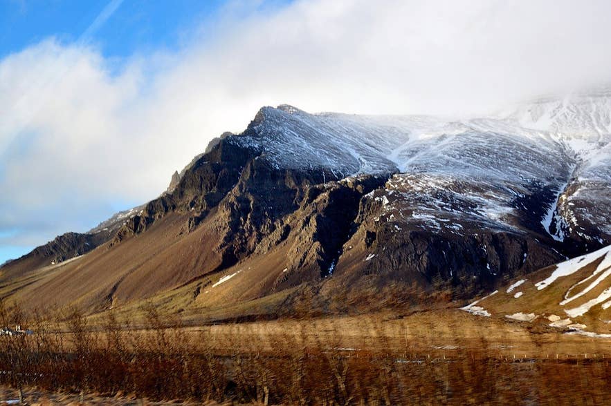
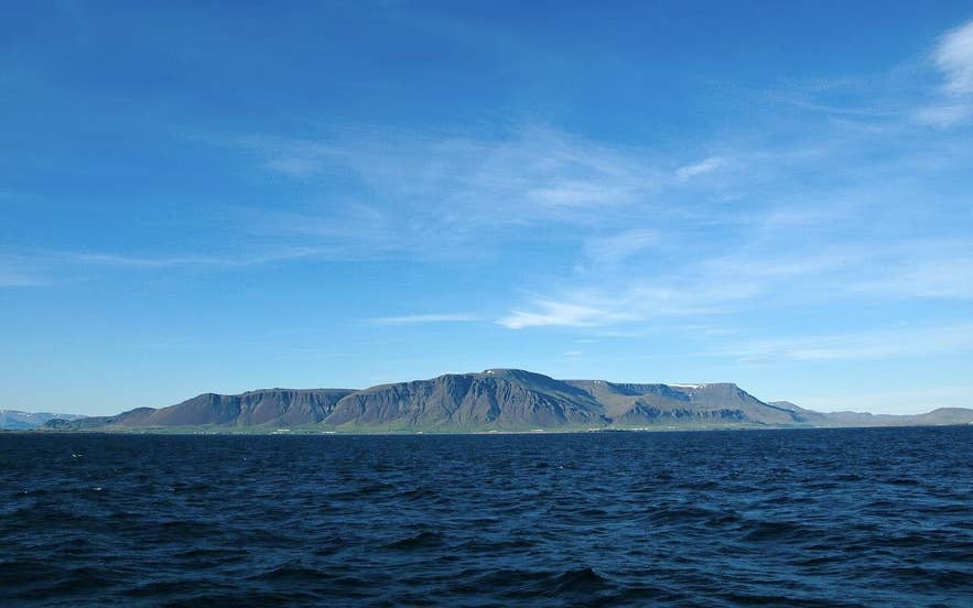
Kerhólakambur cliffs on Esja. Photo: Sue Winston, CC BY 2.0
Kerhólakambur is the broad, flat-topped ridge in the middle of Mount Esja, the mountain that fills the northern horizon of Reykjavík.
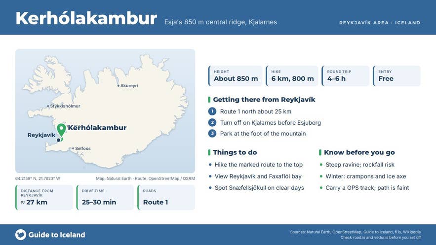
At about 850 metres (851 m on most maps, 840 m in the Ferðafélag Íslands route description) it is higher than the better-known Þverfellshorn summit (780 m) about 2 km to the east, and it is the highest ridge of Esja as seen from the city, though not the highest point of the range.
The hike to the top of Kerhólakambur is a serious half-day climb from the Kjalarnes side with a steep final section and a view that takes in the whole capital area, Faxaflói bay and, on a clear day, Snæfellsjökull.
Key Takeaways About Kerhólakambur
- Kerhólakambur (about 850 m) is the highest point of Esja seen from Reykjavík, higher and quieter than Þverfellshorn (780 m).
- The direct route starts at Esjuberg on Kjalarnes off Route 1, 6 km with 800 m of ascent; Ferðafélag Íslands allows 3 hours.
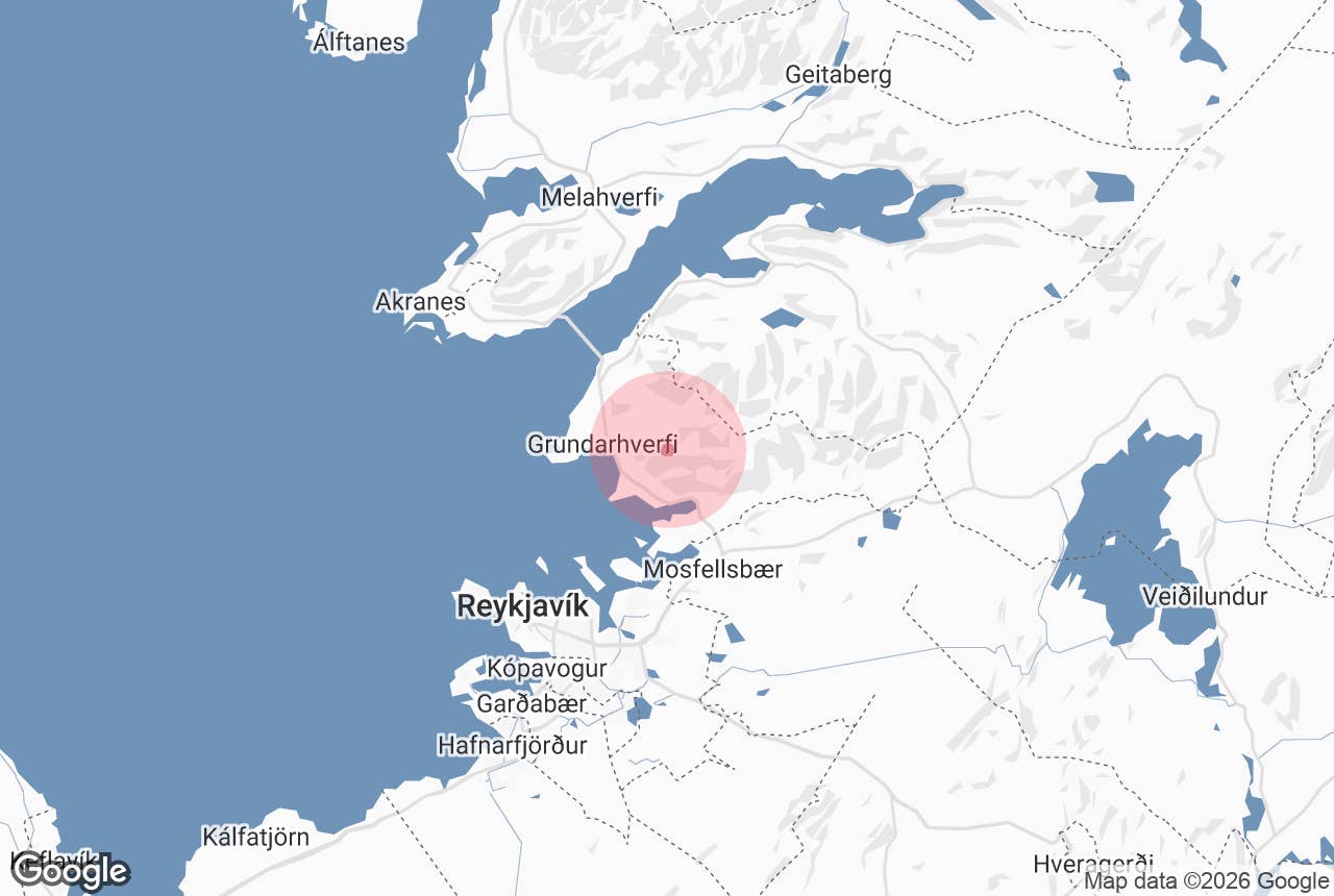
- Esja is 10 km north of Reykjavík; the trailheads are 20–27 km by road on the paved Ring Road, no 4x4 needed, parking free.
- Hiking season June to September; in winter the route needs crampons and an ice axe and the south face is avalanche terrain.
- Esjustofa at Mógilsá has toilets, a café and a Strætó bus stop; the Esjuberg start has no facilities.
Why visit Kerhólakambur
Esja is not a single peak but a volcanic mountain range of basalt and tuff built up in the Pleistocene, with the western part about 3.2 million years old and the eastern part about 1.8 million.
Ice-age glaciers carved the range into the flat tops and steep, gullied faces you see today. Kerhólakambur's south face is a wall of cliffs and scree bands that looks dramatic from the Ring Road on Kjalarnes. "Kambur" means a comb, ridge or crest.
Most of the people who climb Esja go to Þverfellshorn from the Esjustofa hiking centre at Mógilsá, and that path can be crowded on a summer weekend. Kerhólakambur gets a fraction of the traffic.
It is higher, the approach is quieter, and the summit plateau gives a wider view: west over Kjalarnes and Hvalfjörður, south across Kollafjörður to Reykjavík, east along the Esja massif to Hábunga (914 m), the highest point of the range.
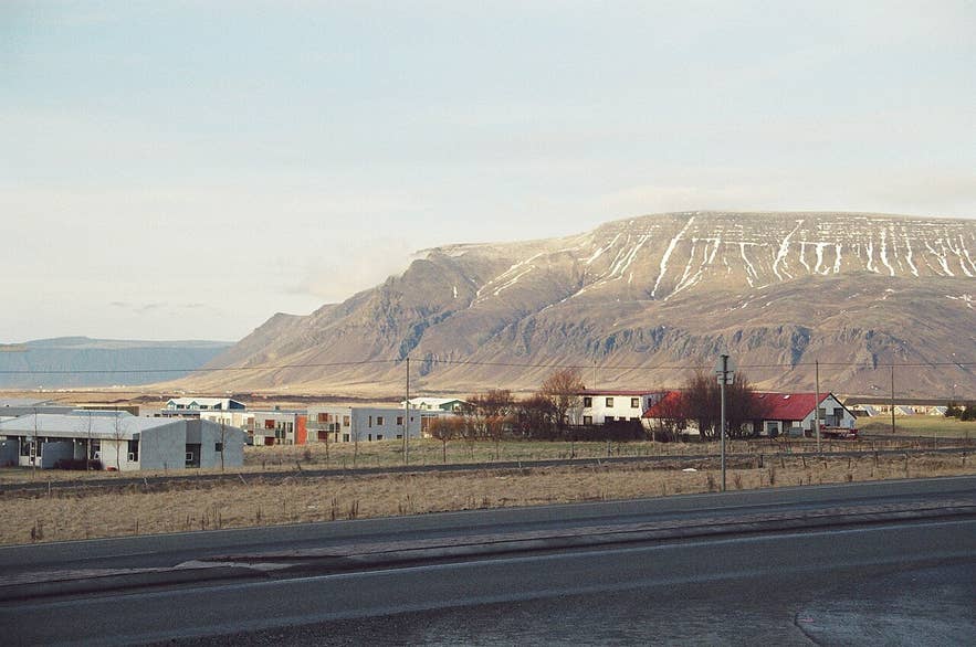
Esja and Kerhólakambur in spring. Photo: Reykholt, CC BY-SA 4.0
How to get to Kerhólakambur
Esja is about 10 km north of Reykjavík on the Ring Road (Route 1) towards Borgarnes and the Hvalfjörður tunnel; by road the Mógilsá car park is about 22 km and the Esjuberg start about 27 km from the city centre, a drive of 25 to 30 minutes.
No 4x4 or F-road driving is involved; the start points are beside the paved Ring Road.
- The direct route starts on Kjalarnes, a few kilometres west of Mógilsá. Turn off Route 1 onto the lane just before the farm Esjuberg, by the weather station, where a signpost marks Kerhólakambur, and park at the foot of the mountain. Ferðafélag Íslands (the Icelandic Touring Association) describes the route as 6 km with about 800 m of ascent and allows 3 hours: cross the Gljúfurá stream, follow the marked path up through a ravine, pass the hill Nípuhóll and a shoulder with views into Blikdalur, then bear right up through a band of rock, where the route is marked, to reach the top. The ravine is steep, with loose stones that can fall on hikers below, and the path is faint in places, so carry a GPS track.
- From Esjustofa at Mógilsá, the main Esja car park on Route 1 at the head of Kollafjörður, experienced hikers sometimes continue west from Þverfellshorn along the plateau to Kerhólakambur and descend the Esjuberg route, which needs a second car or a walk back along the road. Esjustofa has toilets, a café and a Strætó bus stop, Esjurætur (check straeto.is for the current route; the routes serving it have changed).
Plan on 4 to 6 hours for the round trip from Esjuberg, longer than the Þverfellshorn walk. Trails on Esja are graded with a boot symbol system from 1 (easy) to 3 (challenging); on the Kerhólakambur route the steepest ground is in the ravine at the start and the rock band near the top. Parking and the trails are free.
Best time to visit
June to September is the hiking season, when the ridge is usually snow-free and daylight is long enough to start late and still come down in light. May and October are possible for experienced hikers with the right gear, but expect snow and ice on the upper slopes.
In winter Esja is a mountaineering objective, not a walk: the Kerhólakambur route then needs crampons and an ice axe, the steep faces are avalanche terrain, and four people have died in avalanches on the mountain since 1979, most recently in 2020. Pick a day with good visibility; the plateau is featureless in fog.
Kerhólakambur in the Esja range. Photo: Axel Kristinsson, CC BY 2.0
Safety and practical tips
- Wear hiking boots and bring windproof and waterproof layers, hat and gloves even in July. The summit is often several degrees colder and much windier than the car park.
- The final rock band is steep, with loose scree and rock steps; take your time, especially coming down.
- Carry water and food. There are no facilities above the car parks; Esjustofa at Mógilsá has toilets and a café.
- Check the forecast at vedur.is and leave a travel plan at safetravel.is.
- Do not leave the marked path to shortcut across the cliffs on the south face.
- The Esjuberg lane passes a working farm; park without blocking gates or the lane.
Nearby attractions
- Þverfellshorn (1.9 km) - Esja's most-climbed summit, 780 m.
- Esjan (3.6 km) - the mountain as a whole and the Mógilsá trailhead.
- Esjurætur - Hiking Center (3.6 km) - the café and facilities at the foot of the main trail.
- Kjalarnes (4 km) - the farmland district under the mountain, with the Klébergslaug pool.
- Hvalfjörður Tunnel (9 km) - the 5.8 km road tunnel under the fjord on the way north.
- Hvammsvik Hot Springs (17 km) - geothermal pools on the shore of Hvalfjörður, a good place to soak after the hike.
Tours that visit Kerhólakambur
- Thrilling 8-Hour Hike to Mount Esja and Hvalfjordur with Hvammsvik Hot Springs Bathing - a guided day from Reykjavík that hikes up Esja, whose trails the tour describes as leading to Þverfellshorn and Kerhólakambur (about 2.5 hours up), then drives around Hvalfjörður past Þórufoss waterfall and the Steðji rock to finish in the hot pools at Hvammsvík.
