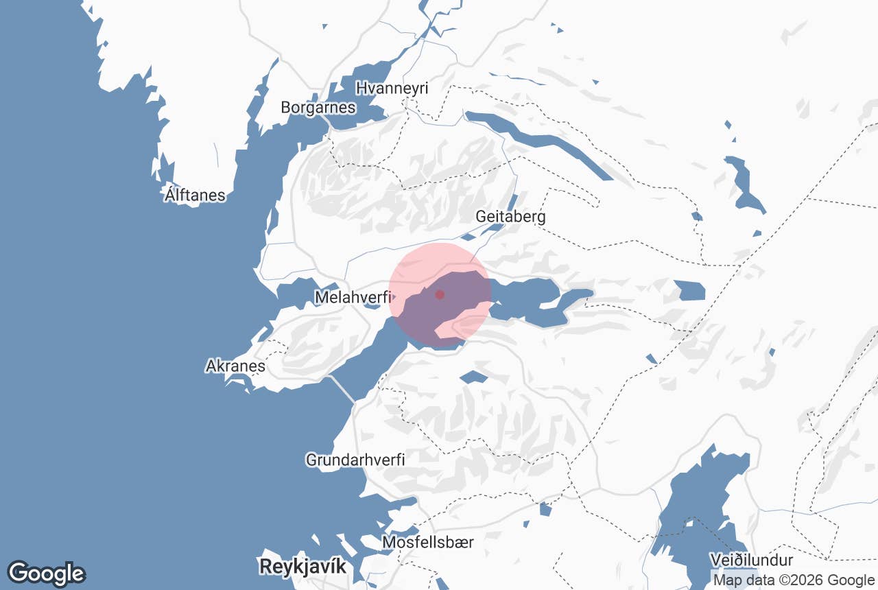
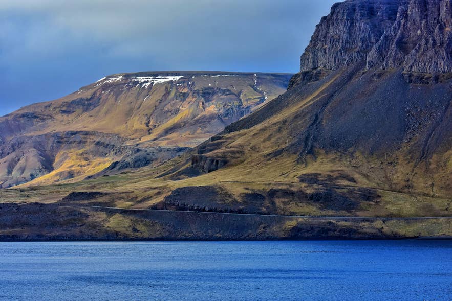
Hvalfjordur is a 19-mile (30-kilometer) fjord in West Iceland, about 40 minutes north of Reykjavik. It is home to Glymur Waterfall, the Hvammsvik Hot Springs, and Allied wartime ruins. Read on to plan your visit.
Hvalfjordur, the Whale Fjord, cuts 19 miles (30 kilometers) into the west coast of Iceland between Mosfellsbaer and Akranes. It is about 3 miles (5 kilometers) across at its widest and roughly 276 feet (84 meters) deep at its deepest point. Most travelers driving the Ring Road pass beneath it in seven minutes through a tunnel and never see it at all.
Why You Can Trust Our Content
Guide to Iceland is the most trusted travel platform in Iceland, helping millions of visitors each year. All our content is written and reviewed by local experts who are deeply familiar with Iceland. You can count on us for accurate, up-to-date, and trustworthy travel advice.
Take Route 47 around the shoreline instead, and you find one of the most rewarding detours in the country. The fjord holds Glymur, Iceland's second-tallest waterfall, the seaside Hvammsvik Hot Springs, the concrete remains of a British naval base, and a working sheep farm that has stayed in one family since 1887.
All of it sits close enough to the capital for a half-day trip, which makes Hvalfjordur an easy first taste of West Iceland for anyone with a rental car. The guide below covers what the name means, what to see along both shores, how the tunnel and the old road compare, and how to time a visit.
Important Facts About Hvalfjordur Fjord
-
Location: West Iceland, between Mosfellsbaer and Akranes, opening into Faxafloi Bay
-
Coordinates: 64.383 N, 21.667 W
-
Size: 19 miles (30 kilometers) long and about 3 miles (5 kilometers) wide
-
Maximum depth: about 276 feet (84 meters)
-
Distance from Reykjavik: about 21 miles (34 kilometers) to the mouth of the fjord, roughly 40 minutes
-
Pronunciation: KVAL-fyur-thur, with a soft "kv" at the start. The name means Whale Fjord
-
Scenic route: Route 47 loops about 38 miles (61 kilometers) around the shoreline, roughly an hour longer than the tunnel
-
Hvalfjordur Tunnel: 3.6 miles (5.77 kilometers) long, toll-free since September 2018
-
Main sights: Hvitanes wartime ruins, Hvammsvik Hot Springs, Glymur Waterfall, War and Peace Museum
How Hvalfjordur Fjord Got Its Name
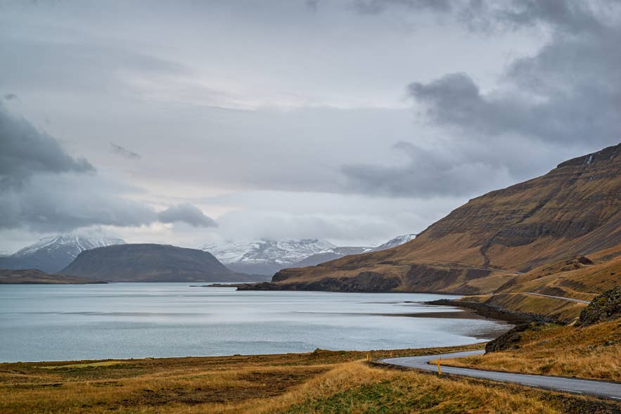 Hvalfjordur means Whale Fjord, and no one is certain why. Whales are rare here today, and the whaling station at the fjord is modern, so it postdates the name by centuries.
The most common explanation is that early settlers found a pod of whales beached in the shallows. One whale meant tons of meat and oil arriving at once, which mattered enormously in a country where food was often scarce. The Icelandic word hvalreki still means both "whale stranding" and "godsend."
A second theory points at the land rather than the water. Hvalfjall, or Whale Mountain, rises at the head of the fjord, and its long humped profile may have given the whole inlet its name.
Then there is the story locals tell, one of many tales in Icelandic folklore that exist to explain a place name. In the legend of Raudhofdi, an elf woman is spurned by her human lover after bearing his child, and she curses him into the shape of a red-headed whale.
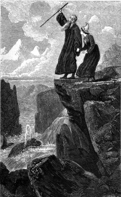
Illustration from Wikimedia, public domain. Engraved by George Pearson after Johann Baptist Zwecker, 1864.
The creature settles in Hvalfjordur and wrecks ships for years until a blind priest lures it up the Botnsa River to Hvalvatn Lake, where it dies. Whale bones were reportedly found by the lake, which is how the story kept its grip.
Travelers sometimes search for the fjord as Whale Bay. It is the same place, and the Icelandic name is the one you will see on road signs.
What To See and Do in Hvalfjordur Fjord
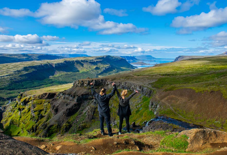 The top things to do in Hvalfjordur sit along both shores, so the order below follows the road rather than a ranking. Turn onto Route 47 and it runs east along the southern shore, loops the head of the fjord, and comes back west along the northern side.
Two smaller stops sit between the main ones. Stedji, a goblet-shaped rock nearly 10 feet (3 meters) tall, stands beside the old road on the southern shore not far from Hvammsvik. At the far end of the loop, the town of Akranes guards the mouth of the fjord with two lighthouses and the Gudlaug Hot Tub on its beach.
Hvammsvik Hot Springs (Southern Shore)
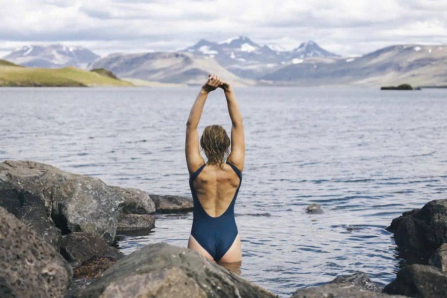
About 12 miles (20 kilometers) along Route 47, and the first major stop on the drive, the Hvammsvik Hot Springs is the busiest attraction on the fjord and one of the best hot springs in Iceland. Eight natural pools sit right at the tideline on an estate whose history reaches back to the 12th century.
What sets it apart is the water. Geothermal water rises from about 4,600 feet (1,400 meters) below ground and mixes with the Atlantic, so the pools shift in temperature and level as the tide moves. The warmest sits around 102 to 107 F (39 to 42 C), while the tidal pool sometimes vanishes under the sea entirely.
Admission to Hvammsvik Hot Springs also covers a sauna, a steam room, a cold plunge, and a swim-up bar. Guests must be at least 10 years old, and towels and wading shoes are available to rent. On site, Stormur Bistro serves light meals built around local ingredients, and the seafood soup has a following.
Numbers are capped, so book ahead. You can also take a Hvammsvik Hot Springs tour with transfer from Reykjavik if you would rather not drive.
Hvitanes and the Wartime Ruins (Southern Shore)
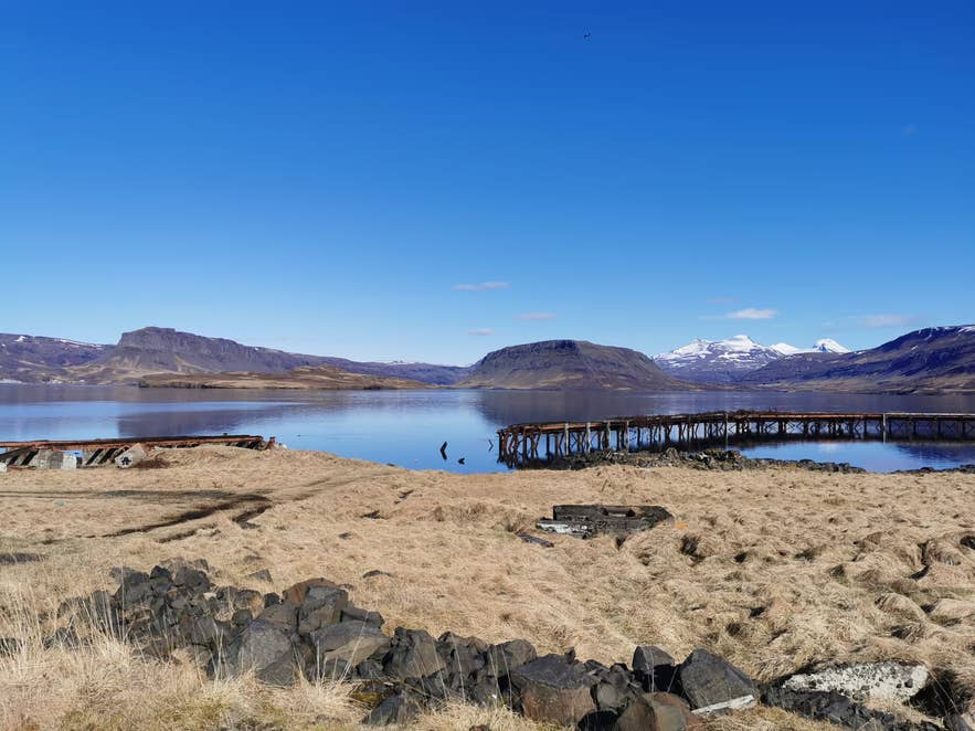 A couple of miles further east, Hvitanes is a low point of land jutting into the fjord from the southern shore. During the Second World War, the Royal Navy packed more than 250 buildings onto it, including quarters, workshops, a hospital, a cinema, and a recreation center.
Almost nothing stands now. What remains is concrete: foundations, the stub of a pier, and gun emplacements scattered across grazing land where sheep now shelter.
An information panel at the roadside viewpoint just west of the point explains the layout. From there you can see Hvitanes below, Hvammsvik back along the shore to the west, and Midsandur across the water. Midsandur is where the Americans built their supply depot, and where the country's last whaling station still operates.
Many of the wartime structures are on private land, so keep to the marked areas. The point also happens to be one of the better places on the fjord to scan for seals and shorebirds.
A guided World War II tour from Reykjavik covers Hvitanes alongside the War and Peace Museum and a 1942 American barracks, the oldest Quonset hut still in use. It runs from May through August.
Glymur Waterfall (Head of the Fjord)
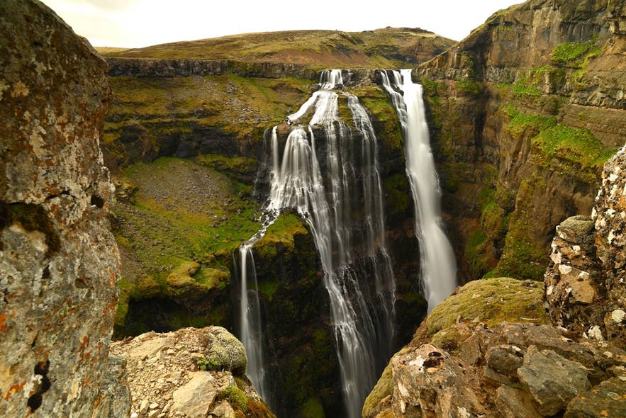 Glymur drops 650 feet (198 meters) into a mossy canyon where the fjord ends. It held the title of Iceland's tallest waterfall until Morsarfoss emerged from a retreating glacier and was measured in 2011. Glymur is still the tallest of Iceland's best waterfalls that you can reach on foot.
The trail is a loop of about 4.3 miles (6.9 kilometers) from the Botnsdalur car park, graded moderate, and it takes about three hours. That makes it one of the more rewarding hikes in Iceland within reach of the capital.
The route passes through a short cave, climbs the rim of the gorge, and crosses the Botnsa River twice. The first crossing is a single log strung with a guide rope.
 That log is seasonal. It goes in mid-to-late June and is removed by early October, which is why the route is a summer hike rather than a year-round one. Attempting the canyon in winter is genuinely dangerous, with ice on steep ground, no river crossing, and constant rockfall in the gorge.
Wear proper boots and pack water shoes for the upper crossing, then check the weather forecast before you set out. Bring food and water, because there is nothing at the trailhead.
The cliffs near the top have no railings, so this is not a route for small children. After heavy rain the river can run too high to complete the loop, in which case turn back the way you came.
Glymur is not the only hike here. Two longer routes start near the head of the fjord: Sildarmannagotur runs north toward Skorradalur Valley, and Leggjabrjotur, the "leg-breaker," climbs east toward Thingvellir National Park. Both are rougher and longer than the Glymur loop, and neither is signposted from the car park.
If you would rather have a guide handle the driving and the river crossing, two tours stand out. The private Glymur hike from Reykjavik or Keflavik Airport runs seven hours and takes Route 47 around the fjord rather than the tunnel, so the drive counts as part of the trip. The shorter private six-hour hike from Reykjavik suits anyone tighter on time.
War and Peace Museum at Hladir (Northern Shore)
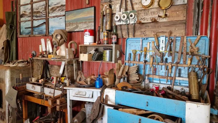 Coming back west along the northern shore, the War and Peace Museum at Hladir is the place to make sense of the ruins you passed earlier. Opened in 2012, it covers the occupation years from 1940 to 1945 through photographs, vehicles, uniforms, and everyday objects.
The exhibition is arranged by theme rather than chronology, with rooms on the British and American forces, the Icelandic Coast Guard, nursing, and civilian life. It is small, personally assembled, and better than its size suggests.
There is a cafe attached, and the waffles have their own reputation. Entrance tickets to the War and Peace Museum can be booked in advance.
Hladir also runs a community center, a campsite, and an outdoor swimming pool with hot tubs, which makes it a practical base if you want more than a day on the fjord.
Bjarteyjarsandur Farm (Northern Shore)
Bjarteyjarsandur is a working sheep farm further along the northern shore, held by the same family since 1887 and passed down through the generations. The family raises Icelandic sheep using sustainable methods and leads the farm tours themselves, which makes this one of the more genuine farm visits in Iceland. Guests are welcome year-round.
A small shop sells sweaters, hats, and mittens knitted from the farm's own wool. In summer there are meals built around farm produce and lamb, and depending on the season you may be put to work.
The shoreline below the farm is a nesting site for common eider ducks, whose down has been gathered in Iceland for centuries. Tread gently in early summer and you may see mothers raising their ducklings.
The campsite here stays open year-round and is a favorite with drivers doing the loop, with a warm communal kitchen and farm dogs that come out to meet you.
Driving Route 47 Around Hvalfjordur Fjord
Route 47 carried the Ring Road until the tunnel opened in 1998, and it still traces the full shoreline of Hvalfjordur for about 37 miles (60 kilometers). The loop adds roughly an hour over the tunnel and delivers the entire point of coming here.
From Reykjavik, follow Route 1 north through Mosfellsbaer for about 21 miles (34 kilometers). The Route 47 junction comes up shortly before the tunnel mouth, so watch for the sign.
The road is paved, quiet, and maintained year-round. Almost every stop in this guide sits on it, so treat Route 47 as the spine of your visit rather than a detour from it. Wide pull-offs make it one of the gentler stretches for anyone new to driving in Iceland.
Allow three to four hours for the loop with stops, or a full day if you plan to hike Glymur. The head of the fjord and the Botnsdalur car park are about an hour from the city. Coming from Reykjavik, take the southern shore first; from Borgarnes, start on the northern side.
There is no public transport to the fjord. You will need a rental car, a camper van, or a place on a guided tour. Arriving at Keflavik Airport? Follow Route 41 toward the capital, then continue north on Route 1, about an hour and a half in total.
The Hvalfjordur Tunnel
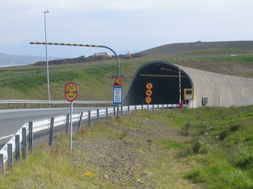
Photo from Wikimedia, Creative Commons, by Eysteinn Gudni Gudnason. No edits made.
The Hvalfjordur Tunnel, or Hvalfjardargong, runs 3.6 miles (5.77 kilometers) beneath the fjord and carries Route 1. It opened on July 11, 1998 as Iceland's first subsea road tunnel, shortening the drive toward west and north Iceland by 28 miles (45 kilometers). Crossing the fjord now takes seven minutes instead of about an hour.
About 2.3 miles (3.75 kilometers) of the tunnel lies under the seabed. Its lowest point sits 541 feet (165 meters) below sea level, with at least 130 feet (40 meters) of rock above the roof. The water itself is only about 130 feet (40 meters) deep at that point, so most of the descent is through solid basalt.
Inside, the tunnel is a single bore with two lanes, widening to three on the northern climb. The speed limit is 70 kilometers per hour, average speed cameras have been in place since 2024, and the lay-bys are for emergencies only. Traffic runs at around 11,000 vehicles a day in summer and 6,700 in winter.
There is no toll. The Hvalfjordur Tunnel has been free since September 28, 2018, when it passed from the private operator Spolur to the Icelandic Road Administration. Iceland does still charge for road use in other ways, so it is worth reading up on road tolls in Iceland before you drive.
The tunnel is the practical choice if you are covering ground. If you have the time, Route 47 above it is the reason to be here at all.
Landscape and Wildlife of Hvalfjordur Fjord
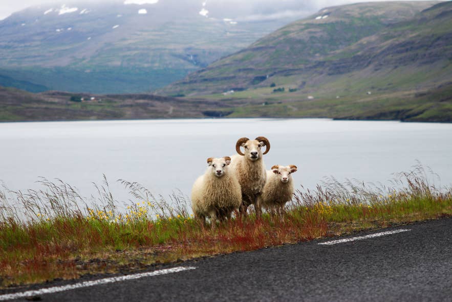 Glaciers carved Hvalfjordur out of basalt that formed roughly three million years ago. When crews dug the tunnel, they cut through those layers and struck faults and volcanic dikes, narrow sheets of hardened magma, every few hundred feet. Above ground, the result is a steep-walled inlet with broad valleys opening off it.
Mountains frame the drive on both sides. Mount Esja rises along the southern side, and Thyrill Mountain climbs sharply from the northern shore. The Skardsheidi Range sits further inland behind Akranes. At the head of the fjord, Hvalfell Mountain stands over the Botnsdalur Valley, which is the valley the Glymur trail climbs.
Above the waterfall lies Hvalvatn Lake, 1.6 square miles (4.1 square kilometers) across and 590 feet (180 meters) deep. That makes the lake deeper than the fjord it eventually drains into. The Botnsa River carries its outflow down the valley, and Glymur is where that water falls.
Two more rivers, both called Fossa, cross Route 47 with runs of cascades. The western Fossa is easy to miss, because its main drop falls from beneath the road into woodland.
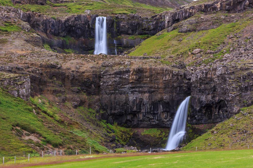 A few hundred yards further on, Route 47 crosses the Brynjudalsa River in the valley of Brynjudalur. Anglers come here for salmon and sea trout, and Skorhagafoss, named after the nearby farm Skorhagi, is visible from the road just before the bridge.
Anglers know the Laxa i Kjos, a salmon river that crosses the southern shore in the farming district of Kjos. Just south of it, Medalfellsvatn Lake sits ringed with summer houses, the small cabins many Icelandic families keep for weekends out of the city.
Offshore to the northwest sits Geirsholmi Island, a small outcrop with near-vertical sides. In the thirteenth century, during the civil war between Iceland's ruling families known as the Age of the Sturlungs, a band of outlaws held the island and raided farms around the fjord from it.
Despite the name, whales are rare here, absent for the better part of a generation until a small group of humpbacks returned in 2025. Most of what you watch is other Icelandic wildlife. Harbor seals come ashore to rest on the sandy flats near the head of the fjord, and low tide is the best time to look, which makes this one of the easier places for seal watching in Iceland.

Photo from Wikimedia, Creative Commons, by Jakub Halun. No edits made.
Hvalfjardareyri, the long sandbar on the southern side, is the standout for Icelandic birdlife. Arctic terns and eider ducks feed in the shallows all summer, and the oystercatcher, a black and white wader with a bright orange bill, is loud enough that you hear it before you see it.
The innermost end of the fjord is greener than most of Iceland. Birch and conifer have taken hold around the Botnsa River alongside lupine, moss, and wildflowers, part of reforestation efforts that have been running for decades.
History and Culture of Hvalfjordur Fjord
For a fjord this quiet, Hvalfjordur has had a busy history. Medieval traders used it as a route inland, Allied convoys sheltered in its depths, and the hymns Icelanders still sing were written on its southern shore. Two of the country's sharpest arguments, over whaling and heavy industry, continue along its coast today.
Hvalfjordur in the Second World War
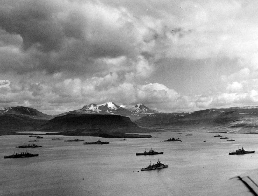
Photo from Wikimedia, public domain, by the National Museum of the U.S. Navy.
Hvalfjordur was one of the most strategically important places in the North Atlantic between 1940 and 1945. Its depth and shelter made it a natural anchorage, and Allied convoys gathered here before a crossing that many ships did not survive.
The British base at Hvitanes was commissioned as HMS Baldur and served as the headquarters of the Flag Officer Commanding, Iceland. Large fleets lay anchored off Hvammsvik, where the US Army built an ammunition store and a recreation center for naval crews.
On the northern shore at Midsandur, the Americans ran a fuel, supply, and repair depot, and some of the old Quonset huts there are still in use by a local company.
The fjord's darkest association is convoy PQ-17, which sailed from here in June 1942. Of its 35 merchant ships, only 11 reached the Soviet port of Arkhangelsk.
As the Allies gained the upper hand over the German submarine fleet, fewer ships came. The British held Hvitanes until the war ended, then left the bases empty. Most of the equipment passed to the Icelandic government as compensation for damage to the land, and the farms went back to farming.
The Whaling Station at Midsandur
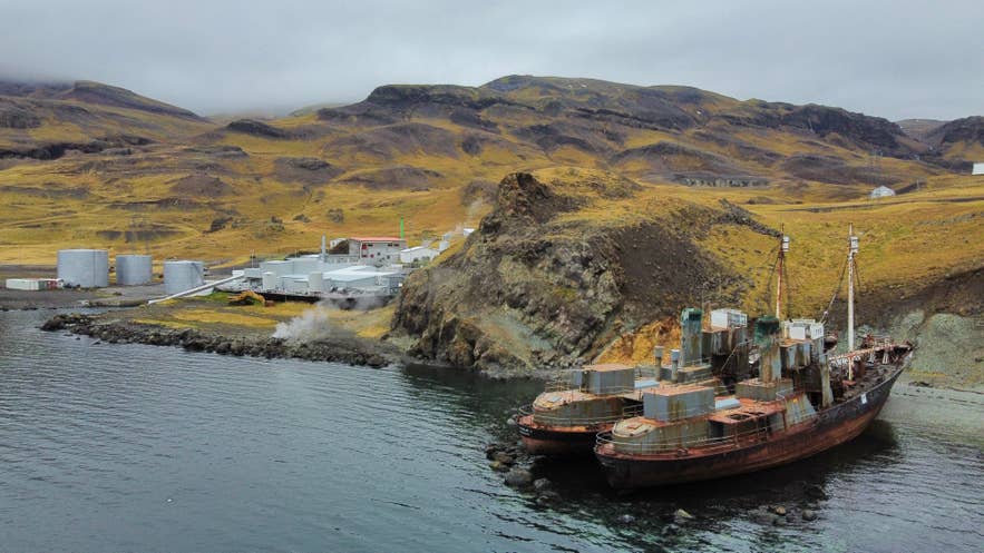
Photo from Wikimedia, Creative Commons, by Vincent van Zeijst. No edits made.
Iceland's only whaling station stands at Midsandur, on the northern shore, built in 1948 on a pier the US Navy left behind. It belongs to Hvalur hf., the country's last fin whaling company.
Whaling here has been intermittent. Hvalur took 24 fin whales in 2023, down from 148 the year before. No hunt followed in 2024, when the season's permit came through too late to sail, or in 2025, which the company said would not be economically viable.
Hunting resumed in June 2026, when the vessel Hvalur 9 brought two fin whales to the station, the first caught in Icelandic waters in three years. Hvalur holds a five-year license, issued in late 2024, allowing up to 209 fin whales a year.
For 2026, Iceland's Marine and Freshwater Research Institute advised a maximum of 150, a 28 percent reduction on its previous advice, and said the figure would be reviewed later in the year.
The practice remains contested. National broadcaster RUV reports that Hanna Katrin Fridriksson, Minister of Industries, has said commercial whaling is not in the public interest and has announced a bill to ban it. She has also pointed to the existing permit as a legal constraint in the meantime. Any ban may not take effect until the current license expires in 2029.
Travelers can drive past the station on Route 47. There is no visitor access, and processing is visible from the road only when a catch is landed.
Hallgrimur Petursson and Hallgrimskirkja at Saurbaer
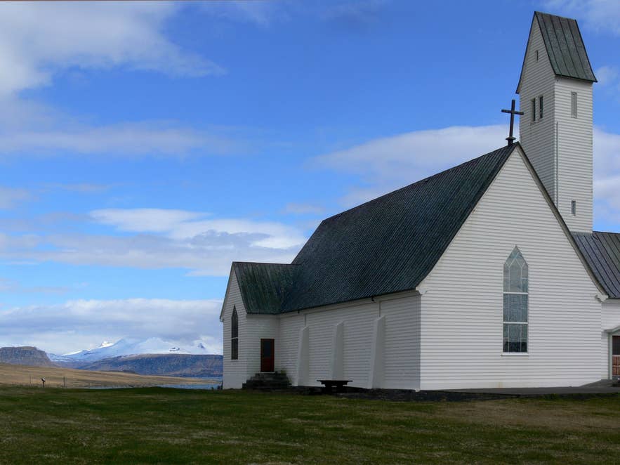
Photo from Wikimedia, Creative Commons, by Christian Bickel. No edits made.
Hallgrimur Petursson, one of Iceland's most celebrated poets, was posted to Saurbaer on the southern shore in 1651 and served the parish until leprosy forced him to retire in 1669. He wrote the Passion Hymns here, a cycle of 50 poems on the suffering of Christ that remain a cornerstone of Icelandic literature. He died in 1674 at Ferstikla, further along the fjord.
Churches have stood at Saurbaer since the Middle Ages. The one there now was consecrated in July 1957 and dedicated to him, and its stained glass and quiet setting above the water make it worth the short stop.
It is also called Hallgrimskirkja, the same name as the landmark church in Reykjavik, which is why travelers sometimes assume the capital's building marks where he worked. Reykjavik's Hallgrimskirkja was meant to open in 1974, on the 300th anniversary of his death, and took until 1986 to finish.
The fjord was also home to Sveinbjorn Beinteinsson, poet, rimur chanter, and the first high priest of the Icelandic Pagan Association.
Mariuhofn, a Medieval Harbor
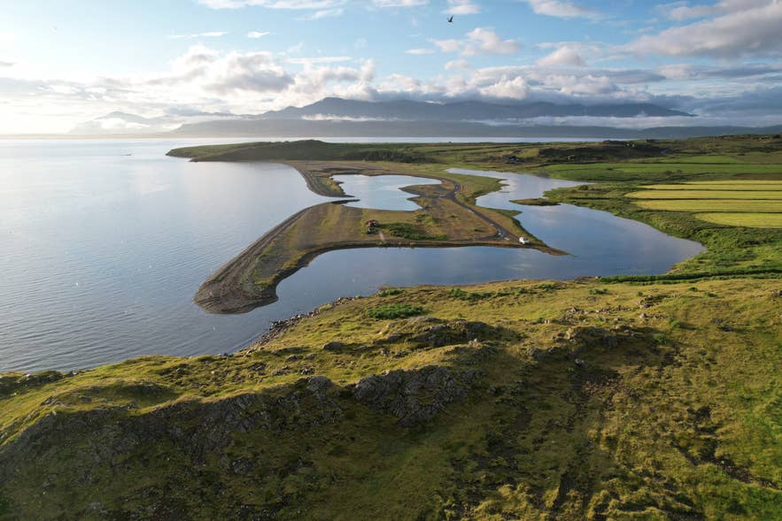
Photo from Wikimedia, Creative Commons, by Steinninn. No edits made.
Long before the tunnel, Hvalfjordur was a working sea route. Medieval manuscripts record ships sailing in and out of the fjord, and Mariuhofn, on a promontory on the southern shore, was among the more important harbors and trading posts in the country.
The site is usually identified with Budasandur, on the inlet of Laxarvogur, though archaeologists have been cautious about both the match and how much of the harbor can still be traced. Little is visible today.
Mariuhofn also carries a grim distinction. The Black Death reached Iceland in 1402, and the traditional account holds that it arrived aboard a ship landing here, carried in a consignment of cloth belonging to Einar Herjolfsson. It is a reminder that this quiet fjord was once a main road.
The Grundartangi Industrial Site
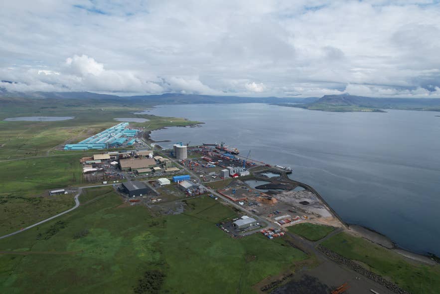
Photo from Wikimedia, Creative Commons, by Steinninn. No edits made.
Grundartangi, on the northern shore near the mouth of the fjord, is one of Iceland's main industrial sites, about 28 miles (45 kilometers) from the capital area and 9 miles (15 kilometers) from Akranes. Its deep-water harbor takes the largest cargo vessels and tankers.
Two heavy plants dominate the site. A ferrosilicon plant has run since 1979, and the aluminum smelter opened in 1998, operating as Nordural under Century Aluminum since 2004. The smelter employs around 600 people and has a capacity of 320,000 metric tons of primary aluminum a year.
Both were contested when they were built and remain so. Along with whaling and hydroelectric development, smelters and silicon plants sit at the center of Iceland's sharpest environmental arguments.
The site is now positioning itself differently. Companies at Grundartangi have signed a shared sustainability policy and are working toward a circular-economy industrial park that reuses byproducts and runs on renewable electricity.
In January 2026, Carbon Iceland secured more than 60 acres there for a plant that would capture carbon dioxide from the existing industry and convert it into renewable eMethanol for shipping and aviation.
When To Visit Hvalfjordur Fjord
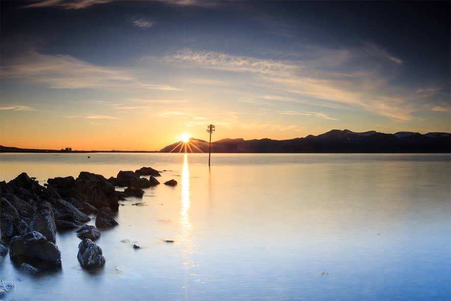 Hvalfjordur is open year-round and the roads are maintained through winter, but the two halves of the year offer very different trips.
Summer, from June through August, is the only sensible window for the Glymur hike, since the log crossing is in place and the trail is dry. Average highs sit around 52 to 57 F (11 to 14 C), the farms and museum are fully open, and daylight is long enough to drive the loop after dinner.
One date stands out this year: the total solar eclipse on August 12, 2026 crosses western Iceland, with about a minute of totality at Akranes on the mouth of the fjord, so expect heavy demand on accommodation and rental cars either side of it.
Winter, from October through March, trades the hike for dark skies and empty roads. Average highs hover near 34 to 39 F (1 to 4 C). Check road conditions before setting out, and skip the canyon entirely.
Spring and fall are the quietest. May and September give you open attractions, thinner crowds, and a fair chance at both good hiking and early or late aurora.
Northern Lights Over the Fjord
 Hvalfjordur is one of the best places to photograph the northern lights in West Iceland, and among the closest dark-sky spots to Reykjavik, about 40 minutes out yet clear of the city glow. The Skardsheidi Range and the surrounding mountains block stray light and frame the aurora above the water.
If you are driving yourself, Route 47 has plenty of wide, safe pull-offs, so you can park and wait without blocking the road. Check the aurora forecast first, since a clear sky matters more than any single location.
The northern lights season in Iceland runs from roughly September to April. Guided northern lights tours put someone else in charge of the driving and the forecast, which matters on a night when the sky is only clear in one direction.
Where To Stay and Eat Near Hvalfjordur Fjord
There is no town on the fjord itself, and the few places that put you up will also feed you. Most visitors treat Hvalfjordur as a day trip from Reykjavik or a stop on the way to Borgarnes, though staying overnight is possible on both shores.
The Hvammsvik Nature Resort sits on the southern shore, where guests keep pool access after the day visitors leave and Stormur Bistro serves light meals built around local ingredients. Hotel Laxarbakki, a family-run set of self-catering apartments on Route 1 near the northern shore, has a sauna, a hot tub you can watch the northern lights from, and a restaurant serving homemade dishes and barbecue.
Hotel Glymur stands on a hill above the fjord in Hvalfjardarsveit, with 22 rooms, two outdoor hot tubs, and a restaurant looking onto the water. Despite the name, it sits about 11 miles (18 kilometers) from the Glymur trail.
Bjarteyjarsandur Farm runs a year-round campsite with a communal kitchen, and the farm kitchen serves its own lamb and produce in summer. Hladir has a campsite too, beside the War and Peace Museum, along with an outdoor pool, hot tubs, and the museum cafe.
Beyond the fjord itself, most beds are in the towns. The nearest hotels in West Iceland are in Akranes at the mouth and Borgarnes to the north, with Mosfellsbaer about half an hour south.
Why Hvalfjordur Is Worth the Detour
Few places in Iceland pack this much into so small a space, and fewer still sit an hour from the capital. A waterfall among the country's tallest, geothermal pools at the tideline, wartime concrete in the grass, and a medieval harbor all share one quiet inlet.
The tunnel exists for people in a hurry. Leave it to them, take Route 47, and give the fjord the two or three hours it deserves. Along the way you will see why Hvalfjordur ranks among the most rewarding of Iceland's fjords.
From here the road runs on to Borgarnes and the Snaefellsnes Peninsula, which makes Hvalfjordur either a half-day trip from the city or the first stop on a longer run through West Iceland. West Iceland tours follow the same road.
