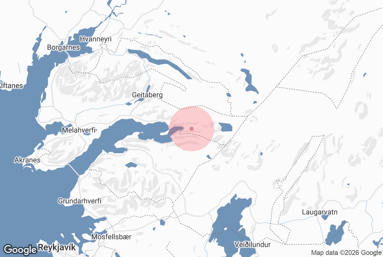
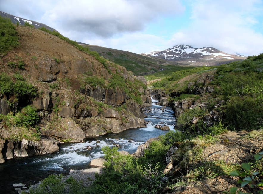
Botnsá gorge in Botnsdalur. Photo: Sigurður Jónsson, CC BY 2.0
Botnsa river (Icelandic: Botnsá, "the river of the valley head", from botn, the inner end of a valley or fjord) is a short, powerful river in West Iceland that drains the lake Hvalvatn, drops over Glymur, the country's second-highest waterfall, and runs down the wooded valley of Botnsdalur into Botnsvogur at the head of Hvalfjörður.
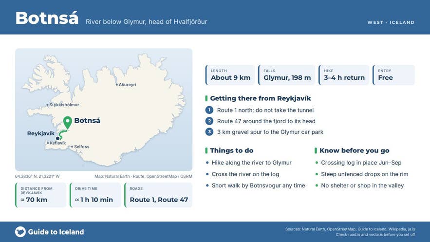
It is only about 9 km long, but in that distance it falls almost 380 metres, and the canyon it has cut is the reason most people come here: the popular hike to Glymur follows Botnsá from the car park in Botnsdalur to the brink of the falls.
Key Takeaways About Botnsá
- About 9 km long, from Hvalvatn (378 m) over the 198 m Glymur waterfall to Botnsvogur at the head of Hvalfjörður
- The Glymur hike follows the river: ~7 km return, 300–400 m ascent, 3–4 hours, with a log crossing below Þvottahellir
- Crossing log in place roughly June–September only; the upper trail is dangerous in winter
- Reached by Route 47 around Hvalfjörður and a 3 km gravel spur; about 70 km / 1h10 from Reykjavík
- Historic boundary river between Borgarfjarðarsýsla and Kjósarsýsla and between the Southern and Western Quarters
Why visit Botnsa river
Botnsá begins at Hvalvatn, a lake 378 m above sea level covering about 4 km² and, at roughly 160–180 m deep, one of the deepest lakes in Iceland (sources rank it second or third).
The lake exists because Hvalfell, the flat-topped tuff mountain beside it, was built up by an eruption beneath the Ice Age glacier and dammed what had been a much longer valley.
From the lake outlet the river runs a short distance west alongside Hvalfell, then plunges 198 m over Glymur into a narrow, mossy canyon. The spray keeps the canyon walls green through summer.
Below the canyon the river settles into Botnsdalur, where birch and planted woodland cover the valley floor, before reaching the sea at Botnsvogur.
The river has long been a boundary. Until the counties were abolished it divided Borgarfjarðarsýsla from Kjósarsýsla, and in the 13th century the border between Iceland's Southern and Western Quarters was moved here from Hvítá.
The name of the waterfall comes from a folk tale: an elf-woman turned a man who had betrayed her into a whale, Rauðhöfði ("Redhead"), which wrecked boats in Faxaflói and drowned the two sons of the priest at Saurbær in Hvalfjörður.
The old, blind priest led the whale up Botnsá by the power of his words; the ground shook and rumbled as it forced its way through the gorge, giving Glymur ("the rumbling one") its name, and the whale died in Hvalvatn, which is how the lake got its name.
Glymur was considered Iceland's highest waterfall until measurements in 2007–2011 showed Morsárfoss, emerging from under Vatnajökull, to be taller.
How to get to Botnsa river
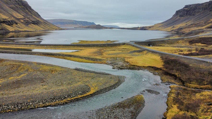
Botnsá meeting the sea at Botnsvogur. Photo: Vincent van Zeijst, CC BY-SA 3.0
From Reykjavík take Route 1 north and, instead of entering the Hvalfjörður Tunnel, turn onto Route 47 (Hvalfjarðarvegur), the old road around the fjord.
Follow it to the head of the fjord, where a signposted gravel side road turns inland into Botnsdalur and ends after about 3 km at the Glymur car park. The drive is roughly 70 km and takes about 1 hour 10 minutes.
Coming from the north or from Borgarnes, Route 47 can be joined at the northern end of the tunnel; Akranes is about 45 km away. Route 47 is paved and open year-round, though the Botnsdalur spur can be snowy or icy in winter.
Parking at the trailhead is free; there is an information board but only basic facilities.
The marked trail follows the east side of Botnsá. After roughly half an hour it passes through Þvottahellir, a small cave once used for drying laundry, and drops to the river, which hikers cross on a log with a fixed rope.
From spring to autumn this log is in place; in winter it is removed and the crossing is unsafe. Beyond the river the path climbs steeply along the canyon rim to viewpoints over Glymur.
The return hike to the viewpoints is about 7 km with 300–400 m of ascent; most people need three to four hours.
Experienced hikers continue to the top of the falls and ford the river about 300 m above them to return down the west side (a 7 km loop), but this is only advisable at low water in summer.
Best time to visit
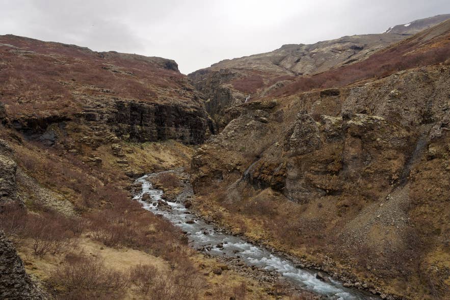
Botnsá in the Botnsdalur canyon. Photo: Jakub Hałun, CC BY-SA 4.0
June to September is the season for the Glymur hike along Botnsá: the log crossing is in place, the path is dry and the canyon is at its greenest. Early summer has the highest water after snowmelt.
In October to May the crossing log is usually removed and the upper trail is icy and dangerous, so limit yourself to the lower valley and the fjord. The lower river and Botnsvogur are pleasant for a short walk at any time of year.
Safety and practical tips
- The log crossing is slippery and the river is cold and fast. Use the rope, take your time, and do not attempt it when the log has been removed.
- The canyon-rim path has steep drops with no railings. Keep well back from the edge, especially in wind or rain, and keep children close.
- The ford above the falls is only for experienced hikers in low water; many people return the way they came.
- Bring waterproofs, grippy boots and water; there is no shelter or shop in the valley. The nearest services are at Hvammsvík on Route 47 and in Akranes and Mosfellsbær.
- Mobile coverage is patchy in the canyon. Leave a travel plan at safetravel.is.
- No fees or opening hours apply.
Nearby attractions
- Botnsdalur – 1 km. The wooded valley the river runs through, with the Glymur car park.
- Glymur Waterfall – 4 km. The 198 m fall on Botnsá.
- Hvalvatn – 7.5 km. The deep lake that feeds the river.
- Hvítanes – 9 km. WWII naval base ruins on the shore of Hvalfjörður.
- Staupasteinn – 11 km. A goblet-shaped protected rock beside Route 47.
- Hvammsvik Hot Springs – 12 km. Geothermal sea-side pools, a good place to soak after the hike.
Tours that visit Botnsa river
- Private Glymur Waterfall Hike with Expert Guide and Transfers from Reykjavik or KEF Airport – a guided private hike along Botnsá, including the log river crossing, to the viewpoints over Glymur, with pick-up in Reykjavík or at Keflavík Airport.
