Najlepsze samodzielne wycieczki po Islandii latem — Największy wybór i gwarancja najniższej ceny
Wybierz lokalizację początkową
Wybierz daty
Dodaj podróżnych
Samodzielne wycieczki po Islandii latem
Doprecyzuj wyniki za pomocą filtrów
Sprawdź naszą ofertę niesamowitych wycieczek i pakietów


Zweryfikowane opinie klientów
Przeczytaj recenzje z pierwszej ręki opublikowane przez podróżnych z całego świata


Letnie samodzielne wycieczki po Islandii — Co warto wiedzieć?
Samodzielne wycieczki organizowane latem to doskonały sposób na poznanie islandzkiej przyrody.
Te pakiety wakacyjne obejmują spersonalizowane plany podróży, wcześniej zorganizowane zakwaterowanie i opcje wynajmu samochodu, dzięki czemu łatwo jest zarezerwować wymarzoną wycieczkę za jednym razem. Podczas całej podróży będziesz mieć wsparcie osobistego agenta, gotowego do pomocy w razie potrzeby.
Lato na Islandii oferuje łagodniejszą pogodę i dużo światła dziennego ze względu na północne słońce, tworząc idealne warunki do zwiedzania. Będziesz mieć swobodę odkrywania we własnym tempie, docierania do ikonicznych miejsc i odkrywania mniej uczęszczanych zakątków. Niezależnie od tego, czy szukasz cudów natury, atrakcji kulturalnych czy ekscytujących zajęć, letnia wycieczka zakładająca samodzielną jazdę pozwoli Ci doświadczyć magii Islandii na swój własny sposób.
Rezerwacja samodzielnej wycieczki organizowanej latem
Samodzielne wycieczki są starannie zaplanowane, aby zapewnić bezstresową i łatwą podróż. Wszystko jest zorganizowane tak, aby zagwarantować Ci płynną podróż dostosowaną do Twoich potrzeb.
- Zakwaterowanie: będziesz mieć wcześniej zarezerwowane noclegi w pobliżu kluczowych atrakcji. Wybieraj spośród wspaniałych miejsc noclegowych wyselekcjonowanych pod kątem komfortu i wygody. Odpowiadają one różnym preferencjom i budżetom.
- Wynajem samochodu: wybierz pojazd dostosowany do planu podróży, z opcjami wjazdu na standardowe drogi lub wymagające trasy oznaczone jako F, w zależności od planu wyjazdu.
- Indywidualny plan podróży: otrzymasz szczegółowy plan podróży z uwzględnieniem islandzkich cudów natury, zabytków kultury i mniej znanych lokalizacji. Możesz łatwo sprawdzić, jak dużą część Islandii zwiedzisz w ramach każdego pakietu, od dwudniowych wycieczek po wielotygodniowe wyjazdy, i dostosować go do swoich potrzeb.
- Opcjonalne wycieczki: dodaj atrakcje, takie jak obserwowanie wielorybów, wędrówki po lodowcu lub relaks w gorących źródłach, które uzupełnią Twój pobyt. Możesz także z łatwością zarezerwować bilety wstępu do muzeów i innych atrakcji kulturalnych.
- Wsparcie w podróży: otrzymasz pomoc osobistego przedstawiciela biura podróży, który pomoże w przypadku pytań, zmian planu lub nieprzewidzianych sytuacji w trakcie wyjazdu.
Wszystkie letnie pakiety z dojazdem własnym są starannie opracowane z wykorzystaniem lokalnej wiedzy, aby pomóc odwiedzającym jak najlepiej wykorzystać czas wakacji, podziwiając cuda natury oraz poznając kulturę i bogatą historię Islandii.
Najlepsze samodzielne wycieczki po Islandii dostępne latem
Islandia oferuje różnorodność letnich samodzielnych wycieczek, z których każda jest dostosowana do odkrywania niesamowitych krajobrazów i atrakcji wyspy. Niezależnie od tego, czy masz tylko kilka dni, czy kilka tygodni na zwiedzanie, możesz znaleźć idealny plan podróży dopasowany do własnych wymagań.
Najlepsze krótkie wycieczki z dojazdem własnym
Są to najlepsze samodzielne wycieczki dla podróżników z ograniczonym czasem, którzy chcą zobaczyć niektóre z najważniejszych atrakcji Islandii, mając mniej niż tydzień.
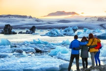
- 3-dniowa letnia samodzielna wycieczka obejmująca Złoty Krąg i południowe wybrzeże aż do laguny lodowcowej Jokulsarlon — Ta wycieczka pozwala zwiedzić słynny Złoty Krąg i piękne południowe wybrzeże, docierając aż do laguny lodowcowej Jokulsarlon.
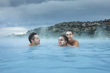
- 4-dniowa samodzielna wycieczka ze Złotym Kręgiem i południowym wybrzeżem organizowana latem — Poświęć więcej czasu na zwiedzanie Złotego Kręgu i podróż wzdłuż południowego wybrzeża do czarnej plaży Reynisfjara. Możesz także wybrać się na ekscytujące zajęcia dodatkowe, takie jak snorkeling w szczelinie Silfra i kąpiel w słynnym spa Błękitna Laguna.
- Malownicza 5-dniowa wycieczka objazdowa po Islandii z Reykjavikiem, Błękitną Laguną i laguną lodowcową Jokulsarlon — Zobacz Złoty Krąg i południowe wybrzeże podczas tej wysoko ocenianej wycieczki. Obejmuje ona lagunę lodowcową Jokulsarlon i pobliską Diamentową Plażę, której nazwa pochodzi od lśniących gór lodowych na czarnym wulkanicznym piasku. Będziesz mieć również czas na zwiedzanie Reykjaviku i kąpiel w spa Błękitna Laguna.
Najlepsze tygodniowe samodzielne wycieczki
Podczas tygodniowej samodzielnej wycieczki po Islandii można zaplanować wiele atrakcji. Trasy te są wysoko oceniane przez podróżników za ich różnorodność i niezapomniane wrażenia.
- Niesamowita 1-tygodniowa letnia samodzielna wycieczka po islandzkiej obwodnicy i Złotym Kręgu — Ta popularna wycieczka obejmuje całą islandzką obwodnicę. W ciągu tygodnia zobaczysz najważniejsze atrakcje na wyspie, w tym Złoty Krąg.
- Tygodniowa letnia samodzielna wycieczka po zachodnim i południowym wybrzeżu Islandii z wodospadami i lodowcami — Odkryj ukryte piękno zachodniej Islandii i całego południowego wybrzeża podczas tygodnia, mając czas na zobaczenie laguny lodowcowej Jokulsarlon i półwyspu Snaefellsnes. Możesz dodać ciekawe zajęcia, takie jak wędrówki po lodowcu, obserwowanie wielorybów i jazda konna.
- Pełna przygód 1-tygodniowa letnia samodzielna wycieczka po Islandii z wyprawą na wyżyny — Zobacz najważniejsze miejsca na południowym wybrzeżu, półwyspie Snaefellsnes i w zachodniej Islandii, a także wybierz się w odległy interior. Poznaj piękny obszar Landmannalaugar i spersonalizuj swoją wycieczkę, biorąc udział w takich atrakcjach jak jaskinie lawowe, snorkeling, jazda na skuterach śnieżnych i nie tylko.
Najlepsze kilkutygodniowe samodzielne wycieczki
Na Islandii jest tak wiele do zobaczenia, dzięki niesamowitej przyrodzie na każdym kroku. Dłuższe wycieczki dają więcej czasu na odkrywanie magii różnych regionów, a poniżej przedstawiamy najlepsze z nich.
- 10-dniowa samodzielna wycieczka po całej islandzkiej obwodnicy z najważniejszymi atrakcjami i Snaefellsnes — Podróżuj po islandzkiej obwodnicy, mając 10 dni, korzystając z tej najlepiej ocenianej samodzielnej wycieczki. Obejmuje ona półwysep Snaefellsnes i oferuje wiele opcji dodatkowych aktywności.
- 13-dniowa samodzielna wycieczka po obwodnicy Islandii z półwyspem Snaefellsnes i Fiordami Zachodnimi — Ta wysoko oceniana wycieczka zabierze Cię do wszystkich regionów Islandii, w tym do odległych Fiordów Zachodnich, znanych ze spektakularnych krajobrazów.
- Epicka 2-tygodniowa samodzielna wycieczka po islandzkiej obwodnicy i Fiordach Zachodnich — Jedź dookoła Islandii z mnóstwem czasu na swobodne zwiedzanie. Ta dwutygodniowa wycieczka obejmuje obwodnicę, Fiordy Zachodnie i półwysep Snaefellsnes.
Najlepsze wycieczki fakultatywne dostępne podczas samodzielnego zwiedzania Islandii latem
Istnieją nieskończone możliwości, aby wzbogacić swoją podróż o niezapomniane doświadczenia. Oto niektóre z najlepszych atrakcji zakładających spotkanie w miejscu zbiórki, które warto uwzględnić w swojej letniej samodzielnej wycieczce po Islandii.
- Wycieczka piesza po lodowcu Skaftafell: zakłada wędrówkę przez oszałamiający lodowiec Skaftafell, będący ujściem Vatnajokull, największego lodowca w Europie. Ciesz się niesamowitymi widokami okolicznych krajobrazów dzięki tej wysoko ocenianej atrakcji.
- Wycieczka do jaskini lodowcowej Katla: ta naturalna jaskinia lodowcowa przy wulkanie Katla jest dostępna przez cały rok i słynie z niebieskiego lodu poprzecinanego czarnymi piaskami wulkanicznymi.
- Wycieczka łodzią Zodiac po lagunie lodowcowej Jokulsarlon: odkryj majestatyczne góry lodowe słynnej laguny lodowcowej Jokulsarlon podczas rejsu, który pozwoli Ci zobaczyć je z bliska.
- Snorkeling między kontynentami w Silfrze: pływaj między płytami tektonicznymi Ameryki Północnej i Eurazji w krystalicznie czystych wodach szczeliny Silfra, jednego z najbardziej unikalnych miejsc do snorkelingu na świecie.
- Spływ kajakowy w lagunie lodowcowej Jokulsarlon: wiosłuj przez spokojne wody laguny lodowcowej Jokulsarlon, przepływając między błyszczącymi górami lodowymi i korzystając z towarzystwa lokalnego przewodnika.
- Rodzinny rejs łodzią RIB na obserwację wielorybów i maskonurów z Husaviku: popłyń łodzią RIB na bliskie spotkanie z islandzkimi wielorybami i uroczymi maskonurami w ich naturalnym środowisku.
- Odwiedź Błękitną Lagunę: zrelaksuj się w słynnych wodach Błękitnej Laguny, co stanowi niezapomniane przeżycie towarzyszące każdej wizycie na Islandii. Bilet Comfort do Błękitnej Laguny obejmuje maseczkę z błota krzemionkowego i orzeźwiający napój.
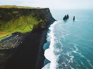
- Jazda konna na czarnej piaszczystej plaży niedaleko Viku: rusz na przejażdżkę na islandzkich koniach wzdłuż pięknej czarnej piaszczystej plaży Reynisfjara niedaleko Viku, z widokiem na formacje skalne Reynisdrangar.
- Wycieczka z obserwacją wielorybów w Husaviku dla całej rodziny: wybierz się na rejs z europejskiej stolicy obserwacji wielorybów, Husaviku, aby zobaczyć humbaki i maskonury.
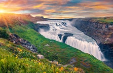
- Wycieczka na skuterach śnieżnych po lodowcu Langjokull spod wodospadu Gullfoss: wybierz się na ekscytującą przejażdżkę skuterem śnieżnym po lodowcu Langjokull, wyruszając spod słynnego wodospadu Gullfoss. To świetny dodatek do samodzielnej wycieczki po obszarze Złotego Kręgu.
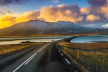
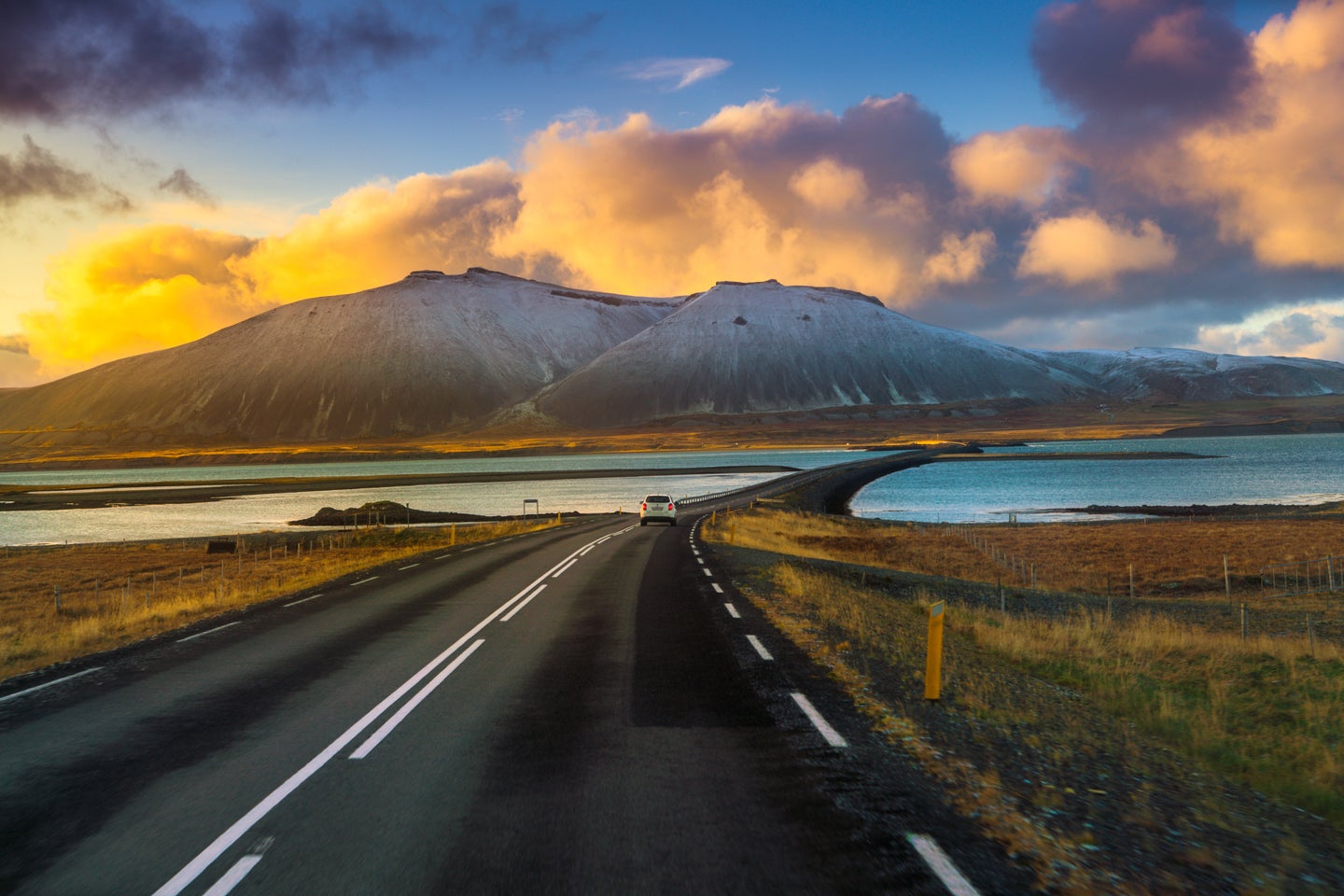
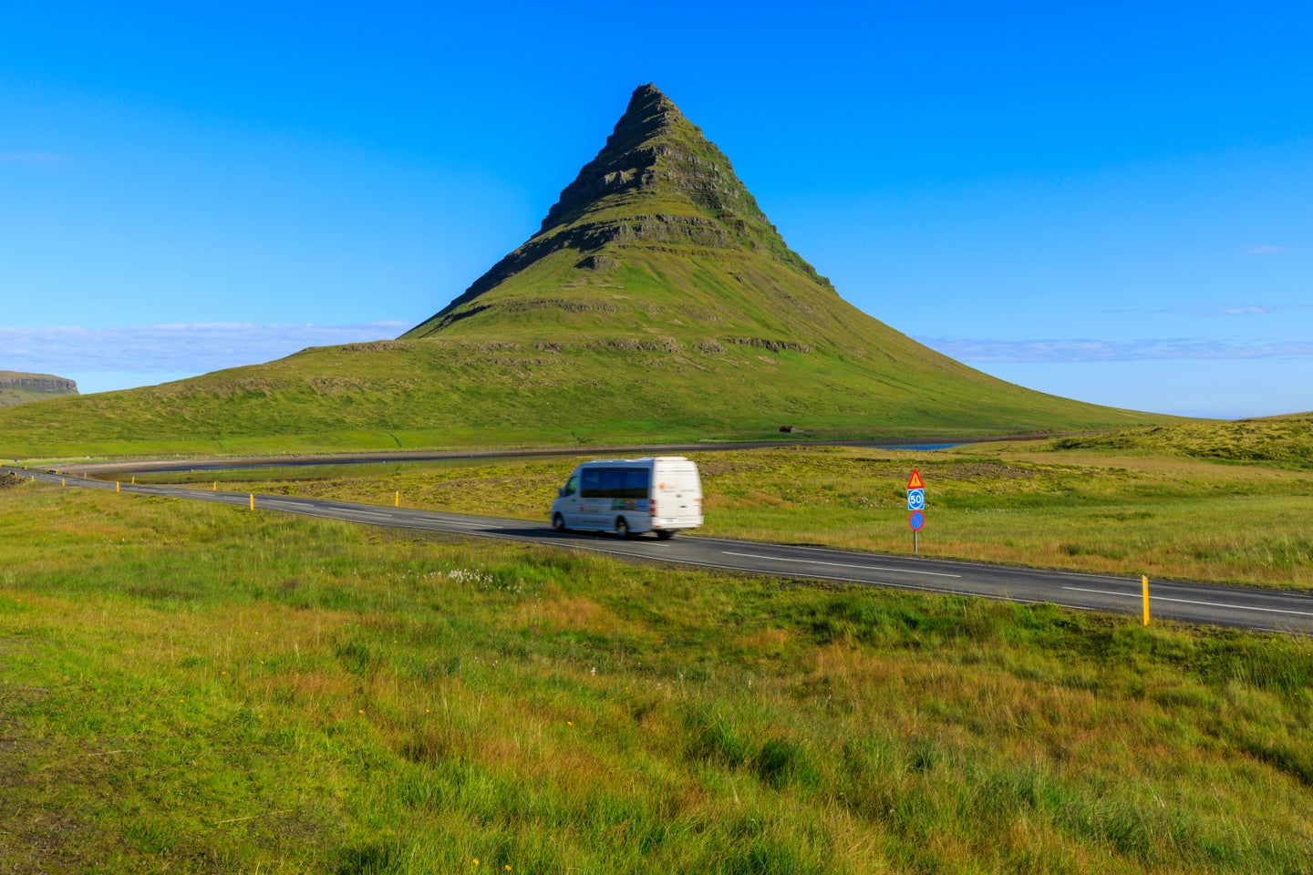
Jazda samochodem na Islandii latem
Wypożyczenie samochodu i wyruszenie na zwiedzanie wyspy latem to najlepszy sposób na poznanie oszałamiających krajobrazów Islandii. Większość dróg, takich jak obwodnica (trasa numer 1), jest w dobrym stanie i łatwa do jazdy o tej porze roku. Dzięki długim godzinom dziennym można bezpiecznie podróżować i cieszyć się widokami, bez obawy o zapadnięcie zmroku. Pamiętaj tylko, aby monitorować islandzką prognozę pogody i warunki drogowe podczas całej wycieczki.
Drogi szutrowe są często spotykane na obszarach wiejskich, takich jak Fiordy Zachodnie i zazwyczaj można po nich jeździć małym samochodem w lecie. Mimo to zalecamy wybranie auta 4x4, gdy się tam wybierasz, ponieważ te samochody są bezpieczniejsze i bardziej praktyczne. Górskie drogi na wyżynach, zwane drogami F, wymagają odpowiedniego pojazdu 4x4. Są one otwarte tylko latem i mogą być trudne w pokonywaniu, więc koniecznie wybierz samochód odpowiedni do trasy, którą chcesz przejechać.
Stacje benzynowe mogą znajdować się daleko od siebie na obszarach wiejskich, więc tankuj paliwo, kiedy tylko możesz. Trzymaj się oznakowanych dróg, ponieważ jazda off-road nie jest dozwolona na Islandii z uwagi na ochronę przyrody. Aby przygotować się do samodzielnej jazdy, zapoznaj się z naszym przewodnikiem po jeździe na Islandii, w którym znajdziesz dalsze informacje i porady dotyczące bezpiecznej oraz przyjemnej podróży.
Często zadawane pytania


Pobierz największą platformę turystyczną na Islandii na telefon i zarządzaj wszystkimi elementami swojej podróży w jednym miejscu
Zeskanuj ten kod QR za pomocą aparatu w telefonie i naciśnij wyświetlony link, aby uzyskać dostęp do największej platformy turystycznej na Islandii. Wprowadź swój numer telefonu lub adres e-mail, aby otrzymać wiadomość SMS lub e-mail z linkiem do pobrania.