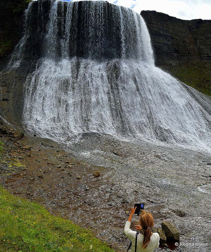
The majestic Waterfall Hvítserkur in Fitjaá River in West-Iceland

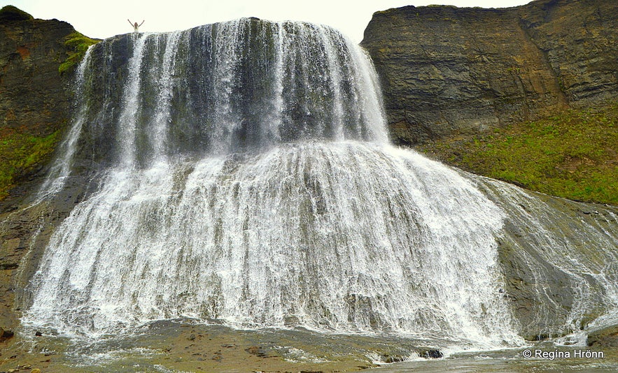
I had seen a photo of the waterfall Hvítserkur from my father-in-law's hiking tour and was in awe of its beauty.
I was adamant to visit this waterfall and get the same photo as he had - of me standing on top of Hvítserkur waterfall.
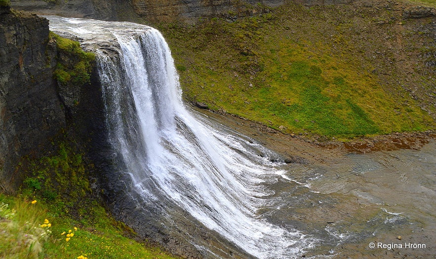
Hvítserkur waterfall
The only problem was that I didn't own a jeep, which is needed for the road leading to Hvítserkur. So I waited for 3 years to save up for a jeep and in August 2018, I was finally able to stand on top of Hvítserkur the waterfall :)
The waterfall can be visited either from below via Skorradalur valley or from above via Uxahryggir. We took the latter route and drove to Þingvellir national park which is 50 km away from Reykjavík, and a part of the most popular tour in Iceland, the Golden Circle.
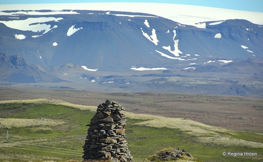
Cairns at Uxahryggir
Instead of following the crowds on the Golden Circle, we turned on road 52 Uxahryggjavegur and stopped by Meyjarsæti and Lake Sandkluftavatn. After 23 km on this road, it turned into a gravel road at Uxahryggir.
On sunny days this route is very scenic with a glacier view of Þórisjökull glacier and Mt. Ok. The landscape is barren with no trees and great visibility.
Remember Þórir from my travel-blog: Ármann in Mt. Ármannsfell and the Troll Games on Hofmannaflöt Plains in South Iceland
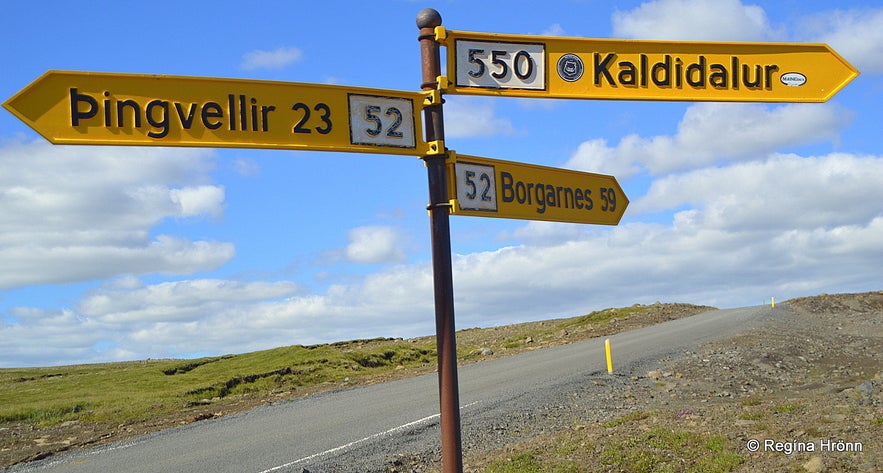
Road signs
You can see in the photo above that road 52 carries on all the way to Borgarnes town. And if you carry on driving straight ahead you will find yourself on the Kaldidalur highland road 550, which is a coarse gravel road leading towards the ice cave tunnel and the wonderful nature of upcountry Borgarfjörður.
Uxahryggir road 52 is marked as "seinfarinn" meaning that it can only be driven slowly. Uxahryggir is an 11 km long gravel road with blind hills (blindhæðir) and turns, but ok for a 2WD.
It is only when you turn off the Uxahryggir road like we did that you need a jeep.
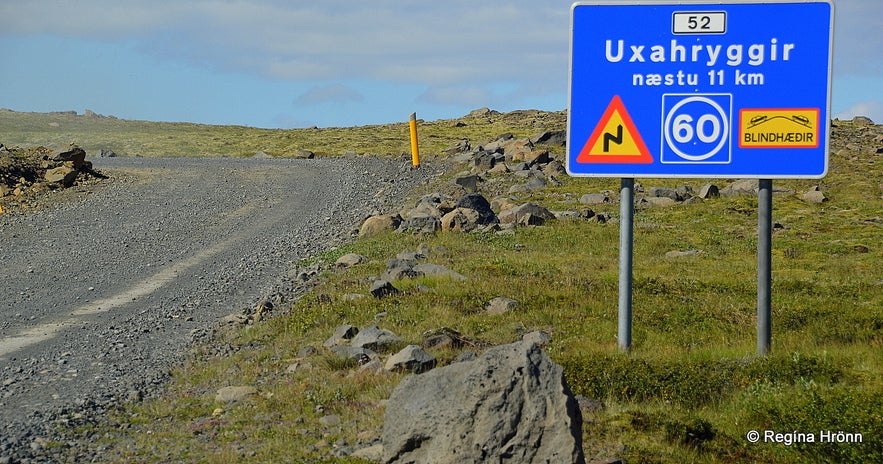
Uxahryggir road number 52
We stopped by the view-dial at Uxahryggir on the way. My father-in-law, Jakob, is a designer of view-dials in Iceland and I always stop by them and take a photo.
They show the names and heights of the surrounding mountains.
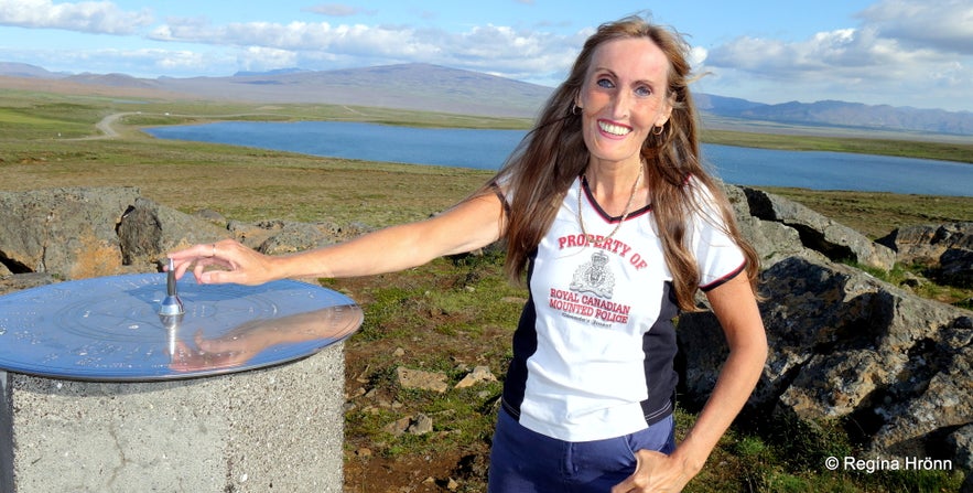 By the view-dial at Uxahryggir in 2021 - Mt. Skaldbreiður in the background
Some of the view-dials are shiny and very pretty, while others are older and more weatherworn. The view-dial at Uxahryggir was designed in 1995, erected in 1996 by FÍ - the Touring Club of Iceland, stolen in September 1997 and restored a month later.
How people can find it in their hearts to steal a view-dial is beyond me - I know how much intricate work and money are put into the view-dials and it pains me to see when they are damaged or stolen.
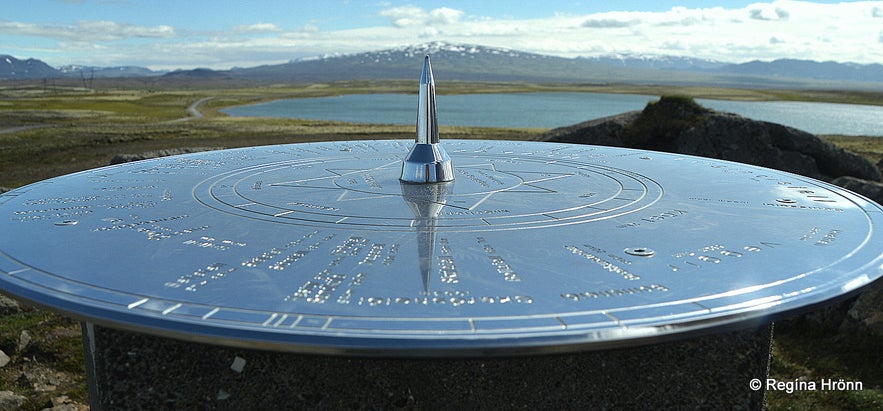
The Uxahryggir view-dial pointing at Mt. Skjaldbreiður
We now kept on driving on Uxahryggir road and made a left turn on road F-508, the mountain road leading to Skorradalur. The road is marked as "illfær vegur" meaning a difficult road to drive on and is for 4x4 jeeps only.
And I can tell you that it was very coarse and bumpy, so never venture on it with a 2WD.
If you carry on driving on the Uxahryggir road it will take you into Lundarreykjadalur valley, where you will find a couple of natural hot springs in which you can bathe.
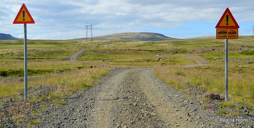
"llfær vegur" leading to Hvítserkur waterfall
We crossed a few creeks on this by-road and drove for quite a while, always on the lookout for Hvítserkur waterfall.
I had seen its location on a map published by Landmælingar Íslands - the National Survey of Iceland, which I use a lot, but not many maps contain its location.
My father-in-law had come here on foot, but we followed the road and I had no idea where the waterfall was located from the road.
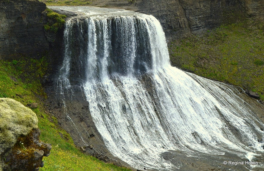
One of the trolls by Hvítserkur waterfall
I only knew that it was in a gully after we had passed Lake Eiríksvatn, from where the river Fitjaá originates.
We opened one gate on the way and I held it open for a passing car, the first car we had met on this less travelled road. The Icelandic couple in the car told us that they had seen a waterfall in the gully some distance from the road.
We were to meet two other cars while driving on this road and were happy that we didn't meet them on the worst part of the road, where it is extremely coarse and high up.
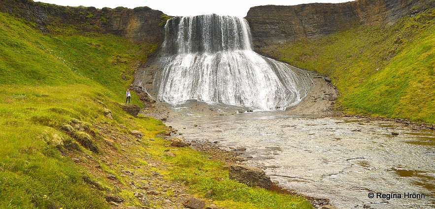
Standing by Hvítserkur waterfall
The gravel road is a cable road, i.e. it was built for the workers, who were putting up the electricity lines.
Finally, we spotted Hvítserkur from the road - way down in the Hvítserksgljúfur gully. We left the car by the road and it took us some 10-15 minutes to walk the 0.53 km to reach the gully - downwards so it was easy - tussocks though and some swamp on the way.
And the desire to finally see Hvítserkur made me half-run down the hill :)
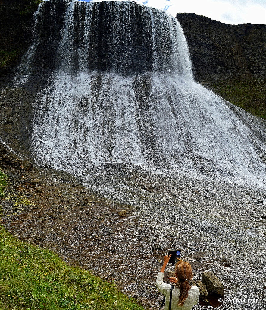
Photographing Hvítserkur waterfall
The ascent, later on, was a bit tougher - nothing major though, just wading through grass and jumping on tussocks trying to remember where we parked the car high up on the road.
I was in awe when I finally stood by Hvítserkur - totally in love with this beautiful off-the-beaten-path waterfall, which I had longed to visit for more than 2 years.
The Icelandic term Hvítserkur means Long White Shirt and it is a fitting name for this beautifully formed waterfall.
We also have a beige welded-tuff mountain by this name, Hvítserkur, in East Iceland.
To me, the cascade of Hvítserkur looks like a beautiful white veil though, more than a white shirt.
We admired Hvítserkur from the edge of the gully and then looked for a way to get down into the gully. It was not easy, but we found a way.
Seeing that Hvítserkur is so wide then I could walk right up to it and stand beneath it in the riverbed itself. This location makes for such a fantastic experience and good photos.
Not many people visit Hvítserkur, seeing that the waterfall is off the beaten path by such a course mountain road. We were totally alone surrounded by this immensely beautiful nature which filled me with both awe and serenity.
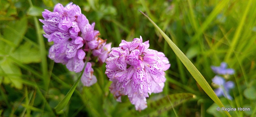
Brönugras - the Orchid of the North
The untouched flora was extraordinary here with so many different types of colourful wildflowers; pink, violet, blue and yellow. It was heavenly lying down in the grass surrounded by this extraordinary beauty.
I am always a bit rushed when travelling in Iceland, but not by Hvítserkur.
What I found quite eerie though was that amidst this abundant flora, there was no fauna. Not a single bird - where were all the migrating birds, which I see and hear all over Iceland?
We visited Hvítserkur in the first week of August and for sure there should have been some birds here.
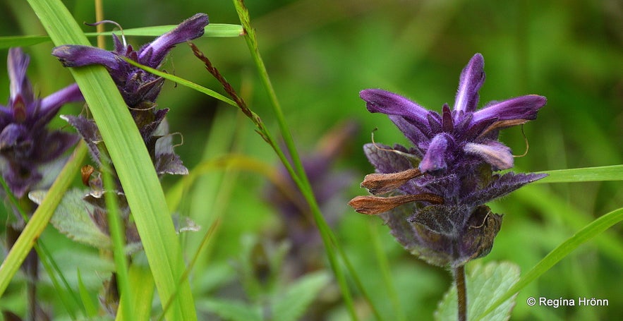
Smjörgras - Bartsia Alpina
We stayed by the waterfall for a long time and I was so absorbed in the beautiful nature here that I didn't want to leave. I am sure that you have found such a place of your own, where you just want to stay.
But I wanted the photo from above like my father-in-law had, so I crawled up the gully holding onto rocks and plants on the way up and asked my husband to stay behind.
Once up I took a dirt path to the top of Hvítserkur.
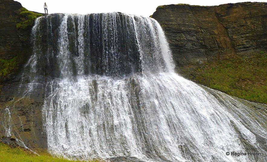
It is possible to stand right on top of the waterfall as it is so wide and the river Fitjaá is not that powerful.
I can tell you that it is quite surreal standing on top of a waterfall in the river looking down!
It can be slippery though so be careful here. And if the wind is blowing from the west you might get totally drenched when you get the waterfall in your face.
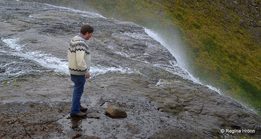
My husband standing on top of Hvítserkur waterfall
After a while the wind turned in exactly that direction, so we took off when my husband was getting drenched. He was wearing the traditional Icelandic woollen sweater lopapeysa, which his mother knitted, and it is not comfortable wearing these sweaters when they get wet.
Further above Hvítserkur, I saw another small, but pretty waterfall.
There are so many pretty waterfalls in this river apart from the pearl of Fitjaá river, Hvítserkur.
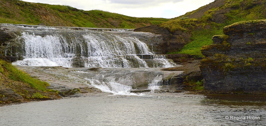
A waterfall in Fitjaá river above Hvítserkur
Hvítserkur can be visited from below as well, i.e. from Skorradalur valley in Borgarfjörður, but a 4x4 is needed after a while from the farm Sarpur. Or you can hike in the gully.
We visited several other smaller waterfalls further down in the Fitjaá river. I must say though that I am not quite sure if I got the correct names for them as there were so many smaller ones.
So I will post photos of the ones I visited in the right order from Hvítserkur.
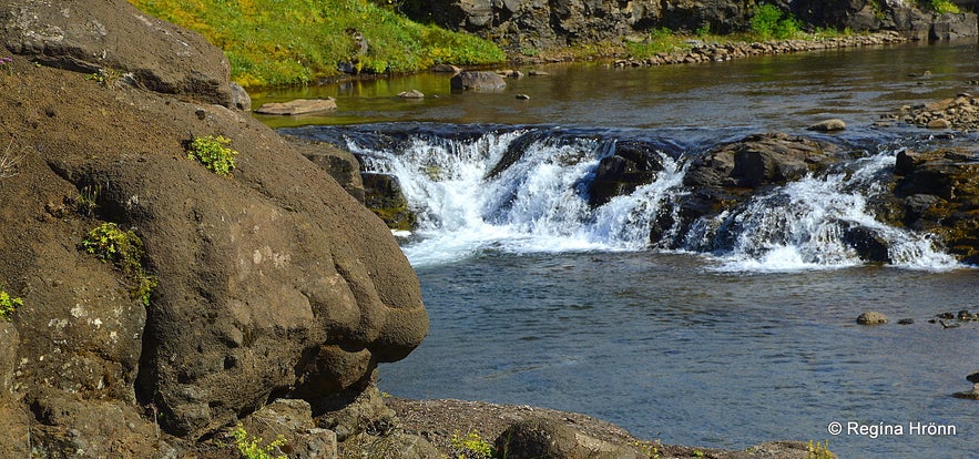
Small waterfalls in the Fitjaá river
The first little waterfall I visited on my way down to Skorradalur valley, was the one in my photo above.
What caught my attention was the big-nosed troll to the left of the waterfall :) Above this small waterfall was another waterfall a little bigger.
I don't know if they have got a name, or if they are just rapids. But they are pretty all the same.
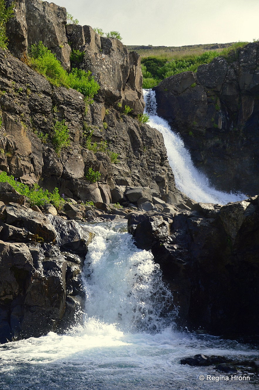
Kvíafoss waterfall
Kvíafoss waterfall was the next one - and the biggest of the waterfalls I visited in Fitjaá river apart from the large Hvítserkur.
It is a beautiful waterfall in a small gorge with a pond in the river beneath the waterfall.
Fitjaá is the spawning area of Arctic char and brown trout and it is believed that no fish can go further up the river than to the roots of Kvíafoss.
Then we have Keilufoss. The name of the waterfall, Tusk Falls, originated from a spell that was put on the waterfall. It ordered that you were never to catch more trout in the river than would suffice for one meal.
It then happened one day that somebody broke this rule and caught tusk - keila in Icelandic. Since that incident fishing stopped at this place. The folklore tells us that since then the waterfall got the name Keilufoss - Tusk Falls instead of Sarpur as it was called before.
I don't have a photo of that waterfall, but from the two photos, I saw online then it is very small.
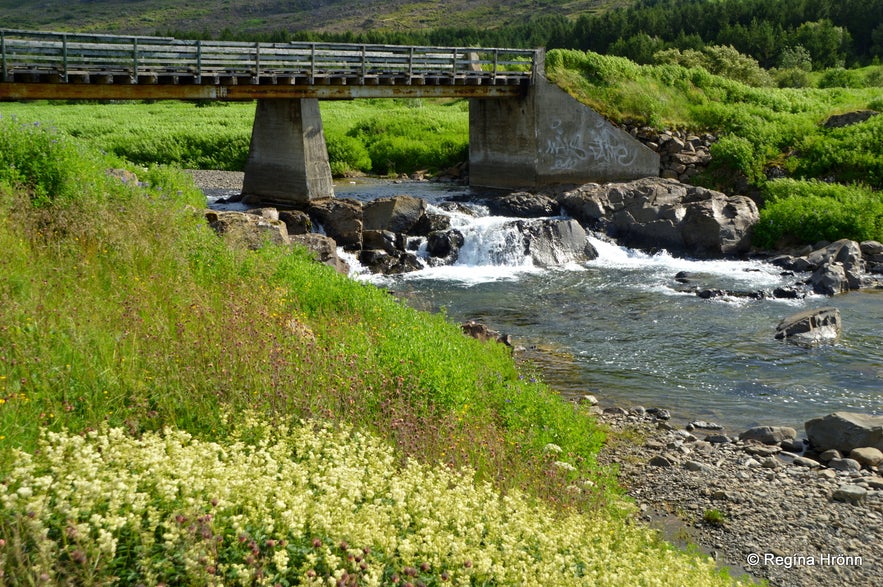
We had by now reached the end of the 4x4 gravel road by the bridge with the signs Vatnshorn and Bakkakot. There we found yet another small waterfall, which I believe is Kjúkufoss.
Fitjaá river runs from Lake Eiríksvatn, at 278 m.a.s., for 10.5 km into Lake Skorradalsvatn at 57 m.a.s., so no wonder there are so many pretty little waterfalls in the river. Fitjaá is Lake Skorradalsvatn's main inlet river.
We had driven through stretches of lupine, which were almost as high as the car, which was quite a difference from the barren landscape of the heath. Our next stop was by the lovely little timber church at Fitjar farm.
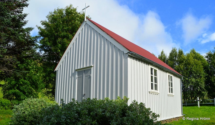
Fitjakirkja church
I visit all the churches I encounter on my travels in Iceland, so I knocked on the farmer's door and he showed me his farm church. Visiting all these little gems enriches my experience of travelling in my country.
Fitjakirkja is part of the 120 km long pilgrim road, which starts at Bær in Borgarfjörður and ends in the historic Skálholt. There has been a church at Fitjar since around Christianity in Iceland, but the current church dates back to 1898.
One of the church objects at Þjóðminjasafnið - the National Museum of Iceland comes from Fitjakirkja. It is an ancient chalice called Fitjakaleikur. Its origin is not certain but it is believed to date back to the early 13th century.
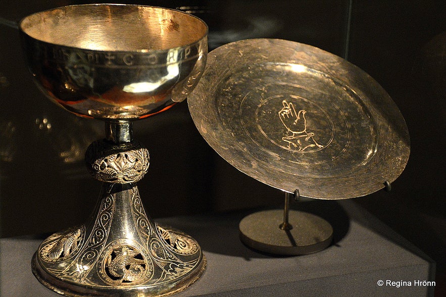
The chalice and a paten at Þjóðminjasafnið - the National Museum of Iceland
I visited the National Museum and took the photo above of the chalice and a paten, which also caught my attention, as engraved in the middle of it is the right hand of God. These fine engraved silver objects are made in the Romanesque style.
I love finding folklore, and old objects at the National Museum to connect to my travel-blog.
I learn more about my country this way and I hope that I can give you a more in-depth experience of Iceland by doing so.
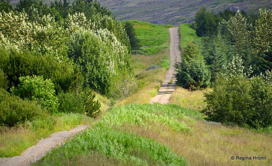
Skorradalur is 28 km long, a beautiful forested valley sporting Lake Skorradalsvatn, into which the Fitjaá river runs its course. Icelandic folklore is connected to the lake - a serpent resides in the lake, called Skorradalsormur.
Similar folklore is to be found in many places, f.ex. in Lagarfljót in East Iceland, where we have the infamous Lagarfljótsormurinn serpent.
From time to time people claim to have seen the serpent in the lake, thus scaring others from fishing in the lake.
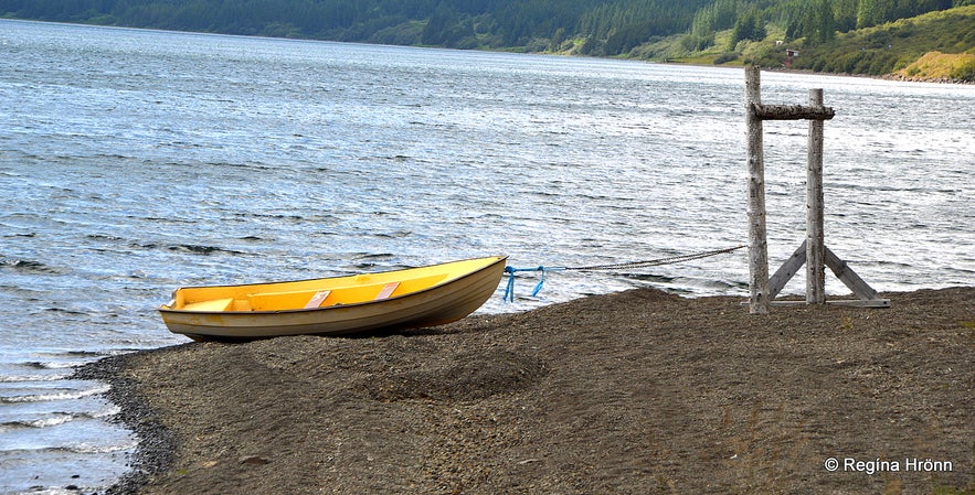
Lake Skorradalsvatn
Running from the west side of Lake Skorradalsvatn we find Andakílsá river, which also has a pretty waterfall, Andakílsárfoss.
I have written another travel-blog about this waterfall along with a hike I took on top of Mt. Hestfjall: Hiking on Mt. Hestfjall in West-Iceland - a Visit to Andakílsá River and a dip in a Hot pool
My next travel-blog is about a visit to Lundarreykjadalur Valley in West Iceland - the natural Hot Pools Krosslaug and Englandshver. It shows you what you will see if you don't turn onto road F-508 for Hvítserkur, but continue along road 52 into Lundarreykjadalur valley.
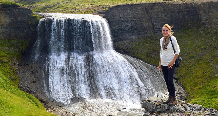 Hvítserkur waterfall
GPS for Hvítserkur: 64°27'29.2"N 21°10'43.0"W
To visit Hvítserkur waterfall it is best to rent a car in Reykjavík and spend a day or two in this area. The distance to Hvítserkur via Þingvellir and Uxahryggir is 87 km, but via the Hvalfjarðargöng tunnel, the distance is 108 km.
Have a lovely time in West Iceland :)
Autres blogs susceptibles de vous intéresser
Mystérieuse Islande
Je me suis longtemps demandé pourquoi j’aimais tant cette île rocheuse et mystérieuse, souvent sombre, tempétueuse... secrète ! C’est peut-être justement pour cette raison – un lieu unique ayant toEn savoir plusPlongée à la faille de Silfra
En octobre dernier, j'ai eu la chance de tester une session snorkeling à Silfra en Islande ! Cette expérience était magnifique ! Je pense que c'est mon activité préférée avec la visite d'une grottEn savoir plusCe qu’on ne vous dit pas avant un voyage en Islande
Vous partez en voyage en Islande ? Vous avez sûrement déjà épluché les forums, guides et autres sites de voyage, réservé votre vol et organisé votre circuit ? Parfait, parfait. Mais avant de savourerEn savoir plus

Téléchargez la plus grande plateforme de voyage d'Islande sur votre téléphone pour gérer l'intégralité de votre voyage au même endroit
Scannez ce code QR avec l'appareil photo de votre téléphone, et cliquez sur le lien apparaissant pour avoir la plus grande plateforme de voyage d'Islande à portée de main. Ajoutez votre numéro de téléphone ou votre adresse e-mail pour recevoir un SMS ou un e-mail avec le lien de téléchargement.


