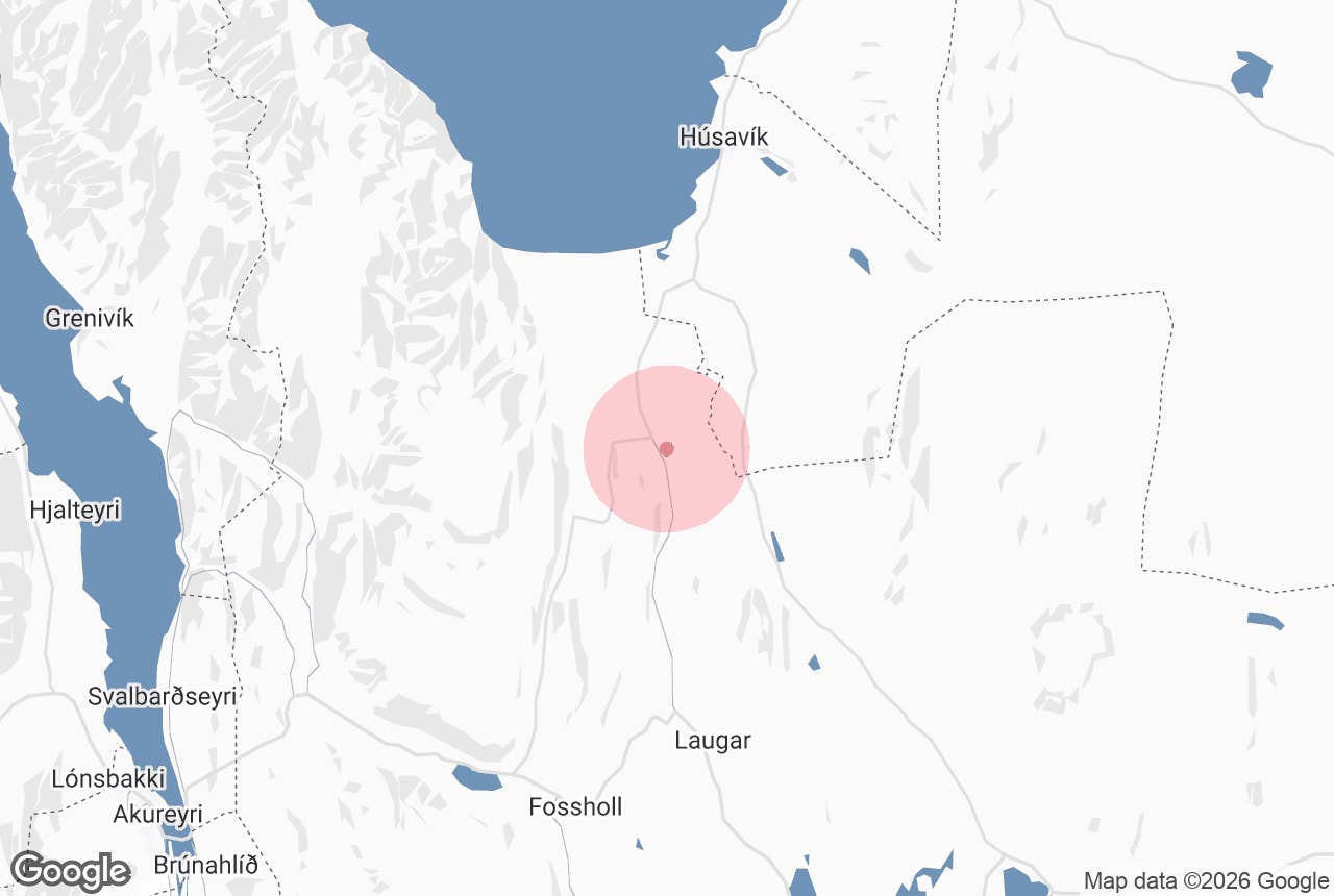
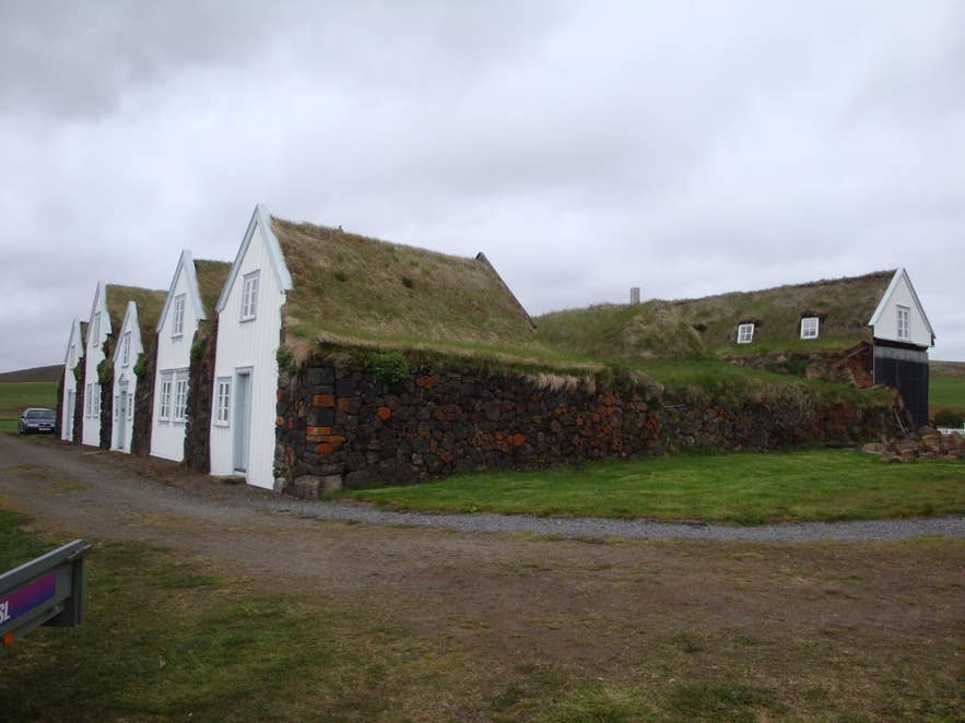
Grenjaðarstaður turf farmhouse, Aðaldalur. Photo: JøMa, CC BY-SA 3.0
Aðaldalur ("main valley") is a broad, low-lying farming valley in North Iceland, running inland from the head of Skjálfandi Bay between the glacial river Skjálfandafljót to the west and the spring-fed Laxá river and Hvammsheiði heath to the east.
It reaches south to the lake Vestmannsvatn, where it merges without a clear boundary into Reykjadalur, while Laxárdalur branches off to the southeast towards Lake Mývatn.
Most of the valley floor is covered by Aðaldalshraun, a roughly 100 square kilometre lava field grown over with birch, juniper and heather.
Húsavík lies just to the north, and the Ring Road passes the valley's southern end, so many travellers cross Aðaldalur on the way between Goðafoss, Húsavík and Mývatn without knowing its name.
Key Takeaways About Aðaldalur
- Broad lava-floored valley south of Húsavík between Skjálfandafljót and the Laxá river
- Aðaldalshraun lava field (about 100 km²) with pseudocraters and the Knútsstaðaborg lava chamber
- Laxá í Aðaldal is one of Iceland's most famous salmon rivers, dropping over Æðarfossar near the sea
- Grenjaðarstaður turf farm museum (built from 1865, lived in until 1949) is open 1 June-15 August
- Routes 85, 845 and 854 are ordinary paved roads; no 4x4 needed
Why visit Aðaldalur
Aðaldalur valley is not a single sight but a landscape, and its appeal is the combination of lava, river and farmland.
The lava came from two directions: an older flow from the shield volcano Ketildyngja about 3,500 years ago, and a younger flow from the Þrengslaborgir crater row near Mývatn roughly 2,000 to 2,200 years ago that ran down the Laxá valley and spread over the older lava.
Along the river you can see what geologists call pseudocraters, small cones formed where the molten lava flowed over wet ground and the steam exploded through it.
Some of the hollows and caves in the lava were used by farmers as sheep shelters, and the lava chamber Knútsstaðaborg is a well-known example.
The Laxá river is the other reason to come. It rises in Lake Mývatn, runs 58 kilometres in total and is Iceland's second largest spring-fed river by volume. Because it is fed by springs rather than glacier melt, it runs clear and its flow stays fairly steady through the year.
The lower stretch, called Laxá í Aðaldal, is one of the most famous salmon rivers in Iceland and the upper part is known for large brown trout.
The river flows over lava for the whole length of the valley until it drops over the lava edge at Æðarfossar, about one kilometre from the sea below the farm Laxamýri. Birdlife along the river is rich: Laxá holds around 250 pairs of harlequin duck, Barrow's goldeneye breed along it, and there is a large eider colony at the river mouth.
The islands and pools make it easy to watch from the roadside.
The valley also holds one of Iceland's most important turf farms. Grenjaðarstaður was a chieftain's seat and church estate from the settlement period, and the turf farmhouse that stands there today was built from 1865 (the oldest part), lived in until 1949 and opened as a folk museum in 1958.
At about 775 square metres it is one of the largest turf farms in the country and once housed up to 30 people. Churches also stand at Nes, and a small airfield sits in the lava field.
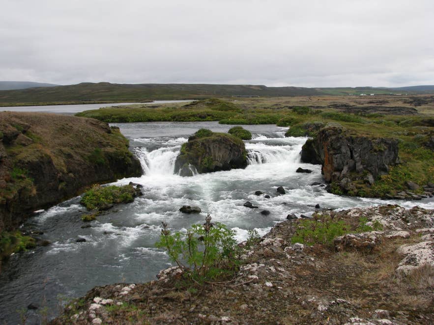
Æðarfossar on the Laxá. Photo: Bromr, CC BY-SA 3.0
How to get to Aðaldalur
Aðaldalur is about 440 to 450 kilometres from Reykjavík by the Ring Road through Akureyri, roughly six to six and a half hours of driving.
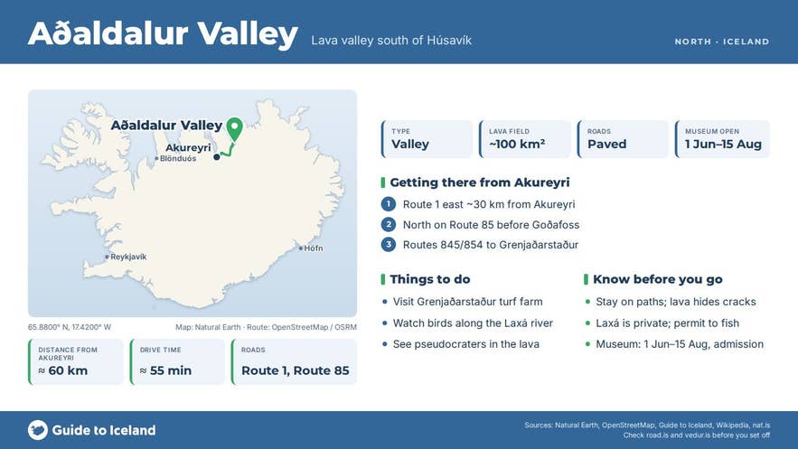
From Akureyri the southern end of the valley is about 60 kilometres: follow Route 1 east for about 30 kilometres and turn north onto Route 85 (Norðausturvegur) towards Húsavík; the junction is about 4 kilometres before Goðafoss. Route 85 then runs the length of the valley along its western side.
From Húsavík the valley begins about 10 kilometres south along Route 85.
Route 845 (Aðaldalsvegur) leaves Route 1 in Reykjadalur about 10 kilometres east of Goðafoss, passes the lake Vestmannsvatn and runs north through the middle of the valley to Route 85; Route 854 (Staðarbraut) branches east from it to Grenjaðarstaður and the Laxá river. All of these roads are ordinary paved roads and need no 4x4.
Grenjaðarstaður is about 30 kilometres by road from Húsavík and 60 kilometres from Akureyri, and has its own car park a few steps from the farmhouse. Æðarfossar lies a few hundred metres from Route 85 near the farm Laxamýri; the surrounding land is farmland, so keep to obvious paths and respect any signs.
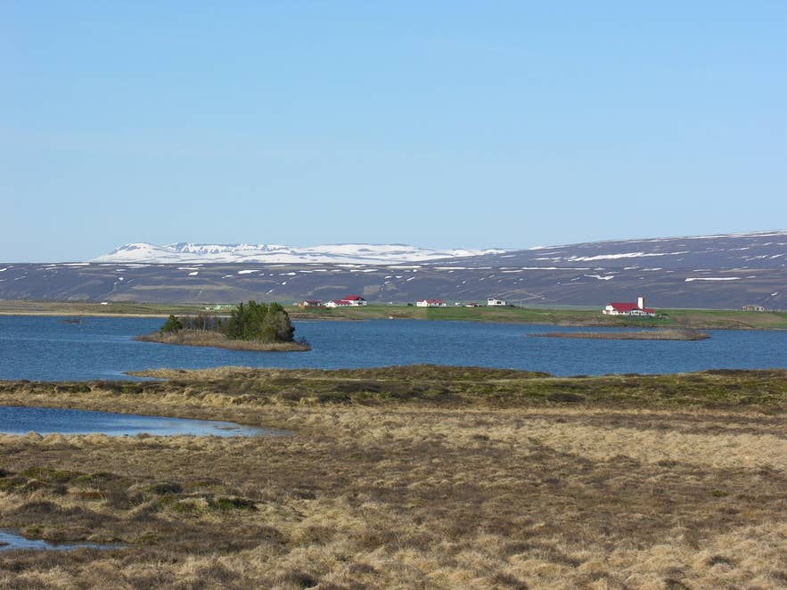
Vestmannsvatn in southern Aðaldalur. Photo: Hansueli Krapf, CC BY-SA 3.0
Best time to visit
June to August is the easiest time: Grenjaðarstaður museum is open daily from 1 June to 15 August (11:00 to 17:00), the birch and heather on the lava are green, and the Laxá birdlife is at its busiest in early summer.
Salmon season on Laxá í Aðaldal runs through the summer and anglers travel from around the world for it, so accommodation in the valley books up early. September brings autumn colours to the birch scrub.
In winter Routes 1 and 85 are main roads kept open by Vegagerðin, and the valley is a low, sheltered area, but museum and farm services are closed and daylight is short.
Safety and practical tips
- The lava is uneven and full of hidden cracks under the moss and scrub. Stay on marked paths; a farmer from the farm Nes once fell into a crevasse in the lava and took almost three days to find.
- Laxá is a private fishing river. Do not fish without a permit, and respect anglers and farmland on the banks.
- Fuel, shops and restaurants are in Húsavík; Laugar in Reykjadalur has a swimming pool, shop and accommodation.
- Grenjaðarstaður charges admission (2,300 ISK for adults in 2026, free for children under 16; check current prices with Menningarmiðstöð Þingeyinga, the Húsavík-based museum service that runs it). Outside the summer season the turf house is closed.
- Weather in the valley is usually calmer than on the coast, but Route 85 across the open sands near the bay is exposed in strong wind.
Nearby attractions
- Grenjaðarstaður – turf farm museum in the valley, about 6 km from the valley centre
- Knútsstaðaborg – lava chamber in Aðaldalshraun, about 4 km
- Æðarfossar – the falls where Laxá leaves the lava, about 12 km
- Laxá í Aðaldal – the salmon river itself
- Húsavík – whale-watching town, about 19 km
- Vestmannsvatn – the lake at the valley's southern end, beside Route 845, about 9 km
- Goðafoss Waterfall – about 23 km to the south on the Ring Road
Tours that visit Aðaldalur
- Private North Iceland Photography Tour with Round-trip Transfers from Akureyri Port – stops for wide views over Aðaldalur and the Laxá river.
- Relaxing 4.5-Hour Godafoss Waterfall and Geothermal Baths Tour From Husavik Port – drives into Aðaldalur to visit the Grenjaðarstaður turf house museum.
