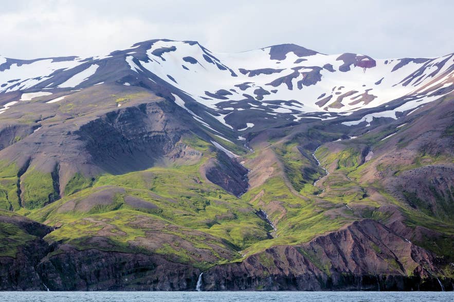
Víknafjöll from Skjálfandi Bay. Photo: Villy Fink Isaksen, CC BY-SA 4.0
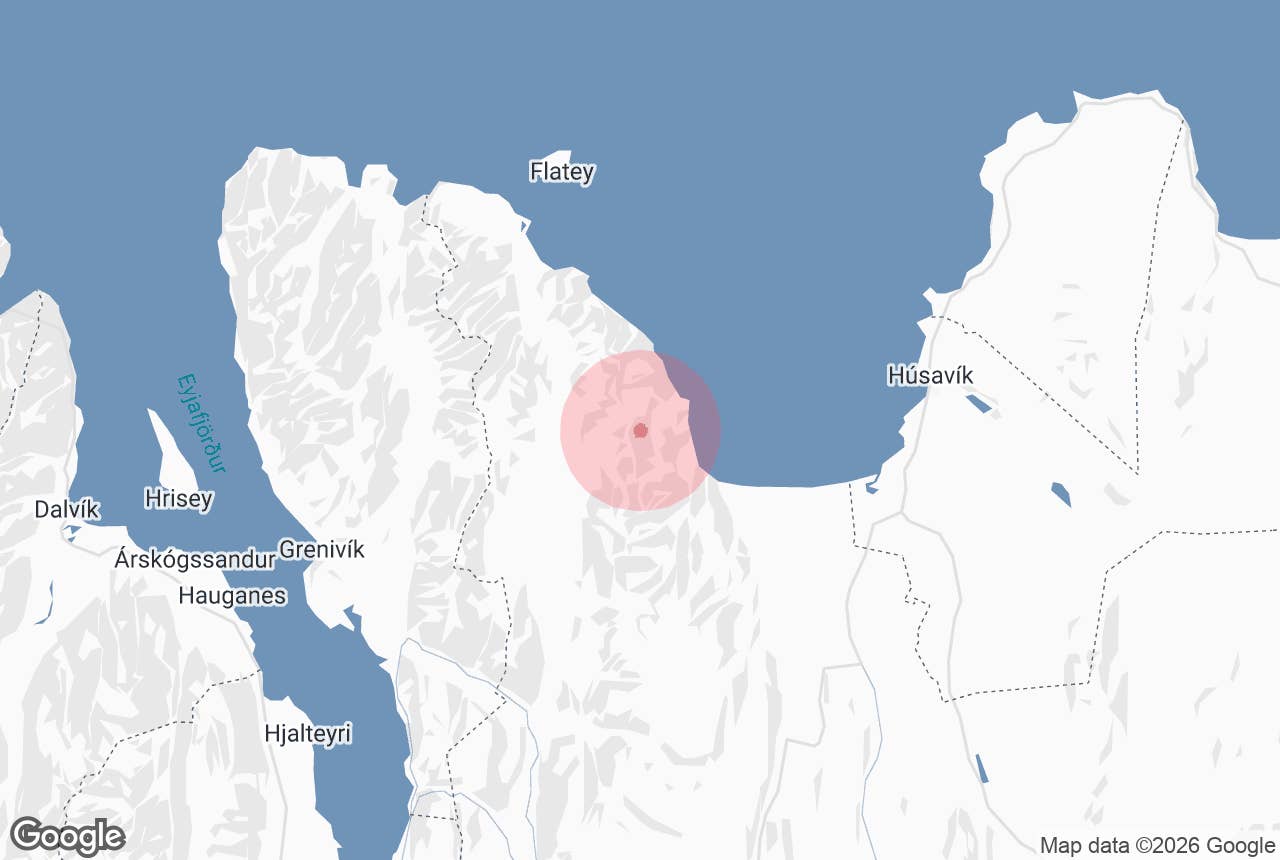
Víknafjöll (Icelandic: Víknafjöll, "the mountains of the coves") is the wall of mountains that lines the western shore of Skjálfandi Bay in North Iceland, directly across the water from Húsavík.
The name comes from the víkur, the small coves of Náttfaravíkur at their foot, where some of the first people in Iceland are said to have settled. Nobody lives there now.
The range is a backdrop that every whale-watching boat from Húsavík sails toward, and one of the wildest coastlines in the north.
Key Takeaways About Víknafjöll
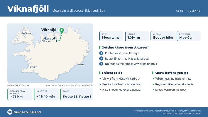
- Víknafjöll is the roughly 1,100 m mountain range on the west side of Skjálfandi Bay, about 18 km across the water from Húsavík.
- At its foot lie Náttfaravíkur, the coves where Náttfari is said to have settled around 870; the last farm was abandoned in 1941.
- There is no road: see the range from Húsavík or a whale-watching boat, or hike in over Flateyjardalsheiði or Kotadalur.
- Best seen May to July, when snow lies in the gullies and the light is long.
- Kinnarfjöll, which has its own GTI page, is the southern continuation of the same mountain wall.
Why visit Víknafjöll
Standing on Húsavík harbour you see the whole range at once: a line of steep, snow-streaked slopes rising straight out of the sea on the far side of the bay, with hanging valleys and gullies cut into them.
Víknafjöll proper is about 8 km long; with Kinnarfjöll continuing it to the south as far as Ljósavatn, the mountain line runs for nearly 40 km.
According to Iceland's national place-name register, Víknafjöll is the name for the mountain range running south from the Hvanndalir valleys (which lie north of Hágöng), above all the coves of Náttfaravíkur. The highest point of the range is 1,094 metres.
South of it the range continues as Kinnarfjöll, above the farming district of Kaldakinn; its northernmost peak, Bakrangi (702 m), stands at the bay, and the valley Kotadalur separates it from Víknafjöll.
Below the mountains lie Náttfaravíkur, the coves named after Náttfari.
The Book of Settlements says that when the Swedish explorer Garðar Svavarsson sailed away from Húsavík after wintering there around 870, a man named Náttfari was left behind in a boat with an enslaved man and woman, and settled in the cove that carries his name.
If the story is right, they were living on this shore before Ingólfur Arnarson, the official first settler, reached Reykjavík. Three farms were later worked in the coves: Vargsnes in the north, Naustavík in the middle and Kotamýrar in the south.
Naustavík was the district's largest fishing station in the 17th century and concrete houses from the last period of settlement still stand there; Naustavík, the last farm, was abandoned in 1941.
Today the coves are reachable only on foot over the mountains or by boat, and the short hanging valleys at the foot of the cliffs are well vegetated.
From the water, the view is of basalt layers, waterfalls dropping off the cliffs, and in early summer, snow lying in the gullies down to sea level.
This is the scenery that frames the humpback whales, minke whales and dolphins on a Skjálfandi whale-watching trip, and on a clear midsummer evening the low sun lights the range from the north-west.
How to get to Víknafjöll
There is no road to Víknafjöll or to Náttfaravíkur.
The range is seen from Húsavík, which is about 460 to 480 km from Reykjavík via Route 1 and Route 85 (roughly six to seven hours), or about 75 km (just over an hour) from Akureyri through the Vaðlaheiðargöng tunnel.
From Húsavík harbour the mountains fill the western horizon about 18 km away.
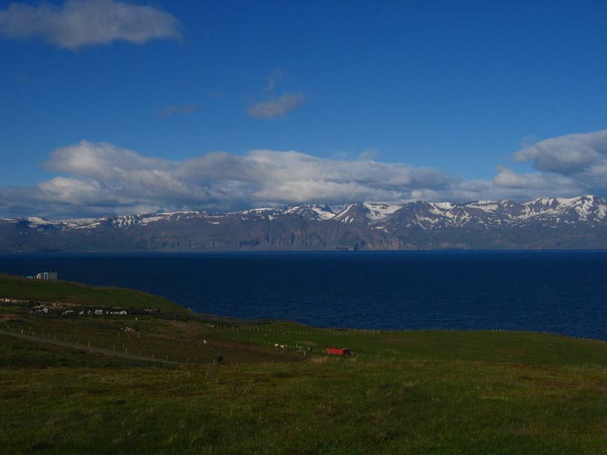
Víknafjöll across Skjálfandi Bay. Photo: Gestur Pálsson, CC BY-SA 3.0
The closest you can get by car is the farming district of Kaldakinn, on Route 85 along the west side of Skjálfandafljót between Ljósavatnsskarð and the bay, from where tracks lead toward the southern end of the range.
Two historic walking routes reach the coves: west over Flateyjardalsheiði and Almannaskarð, or south from Kaldakinn up Kotadalur and over Kotaskarð.
Both are serious mountain hikes for experienced, self-sufficient walkers with a map and GPS; the shoreline route below the cliffs that people once used at low tide is no longer passable.
The usual way to see the mountains close up is from a boat: whale-watching tours from Húsavík cross the bay toward this coast, and some longer sailings go along it.
Best time to visit
For seeing the range, any clear day works, but the mountains are at their best from May to July when snow still lies in the gullies and the light is long. Whale-watching trips run from spring to autumn, with puffins on the bay from mid-April to mid-August.
For walking into Náttfaravíkur the window is July to early September, when the passes are free of snow. In winter the range is often hidden in cloud and the coves are inaccessible.
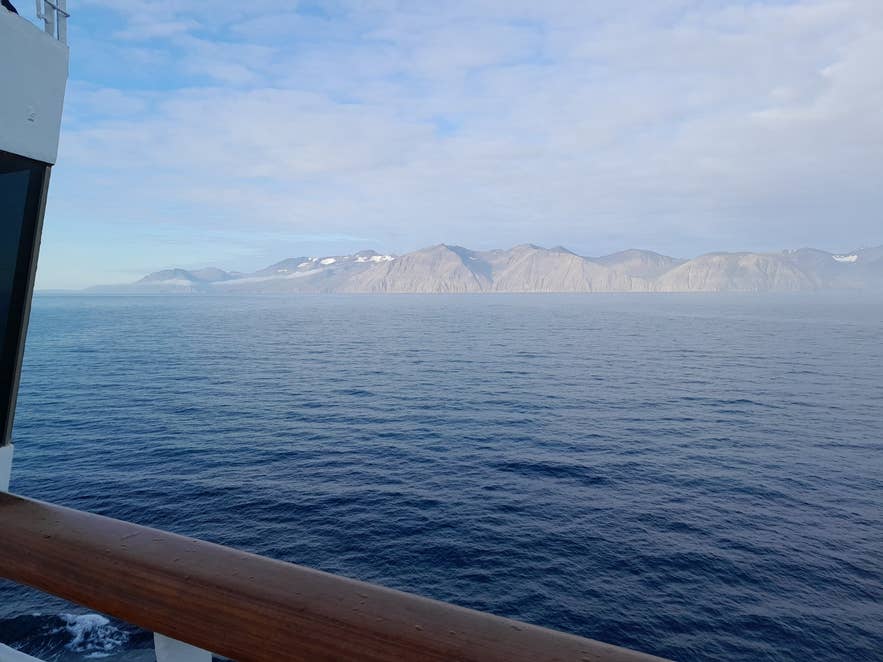
Víknafjöll from Skjálfandi bay. Photo: Hornstrandir1, CC BY-SA 4.0
Safety and practical tips
- Víknafjöll is a wilderness. There are no facilities, waymarked trails, shelters or mobile coverage guarantees in Náttfaravíkur. Register your hiking plan at safetravel.is.
- Weather changes fast on the passes; carry full waterproofs, food, a map and GPS, and expect snow patches into July.
- River crossings and steep scree are part of both walking routes. Do not attempt the old shoreline route.
- From a boat, dress for several degrees colder than on land and bring binoculars for the cliffs and the waterfalls.
- The best free viewpoints on the Húsavík side are the harbour, Húsavíkurhöfði headland and the road north toward Tjörnes.
Nearby attractions
- Skjalfandafljot – the glacial river entering the bay south of the range, 6 km
- Skjalfandi Bay – the whale-watching bay the mountains overlook, 11 km
- Flat Island – Flatey, the low island off the mouth of the bay, 17 km
- Húsavík – the town with the best view of the range, 18 km
- Húsavík Whale Museum – 18 km
- Geosea Geothermal Sea Baths – cliff-top pools facing the mountains, 18 km
- Kinnarfjöll – the continuation of the range south above Kaldakinn, 23 km
Tours that visit Víknafjöll
- Small Group 2-Hour Puffin and Whale Watching Tour from Husavik – sails Skjálfandi Bay with the Kinnarfjöll and Víknafjöll ranges as the backdrop, passing the puffin island and the Tjörnes fossil cliffs.
