Discover the best hiking trails in Iceland, learn what to pack, and where to find the top trails. Explore Iceland’s most beautiful and challenging hikes and get all the information you need to hike in Iceland in this complete guide.
Iceland is one of Europe’s best hiking destinations, with marked trails crossing volcanic highlands, glacier valleys, and lava fields. Each region has its own signature paths, and guided hiking tours in Iceland handle equipment and route planning if you’d rather not organize it yourself.
Why You Can Trust Our Content
Guide to Iceland is the most trusted travel platform in Iceland, helping millions of visitors each year. All our content is written and reviewed by local experts who are deeply familiar with Iceland. You can count on us for accurate, up-to-date, and trustworthy travel advice.
The main hiking season runs from late June to mid-September in the highlands, while routes near Reykjavik and the South Coast stay open year-round. Whether you explore the country on your own or pair your walks with camping in Iceland, the country has day hikes and multi-day treks to suit every traveler.
Hiking ranked fifth among the experiences tourism professionals would most recommend to visitors in a 2026 survey. However, hiking and mountain climbing also ranked first among underrated experiences, suggesting that travelers have explored only part of what Iceland’s trails offer.
The Highlands also ranked among the recommended options. Together, the findings encourage travelers to look beyond the busiest routes and explore hiking areas such as Landmannalaugar, Thorsmork, and Kerlingarfjoll.
Below, we cover the most popular hiking trails in Iceland by region, plus day hikes near Reykjavik, packing advice, and safety guidance for Iceland’s fast-changing weather.
What to Know About Hiking in Iceland
-
Iceland has hiking for every level, from short waterfall walks near Reykjavik to multi-day treks.
-
Proper preparation is essential, including checking trail length, difficulty, terrain, weather, and packing the right clothing and gear.
-
The Highlands offer many of the country’s best trails, especially in Landmannalaugar, home to the Laugavegur and Fimmvorduhals routes.
-
Most Highland and remote trails, such as Landmannalaugar, Hornstrandir, and Viknaslodir, are summer-only, usually from late June to September.
-
July and August are the only frost-free months on Highland trails, according to our 26-year temperature study. Hut and tent hikers in June and September should pack for nights below freezing.
-
Highland and remote trails open from late June, when Iceland gets its fewest downpours of the year, according to our study of the rainiest month in Iceland.
-
The Westfjords also provide outstanding hiking, with top areas such as Hornstrandir Nature Reserve and the Hornvik Bay region.
-
The South Coast is rich in scenic hikes, including routes in Vatnajokull National Park and around many of the region’s waterfalls.
-
North Iceland offers excellent hiking options near Dettifoss Waterfall and around Myvatn.
-
There are also accessible trails near Reykjavik and Keflavik International Airport, including the Keilir Mountain hike.
-
Glacier hiking in Iceland must be done with a certified guide and is available in Vatnajokull National Park, on Solheimajokull Glacier, and in other glacial regions.
Iceland Hiking Trails at a Glance
| Trail | Region | Distance | Duration | Difficulty | Best Time |
| Esjan Mountain | Near Reykjavik | 8.7 miles (14 km) | 3 to 4 hours | Easy to Challenging | Year-round (hike the summit during summer) |
| Helgafell Mountain | Near Reykjavik | 6.5 miles (10.5 km) | 3 to 4 hours | Moderate | Year-round |
| Glymur Waterfall | Near Reykjavik | 4.3 miles (6.9 km) | ~3 hours | Moderate | June to August (log bridge) |
| Gullfoss Waterfall | Golden Circle | 1.3 miles (2.1 km) | 30 mins to 1 hour | Easy | Year-round |
| Thingvellir National Park | Golden Circle | 2.6 miles (4.2 km) | 1 to 2 hours | Easy | Year-round |
| Reykjadalur Hot River Valley | Golden Circle | 4.3 miles (7 km) | 4 hours | Easy | Year-round (best during summer) |
| Svartifoss Waterfall | South Iceland | 2.1 miles (3.2 km) | 1 hour | Easy to Moderate | Year-round |
| Skogafoss Waterfall | South Iceland | 4.2 miles (6.8 km) | 45 mins to 1.5 hours | Easy | Year-round |
| Seljalandsfoss Waterfall to Gljufrabui Waterfall | South Iceland | 1.19 miles (1.9 km) | 30 mins to 1 hour | Easy | Year-round |
| Mulagljufur Canyon | South Iceland | 3.7 miles (6 km) | 2.5 to 4 hours | Moderate to Challenging | June to August |
| Landmannalaugar (day routes) | Highlands | 3.8 to 8.1 miles (6.1 to 13 km) | 2.5 to 4 hours | Moderate to Challenging | Late June to August |
| Laugavegur Trail | Highlands | 34 miles (55 km) | 4 days | Moderate to Challenging | Late June to August |
| Fimmvorduhals Trail | Highlands/South Iceland | 16 miles (26 km) | 7 to 12 hours | Challenging | July to September |
| Viknaslodir Trail | Eastfjords | 93 miles (150 km) | 5 to 10 days | Moderate to Challenging | June to August |
| Borgarfjordur Eystri to Seydisfjordur | Eastfjords | 34 miles (55 km) | 3 to 4 days | Challenging | June to August |
| Dettifoss to Selfoss Waterfall | North Iceland | 2.2 miles (3.5 km) | 1 to 2 hours | Easy | June to August (east road) |
| Hornstrandir Nature Reserve | Westfjords | 34 miles (55 km) | 3 days | Challenging | Late June to August |
| Arnarstapi to Hellnar | Snaefellsnes Peninsula | 1.9 miles (3.1 km) | 1 hour | Easy | Year-round |
| Keilir Mountain | Reykjanes Peninsula | 4.4 miles (7.1 km) | 2 to 3 hours | Moderate | June to August |
| Hafnir Town to Hafnarberg Sea Cliffs | Reykjanes Peninsula | 8 miles (12.8 km) | 3 to 4 hours | Easy | Year-round |
| Hvannadalshnukur Peak | South Iceland | 18 miles (28.6 km) | 12 to 15 hours | Challenging | April to June |
| Svinafellsjokull Glacier | South Iceland | 1 to 2 miles (2 to 3.5 km) | 3 to 5 hours | Challenging | May to September |
| Falljokull Glacier | South Iceland | 1 to 3 miles (1.5 to 5 km) | 3 to 5 hours | Challenging | June to August |
| Solheimajokull Glacier | South Iceland | 2.1 miles (3.4 km) | 2 to 4 hours | Easy to Moderate | Year-round |
Preparing for a Hike in Iceland
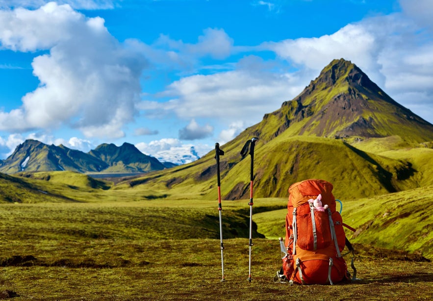
Preparing for a hike in Iceland comes down to four things: dress in warm layers, pack a waterproof and windproof shell, match the trail to your fitness, and share your plans first. Iceland’s weather changes fast, so never trust the forecast alone. Know the emergency number, 112, and register harder or solo routes before you go.
Difficulty of the Hike
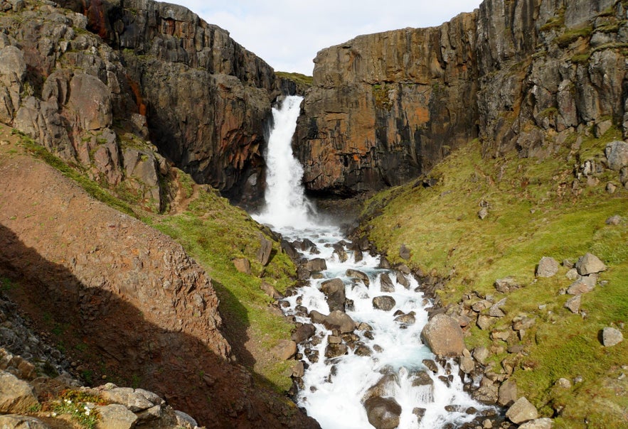
Before you commit to any hike in Iceland, look up these four details for any hike:
-
Total distance – Is it a short out-and-back or a long loop?
-
Elevation gain – How much climbing is involved, not just the highest point?
-
Terrain type – Are there paved paths, dirt tracks, lava fields, rocky ground, snow, or river crossings?
-
Typical duration – How long the route takes for an average hiker, including stops?
For any difficult or solo hike, inform the search and rescue team in Iceland by filling out the form on the SafeTravel website.
How To Choose the Best Hiking Trails in Iceland
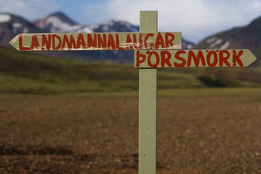
With the practicalities sorted, choosing among the best hiking trails in Iceland comes down to the landscape you want, your fitness level, and the season. Decide first whether you are drawn to geothermal mountains, remote coastal cliffs, or glaciers.
Each region offers a different kind of hike:
-
The Highlands, including Landmannalaugar and Kerlingarfjoll, bring colorful rhyolite peaks and steaming hot springs. It is home to some of the best backpacking trails in Iceland.
-
The Westfjords offer dramatic sea cliffs, remote wilderness, and far fewer crowds.
-
The South Coast offers accessible waterfall walks and glacier hikes in Vatnajokull National Park.
With a region in mind, match a trail to your fitness level. Half-day walks suit beginners, multi-day treks reward stronger hikers, and hiking across Iceland from the north to the south is a challenge for experts.
Logistics matter too. Day hikes near Reykjavik are reachable year-round, while the Highlands need four-wheel-drive vehicles and are usually open only from mid-summer to early fall.
The sunniest month for hiking in Iceland depends on the region. Our 26-year sunshine study found that trails around Reykjavik and the South Coast get their best sunshine odds in May. North Iceland and the Westfjords have their sunniest month in June, when the Highland trails also begin to open.
Warmth splits the same way as sunshine. The warmest afternoons in Iceland are in the north, and the Highlands stay colder than the coast in every month. A Laugavegur pack needs a warmer layer than a South Coast day walk.
The Best Hiking Trails Close to Reykjavik
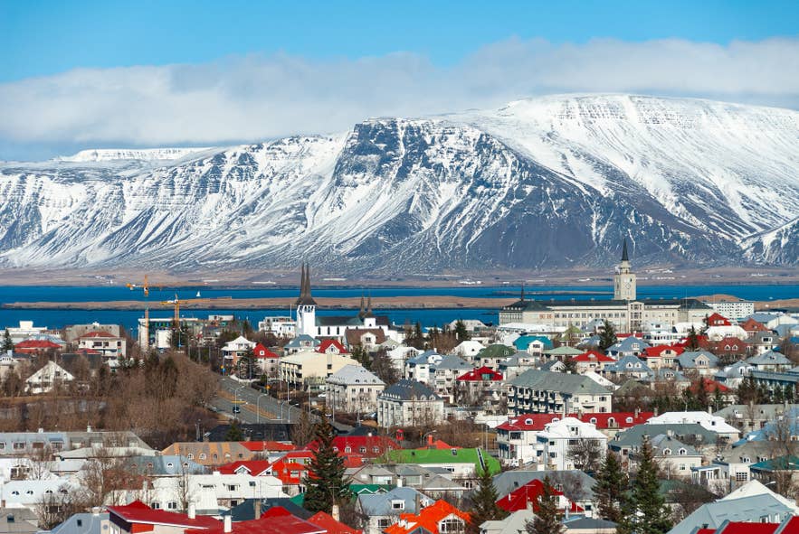
Within about an hour from Reykjavik, you can reach hidden canyons and lava fields without a long drive. These hiking trails near Reykjavik suit a half-day trip and work well if you are short on time or based in the capital.
Hiking Esjan Mountain
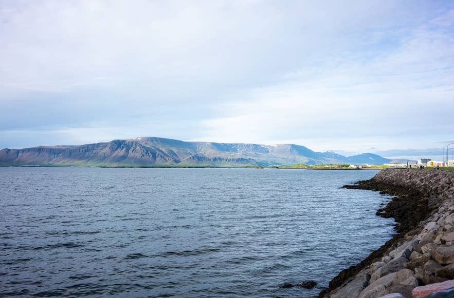
Esjan is the closest mountain to the capital and one of the most popular day hikes in Reykjavik. It is one of the only major Icelandic mountain hikes reachable by taking a city bus to the stop called “Esjuraetur – Hiking Center.”
The trail becomes demanding near the top, where ropes and steps help hikers through the steeper sections. Those who prefer an easier option can hike to the Steinn viewpoint. If you’re up for a challenge, you can hike the Thverfellshorn summit.
In winter, climbing to the summit is not recommended except for experienced hikers, as snow can create avalanche risks. Weather conditions should always be checked before starting, even in summer, as the mountain is exposed to strong winds.
-
Distance: 8.7 miles (14 kilometers)
-
Elevation Gain: Up to 3,000 feet (914 meters); Thverfellshorn 2,560 feet (780 meters)
-
Duration: Three to four hours
-
Difficulty: Easy to Challenging (depending on the chosen route)
Hiking to Helgafell Mountain
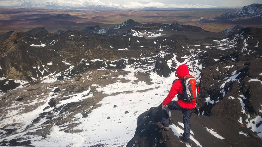
Helgafell lies just 20 minutes south of Reykjavik, near the town of Hafnarfjordur, and is a favorite volcanic day hike in Iceland among locals. It suits families and travelers looking for an easy hike near Reykjavik.
Most hikers begin at Kaldarbotnar, where the parking area and trailhead are located. The trail first crosses flat, moss-covered lava fields, then climbs gently up the mountain’s northeast side. The summit offers views over Reykjavik, Hafnarfjordur, and the Reykjanes Peninsula.
Note: The trail is exposed with no shade, so windproof clothing is useful. In winter, the path can become icy, and hikers should take extra care on steeper sections.
-
Distance: 6.5 miles (10.5 kilometers)
-
Elevation Gain: 1,109 feet (338 meters)
-
Duration: Three to four hours
-
Difficulty: Easy to Moderate
Hiking to Glymur Waterfall
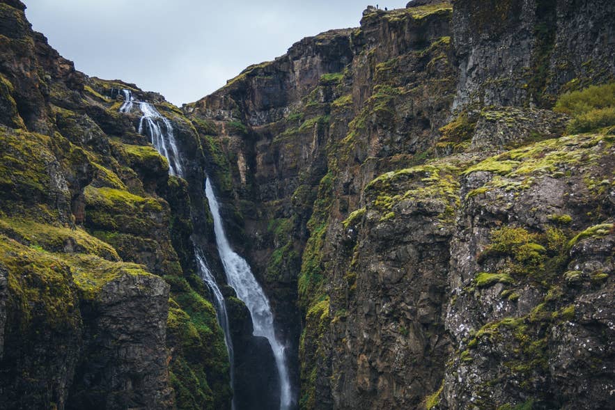
Hiking the Glymur Waterfall trail takes you to Iceland’s second-tallest waterfall. To reach the trailhead, you must drive to the base of Hvalfjordur Fjord in West Iceland.
The hike includes walking through a lava cave, a river crossing on a log bridge (available only in summer), and climbing a steep mountainside. If the full route feels too challenging, stop after an hour and still enjoy the canyon views. The river’s right side offers the best waterfall views.
Note: In early summer or after heavy rain, water levels may be too high to complete the loop, so hikers should turn back the same way. The clifftops have no railings, so this trail is not recommended for small children.
-
Distance: 4.3 miles (6.9 kilometers)
-
Elevation Gain: 1,300 feet (400 meters)
-
Duration: About three hours
-
Difficulty: Moderate to Challenging (not recommended for those with severe vertigo)
The Best Hiking Trails Around the Golden Circle
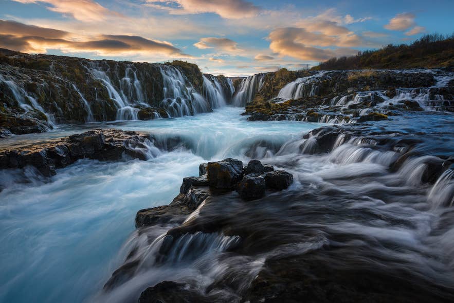
The best hiking trails around the Golden Circle sit close to its three main attractions: Thingvellir National Park, Gullfoss Waterfall, and Geysir Geothermal Area. This makes it easy to pair a hike with the classic Golden Circle tours.
Most trails are short to moderate and suit families. They stay accessible year-round, though winter calls for proper footwear.
Gullfoss Waterfall Hike
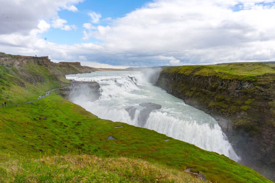
Unlike Iceland’s longer hiking routes, Gullfoss Waterfall offers an accessible walk to its viewpoints along the Hvita River canyon. It’s one of Iceland’s top attractions and a highlight of the Golden Circle route.
Even in winter, 358 cubic feet (109 cubic meters) of water rushes over the falls each second, creating a dramatic sight. The trail is short and easy, with paths leading close to the viewing platforms.
Note: The spray makes the ground slippery, so wear sturdy and waterproof footwear. Gullfoss is popular, so visiting before 9:00 AM offers a less crowded experience.
-
Distance: 1.3 miles (2.1 kilometers)
-
Elevation Gain: Minimal
-
Duration: 30 minutes to one hour
-
Difficulty: Easy
Oxararfoss Waterfall Hike in the Thingvellir National Park
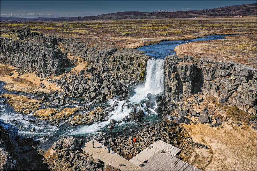
In Thingvellir National Park, most visitors walk through the Almannagja Gorge, a rift valley between two tectonic plates. The landscape is full of interesting rock formations and narrow fissures. At the top of the gorge, you’ll see Thingvallavatn, Iceland’s largest lake.
The trail to Oxararfoss Waterfall is easy to follow and suitable for most hikers. The paths are well-maintained and mostly flat, with wooden walkways that are even wheelchair-accessible in many sections. The area can be busy during midday, so visiting earlier helps avoid crowds.
-
Distance: 2.6 miles (4.2 kilometers)
-
Elevation: Minimal
-
Duration: One to two hours
-
Difficulty: Easy
Hiking to Reykjadalur Hot River Valley
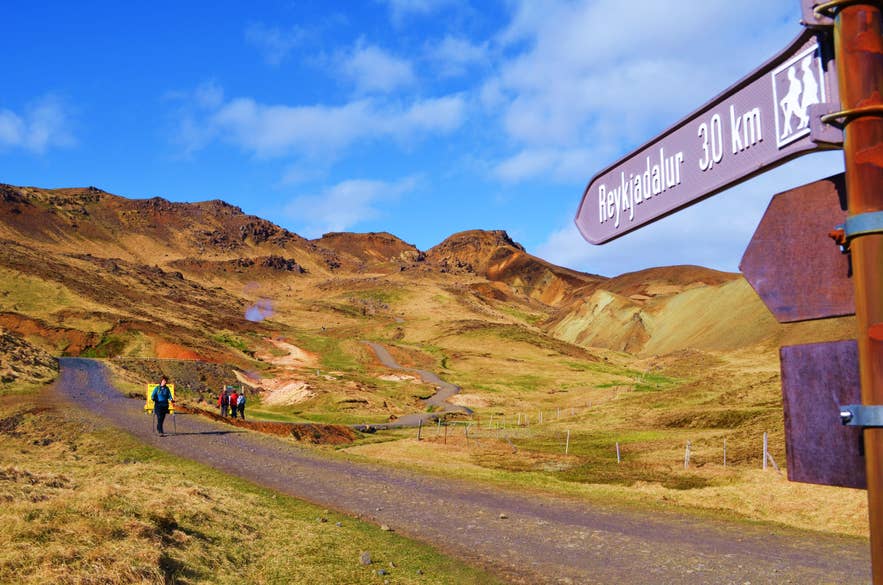
Reykjadalur, or “Steam Valley,” is a popular hiking destination in Iceland near the Golden Circle. The trail leads through a geothermal valley filled with steam vents, hot pools, and mountain views. At the end of the hike, you can bathe in a warm natural river, so bring swimwear.
The trail is easy but includes steady uphill sections and can be windy or muddy, especially in early spring or after rain. Stay on marked paths, as the ground near hot springs can be unstable and hot. Parking is available at the trailhead, and the route is well marked.
Tip: Reykjadalur is one of Iceland’s most popular hikes and can get busy during summer afternoons. Midday (11:00 AM to 3:00 PM) tends to be the busiest time on the trail.
-
Distance: 4.3 miles (7 kilometers)
-
Elevation Gain: 660 feet (200 meters)
-
Duration: 2 hours each way
-
Difficulty: Easy
The Best Hikes in South Iceland
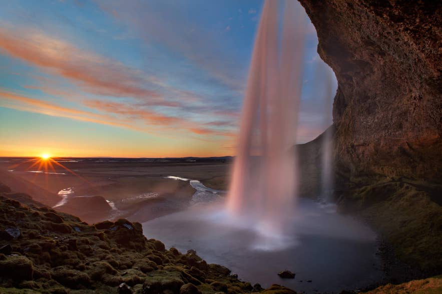
South Iceland holds the country’s most accessible hikes, including the Svartifoss and Skogafoss Waterfall trails and the Seljalandsfoss-to-Gljufrabui walk. Most sit just off the Ring Road, so many South Coast tours include a short hike in the itinerary.
Svartifoss Waterfall Hike in Vatnajokull National Park
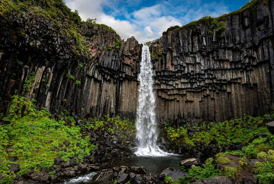
In Vatnajokull National Park, you’ll find Svartifoss Waterfall, also known as the “black falls” for its dark basalt columns. From the visitor center at Skaftafell Nature Reserve, take the Waterfalls Trail, which is the easiest route in the park. Along the way, Magnusarfoss and Hundafoss Waterfalls appear on the trail before you reach Svartifoss.
Tip: Wet rocks near the falls stay slippery year-round, and ice forms on the path in winter. Bring spikes or sturdy winter shoes from November to April.
-
Distance: 2 miles (3.2 kilometers)
-
Elevation Gain: 330 feet (100 meters)
-
Duration: One hour
-
Difficulty: Easy
Skogafoss Waterfall Hike
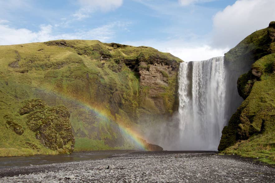
Skogafoss is one of the most popular attractions on the South Coast and is also part of the Fimmvorduhals trails. Climb the steel staircase next to the 197 feet (60 meters) waterfall for views from the top.
You can also continue along the Waterfall Way trail above the falls to see roughly 25 more waterfalls along the Skoga River. The area can be windy and wet from the waterfall spray, so waterproof shoes and an outer layer are recommended.
Tip: Skogafoss Waterfall is close to the Ring Road and often crowded, so visiting before 10:00 AM is recommended.
-
Distance: 4.2 miles (6.8 kilometers)
-
Elevation: 1,640 feet (500 meters) for the Waterfall Way hike
-
Duration: 45 minutes to 1.5 hours
-
Difficulty: Easy
Seljalandsfoss Waterfall to Gljufrabui Waterfalls Hike
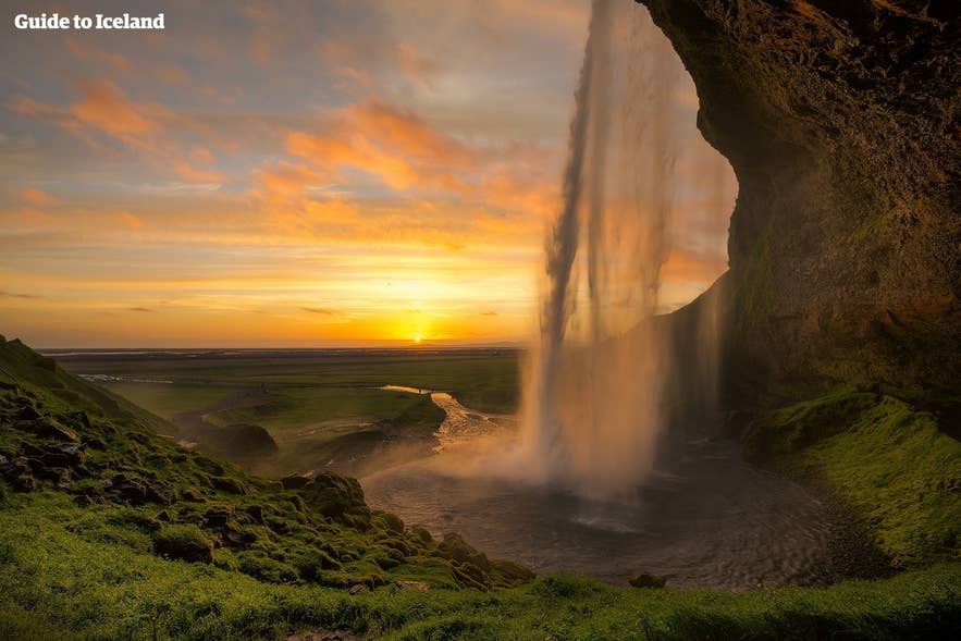
This easy hike in South Iceland near the Thorsmork area connects Seljalandsfoss Waterfall to the hidden Gljufrabui Canyon. Seljalandsfoss is fed by meltwater from Eyjafjallajokull Glacier and drops 200 feet (60 meters) into a small cave you can walk behind.
Please note that the path behind Seljalandsfoss closes in winter when ice forms on the rocks. Check the signs at the trailhead from November to April.
Tip: Expect to get wet behind the falls and on the slippery rocks inside Gljufrabui Canyon. Bring waterproof shoes, a rain jacket, and a dry bag for your phone or camera.
-
Distance: 1.19 miles (1.9 kilometers)
-
Elevation: Minimal
-
Duration: 30 minutes to one hour
-
Difficulty: Easy
Mulagljufur Canyon Hike
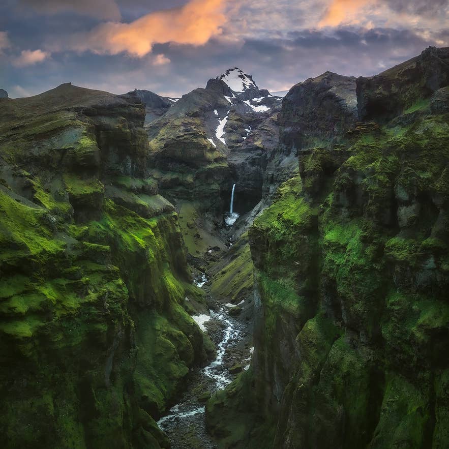
Mulagljufur Canyon is one of South Iceland’s hidden valleys. The trail passes steep cliffs and hanging glaciers, offering sweeping views toward the mountains above the canyon.
The route climbs toward viewpoints overlooking Mulafoss and Hangandifoss Waterfalls. These tall cascades drop into the gorge, framed by the distant peaks of Oraefajokull.
Tip: Parts of the path are steep or muddy after rain, so wear sturdy footwear and bring enough water.
-
Distance: 3.7 miles (6 kilometers)
-
Elevation Gain: 1,150 feet (350 meters)
-
Duration: 2.5 to 4 hours
-
Difficulty: Moderate to Challenging
The Best Hikes in the Icelandic Highlands
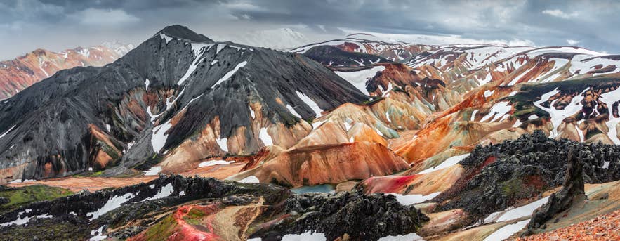
The Icelandic Highlands hold some of the country’s most remote landscapes, including rhyolite mountains, black sand deserts, hot springs, and crater lakes. The trails below cover the most popular hiking trails in the Highlands.
Landmannalaugar Hiking Trail
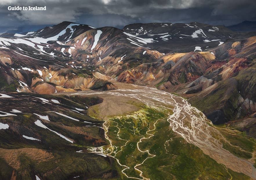
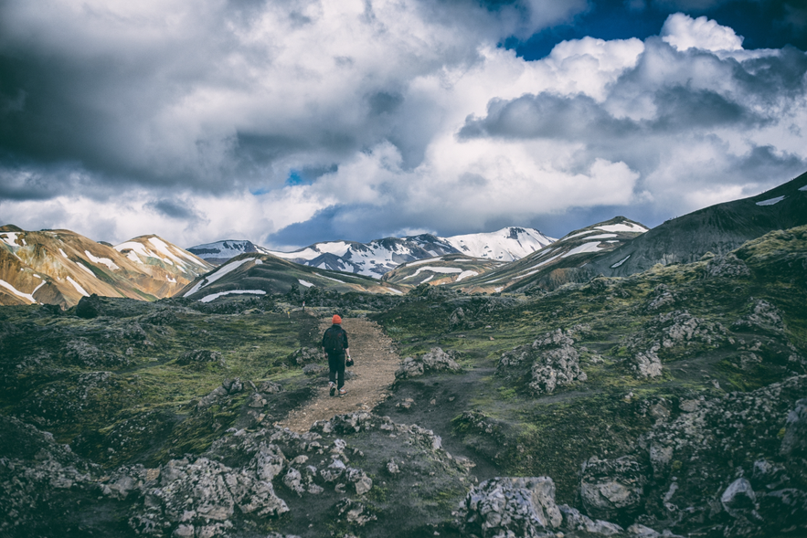
Landmannalaugar is widely known as one of the best hiking trails in Iceland. The surrounding rhyolite mountains glow in shades of orange, green, purple, and red, making this region a beauty to witness.
Geothermal hot rivers run through Landmannalaugar and stay warm enough for bathing, so you can soak after a day on the trail. A Landmannalaugar hiking and natural bath tour combines a guided trail with a soak in the hot river after a day on the trail.
Note: Landmannalaugar is only accessible during summer in Iceland. The area is usually open from late June or early July until the end of September.
Three Major Hiking Routes in Landmannalaugar
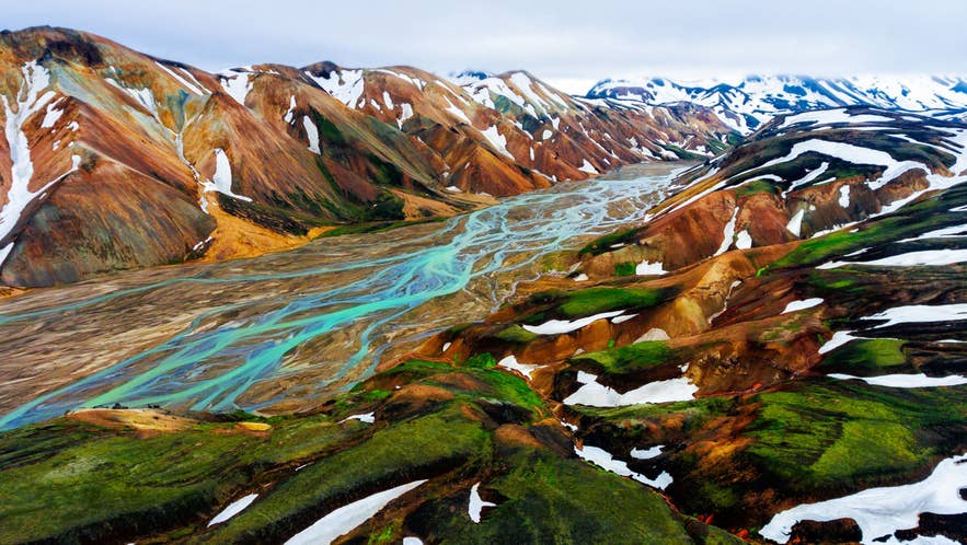
Whether you are looking for short walks or day-long treks, Landmannalaugar has well-marked trails for all skill levels. Here are the best hiking trails in Landmannalaugar.
1. Laugahraun Lava Field to Brennisteinsalda Mountain Hike
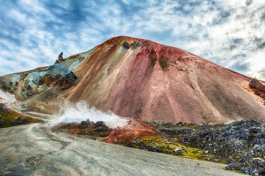
The hike from Laugahraun Lava Field to Brennisteinsalda Volcano is one of the most popular short hikes in Landmannalaugar. The trail passes obsidian rock formations, steaming vents, and viewpoints overlooking the red and orange slopes of Brennisteinsalda without the challenge of a difficult ascent.
-
Distance: 4.1 miles (6.6 kilometers)
-
Elevation Gain:1,430 feet (436 meters)
-
Duration: 2.5–3 hours
-
Difficulty: Moderate
2. Mount Blahnjukur Hike
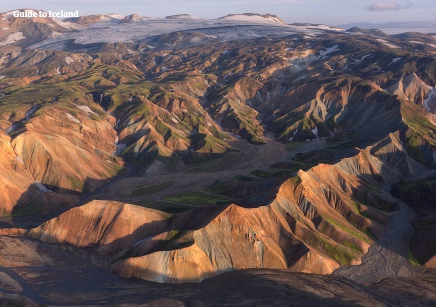
The hike to Mount Blahnjukur, known as the “Blue Peak,” offers some of the best views in Landmannalaugar. Known for its panoramic views of rhyolite mountains, Brennisteinsalda, and up to five glaciers on clear days, it’s a favorite spot among photographers.
-
Distance: 3.8–4.1 miles (6.1–6.5 kilometers)
-
Elevation Gain: 3,051 feet (940 meters)
-
Duration: 2.5–3.5 hours
-
Difficulty: Moderate to Challenging
3. Ljotipollur Crater Lake Hike
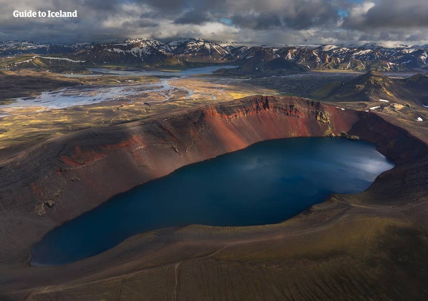
The hike to Ljotipollur Crater Lake, whose name means “the ugly puddle” in Icelandic, leads to the Fjallabak Nature Reserve. The trail is mostly flat, followed by a moderately steep climb to the crater rim. From the top, you’ll see the blue lake surrounded by sloping red hills and green moss that stand out against the dark gravel.
-
Distance: 8.1 miles (13 kilometers)
-
Elevation Gain: 721 feet (220 meters)
-
Duration: 4 hours
-
Difficulty: Moderate
Laugavegur Hiking Trail
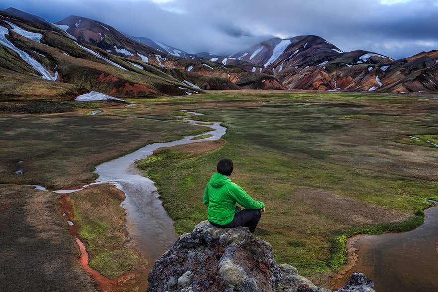
The Laugavegur Trail is Iceland’s most famous multi-day hike, crossing the southern Highlands from Landmannalaugar to the glacier valley of Thorsmork. You can walk it on a guided 5-day Laugavegur hiking tour.
The trail passes colorful hills, black sand plains, obsidian fields, and river valleys. Several rivers are unbridged, so wade with care. Water levels change with weather and time of day, so cross in the morning before afternoon meltwater raises the levels.
Note: On the Laugavegur Trail, you will not find shops, cafes, or bars. The name can confuse some visitors because Reykjavik’s main shopping street is also called Laugavegur, but this trail is in the Highlands.
-
Distance: 34 miles (55 kilometers)
-
Elevation Gain: Roughly 4,800 to 5,500 feet (1,450 to 1,600 meters )
-
Duration: Four days
-
Difficulty: Moderate to Challenging
Choosing Your Direction
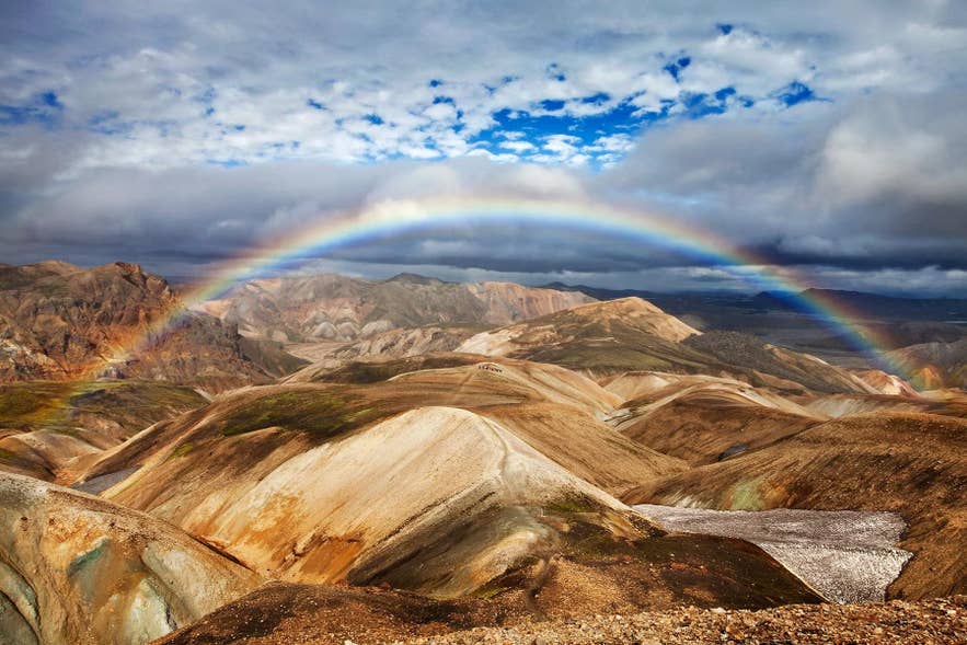
You can hike from Landmannalaugar or from Thorsmork. Most travelers start at Landmannalaugar for two reasons:
-
The climb is easier from this end.
-
It offers a favorable downhill elevation profile.
Mountain Huts Along the Route
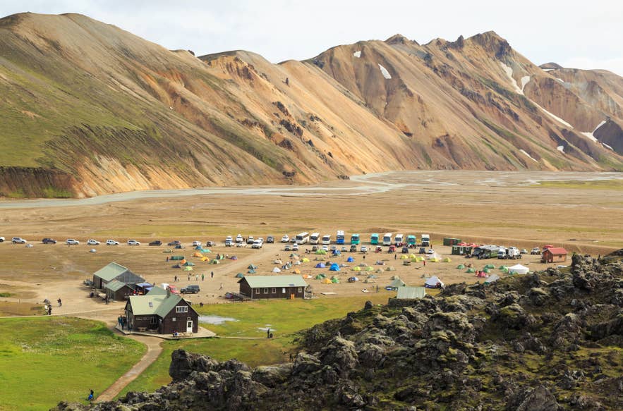
The route traditionally takes two to four days, with overnight stays at four huts between the start and end points:
-
Hvanngil
-
Emstrur
Additional huts sit at the start and end of Landmannalaugar and Thorsmork. If you have not booked a hut, you can camp beside them with your own tent and gear.
Getting To and From the Trail
-
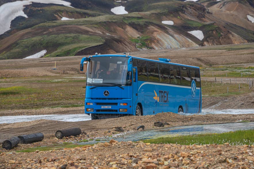
Highland buses run from Reykjavik or Hella to Landmannalaugar. Buses operate daily from mid-June to mid-September, with the trip taking around 4 to 4.5 hours each way.
-
From Reykjavik: Take a hiker’s bus pass to Landmannalaugar for the outbound trip, then book the one-way bus back to Reykjavik for the return.
-
From Hella: Take a one-way bus from Hella to Landmannalaugar, then book the one-way bus back to Hella for the return.
-
Super jeep tours and private drivers: A super jeep tour to Landmannalaugar and private drivers also reach the trailhead in summer, depending on road and weather conditions.
Fimmvorduhals Hiking Trail
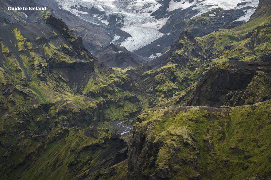
The Fimmvorduhals Trail extends the Laugavegur south, passing between Eyjafjallajokull Volcano and Myrdalsjokull Glacier. The route runs 14 miles (22 kilometers) from Thorsmork to Skogar, passing waterfalls, snowfields, and craters left by the 2010 eruption.
If you plan to hike only the Fimmvorduhals, many hikers start in Skogar. This direction follows the long line of waterfalls along the Skoga River before finishing the route in 10 to 12 hours. The full trail can also be done on a 6-day guided trek from Landmannalaugar, but it suits experienced hikers due to changing mountain weather.
-
Distance: 16 miles (26 kilometers)
-
Elevation gain: Up to 3,300 feet (1,000 meters)
-
Duration: Seven to 12 hours
-
Difficulty: Challenging
Tip: Book mountain huts through the Iceland Touring Association and use Highland hiking bus passes for transport to your start and end points.
Driving and 4x4 Access
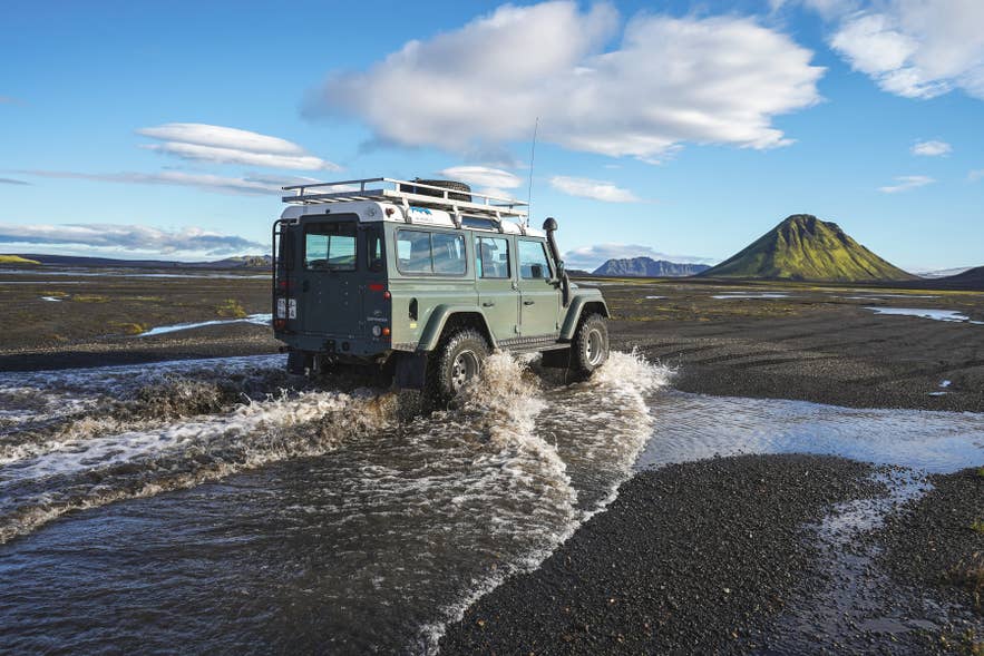
With a small rental car, park in Hvolsvollur town and join a super jeep day tour to Thorsmork. The unbridged river crossings need 4x4 vehicles. Once in Thorsmork, you can enjoy shorter hikes in the area before starting the main trail.
The Best Hikes in the Eastfjords of Iceland
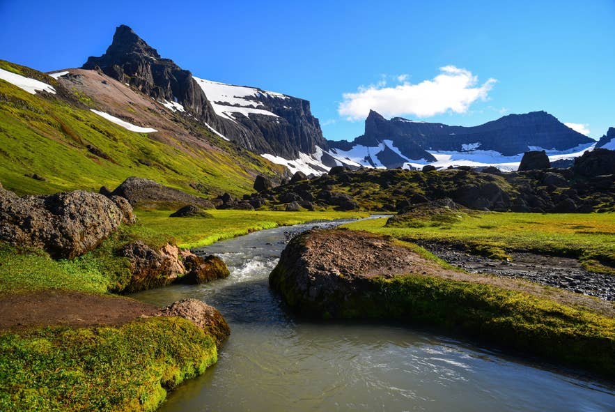
If you’re looking for crowd-free hiking trails in Iceland, the Eastfjords offer scenic routes through remote fjords, colorful mountains, and peaceful fishing villages. The two routes below are the main multi-day treks in East Iceland.
Viknaslodir Hiking Trails in the Eastfjords
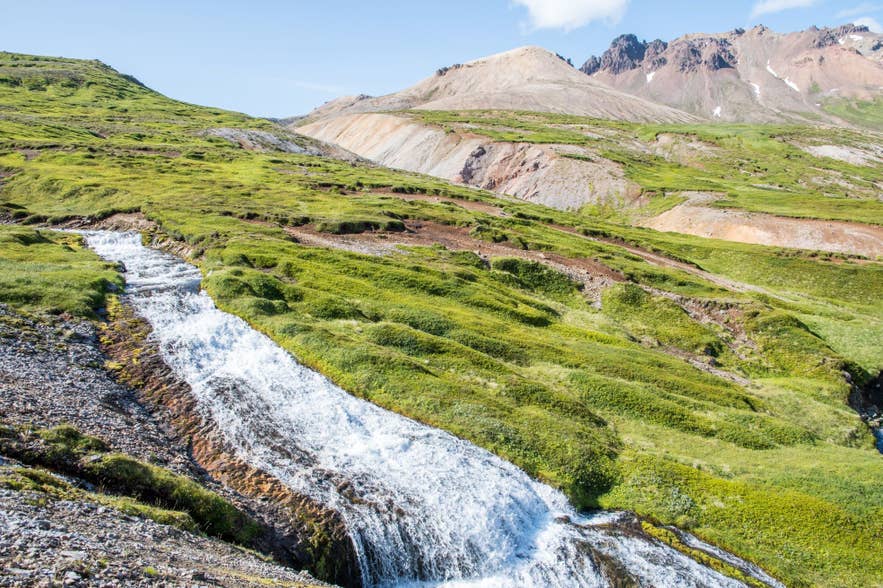
Viknaslodir Hiking Trail, often called “The Trails of the Inlets,” is a route that stretches from Borgarfjordur Eystri to Seydisfjordur. The route passes rhyolite mountains, sea cliffs, black sand beaches, and abandoned farms, with chances to spot puffins near Borgarfjordur Eystri.
Some sections have markers like poles, flags, and cairns, but many parts are lightly marked. Since trails can disappear in bad weather or snow, reliable digital navigation is essential.
Note: Viknaslodir Hiking Trails are available only in summer. Roads to Borgarfjordur Eystri, one of the best towns to visit in East Iceland, may be closed in winter due to heavy snow, and the mountain huts along the trail are unavailable.
-
Distance: 93.2 miles (150 kilometers)
-
Elevation Gain: 6,178 to 8,195 feet (1,883 to 2,498 meters)
-
Duration: Five to ten days
-
Difficulty: Moderate to Challenging
Borgarfjordur Eystri to Seydisfjordur Hike
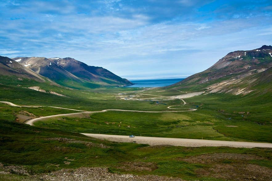
This hiking trail in the Eastfjords covers the villages of Borgarfjordur Eystri and Seydisfjordur. Hikers will enjoy views of the North Atlantic, walk through mountain passes, and pass small farmsteads along the way.
Because this route crosses high terrain, weather and visibility can shift quickly. Most travelers complete this hike in three to four days, staying in huts or designated campsites along the trail.
-
Distance: 34 miles (55 kilometers)
-
Elevation Gain: 8,195 feet (2,498 meters)
-
Duration: Three to four days
-
Difficulty: Challenging
The Best Hikes in North Iceland
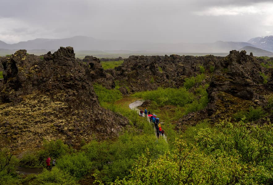
North Iceland hiking trails cover volcanic craters, geothermal areas, and quiet fjords. The two areas below are the region’s main hiking hubs.
Dettifoss Waterfall to Selfoss Waterfalls Hike
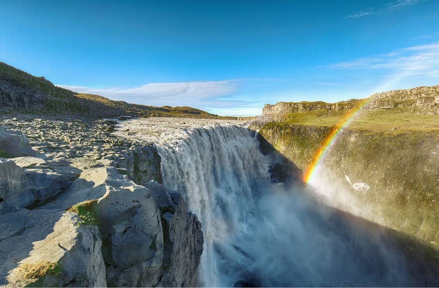
Dettifoss and Selfoss are two of the most powerful waterfalls in Iceland and are located in Vatnajokull National Park near the town of Husavik in Northeast Iceland. Selfoss sits upstream from Dettifoss and can be viewed from both the east and west sides of the river.
-
Distance: 2.2 miles (3.5 kilometers)
-
Elevation Gain: 255 feet (78 meters)
-
Duration: One to two hours
-
Difficulty: Easy
Choosing your side of the river:
-
East side: Best view of Selfoss. The gravel road is often closed outside of summer.
-
West side: Easier to reach via Route 862, with a short walk to the viewing platforms. Toilets and basic facilities are available on the west side during the main season.
Lake Myvatn Area Hiking Trails
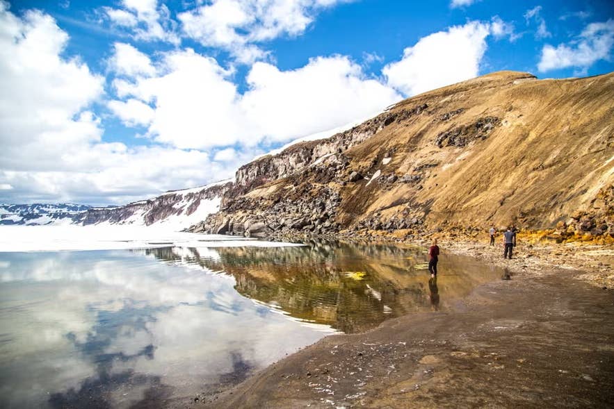
The Lake Myvatn region in North Iceland offers hikes for all levels, from easy lakeside walks to longer climbs through lava and geothermal landscapes. Located in one of Iceland’s most active volcanic areas, it features craters, lava fields, and steaming hot springs, all within a short drive.
If you want to end your hike with a soak in geothermal water, a Myvatn hiking and Earth Lagoon tour combines a guided walk in the Myvatn area with a stop at a hot pool.
Top trails around Lake Myvatn:
-
Hverfjall Crater Rim Trail: A 2.8-mile (4.5-kilometer) loop around a massive cone with sweeping views over Lake Myvatn. The initial ascent is steep, but the rim path is flat.
-
Dimmuborgir Lava Field: A 45- to 60-minute walk through a maze of towering lava pillars, arches, and caves. Color-coded trails start at the main parking lot, with options from 10-minute walks to 2-hour hikes.
-
Skutustadagigar Pseudocraters: A flat 1.1-mile (1.8-kilometer) loop through grassy pseudocraters along the southern shore just off Route 848. There is also the longer 1.9-mile (3-kilometer) loop that circles the Stakholstjorn Pond.
-
Hofdi Peninsula: An easy walking trail through a birch forest to a lakeshore lined with unique rock pillars rising out of the water.
-
Krafla and Leirhnjukur Lava Field: This area has trails through fumaroles, mud pots, and the turquoise pool at Viti Crater. Join an Askja Highland super jeep tour to reach the remote volcanic deserts that are only accessible in summer.
The Best Hikes in the Westfjords of Iceland
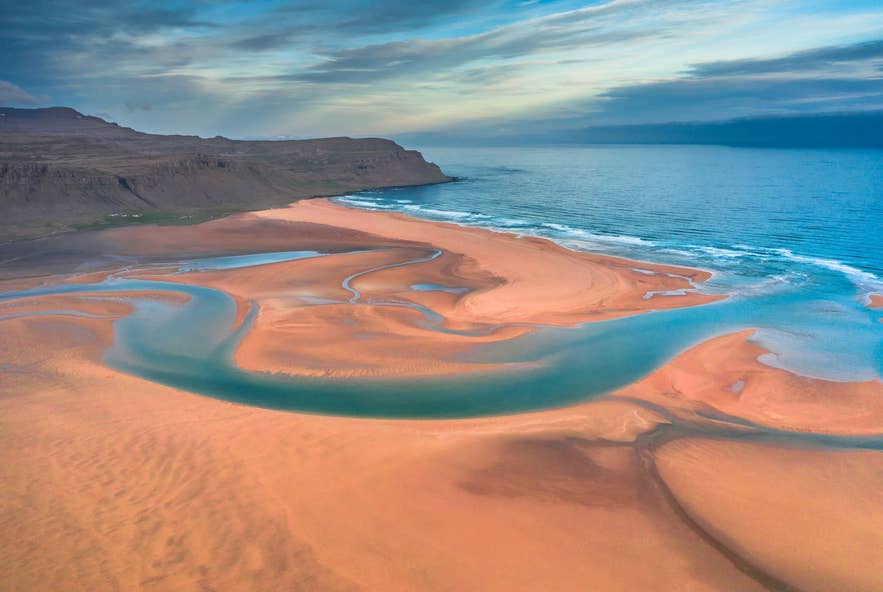
Discover the hidden gems of Iceland’s Westfjords and explore some of the best hikes in this remote region. Explore dramatic fjords and steep bird cliffs on trails ranging from easy day walks to longer backcountry routes, perfect for hikers seeking solitude and untouched nature.
Hiking the Hornstrandir Nature Reserve
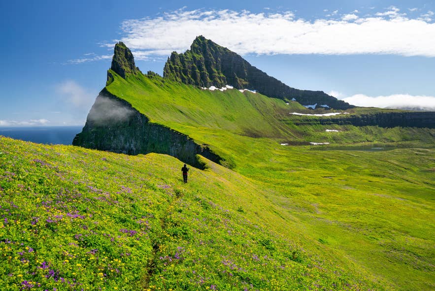
The Hornstrandir Nature Reserve in the Westfjords is one of Iceland’s most isolated regions. Only reachable by boat from Isafjordur, the area lets you explore roadless landscapes, see nesting puffins, and spot protected Arctic foxes in their natural habitat.
Camping is the only overnight option, so you’ll need to bring all food, gear, and supplies. Stays are allowed only at marked campsites. For a smoother experience, consider joining a guided 2-day hiking and wildlife tour in Hornstrandir Nature Reserve and Hornvik Bay.
Note: Arctic foxes often approach hikers and campsites. Never feed them and keep a respectful distance.
-
Distance: 34 miles (55 kilometers)
-
Elevation Gain: 2,953 feet (900 meters)
-
Duration: Varies depending on the route
-
Difficulty: Challenging
How to Reach Hornstrandir Nature Reserve
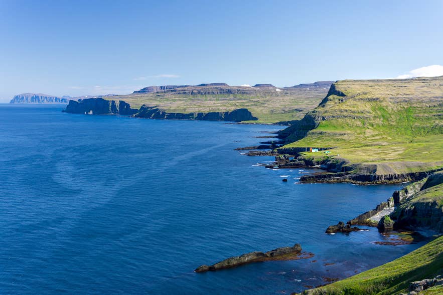
Hornstrandir is only reachable by boat from one of two departure points:
-
Isafjordur: The main port for Hornstrandir crossings.
-
Bolungarvik: A smaller alternative departure point.
Most boats land at Hesteyri, the main starting point for exploring the reserve. Book accommodations in the Westfjords in advance for your nights before and after the trek.
Three-Day Hornstrandir Itinerary
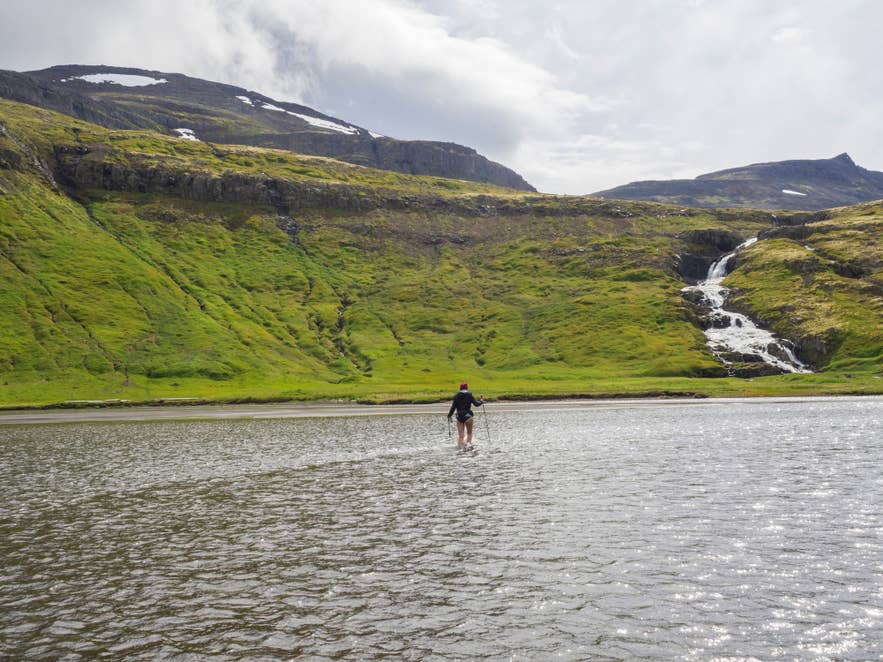
This three-day route covers Hornstrandir’s highlights, from remote bays and mountain passes to the famous Hornbjarg Cliffs.
Day 1: Hesteyri to Hloduvik Bay
Hike 9 miles (15 kilometers) from Hesteyri Harbor to Hloduvik Bay in four to six hours. Camp overnight by the bay.
Day 2: Skalarkambur Mountain and Hornvik Bay
Climb Skalarkambur Mountain for fjord views, then descend through Rekavik Bay to Hornvik Bay. For a longer day, continue to the old farm at Horn near Hornbjarg, a 1,640-foot (500-meter) sea cliff known for nesting seabirds. Follow marked paths, as fog is common.
Day 3: Hornvik Bay to Veidileysufjordur
Cross the mountain pass from Hornvik Bay into Veidileysufjordur, where a boat returns you to the mainland. In Isafjordur, book a table at Tjoruhusid for a dinner to close out the trip.
The Best Hiking Trail in the Snaefellsnes Peninsula
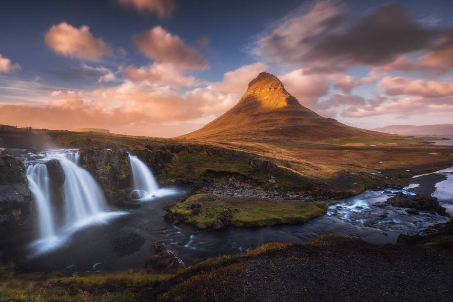
The Snaefellsnes Peninsula’s main hiking trail runs along its coastline through volcanic terrain. From short walks to more demanding routes around the Snaefellsjokull Glacier, these trails offer some of the most rewarding hiking experiences in Iceland.
Arnarstapi to Hellnar Hike in the Snaefellsjokull National Park
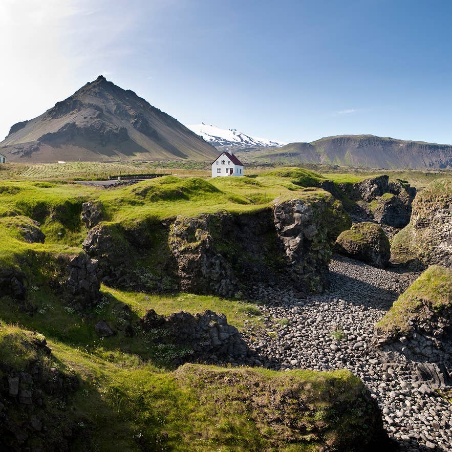
In Snaefellsjokull National Park, a coastal trail connects the villages of Arnarstapi and Hellnar. The path follows sea cliffs and lava formations, passing arches, basalt columns, and glacier views. The terrain is mostly flat, with some narrow or uneven sections.
Parking is available in both towns, and the trail is easy to follow. If you don’t have transport at the other end, you’ll need to walk back the same way. Nesting seabirds are common in summer, so stay on marked paths to protect the coastline.
-
Distance: 1.9 miles (3.1 kilometers)
-
Elevation Gain: 120 to 177 feet (35 to 54 meters)
-
Duration: One hour
-
Difficulty: Easy
The Best Hiking Trails on the Reykjanes Peninsula
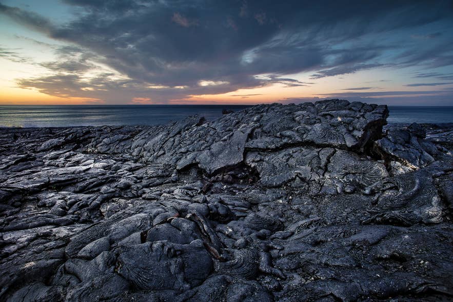
The Reykjanes Peninsula is where most travelers begin or end their Iceland trip. This region is home to Keflavik International Airport, the Blue Lagoon, the Bridge Between Continents, and the Krysuvik Geothermal Area.
The recent volcanic eruptions in the Reykjanes Peninsula brought this region into the global spotlight in 2021. Trails lead through geothermal fields, lava fields, caves, mountains, and coastal cliffs, offering plenty of variety in a compact area.
Reykjanes Eruption Sites Hike
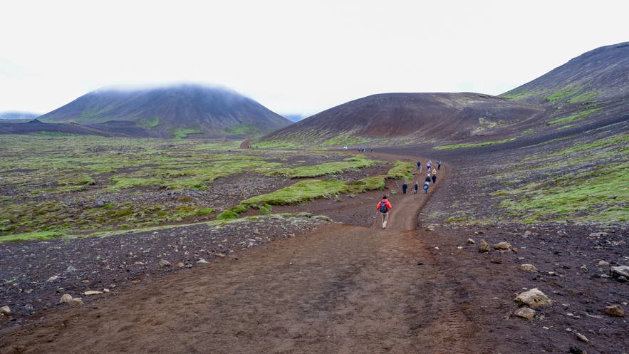
The eruption areas within the Fagradalsfjall volcanic system offer some of the most striking terrain on the Reykjanes Peninsula. Trails take hikers past the 2021 Geldingadalir lava, the 2022 Meradalir flows, and the 2023 Litli-Hrutur Crater.
The recent volcanic eruptions on the Reykjanes Peninsula have reshaped the terrain, so always check current conditions before setting out. Hikers should only visit in stable weather and follow all marked paths and safety guidance.
-
Distance: Varies by active trail
-
Elevation Gain: Varies by active trail
-
Duration: One to four hours
-
Difficulty: Moderate to Challenging
Keilir Mountain Hike
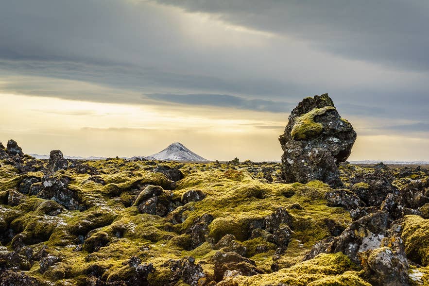
One of the most popular and accessible hikes on the Reykjanes Peninsula is hiking to Keilir Mountain. The cone-shaped peak rises above the surrounding lava field and sits between Reykjavik and Keflavik International Airport, so it suits travelers with only half a day to spare.
A steep climb up loose volcanic rock to the summit. Trekking poles help with footing on the way up and down. Strong winds and low visibility are common, so attempt the summit only in clear weather and stay on the marked route.
-
Distance: 4.4 miles (7.1 kilometers)
-
Elevation Gain: 1,148 to 1,246 feet (350 to 380 meters)
-
Duration: Two to three hours
-
Difficulty: Moderate
Hafnir Town to Hafnarberg Sea Cliffs Hike
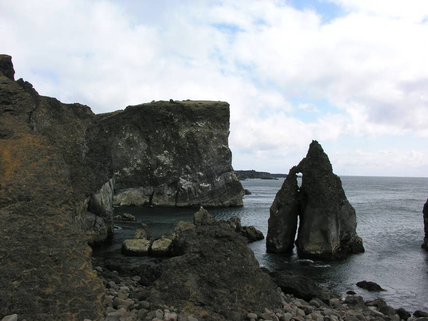
Another hiking trail in the Reykjanes Peninsula runs from Hafnir fishing settlement to Hafnarberg Cliffs on the western coast. The cliffs are a popular birdwatching site, with nesting razorbills, fulmars, guillemots, and kittiwakes in summer.
The cliffs also offer chances to see whales, dolphins, and seals offshore. Stay back from the edge, as the rocks can be unstable.
The route also passes the Bridge Between Continents, a 49.2-foot (15-meter) walkway over the rift between two tectonic plates. Plaques on each side read “Welcome to America” and “Welcome to Europe.”
-
Distance: 8 miles (12.8 kilometers)
-
Elevation Gain: 200 feet (61 meters)
-
Duration: 3–4 hours
-
Difficulty: Easy
Best Glacier Hikes in Iceland
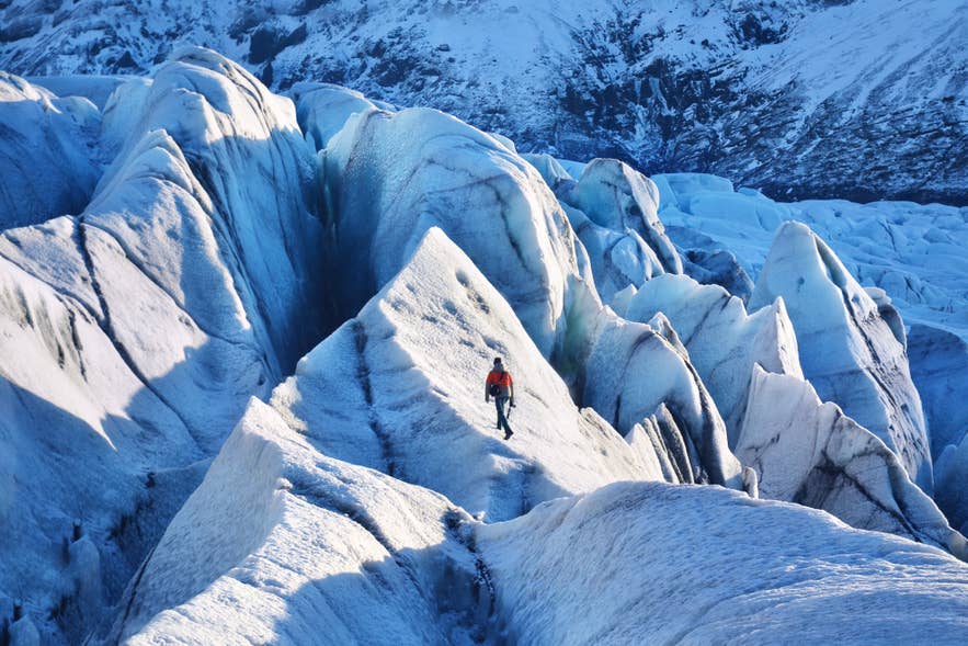
Glacier hiking takes you across ice formations, crevasses, and frozen terrain on Iceland’s outlet glaciers. Guided glacier hiking tours supply the safety gear, crampons, and expert guidance that make the activity accessible to beginners.
Unlike the marked trails above, a glacier hike is not a route you can walk on your own, and every one of these has to be booked with a guide. Guided glacier hikes start at around 12,900 ISK (107 USD) for a short route and run to 33,500 ISK (277 USD) for hikes that add ice climbing, and our comparison of Iceland’s glacier hiking tours sets out what each price band buys.
Hvannadalshnukur Hike in Vatnajokull National Park
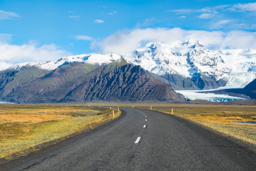
Hvannadalshnukur is Iceland’s most demanding glacier hike. The summit stands at 6,923 feet (2,110 meters), making it the country’s highest peak, and the route climbs through hard ice and snow on the Oraefajokull Glacier.
This challenging hike is attempted only in late spring and summer, when conditions are stable. Hikers wear a harness and travel roped together due to deep crevasses along the route. Previous glacier experience and experienced mountain guides are recommended.
-
Distance:18 miles (28.6 kilometers)
-
Elevation Gain: 6,920 feet (2,110 meters)
-
Duration: 12 to 15 hours
-
Difficulty: Challenging
Svinafellsjokull Glacier Hike
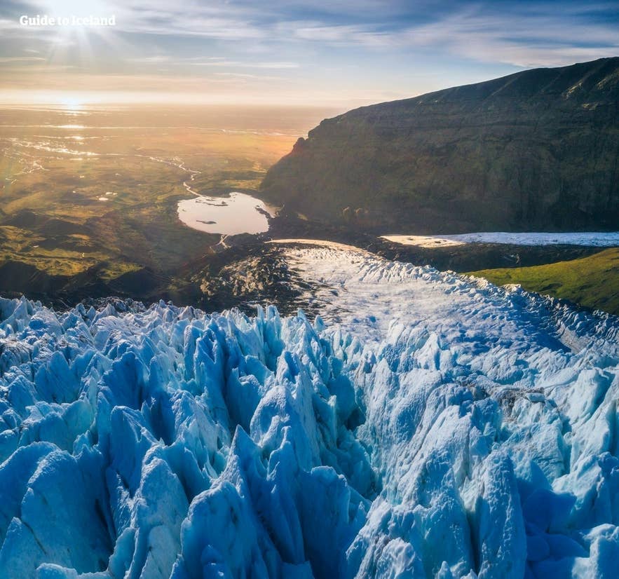
Svinafellsjokull, an outlet glacier of Vatnajokull, has sharp ridges, deep crevasses, and sweeping ice formations. The higher routes open views over neighboring glaciers and peaks.
Slopes near glacier edges are unstable, so access is only possible with certified guides in monitored areas. Winter is popular for its bright blue ice and seasonal ice caves. Many visitors join a guided glacier hike on Vatnajokull, which follows short routes.
-
Distance: Usually 1.4–2.0 miles (2.3–3.2 kilometers)
-
Elevation Gain: 173 feet to 213 feet (53 to 65 meters)
-
Duration: 3 to 5 hours
-
Difficulty: Moderate
Falljokull Glacier Hike
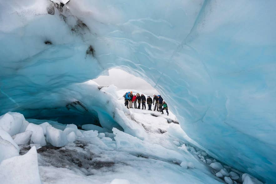
The Falljokull Glacier is called the “falling glacier” because its massive ice falls make for a stunning sight. It’s an outlet of the Oraefajokull Glacier in South Iceland, which itself is part of the larger Vatnajokull Glacier.
Guided glacier hike on Falljokull takes you through crevasses, ice ridges, and frozen landscapes. Because this glacier moves quickly, tours adjust their routes based on daily conditions. The hike requires a good level of fitness due to uneven terrain.
-
Distance: Usually 1–3 miles (1.5–5 kilometers)
-
Elevation Gain: 577 to 1,312 feet (176 to 400 meters)
-
Duration: 3 to 5 hours
-
Difficulty: Challenging
Solheimajokull Glacier Hike
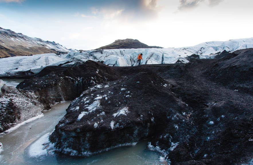
The Solheimajokull Glacier in South Iceland is the closest glacier to Reykjavik and the most popular beginner-friendly option. It sits near Eyjafjallajokull Volcano, which is often visible from the ice on clear days.
With no tall peaks nearby, Solheimajokull opens up wide views from the glacier itself. The ice texture also makes it a good site for ice climbing. You can glacier hike on Solheimajokull with a guide, or combine it with ice climbing tours for a more adventurous trip.
-
Distance: 2.1 miles (3.4 kilometers)
-
Elevation Gain: 490 to 660 feet (150 to 200 meters)
-
Duration: 2 to 4 hours
-
Difficulty: Easy to Moderate
Skaftafell Glacier Hike
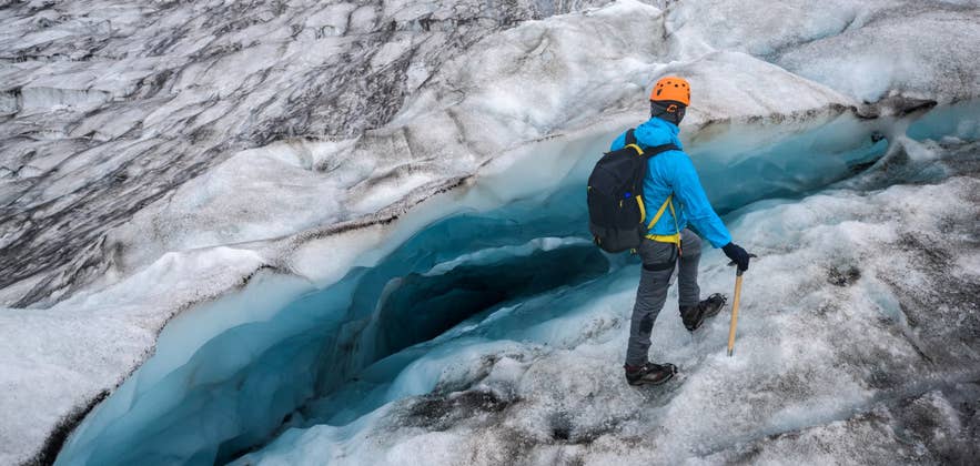
Skaftafell, within Vatnajokull National Park, is a popular destination for glacier hikes in Iceland. It sits at the foot of outlet glaciers like Falljokull and Svinafellsjokull, with operators usually meeting hikers at the parking area before a short drive to the ice.
A glacier hike from Skaftafell crosses blue ice, deep crevasses, and meltwater channels that shift with the seasons. The terrain ranges from broad, walkable ice tongues for beginners to steep sections for stronger hikers, so most fitness levels are covered.
Note: Skaftafell tours run year-round, but winter visits offer the clearest blue ice and possible access to seasonal ice caves. Guided tours include crampons, harness, helmet, and ice axe. Wear sturdy ankle-supporting boots and bring warm, waterproof layers.
-
Distance: 1.5 to 7 miles (2.4 to 11 kilometers)
-
Elevation Gain: 492 to 820 feet (150 to 250 meters) on shorter guided tours; 1,150 to 3,986 feet (350 to 1,215 meters) on the challenging routes
-
Duration: 1 to 2 hours
-
Difficulty: Easy to Challenging
What to Pack for a Hike in Iceland
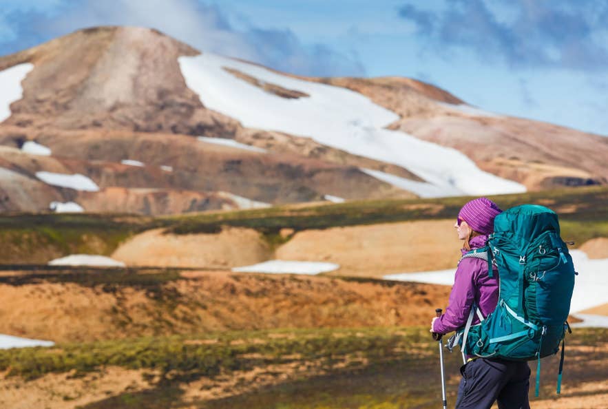
After you choose your hikes, ensure you know what to pack for Iceland in any season. The items you bring should help you stay warm and comfortable throughout your hike. Iceland’s weather can change quickly, so knowing what to wear in Iceland is essential.
Build a three-layer system when hiking in Iceland:
-
Base layer: moisture-wicking merino wool or synthetic fabric.
-
Mid-layer: fleece, Icelandic wool, or a light down jacket.
-
Outer shell: a waterproof, windproof jacket and rain pants.
Essential packing list for all hikes in Iceland:
-
Sturdy hiking boots: Iceland’s terrain demands good shoes with ankle support.
-
Scarf, gloves, and hat: For added warmth and wind protection.
-
Water bottle: It’s recommended to bring 0.26 gallons (one liter) for a two-hour hike. More is needed for strenuous hikes.
-
Snacks: Energy gel for more challenging hikes and granola bars for lighter hikes.
Additional packing items for difficult hikes in Iceland:
-
Backpack: A 20- to 30-liter waterproof daypack with a hip strap and a rain cover.
-
Map and compass or GPS device: Essential for navigation, especially in remote areas.
-
First aid kit: Including bandages, blister pads, pain relievers, and any personal medications.
-
Trekking poles: These are helpful for stability on uneven terrain and during river crossings.
-
Headlamp or flashlight: Pack extra batteries during the long nights in winter.
If your trip includes time on the ice, read our guide on what to wear for glacier hikes in Iceland, as you’ll need crampons and extra layers. These lists are not exhaustive, but they cover the basics for a safe and comfortable hike in Iceland.
Experience the Ultimate Hiking in Iceland

Don’t wait any longer to start planning your hiking experience in Iceland and explore the beauty of the land of fire and ice for yourself. With such diverse landscapes and scenery, you’re sure to find hiking trails that match your skill level and personal preferences.
Is it safe to hike in Iceland?
Many trails are remote, which makes good planning essential. Before you set off, register your travel itinerary with the SafeTravel Iceland Plan Tracker. If an emergency occurs, the information can help rescue teams locate you more quickly.
How difficult are glacier hikes in Iceland?
Are crampons needed for hiking in Iceland?
You can rent a crampon from outdoor equipment shops if trail conditions require them. However, if you join glacier hiking tours, your guide will provide all the necessary safety equipment as part of the tour.
Can I take lava rocks I find on hikes?
Is a permit needed to hike in Iceland?
What is the most popular hiking trail in Iceland?
When is the best time to hike in Iceland?
Do you need a guide to hike in Iceland?
Did you enjoy our article about hiking in Iceland? What hiking routes would you want to experience during a visit? Please feel free to share any thoughts or questions you might have in the comment section below

I’m Icelandic but grew up abroad, and returned as an adult to reconnect with my roots. I have a soft spot for scenic drives, peaceful geothermal spas, and the little details that turn a good trip into a great one. Here, I share all my best tips with you!