

説明
まとめ
説明
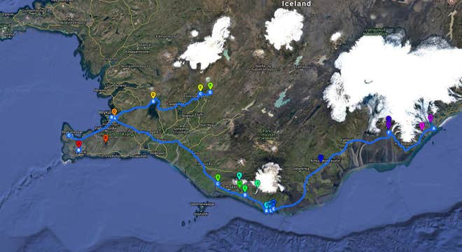
5日間かけて冬の南アイスランドを巡るアドベンチャーです。ガイドが案内する1泊2日南海岸ツアーと、ゴールデンサークルのセルフドライブを組み合わせました。レイキャビク自由行動タイムもあります。冬のアイスランドでたくさん運転するのは不安、だけどドライブにもちょっとだけ挑戦したいという方にぴったり!
アイスランドにはたくさんの美しい場所があり、5日間でどこを訪れるべきか迷ってしまうほど。このプランなら、プロが選び抜いた名所を効率よく回ることができます。宿やレンタカーもついているので安心です。
ご予約確定後に詳細な旅程表をお送りします。サポートは24時間年中無休。旅行中も困ったことがあれば何でも担当者にご相談ください。
訪れるのはブルーラグーン温泉、天然の氷河の洞窟、滝や黒砂海岸、間欠泉、二つの国立公園など。レイキャビク観光もできます。
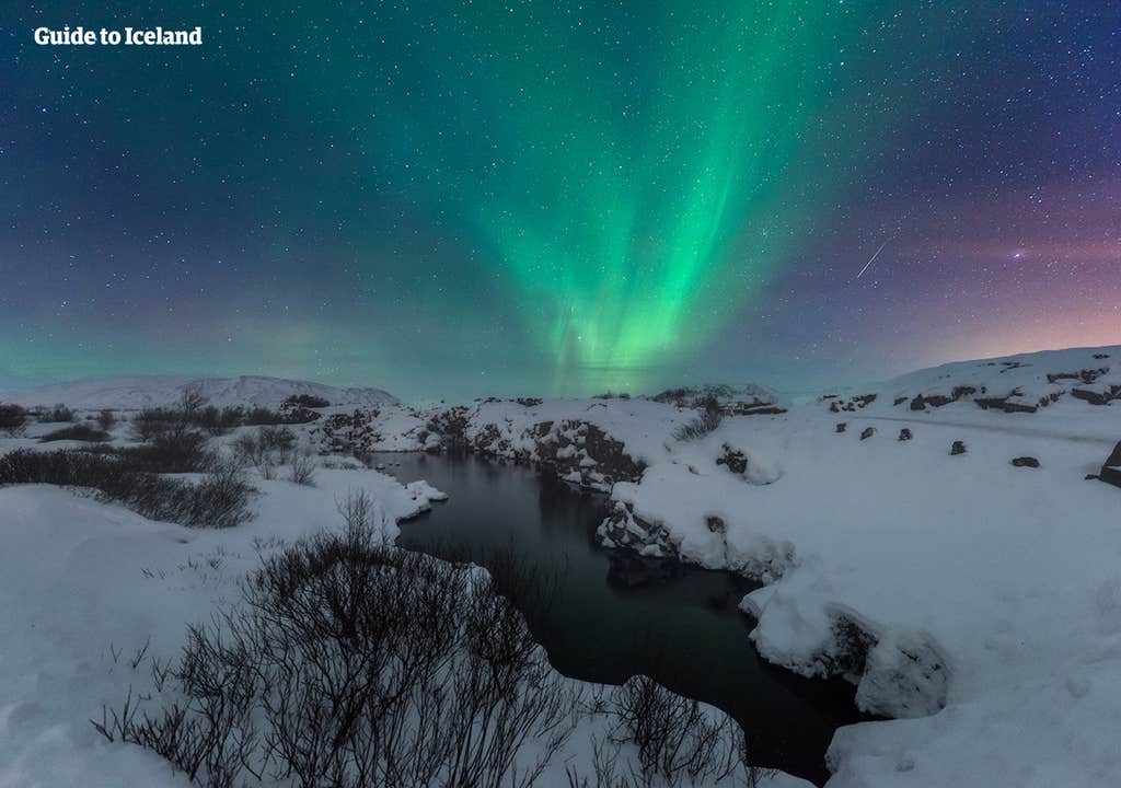
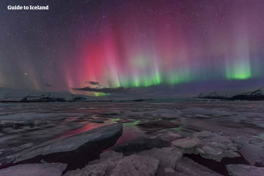
そして冬のアイスランドといえばオーロラ。4泊5日の旅行では、4回鑑賞のチャンスがあります!
観光だけで物足りない方は有料オプションのアクティビティを追加してください。氷河スノーモービル、地熱谷を歩く乗馬ツアー、二つの大陸プレートの間を泳ぐシュノーケリング体験からお選びいただけます。
開始場所はケプラヴィーク国際空港です。ご到着時にレンタカーをお受け取りください。宿泊先はレイキャビク中心部のホテルでをご用意しております。
4日目はレンタカーでゴールデンサークル観光に挑戦です。シンクヴェトリル国立公園、ゲイシール地熱地帯、グトルフォスの滝を訪れることができます。
旅程表は観光情報もたっぷり掲載していますので、ガイドブックのようにお使いいただけます。キャンセルはご出発24時間前まで無料です。
バスツアーとセルフドライブを組み合わせた冬のアイスランド4泊5日の旅のご予約はこちらから!カレンダーで日付を選択すると空き状況をご確認いただけます。


