
説明
まとめ
説明
9日間でアイスランドを一周するレンタカー旅で、一生に一度の素晴らしい旅をお楽しみください。有名なリングロードを走り、途中で美しいスナイフェルスネス半島も探索できます。
白夜と呼ばれる真夜中の太陽、珍しい氷の洞窟、力強い滝、そして素晴らしい野生動物との出会いなど、忘れられない体験がアイスランドであなたを待っています。
ツアーご予約後にお送りする旅程表は、アイスランドの人気スポット、隠れた名所、寄り道する価値のある場所を全てカバーしておりますが、ご希望に合わせてカスタマイズも可能です。そしてこのレンタカーパッケージには、新しいレンタカーはもちろん、8泊分の宿泊施設も含まれています。
もう、慣れない国の旅程を計画するストレスとは無縁です!アイスランド旅行の専門家に旅の手配はお任せいただくことで、観光の時間を最大限に活用し、自由に、そして柔軟にこの国の魅力を探検していただけます。
この9日間の旅には、ブルーラグーン、ゴールデンサークル、南海岸、東部フィヨルド、北部地域、スナイフェルスネス半島などの有名な目的地はもちろんのこと、まだあまり知られていない穴場スポットも含まれています。
旅はゴールデンサークルの景観ルートから始まります。ここではシンクヴェトリル国立公園、噴出するストロックル間欠泉、そして力強いグトルフォス滝に出会えます。
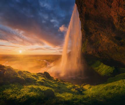
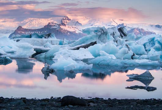
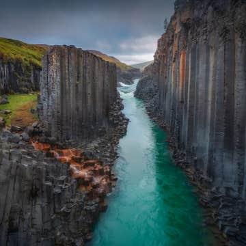
そこから南海岸に沿って進みます。この区間には、スコゥガフォス滝、レイニスフィヤラの黒い砂浜、そして近くのダイヤモンドビーチに向かって流れる氷山が浮かぶ夢のようなヨークルスアゥルロゥン氷河湖といった印象的な景色が広がっています。
アイスランド東部はより静かな雰囲気で、曲がりくねった海岸道路、穏やかなフィヨルドの景色、そして一般的な観光ルートから離れた小さな漁村が待っています。この地域は、ゆっくりと景色を楽しみたい方に特におすすめです。
北部では、ミーヴァトン湖の周りに火山地形が広がり、ゴーザフォス滝、アウスビルギ渓谷、そしてアークレイリでは自然の不思議と地元文化の融合を楽しめます。絵のように美しいフーサヴィークも、ホエールウォッチングシーズンには特に訪れる価値があります。
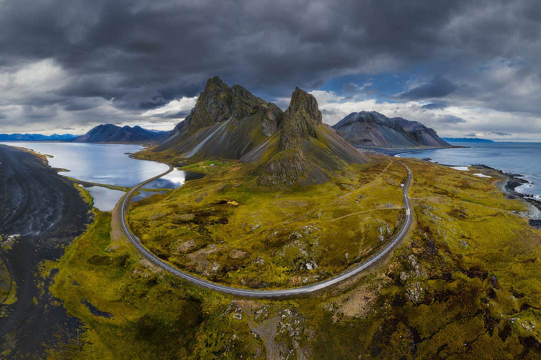
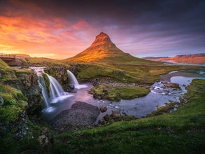
最後の区間は、多様な景観と劇的な海岸線で知られるスナイフェルスネス半島です。キルキュフェットル山、イートゥリ・トゥンガのビーチ、スティッキスホゥルムルの村、そして氷河に覆われたスナイフェルスヨークトル氷河の火山が見どころです。
ガイド付きツアーのように、厳密なスケジュールやグループの他の参加者に気を遣うこともありません。いつ到着し、どれくらい滞在し、次にどこへ行くかはあなた次第。アイスランドを、完全にあなたの好きなように旅していただけるのが最大の特徴です。
実際にご利用いただいたお客様から高い評価をいただいているこのセルフドライブツアーでは、ご予約時にさまざまなオプショナルツアーを割引価格で追加いただけます。夏のアイスランドは日照時間がほぼ24時間あるため、アイスランドの夏を最大限に楽しめます。ラングヨークトル氷河でのスノーモービル、南海岸での氷河ハイキング、氷の洞窟への探検、ヨークルスアゥルロゥン氷河湖でのボートツアー、また、フーサヴィークでのホエールウォッチングや、リングロード沿いの複数の場所での乗馬ツアーなど、多様な選択肢からお選びいただけます。
さらにこのツアーには、24時間365日利用可能な旅行コンシェルジュサービスが付いています。旅程に関するご質問やオプショナルツアーに関するお問い合わせなど、どうぞ遠慮なくご利用ください。そして予期せぬ旅行計画の変更があった場合でもご安心ください。出発24時間前までのキャンセルなら、キャンセル料無料で全額返金させていただきます。
美しい滝を追いかけ、壮大な氷河を歩き、白夜を体験する。9日間で夏のアイスランドが持つ多様な魅力を大満喫できるレンタカーの旅、セルフドライブツアー。ご希望の日程をお選びいただき、空き状況をご確認ください。


