
説明
まとめ
説明
冬の南海岸を巡る、究極の3日間セルフドライブツアーでアイスランドを自由に探検してみませんか!冬のアイスランドを満喫するなら、この3日間のセルフドライブツアーがおすすめです。面倒な計画は不要。オーロラや氷の洞窟、氷河湖、ブラックサンドビーチなど、感動的な景色の数々を自分のペースで楽しむことができます。
この冬のパッケージには、レンタカーと2泊分の宿泊が含まれており、ご予算やご希望に応じてアップグレードも可能です。観光地の詳細やおすすめの立ち寄りスポット、オプショナルアクティビティなどを盛り込んだ充実の旅程表もご用意。南アイスランドの見どころを余すことなくご案内します。
旅のスタートはケプラヴィーク国際空港またはレイキャビクから。最新モデルの広々としたレンタカーには無料Wi-Fiも完備されており、快適にドライブを楽しめます。
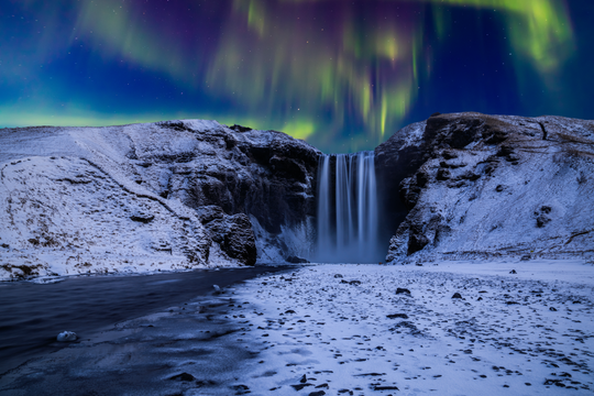
1日目は、南海岸の代表的な観光地を巡ります。セリャラントスフォス滝やスコゥガフォス滝、レイニスフィヤラのブラックサンドビーチ、そしてヴィーク村など、アイスランドを代表する絶景スポットを心ゆくまでご堪能ください。
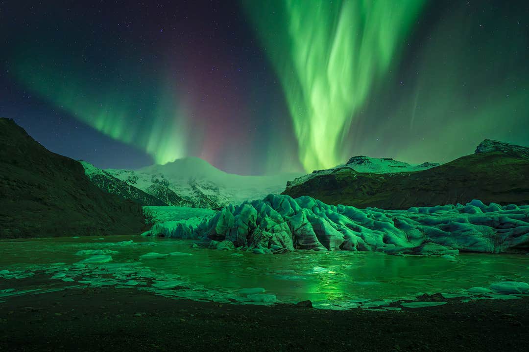
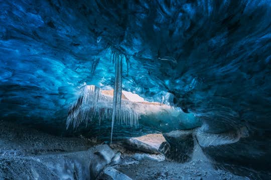
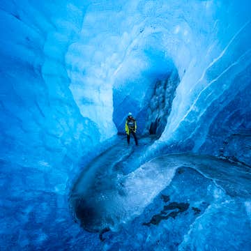
2日目は、この旅のハイライト。ヨークルスアゥルロゥン氷河湖を訪れ、ヨーロッパ最大の氷河・ヴァトナヨークトル氷河での氷の洞窟探検にも参加できます。専属ガイドと合流し、スーパージープに乗って雪原を走り抜け、幻想的な氷の世界へと足を踏み入れます。
3日目は、氷河湖周辺をさらに探索した後、レイキャビクへ戻ります。ダイヤモンドビーチを散策したり、スヴァルティフォス滝へのハイキングを楽しんだり、スカフタフェットル自然保護区(でのガイド付き氷河ハイキングに参加することも可能です。
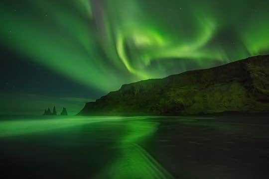
そして夜は毎晩、オーロラ鑑賞のチャンス。特に国立公園周辺は人工の明かりが少なく、視界が開けているため、オーロラ観測には最適です。空が晴れていて磁気活動が活発な夜には、夜空を舞う美しいオーロラを目にすることができるでしょう。
この冬の旅程は、現地在住の旅行専門家チームがアイスランドの冬の天候と日照時間を考慮して丁寧に設計。安心してアイスランドの魅力を体感していただけます。
さらに、24時間対応の旅行コンシェルジュサービス付きで、出発前も旅の途中もスムーズにプラン変更が可能。出発の24時間前までなら、全額返金でのキャンセルもOKなので、急な予定変更にも対応できます。
氷の洞窟、氷河、そして秘境の数々。
この3日間のセルフドライブツアーで、“火と氷の国”アイスランドの冬をまるごと体験してみませんか?
ご希望の日程をお選びいただき、空き状況をご確認ください。


