
説明
まとめ
説明
夏のアイスランドを満喫できる、南海岸を巡る2日間のガイド付きツアーです。美しい自然と、太陽が沈まない白夜の魔法に包まれながら、滝や氷河、黒砂のビーチ、そしてヨークルスアゥルロゥン氷河湖など、アイスランドを代表する絶景スポットを訪れます。
ご家族連れにも安心のゆったりとしたペースで進むこのツアーは、年齢問わず誰もが楽しめる内容となっています。現地の専門家によって綿密に組まれた日程で、アイスランドの魅力を効率よく、かつ印象深く体験できます。
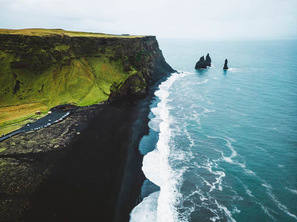
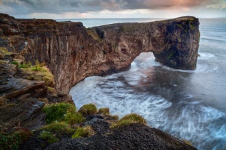
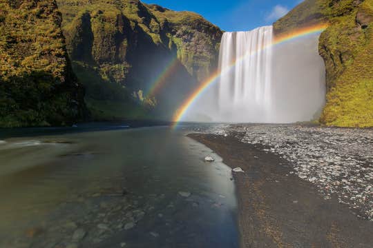
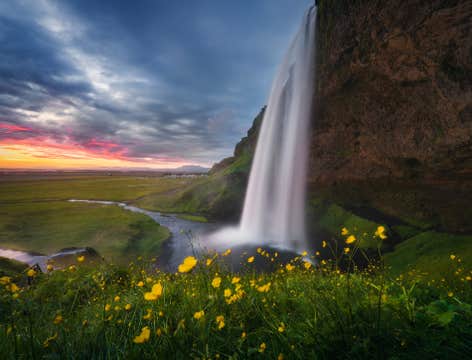
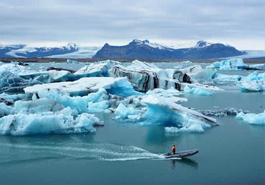
セリャラントスフォスの滝やスコゥガフォス滝、ミールダルスヨークトル氷河、レイニスフィヤラの黒砂海岸など、南海岸を代表する観光名所を訪れます。また、ヨークルスアゥルロゥン氷河湖ではヴァトナヨークトル氷河の壮大な景色もお楽しみいただけます。
移動は少人数グループでの快適なミニバス移動。英語を話すプロフェッショナルガイドが同行し、アイスランドの自然や歴史にまつわる話を交えながら案内してくれます。質問にも気軽に応じてくれるので、より深くアイスランドを知ることができます。
さらに、旅を一層特別なものにするオプション体験も追加可能です。たとえば、ヨークルスアゥルロゥン氷河湖では、水陸両用ボートに乗って氷山の間を進むクルーズをお楽しみいただけます。
宿泊は、厳選されたカントリーサイドの宿で1泊。旅の疲れを癒し、翌日に備えてゆっくりとお過ごしください。レイキャビクからの往復送迎、手荷物1点分のスペースも含まれており、移動もスムーズです。
この夏限定のツアーは、出発から帰着までしっかりサポート付き。無料キャンセル・全額返金保証付きなので、予定変更があっても安心です。
アイスランドの魅力をお得に、効率よく、そして忘れられない体験として味わえるこのツアー。ぜひこの夏、南海岸の宝石のような絶景を巡る冒険に出かけましょう。
ご希望の日程をお選びいただき、空き状況をご確認ください。


