The beautiful Brúarfoss Waterfall - is this the bluest River in Iceland
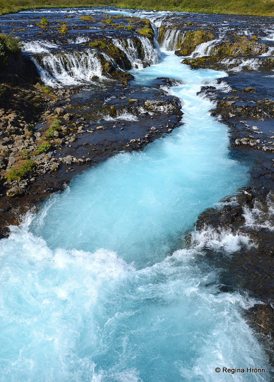
In this travel blog, I want to show you one of the most beautiful waterfalls in Iceland, the powdery blue Brúarfoss waterfall which runs in the spring-fed river Brúará, which I like to call the bluest river in Iceland.
Top photo: Brúarfoss waterfall
Hlauptungufoss waterfall
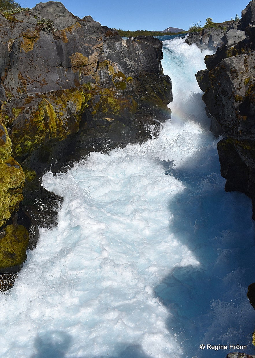 Hlauptungufoss waterfall
Now, let's start the hike to the waterfall and hike for a while in Iceland's pristine nature on the east side of Brúará river. Along the way, you will see a couple of smaller waterfalls.
The hike to Brúarfoss waterfall is 3.5 km long one way and the latter part of it takes you alongside the powdery blue Brúará river. One part of the hike will take you through a small forest.
Brúará river is a spring-fed river originating at 430 m.a.s.l. above Brúarárskörð on Rótarsandur south of Mt. Hlöðufell.
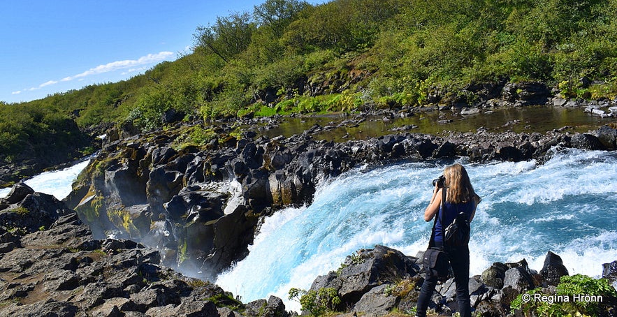
Photographing Hlauptungufoss
After the source, the river runs in the approx. 4 km long Brúarskörð gully and several spring-fed rivers merge with it along the way to Brúarfoss waterfall.
The forceful river Brúará has made potholes in the riverbed which then with time have turned into a chasm.
This makes the colours of the river powdery blue and white and these beautiful colours are enhanced by the sun.
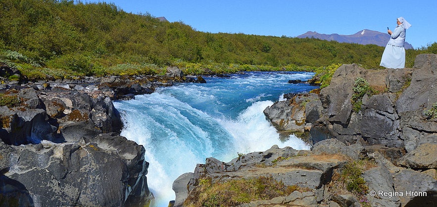 A nun dressed in powdery blue by Hlauptungufoss waterfall
Thirty minutes into the hike we reached the first waterfall in the river, the beautiful blue Hlauptungufoss waterfall, which cascades with great force into a small gully.
Fish can reach Hlauptungufoss waterfall, but they cannot jump above the approx. 4 meters tall waterfall, so this is as far as they go.
We, who live here in Iceland, have the advantage of being able to plan our hikes in accordance with the weather forecast, and we waited for a sunny day for this hike.
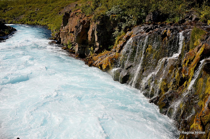 Brúará river by Hlauptungufoss waterfall
It was a warm and sunny day which made this hike one of the most memorable days of the summer.
We went on this hike during the time when we couldn't travel abroad and visited many of the sights in Iceland, that we hadn't visited for decades.
I first visited Brúarfoss waterfall decades ago when I was staying in one of the summer cottages close to the river, but had never done the whole hike before.
Miðfoss waterfall
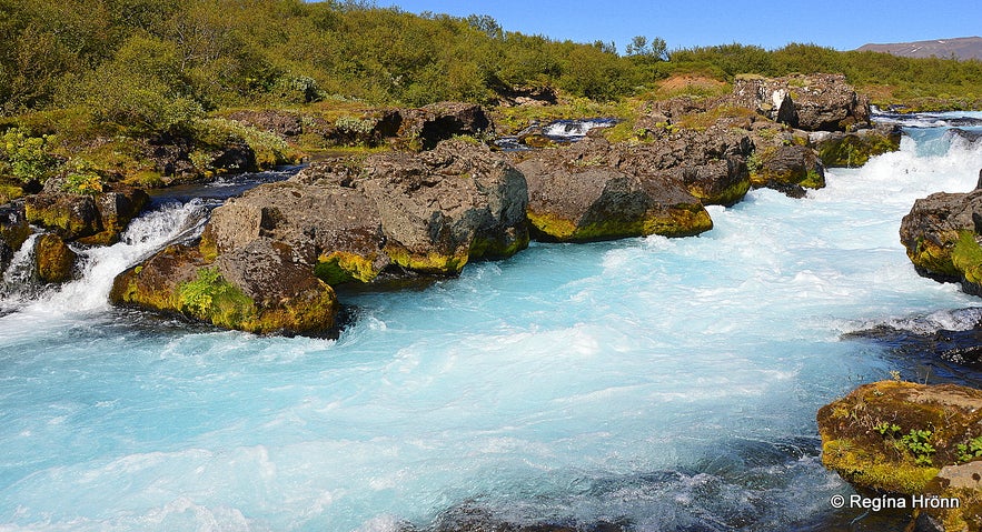 Miðfoss waterfall in Brúará river
It is a very popular hike, so you can expect the path to be crowded, but on this summer day during Covid, there were only a couple of Icelanders on this hike.
We hiked for another half a kilometer alongside the river which runs in a chasm above the Hlauptungufoss waterfall and reached another waterfall, the small Miðfoss (the Middle waterfall).
It is beautiful, but more like rapids in the river.
Take care here by the river bank when admiring or photographing the waterfall, as there has been a tragic fatal accident here, where a boy fell into the river and his father jumped in to rescue him.
He was able to push his son toward the river bank and passers-by were able to pull him out.
Sadly, the father was caught in the current in the middle of the river and went downstream with the river. Only to drown in the forceful river. This is so sad, so let's be extra careful here. We want our foreign visitors to be safe here in Iceland.
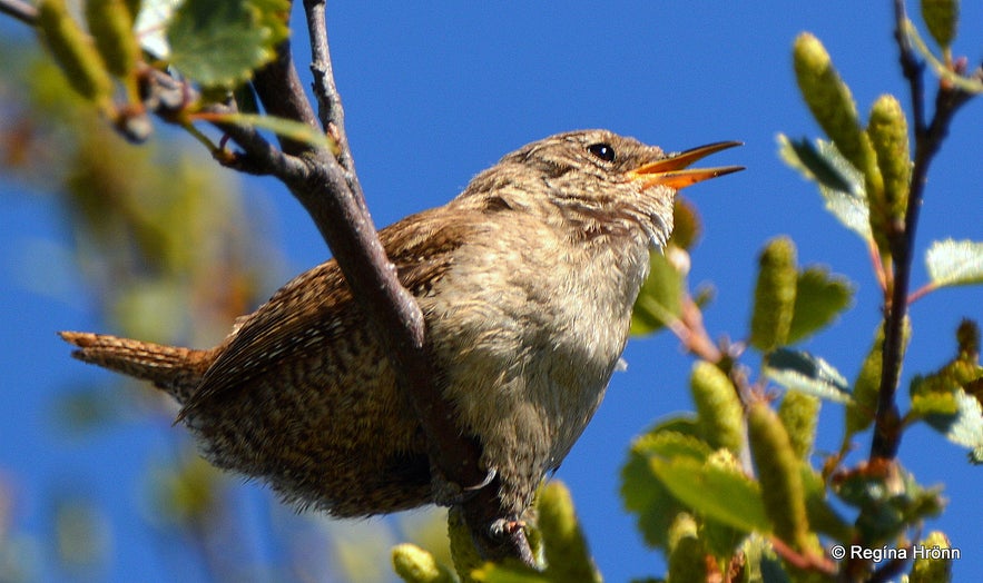
A Eurasian Wren singing by Miðfoss waterfall
When we were taking photos of Miðfoss waterfall we heard the most wonderful birdsong. We walked towards the sound and saw this tiny Músarindill - Eurasian Wren singing at the top of its lungs.
The singing was mesmerizing and added to the beauty of this day. This tiny little bird with a big voice is Iceland's second smallest bird and stays in Iceland all year long. I rarely see it on my travels in Iceland though.
The Eurasian Wren used to be our smallest bird, but then the tiniest bird in Europe, the Goldcrest settled in Iceland.
Brúarfoss waterfall
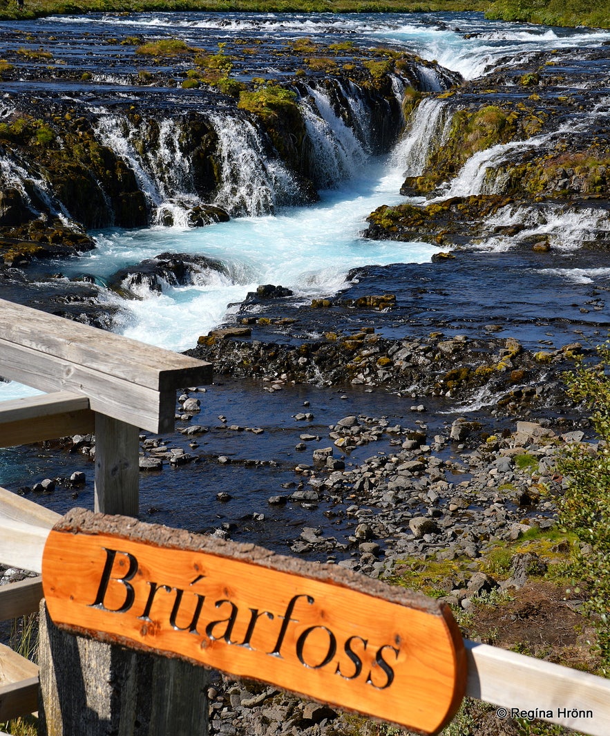 Brúarfoss waterfall
By now we were 2.5 km into the hike to Brúarfoss waterfall. The hike is rocky and can be muddy so wear good hiking shoes.
When we reach the river Fremri-Vallá which merges with the Brúará river the path leads up to a bridge where we can cross that small river.
This beautiful hike ended by the queen of Brúará, Brúarfoss, or Brúarárfoss waterfall.
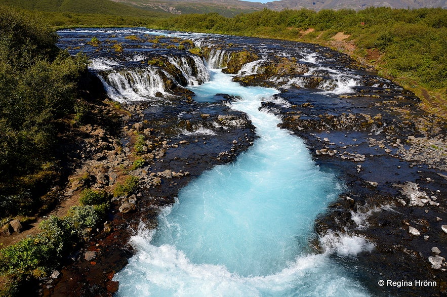 Brúarfoss waterfall as seen from the bridge
It is breathtaking watching this beautiful waterfall. It is not tall, but very picturesque. The best view of the waterfall, in my opinion, is from that bridge.
Watching Brúarfoss waterfall from above you can easily see the chasm in which the major part of the Brúará river runs.
This powdery blue pool makes Brúarfoss waterfall so picturesque. I adore this colour.
You can take a myriad of photos of Brúarfoss waterfall from different angles, but the most scenic photo must be from the bridge.
As I mentioned earlier then by Brúarfoss waterfall the river falls into a narrow chasm before it continues on its journey to the glacial river Hvítá below Skálholt Episcopal See.
Hvítá river then merges with Ölfusá, the most voluminous river in Iceland, which then runs its course to the sea in South Iceland.
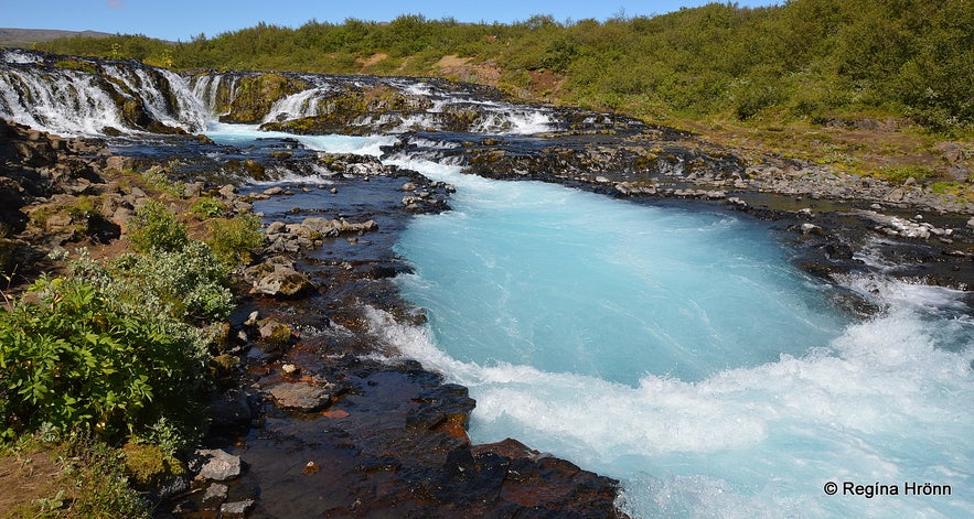
Brúarfoss as seen from below
In this location, above the waterfall, a small wooden bridge was placed so that the river could be crossed. This was a thoroughfare and people would cross the river on horses or wade the parts of the river that were not bridged.
There was a natural stone arch over Brúará but the story goes that it was destroyed so the paupers didn't have such easy access to the Episcopal See of Skálholt.
According to Biskupasögur Jóns prófasts Halldórssonar í Hítardal about the Bishops at Skálholt from years 1540-1801, there used to be a stone archway across the river, thus its name Brúarfoss - the Bridge waterfall.
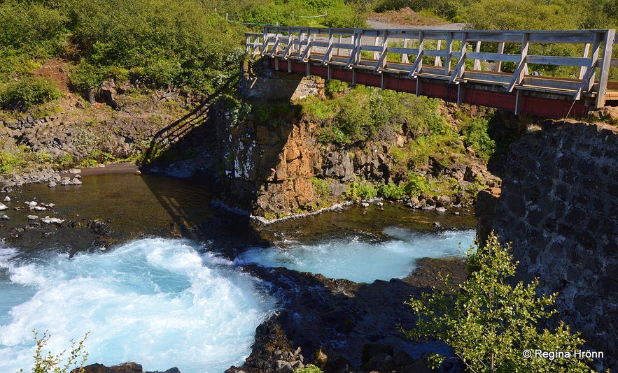 The bridge over the Brúará river
I translated the account on page 190 from Biskupasögur into English and recapitulated it as it is an old account:
"Around the year 1602 in Iceland, there were years of hardship both at land and sea. Poor and displaced people from all directions flocked to Skálholt.
The steward (bryti) at Skálholt was of the meaning that to lessen the crowds of people the natural stone arch over the river Brúará (whence it gets its name) would be destroyed.
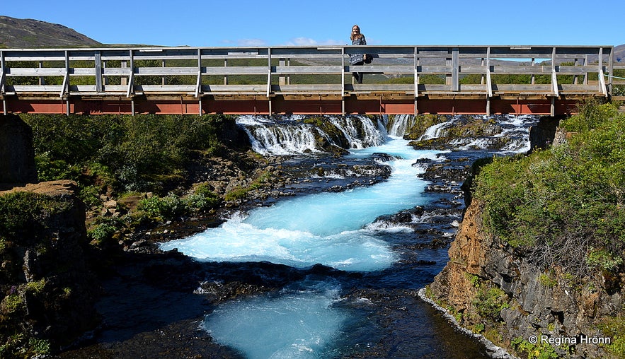 The bridge over the river Brúará below the Brúarfoss waterfall
He went to Brúará with a workforce and destroyed the stone bridge. This he did with the knowledge of the bishop's wife Helga Jónsdóttir, if not with her advice.
But this was done without the knowledge of bishop Oddur. Upon finding out about this act the bishop was livid and strongly reprimanded the steward, and said that this would mean misfortune for both the bishop and the steward.
A little later the steward of Skálholt drowned in the Brúará river".
Parts of the natural bridge can still be seen under the wooden bridge, I believe.
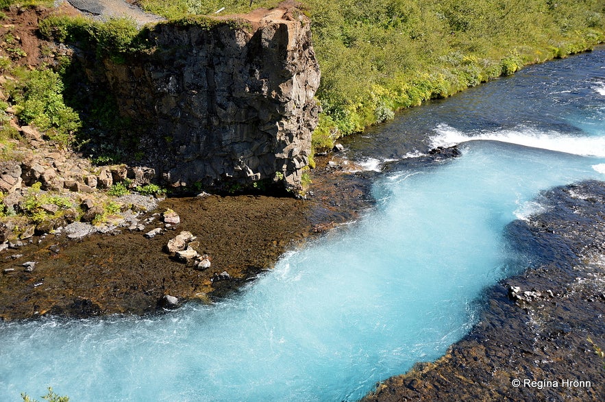 The river also runs in a deep chasm here right after it cascades into Brúarfoss waterfall
Another bishop, the Danish Jón Gerreksson, was drowned in the Brúará river on the 20th of July, 1433.
This execution took place way below Brúarfoss waterfall, next to Skálholt episcopal see by Spóastaðir in Biskupstungur (Áfangar - aftökustaðir).
Jón was known for his atrocities and drowning him, which seems to be a very harsh thing to do, seems to have been the only way to stop him and his men.
See also: The historic Skálholt Episcopal See in South Iceland.
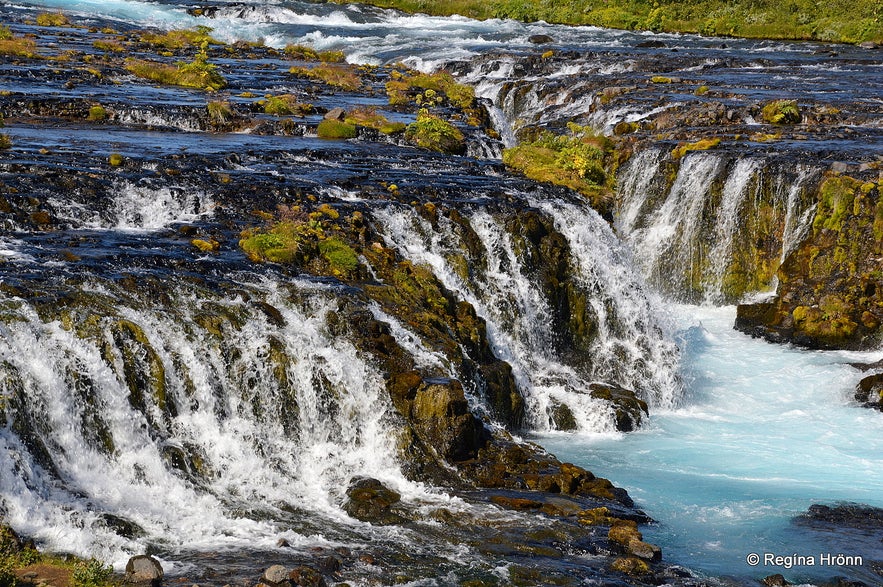 Brúarfoss waterfall up close
In 1680 farmers at Biskupstungur and the gentry of the county, tried to get their bridge back by rolling boulders into the narrowest part of the river.
But in the wintertime during swellings of the river the manmade bridge got ruined over and over again and had to be rebuilt.
Then around the turn of the century 1800 an old wooden bridge was placed over the chasm above Brúarfoss, not the whole river, but just the chasm.
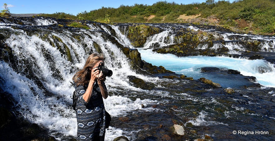 By Brúarfoss waterfall photographing the new bridge - the old bridge was somewhere above me
In 1824 the minister Guðni sterki (the strong) Guðmundsson from Miðdalur renewed that bridge and added a railing. Another bridge was built around 1860-1870 and was in use until 1901 (Kóngsvegurinn og brúin yfir Brúará).
And I remember reading in an old travel account from a foreign traveller in Iceland that he got scared when he saw that his Icelandic guide went straight into the river, not knowing about the wooden bridge, which disappeared from sight as the river covered it.
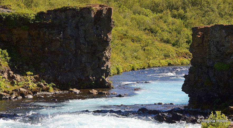 Brúarár river a little below the bridge
In 1901 a wooden bridge was erected across the whole river at Steinbogabrúgljúfur gorge.
Here was the Kóngsvegur - the King's Road, built for the Danish King Friðrik VIII for his Iceland visit in 1907. And the bridge was called Kóngsbrúin - the King's Bridge.
The king had an entourage of approx. 200 men and I have read the marvellous book Íslandsferðin 1907 about their adventures in Iceland.
Cars drove on this bridge and the British army fortified the bridge in WW2 and drove heavy trucks across the bridge.
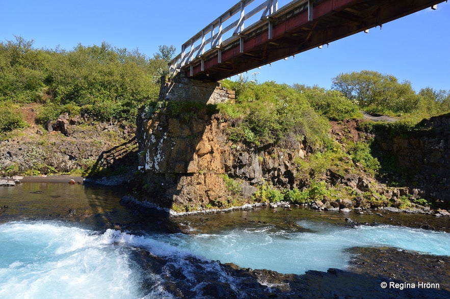 The bridge from 1966
The bridge had become dilapidated and a fatal accident took place here in 1960 when a Scottish guide on horseback drowned in the river together with his horse.
He was guiding British boy scouts and didn't trust the bridge with all the horses and decided on crossing the river above the waterfall and landed in the chasm.
My great-uncle Gunnar Bjarnason had accompanied them and took part in the rescue. One boy scout fell into the chasm in the river but Gunnar was able to rescue him (Skoskur ferðamaður fórst í Brúará).
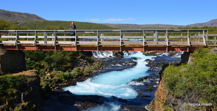 The steel beam bridge from 1966
The bridge was then torn down in 1961 and there was no bridge across the river for 5 years.
The current steel beam bridge, which was erected in 1966, stands on the pillars of the old bridge. It was not built for cars, only for horses and pedestrians.
The woodwork of the bridge was renewed in 2009. And nowadays it it is used by a myriad of tourists who have come to admire Brúarfoss :)
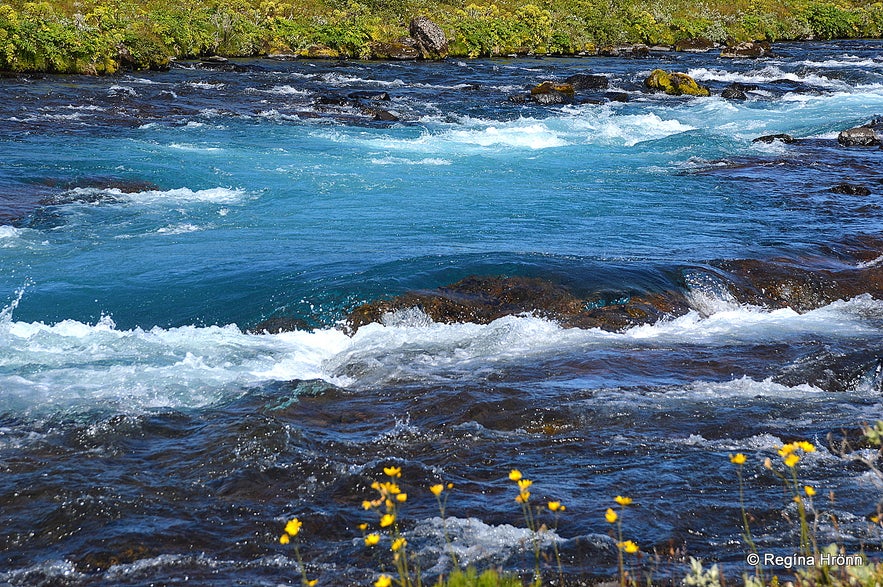 Brúará river is very blue
Brúará river is around 40 km long and merges with Hvítá glacial river as I mentioned earlier.
I have seen so much wrong information on the internet about the Brúará river.
I have seen the spring-fed river being referred to as a glacial river originating in Langjökull glacier and thus the colour, but that is Hvítá river, not Brúará. And they merge much further down the river.
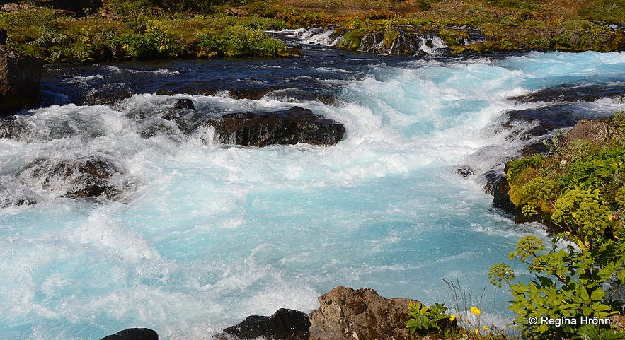 The water in Brúará river is churning so it is both white and blue
I have also read that this waterfall is in the Hítará river, but that river runs in West Iceland and has a small Brúarfoss waterfall, which has nothing to do with the Brúarfoss waterfall in the Brúará river here upcountry in South Iceland.
You can see photos of that small Brúarfoss waterfall in my travel-blog about Hítardalur valley.
The Giantess Hít in Hítardalur Valley and the Party of the Trolls - Folklore from West Iceland
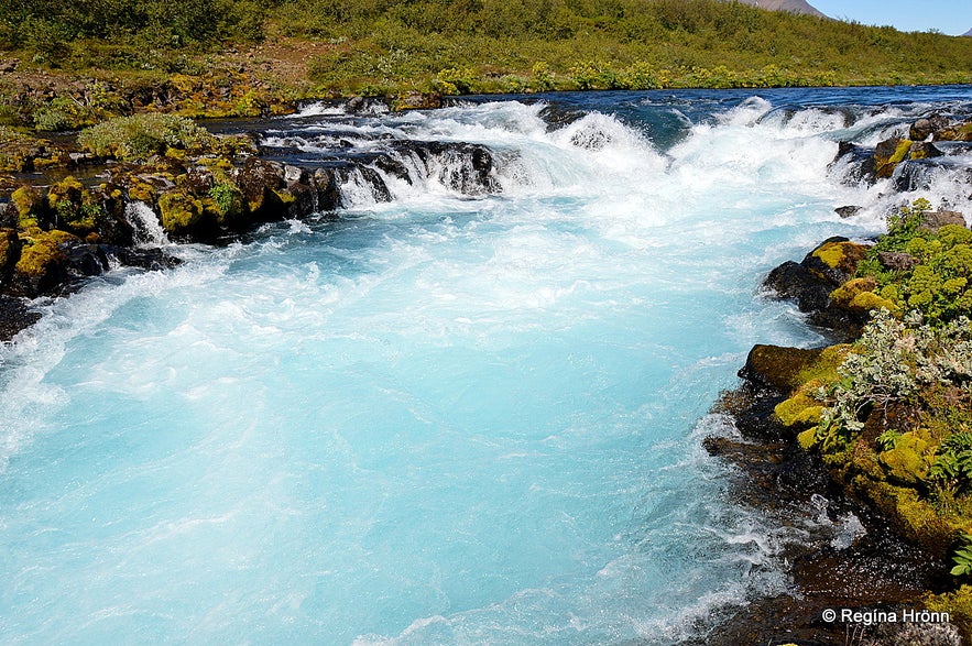 Brúará river by Miðfoss waterfall
This is not a fast hike, been there and done that, but an amazing visit to nature at its most beautiful.
Let's be respectful of other visitors who want to enjoy this beautiful scenery and refrain from using drones. Let's enjoy nature and its sounds.
I am afraid though that this hike has become too popular due to the beauty of nature and might be overly crowded.
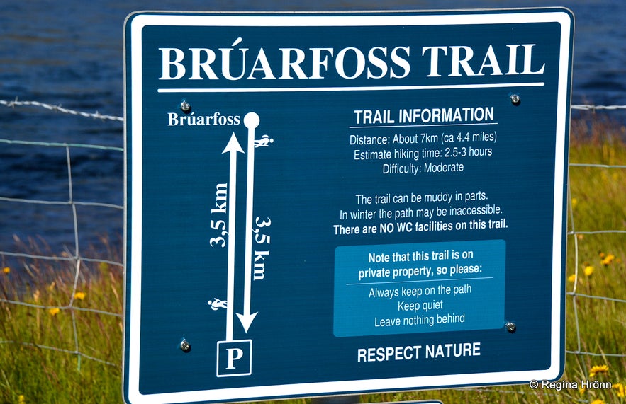 The information sign at the beginning of the hike to Brúarfoss
I decided on writing about it as I am travel writer showing you beautiful places in Iceland. But I am also a great fan of Iceland and connect to the soul of my country and I hope that it shines through in my articles.
The hike to Brúarfoss is 3.5 km one way, and hiking back and forth 7 km takes some 2.5 - 3 hours depending on how long you want to stay and admire the sights.
This is private land but the landowners have recently opened up a road on the west side of the river with a parking area closer to Brúarfoss waterfall. You can check out their website Bruarfoss.is. This is a pay zone parking.
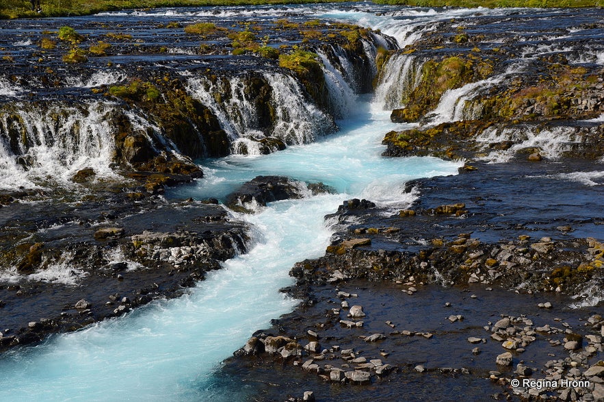 Brúarfoss waterfall
Have a lovely time at Brúarfoss waterfall. And as always, let's respect nature and leave nothing behind but our footsteps and take nothing but photos and good memories :)
Here is the location of Brúarfoss waterfall on Google Maps.
Ref.
Íslandshandbókin
Kóngsvegurinn og brúin yfir Brúará
Skoskur ferðamaður ferst í Brúará
Fisk- og botndýrarannsóknir vegna fyrirhugaðrar virkjunar í Brúará í landi Efstadals
기타 흥미로운 블로그
요쿨살론부터 비크까지, 꽃보다 청춘 5화
드디어 하늘씨과 쓰리스톤즈가 합류했는데요! 설원을 달리는 모습에 저도 아이슬란드가 엄청 그리워졌답니다. 빙하와 빛나는 요쿨살론 첫번째로 향한 요쿨살론(Jokulsarlon)은 아이슬란드의 대표적인 명소 중 하나랍니다. 영어로 Glacier lagoon 이라고도 하는데요. 방송에 나온 것처럼 눈 앞에 보이는 빙하는 빙하수가 흘러서 녹았다 얼었다를더 보기스코가포스 폭포부터 오로라까지, 꽃보다청춘 4화를 따라서
여행 5일째, 포스톤즈가 처음으로 향한 곳은 아이슬란드 남부에 있는 스코가포스 폭포(skogasfoss)입니다. 아이슬란드 남부의 대표적인 폭포 중 하나에요. 방송에서는 들르지 않았지만 스코가포스 거의 바로 옆에 위치한 셀리야란드스포스(seljalandsfoss) 폭포와 함께 같이 들르곤 한답니다. 스코가포스 폭포는 폭포의 물줄기 끝까지 올라갈 수 있단더 보기꽃청춘을 따라서
요즘 인기리에 방영되고 있는 꽃보다 청춘 아이슬란드편! 저도 매주 빼놓지 않고 시청하고 있습니다. 많은 분들께서 포스톤즈의 발랄한 매력과 아이슬란드의 놀라운 경치에 빠져드셨을 것 같습니다! 이번에는 꽃보다 청춘을 따라서 아이슬란드를 한번 가보도록 해요! 사실 아이슬란드가 한국에서 그렇게 가기 쉬운 나라는 아닙니다. 거리도 멀고 항공권도 비싸고! 우더 보기

아이슬란드 최대의 여행 마켓플레이스를 전화에 다운로드하여 전체 여행을 한 곳에서 관리하세요
전화 카메라로 이 QR 코드를 스캔하고 표시되는 링크를 누르면 아이슬란드 최대의 여행 마켓플레이스를 주머니에 넣을 수 있답니다. 다운로드 링크가 포함된 SMS 또는 이메일을 받으려면 전화번호 또는 이메일 주소를 추가하세요.


