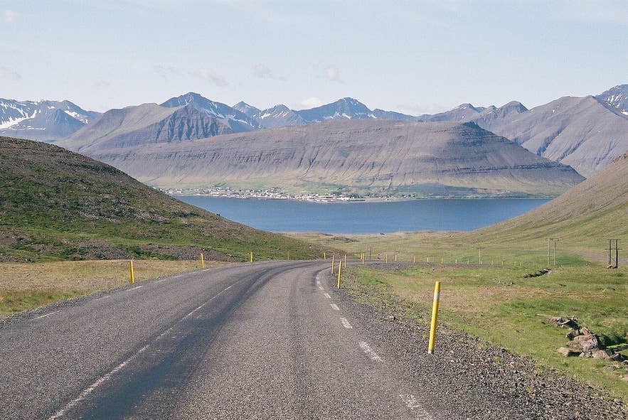
Westfjords Alps above Dýrafjörður. Photo: Reykholt, CC BY-SA 4.0
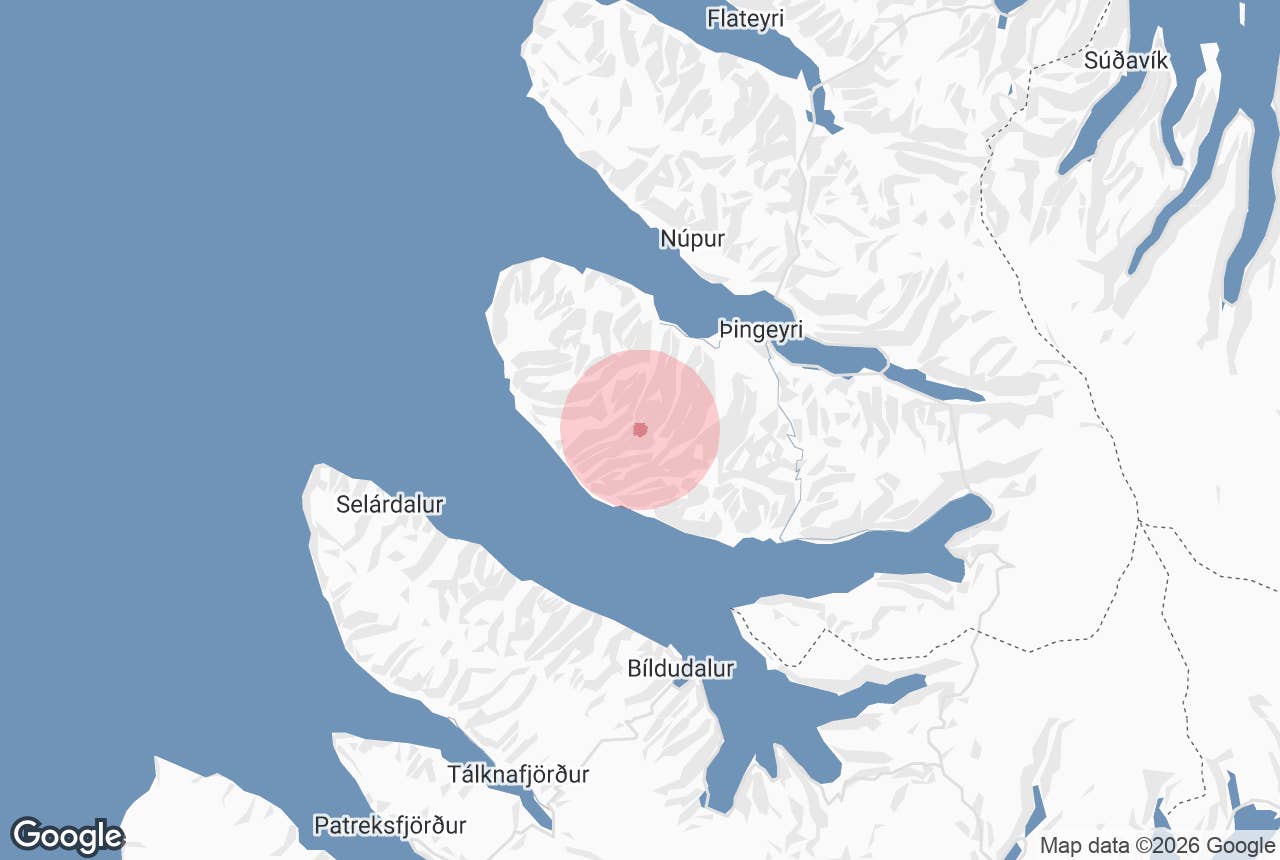
The Westfjords Alps (Icelandic: Vestfjarðaalpar, "the Alps of the Westfjords") are the sharp-ridged mountains that fill the peninsula between Dýrafjörður and Arnarfjörður in the central Westfjords.
Most mountains in this part of Iceland are flat-topped plateaus worn down by ice; this group is the exception, a cluster of pointed summits and narrow ridges that includes Kaldbakur, at 998 metres the highest mountain in the Westfjords.
The range forms the backdrop to the village of Þingeyri and is in view for much of the drive between Ísafjörður and Dynjandi waterfall.
Key Takeaways About Vestfjarðaalpar
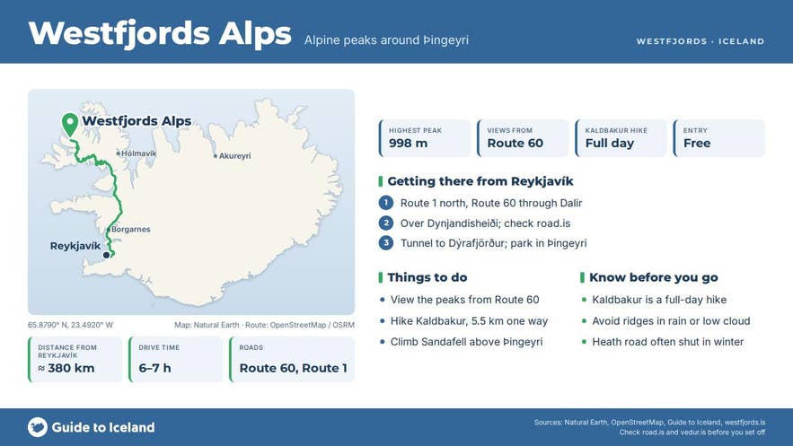
- Alpine ridge range between Dýrafjörður and Arnarfjörður; Kaldbakur (998 m) is the highest mountain in the Westfjords
- Best roadside views from Route 60 descending to Þingeyri; no F-road needed to see the range
- Kaldbakur hike from Kirkjubólsdalur: about 5.5 km one way, close to 1,000 m of ascent, 5–6 hours from the farm
- Dýrafjarðargöng tunnel (2020) keeps Route 60 open under the range all year
- About 49 km from Ísafjörður and 380 km from Reykjavík
Why visit Westfjords Alps
The Westfjords are built from some of the oldest rock in Iceland, basalt lava stacked up roughly 14 to 16 million years ago and then carved by glaciers into fjords and plateaus.
Between Dýrafjörður and Arnarfjörður the rock is different: the peaks are the eroded cone-sheet intrusions of an ancient central volcano (the Tjaldanes or Hrafnseyri volcano, one of the oldest in Iceland), and glaciers cutting in from both fjords left ridges rather than tabletops. The result is a compact alpine landscape with:
- Kaldbakur (998 m), the highest point of the Westfjords. A two-metre cairn stands on the summit, which is why locals like to say the mountain reaches 1,000 metres when you stand on top of it. There is a visitors' book in the cairn. From the top you can see most of the Westfjords and, on a clear day, Snæfellsnes across Breiðafjörður.
- Ridges and hanging valleys such as Kirkjubólsdalur, Meðaldalur and Fossdalur, which open onto Dýrafjörður and Arnarfjörður and give walkers a way into the heart of the range.
- Sandafell (367 m), the small mountain beside Þingeyri. A 1.5 to 2 hour round trip from the village leads to a summit viewpoint with a panorama plate naming the peaks of the Westfjords Alps across the fjord.
- A quiet corner. Þingeyri is a village of a few hundred people with a café, a swimming pool, a golf course in Meðaldalur valley and an information centre that knows the trails.
The range is also the reason the old road between the two fjords, Hrafnseyrarheiði, was closed for much of every year. Since October 2020 the 5.6 km Dýrafjarðargöng tunnel on Route 60 has carried traffic under the mountains, and the view of the peaks from the tunnel approaches is one of the best drive-by views in the Westfjords.
How to get to Westfjords Alps
The Westfjords Alps lie along Route 60 (Vestfjarðavegur), between Þingeyri on Dýrafjörður and Hrafnseyri on Arnarfjörður.
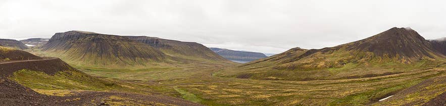
Old Hrafnseyrarheiði pass, Westfjords Alps. Photo: Diego Delso, CC BY-SA 4.0
- From Ísafjörður: about 49 km, 45 to 50 minutes to Þingeyri on Route 60 through the Vestfjarðagöng tunnel and over Gemlufallsheiði. The first full view of the range comes as the road drops towards Dýrafjörður above Þingeyri. Dynjandi waterfall is a further 28 km south through the Dýrafjarðargöng tunnel.
- From Reykjavík: about 380 km, 6 to 7 hours in summer via Route 60 over Dynjandisheiði. The final section of the Dynjandisheiði road was being rebuilt in 2025–26 (completion was scheduled for autumn 2026), and the heath is closed for long spells in winter; check road.is.
- Cruise passengers from Ísafjörður reach the viewpoint and Dynjandi in a half-day shore excursion.
For hiking, the two usual starting points are the farm Kirkjuból in Kirkjubólsdalur (signed off Route 60 west of Þingeyri) and the head of Fossdalur on the Arnarfjörður side.
The track into Kirkjubólsdalur is a rough jeep trail; the Kaldbakur route from there is roughly 5.5 km one way with close to 1,000 metres of ascent, via the Kvennaskarð and Meðaldalsskarð passes, and takes 5 to 6 hours from the farm; the shorter route from the head of Fossdalur has about 570 metres of ascent and takes 2.5 to 3 hours.
Þingeyri is also the start of Kjaransbraut, the narrow summer-only 4x4 track (Route 622) around the headland of Svalvogar to Arnarfjörður, which runs beneath the outer peaks of the range; the coastal section cannot be driven at high tide and the road is not suitable for small cars. No F-roads are needed to see the range from Route 60.
Best time to visit
Late June to early September is the window for hiking: the snow has left the ridges, the Kirkjubólsdalur and Fossdalur tracks are dry and the days are long. July is often the most reliable month for a clear summit view.
In May and early June the peaks still carry snow and the view from Route 60 is at its most dramatic, but the high routes are not yet safe.
From October to April the tunnel keeps Route 60 open between Þingeyri and Arnarfjörður, and the Westfjords Alps are a winter driving view rather than a hiking destination; Dynjandisheiði south of Dynjandi is often closed.
Safety and practical tips
- Kaldbakur is a long day. Register your route with the information centres in Þingeyri or Ísafjörður, carry a hiking map of the area and turn back if cloud comes down on the ridges.
- The ridges are narrow with loose scree and full exposure to wind. Do not attempt them in rain or low cloud.
- Mobile coverage is patchy in the valleys.
- There are no fees, gates or opening hours. Fuel, food, a swimming pool and toilets are in Þingeyri; there are toilets and a car park at Dynjandi.
- Kjaransbraut (Route 622) should only be driven in a high-clearance 4x4, in summer, at low tide, and after checking conditions in Þingeyri.
- Weather on the heaths changes within the hour. Check road.is and vedur.is before setting out.
Nearby attractions
- Kaldbakur - the highest peak of the range, 998 m
- Sandafell Mountain - 9 km, viewpoint hike above Þingeyri
- Þingeyri - 10 km, the village at the foot of the range
- Hrafnseyri - 12 km, birthplace of Jón Sigurðsson, on Arnarfjörður
- Svalvogar - 12 km, the headland at the end of Kjaransbraut
- Dynjandi - 23 km, the Westfjords' largest waterfall
Tours that visit Westfjords Alps
- Small Group Shore Excursion to Dynjandi Waterfall and the Westfjords from Isafjordur Port - pauses to take in the Westfjords Alps on the way to Dynjandi.
- Dynjandi Waterfall Shore Excursion from Isafjordur - stops at a viewpoint over the jagged range before continuing to Dynjandi, Arnarfjörður and Hrafnseyri.
