The Magical Snæfellsnes Peninsula in West-Iceland - Part I
- Eldborg Scoria Crater
- Gerðuberg basalt columns
- Rauðamelsölkelda mineral spring
- Rjúkandi - café, hotel & a restaurant at Vegamót
- Ölkelda mineral spring
- Staðastaður historic site
- Seal-spotting at Ytri-Tunga
- Golden beaches by Langaholt
- Lýsuhólslaug mineral water pool
- Bjarnarfoss waterfall
- Búðir and Búðahraun lava field
- Mt. Knarrarfjall - beautiful Rhyolite mountains
- Rauðfeldsgjá gorge
- Sönghellir cave
- Mt. Stapafell
- Arnarstapi
- Hellnar
- Bárðarlaug pool
- The serial killer Axlar-Björn
- Laugarbrekka
Snæfellsnes peninsula in West Iceland is one of my favourite places to visit, it is a truly magical place with so many interesting, beautiful sights. It is only a couple of hour's drive from Reykjavík, so I visit it often.
The Snæfellsnes peninsula and the Westfjords of Iceland are among the few locations in Iceland with golden and pink beaches; we Icelanders are used to our beaches being black lava sand beaches. The beauty here is just breathtaking. If you want to visit this beautiful region, make sure to book accommodations in Snaefellsnes.
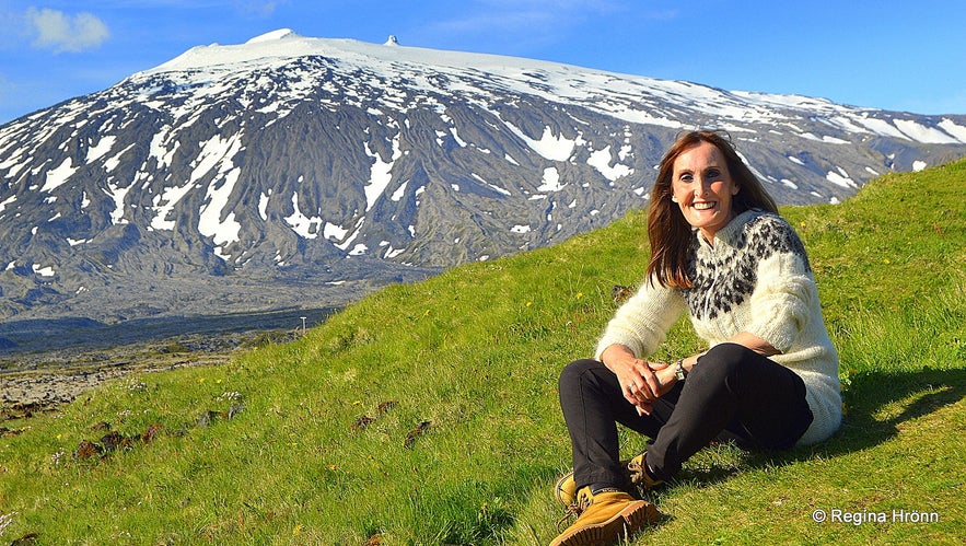
Top photo: Snæfellsjökull in the background
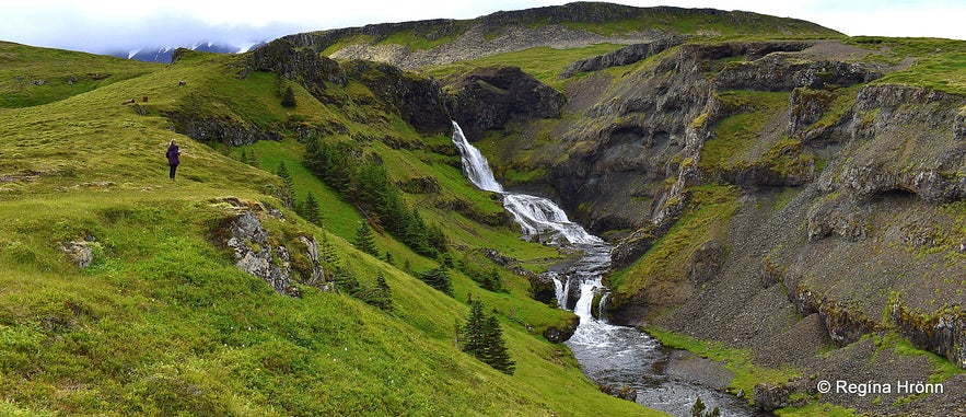 Kvernárfoss waterfall - the concert hall of the elves
I will take you on a tour of the peninsula, coming from Reykjavík and driving on the south coast of Snæfellsnes. This is not a complete guide of the peninsula, just a reference guide in chronological order to many of the interesting sights I visit when I travel around the peninsula.
You will see stretches of lava fields, basalt columns in abundance, amazing gorges, waterfalls, and lovely villages - each of which has got its own museum, even a Shark museum where one can taste cured shark!
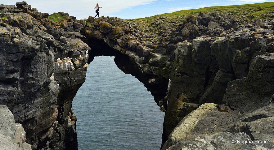 A stone bridge at Arnarstapi
There are so many interesting sights on Snæfellsnes that I ended up writing 5 detailed travel-blogs, plus many side-blogs!
As Snæfellsnes is such a historic peninsula, and I love writing about Icelandic folklore, trolls, and elves, then I will refer to several additional travel-blogs, where I have written about these stories.
I hope you will enjoy travelling with me :)
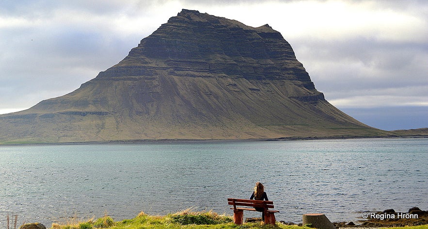 Mt. Kirkjufell, the most photographed mountain in Iceland
The landmark on the Snæfellsnes peninsula is Snæfellsjökull glacier, which is a stratovolcano, 1446 m high with a 200 m deep crater.
Snæfellsjökull glacier towers over the National park of Snæfellsnes at the far west end of the 90 km long peninsula.
There are a lot of interesting stories connected to the glacier, and it is believed to be the meeting place of extra-terrestrials. Some people believe it to be one of the seven chakras (energy centers) in the world.
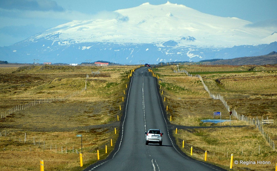 Driving towards Snæfellsjökull glacier
While visiting the interesting places on the Snæfellsnes peninsula you may be aware of the glacier's magnetic energies.
Many people have a hard time sleeping while visiting Snæfellsnes, including me, due to what might be magnetic energies from the glacier.
Snæfellsjökull volcano hasn't erupted for some 1,800 years, but one never knows when the next eruption is going to take place.
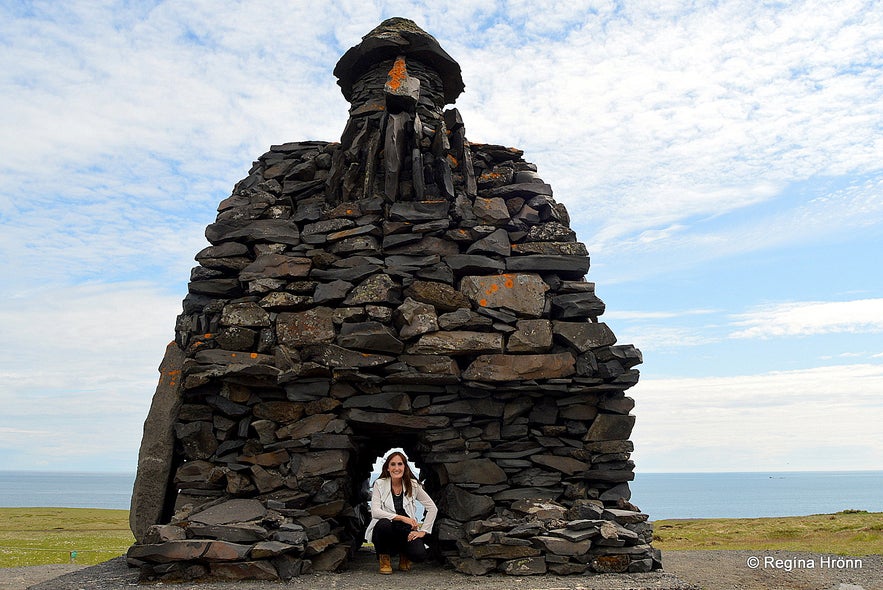 The statue of Bárður Snæfellsás at Arnarstapi
And you might even meet the half-troll half-man Bárður Snæfellsás, who was one of the settlers of Snæfellsnes, but he disappeared into Snæfellsjökull ice cap after a terrible family tragedy and has since been the Protector of Snæfellsnes.
Jules Verne wrote an interesting science fiction Journey to the Centre of the Earth in 1864 about a group of scientists, who ventured into the crater of Snæfellsjökull glacier.
Remember the movie, Journey to the Centre of the Earth from 2008, starring Brendan Fraser? Parts of it were filmed here by the glacier and his female co-star, Anita Briem, is Icelandic.
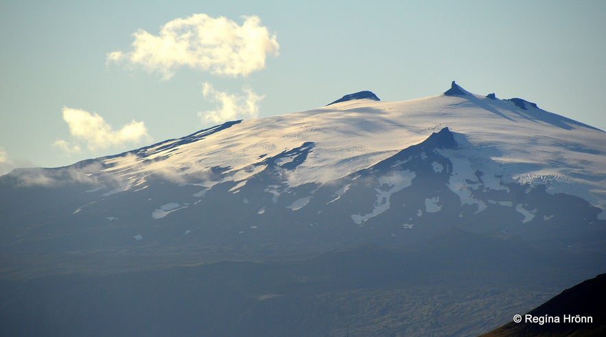 Snæfellsjökull glacier
Tours called the Top of the Diamond and Snaefellsjokull Glacier Hike will take you to the top of Snæfellsjökull glacier.
Now let's start our journey - which I will be adding to with time when I visit more interesting sights on the peninsula. We drive west on the southern part of the Snæfellsnes peninsula and follow road 54.
Eldborg Scoria Crater
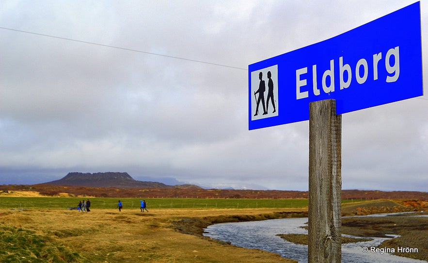 Elborg scoria crater
My first stop is at Eldborg scoria crater, which is on the boundaries of the Snæfellsnes peninsula and Mýrar and stands like a guard of the peninsula. Elborg, which means Fortress of Fire, is a perfectly shaped volcanic crater and the hike to it is some 3 km - 6 km back and forth.
It is a very easy hike, only the hike up to the top of the crater is a bit strenuous, nothing major though, and there are chains that make the 60 m ascent easier.
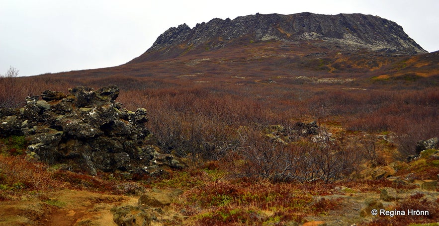 Eldborg
I have written a special travel-blog about my hike to Eldborg crater, where you can get a lot more information and photos of this beautiful crater.
A Hike to the perfectly shaped Eldborg Scoria Crater on Snæfellsnes in West-Iceland
Gerðuberg basalt columns
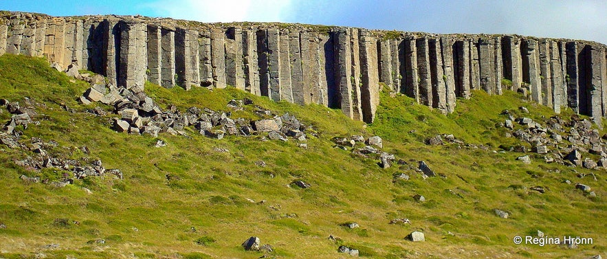 Gerðuberg basalt columns
Gerðuberg is my second stop. Gerðuberg is such a beautiful belt of lofty basalt columns - like a long man-made wall with the highest basalt columns being around 10-14 meters. The basalt columns are also very even, 1-1.5 m.
Seeing that Iceland is a volcanic island then we have many beautiful basalt formations in Iceland, but at Gerðuberg you will see one of the longest basalt column belts in Iceland.
It is possible to walk up to the basalt columns and get some good photos, and there is a path leading up to the top of the columns.
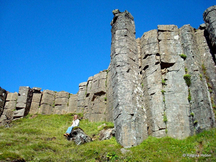 You can see how tall the Gerðuberg basalt columns are compared to me
Gerðuberg is not by the main road, and that is why so many people miss it or only see it from afar. But it is so worth it seeing these colossal basalt columns up close. It is located on the southern side of the Snæfellsnes peninsula off road 54.
Turn right onto a gravel road by the sign Gerðuberg (opposite the road on 54 is road no 567, but I haven't seen a road number for the road leading up to Gerðuberg. The road is a gravel road, but there is only a couple of kilometers drive up to Gerðuberg, and you will find parking beneath the basalt columns.
Rauðamelsölkelda mineral spring
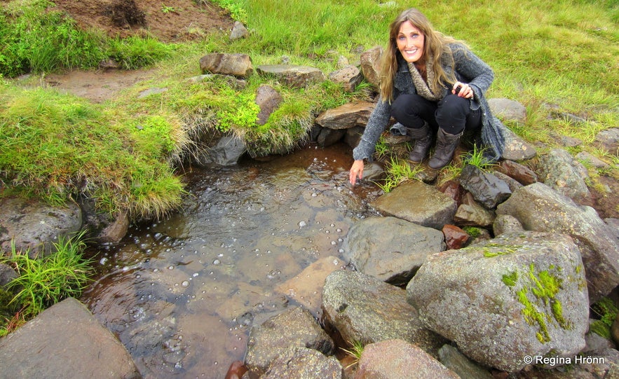 By Rauðamelduölkelda mineral spring
In Snæfellsnes you will find several natural mineral springs, including my favourite one, Rauðamelsölkelda, where one can drink fresh, carbonated water coming straight from the ground.
If you continue up the road from Gerðuberg and drive to the end of the gravel road, you will find Rauðamelsölkelda.
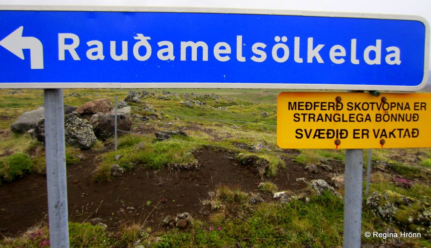 The sign says, the use of firearms is strictly forbidden
Rauðamelsölkelda is one of the best-known natural mineral springs in Iceland as the water from it is so light and refreshing. It is also believed to have healing properties.
The hike up to Rauðamelsölkelda is through a lava field, and there is a small waterfall in this beautiful off-the-beaten-path area.
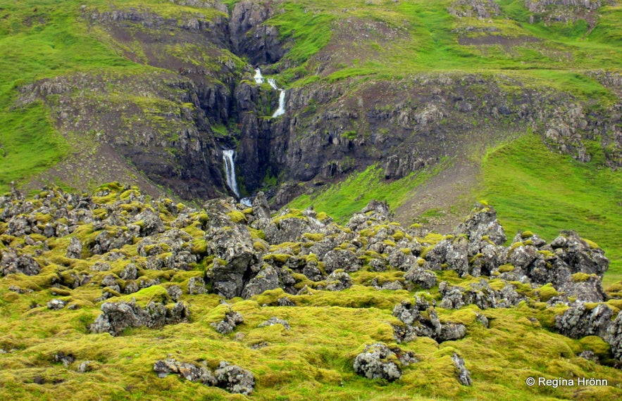 By Rauðamelsölkelda
You can find more details in my additional travel-blog about Natural Mineral Springs on the Snæfellsnes Peninsula in West Iceland.
Rjúkandi - café, hotel & a restaurant at Vegamót
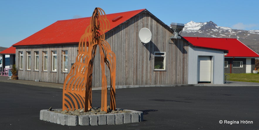 Artwork by Vegamót
At Vegamót, by the intersection of roads 54 and 56, you will find Rjúkandi, which is a hotel with a restaurant and café for passers-by. Here I stop to have coffee and use the facilities.
Note that toilets are few and far between on Snæfellsnes, so here I would advise you to follow my example, but always buy something to pay for the facilities :)
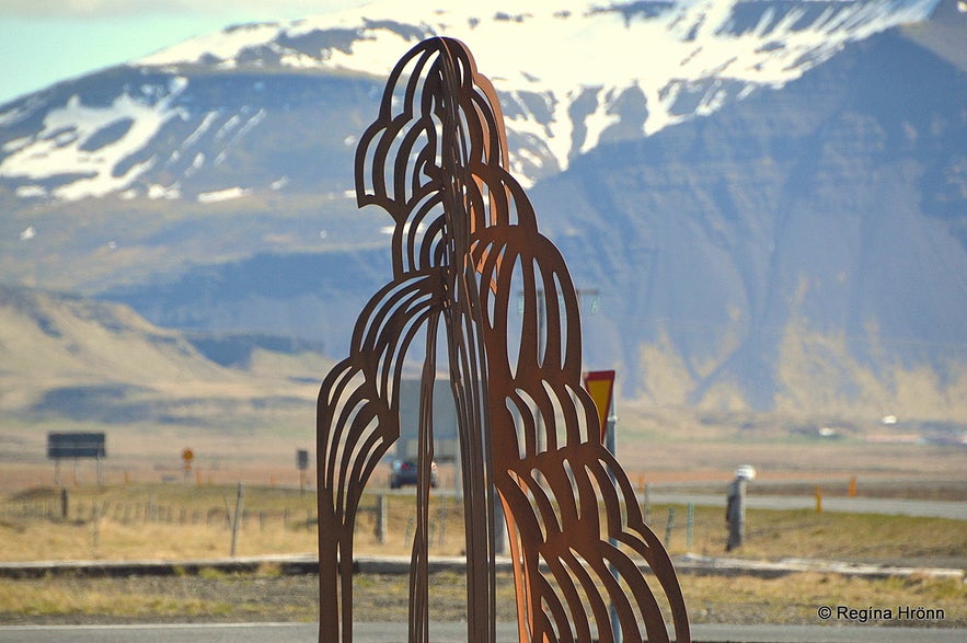
You will notice artwork in front of the café, ask the owners to tell you what it represents.
Ölkelda mineral spring
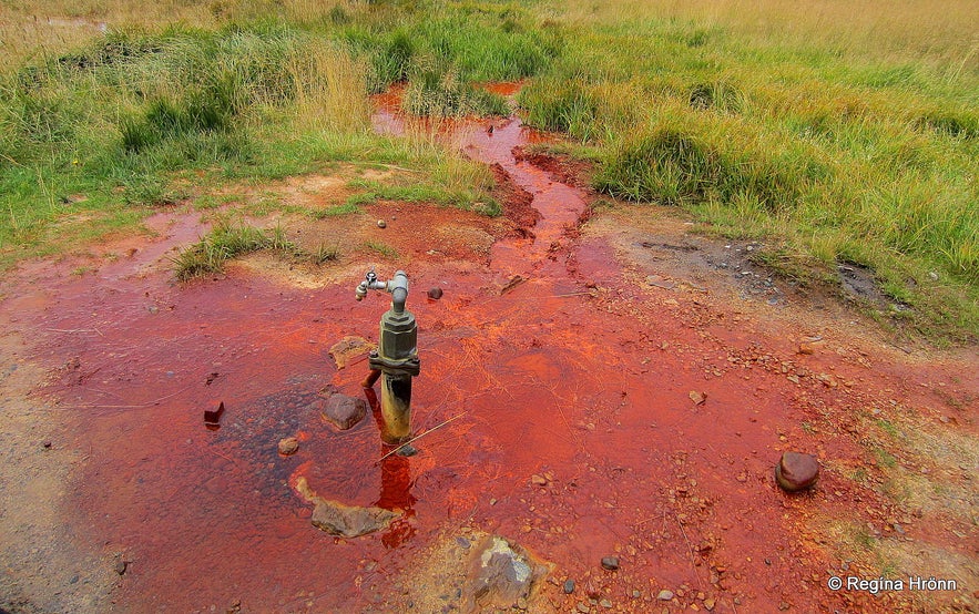 Ölkelda mineral spring
You will find another mineral spring at Ölkelda, which is quite different from Rauðamelsölkelda and the water tastes differently.
Before 1904 the mineral water welled up from a hole in the ground, but the farmer at Ölkelda farm built up Ölkelda the way it is today. The water apparently has some health benefits and the farmers on Ölkelda farm have used it as such for centuries.
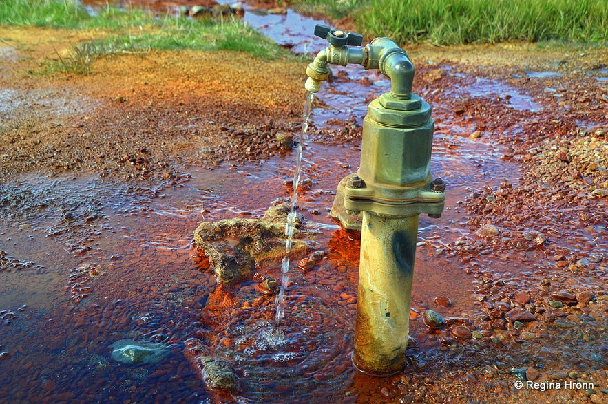 Ölkelda mineral spring
I can testify that the water helps as during one of my visits to Snæfellsnes, I was feeling so nauseous and got all better after drinking a glass of the mineral water from Ölkelda :)
Ölkelda is just a short distance from road 54 on the south side of the Snæfellsnes peninsula. If you are driving west on the peninsula, then you turn right on road 571 and drive for a very short distance. Here you can see the location on a map.
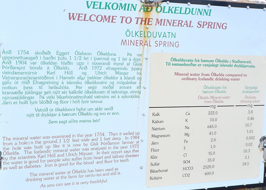 The information sign at Ölkelda
I have written an additional travel-blog about natural mineral springs on the Snæfellsnes peninsula, where you can get more information about these mineral springs.
As always let's respect these wonders of nature and leave them as we found them for others to enjoy.
Staðastaður historic site
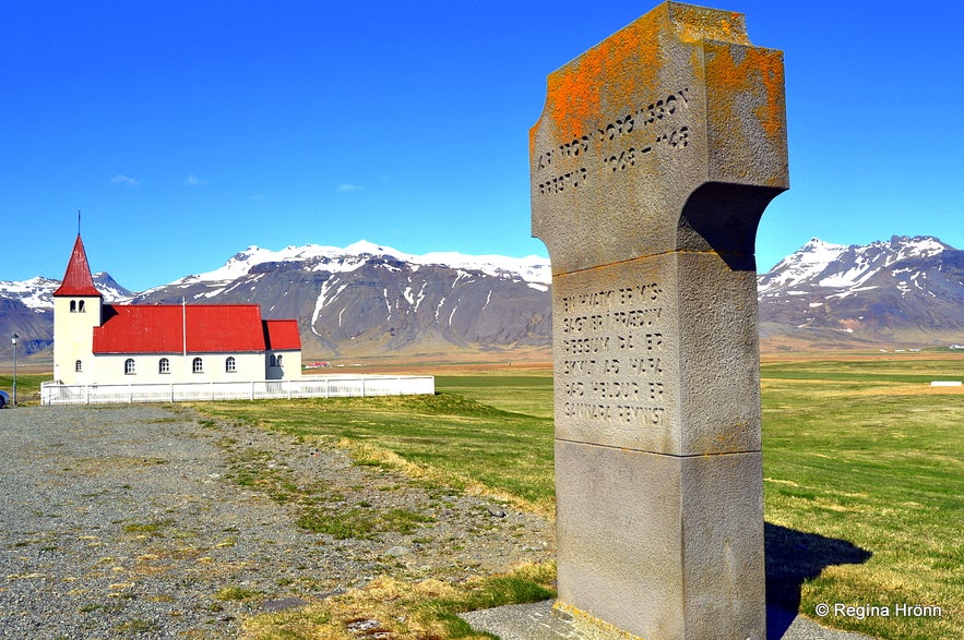 Staðastaður and the monument for Ari fróði
Staðastaður is one of the historic sites on the Snæfellsnes peninsula. Ari Fróði Þorgilsson (1067-1148) - Ari the Wise, lived and served as a priest at Staður at Ölduhryggur, which is now called Staðastaður.
Ari the Wise has been called the father of Icelandic historiography as he is best known for writing Íslendingabók or the Book of Icelanders, which tells us about the early history of Icelanders.
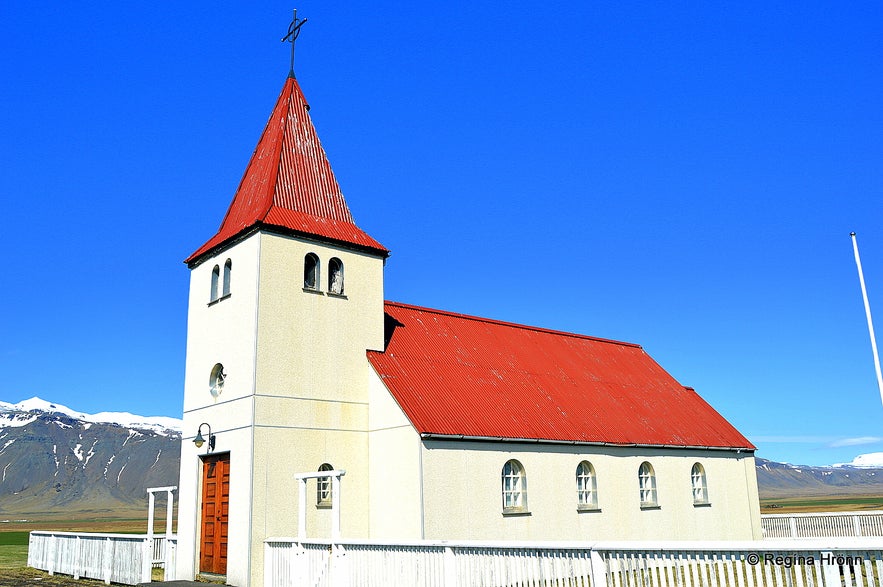
Staðastaðakirkja church
Íslendingabók is the first written work of history in Iceland from the Settlement of Iceland until 1118. Ari the Wise wrote Íslendingabók over a period of ten years, from 1122-1132.
You will find a memorial - a big concrete cross - in memory of Ari Fróði at Staðastaður. The sculptor Ragnar Kjartansson created this artwork in 1981.
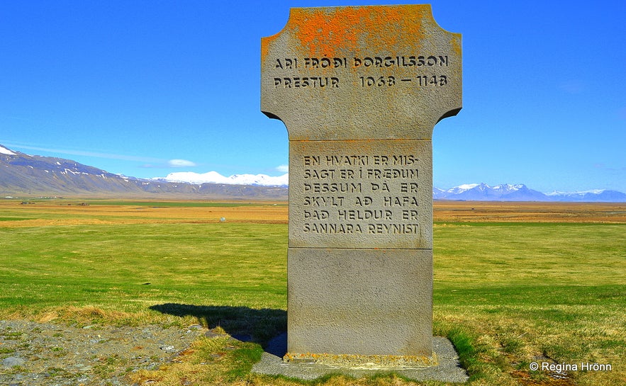 The monument
Ragnar has created several monuments on Snæfellsnes, for example, the one of Bárður Snæfellsás - the Mythical Protector of Snæfellsnes at Arnarstapi and the monument for drowned fishermen at Hellissandur.
Written on the cross is "En hvatki er missagt er í fræðum þessum þá er skylt að hafa það heldur sem sannara reynist" meaning that if anything proved to be wrong in his writings then it must be corrected.
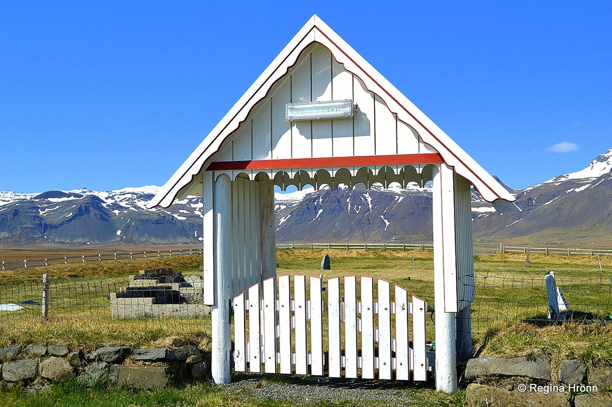 Staðastaður graveyard
On the back of the cross is written what Snorri Sturluson had to say about Ari Fróði "Ari hinn Fróði Þorgilssonar Gellissonar ritaði fyrstur manna hér á landi að norrænu máli fræði bæði forna og nýja. Snorri Sturluson" - Ari the Wise Þorgilsson, the son of Gellir, was the first man in Iceland to write in Old Norse both old and new studies (instead of Latin RHR).
There is a vicarage at Staðastaður and the current concrete church was built in 1942-1945. It was locked at the time of my visit, as are most churches in Iceland.
 Staðastaður with the backdrop of Snæfellsjökull glacier
A well-known Icelandic novel has been written by the Icelandic Nobel prize winner, Halldór Kiljan Laxness. It is called Kristnihald undir Jökli or Under the Glacier. The setting of the novel is at and around Staðastaður.
Staðastaður is only a very short drive from road 54. You will see the church at Staðastaður ahead as you drive west on the peninsula. It is a beautiful sight when the church stands tall with the Snæfellsjökull glacier in the background.
Seal-spotting at Ytri-Tunga
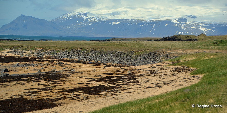 Ytri-Tunga
Ytri-Tunga is a very popular beach for seal spotting as a seal colony resides here, as it were. The primary season for seal spotting is in June and July, but I have seen the seals in the winter months as well.
I love spotting seals, they are so beautiful and curious, and often they follow me when I am walking on the beach. You can even see them in Reykjavík, and I often saw them on a beach in the Grafarvogur suburb, where I used to live.
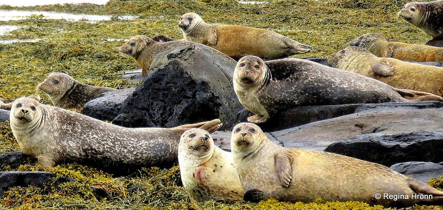 Seals resting
You can see both the common seal and the grey seal at Ytri-Tunga, but the grey seal is bigger than the common seal. The seals you will see on top of rocks or on the beach are usually the common seals.
On the information sign by the parking lot at Ytri-Tunga, you will see the difference between these 2 seals.
To reach Ytri-Tunga from the main road (54) you turn left and drive a short distance toward the farm. There is a 10-minute walk on a golden beach to the main seal-spotting location.
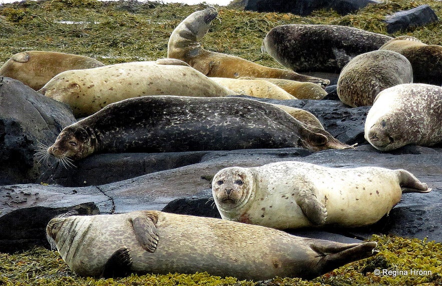 A seal colony resting
On the way be on the lookout for seals as they are swimming all around in the sea. They are a bit far away to get a decent photo unless you have a good zoom on your camera.
Here you can see the location of Ytri-Tunga on the map.
Golden beaches by Langaholt
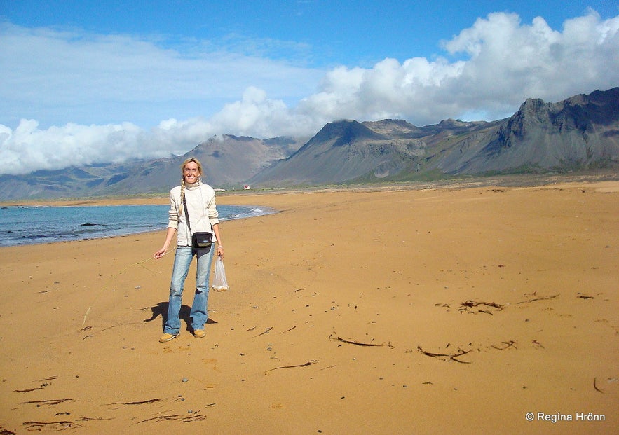
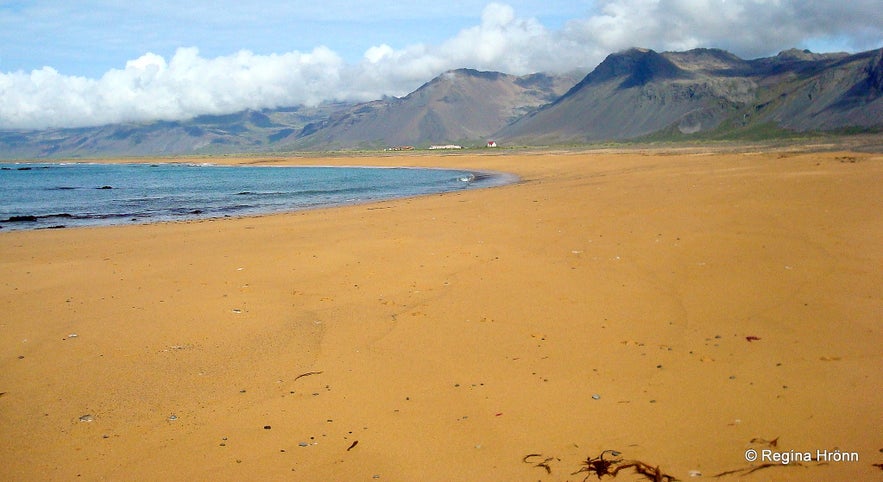 The golden beach close to Langaholt
Snæfellsnes peninsula is one of only a few places in Iceland where the beaches are golden. Golden, pink, and even orange/red beaches can mainly be seen in the Westfjords of Iceland as you can see in my travel-blog Rauðasandur Beach & Sjöundá in the Westfjords of Iceland - Red Sands & a Crime Scene.
I love camping at Langaholt, which is located almost next to a beautiful golden beach with a lot of colourful pebbles. I come here mainly for a particular type of crystal pebbles that I collect. But also for the sheer natural beauty of this place.
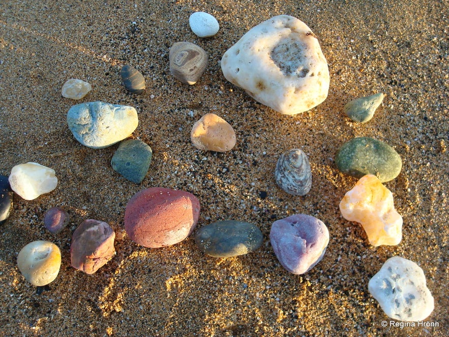 Colourful pebbles on the beach
The campground is very popular amongst Icelanders, and the kids jump into the cold sea on warm days here. On a sunny summer day, this is the place to be.
To us, Icelanders, spending time on this golden beach feels like we have gone abroad for the day.
Many of our visitors want to see the black lava beaches as they are so used to golden beaches, but we Icelanders are so used to black beaches that we seek out golden beaches. It was not until I first went to a beach in Italy when I was 11 years old that I realized that not all beaches are black :)
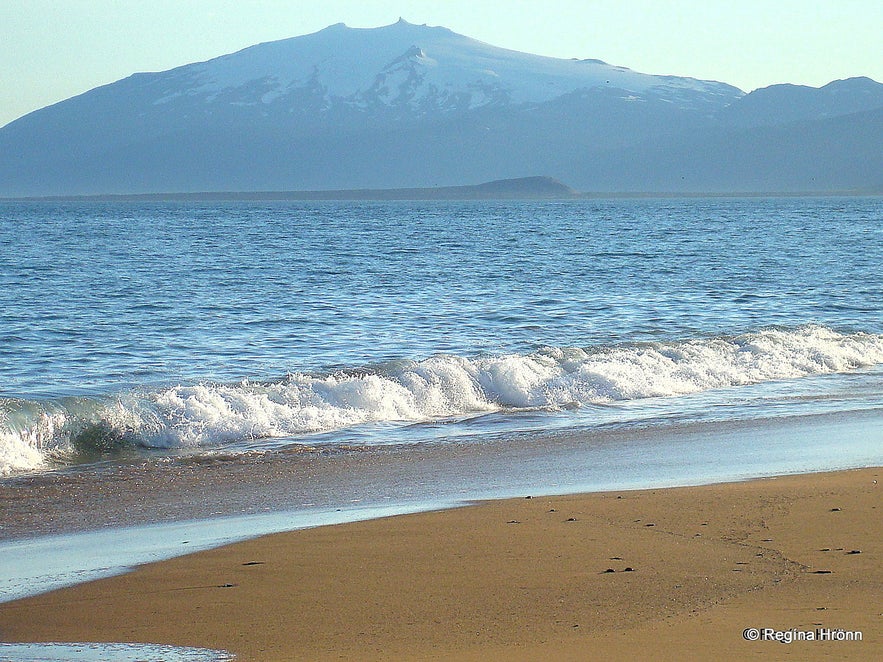 The beach by Langaholt and Snæfellsjökull glacier
There is a fantastic view of the magical Snæfellsjökull glacier from here, and my favourite photo of Snæfellsnes is of the golden beach, the blue sea, and the white glacier in the background.
Just a word of warning - bring a stick or an umbrella with you to the beach if you visit this area in the summertime during the nesting period of the Arctic tern.
You will notice a lot of Arctic tern flying incessantly back and forth to the sea and returning with a fish in their beak to feed to their chicks waiting in their nest.
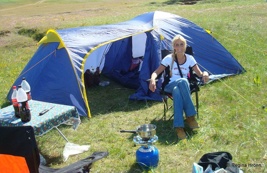 Camping at Langaholt - my favourite camping spot
This area is the nesting site of the Arctic tern, and a cranky bird or two has been known to attack people on their way to the beach and on the beach. They will attack the highest point so keep the stick above your head.
During the bright summer nights, it is lovely taking a walk in Icelandic nature. This is the time when you will be totally alone in nature - it is so still, and the only sounds that can be heard are the sounds of nature and the birds singing - just heavenly.
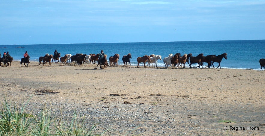 Horses on the beach by Langaholt
You might encounter people riding Icelandic horses on the beach, and once I saw this beautiful sight on the beach. The Icelandic horses are direct descendants of the horses which the Vikings brought with them to Iceland.
Here you can see the location of Langaholt on the map.
Lýsuhólslaug mineral water pool
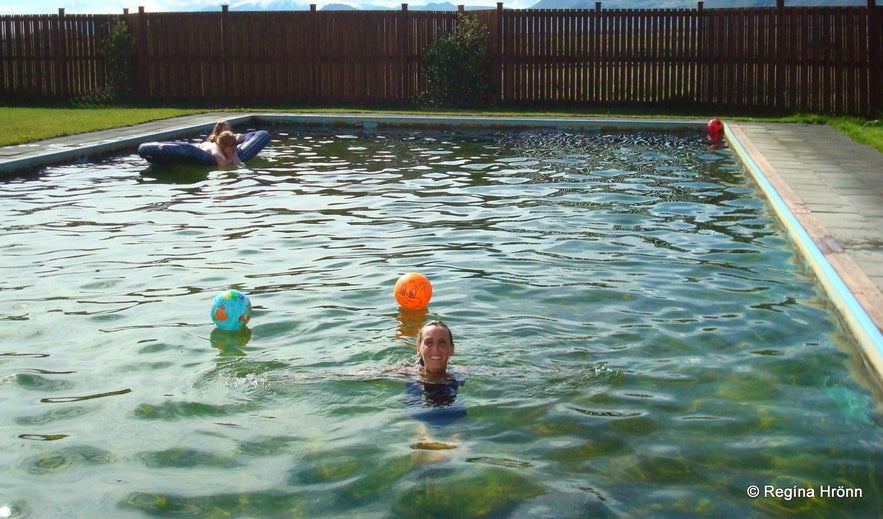 Bathing in Lýshuhólslaug geothermal mineral pool back in 2008
Lýsuhólslaug is a geothermal mineral water pool. When camping by the golden beach at Langaholt, I always visit Lýsuhólslaug.
There is pure carbonated geothermal mineral water in the pool coming straight from the earth, and no chemicals are added to the water, so it is as natural as can be. The water is claimed to be very healthy and healing.
The pool is only open in the summertime, but at Lýsuhóll farm there is accommodation and horse riding. Here you can see the location of the Lýsuhólslaug pool on the map. The pool was renovated in 2019.
Bjarnarfoss waterfall
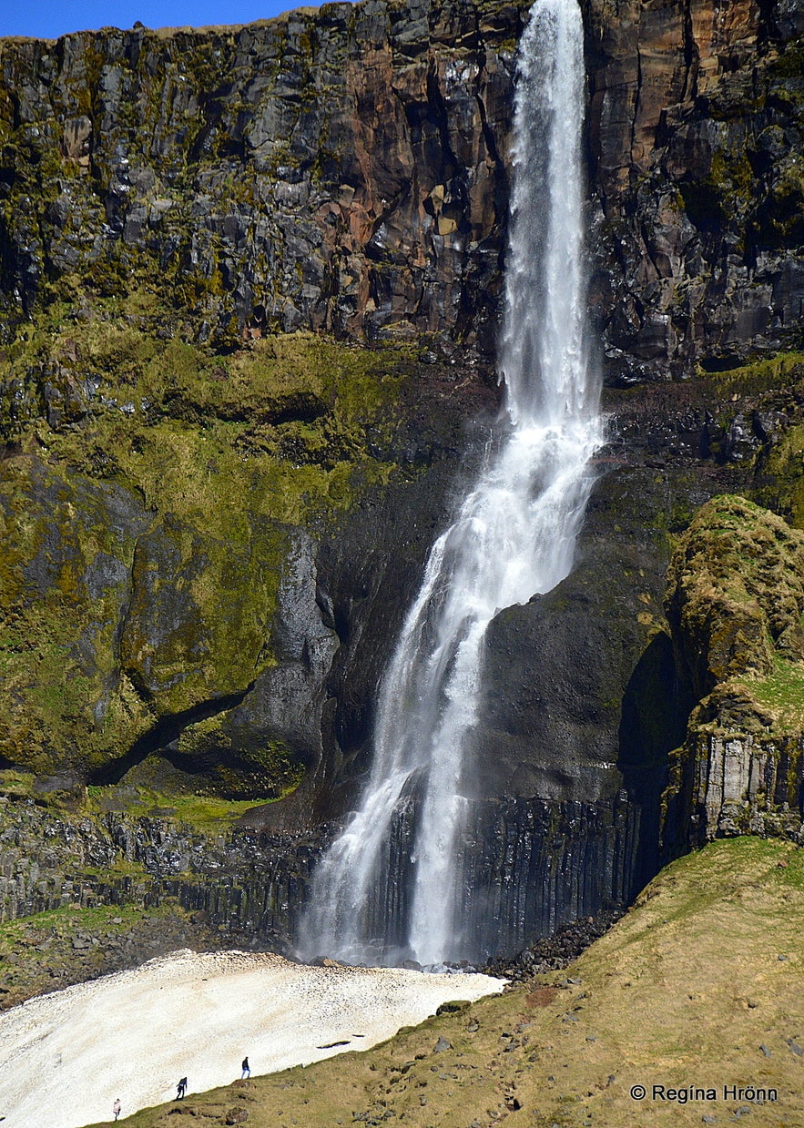 Bjarnarfoss waterfall
By now we have reached Bjarnarfoss waterfall, which is close to the road by the junction of roads 54 and 574.
There is a legend connected to Bjarnarfoss, and it got its name from the farmer Bjarni, who lived here at Foss ages ago. Bjarni was a wealthy farmer who owned a lot of money (spesía). He also owned a large number of cattle. He allowed the cattle of other farmers to graze on his land in Fossdalur valley.
One winter's day during a blizzard a vagrant sought shelter at Bjarni's farm. Bjarni refused to let him in and made him feel unwelcome. The vagrant swore that Bjarni would regret behaving like this. The next summer Bjarni found all of his grazing cattle dead, but the cattle of the other farmers were unharmed.
Bjarni got struck by another misfortune until he went crazy and threw his money into the pool by the waterfall, which from then on got the name Bjarnarfoss waterfall. And his farm Foss was named Bjarnarfoss and the valley was renamed Bjarnarfossdalur from then on.
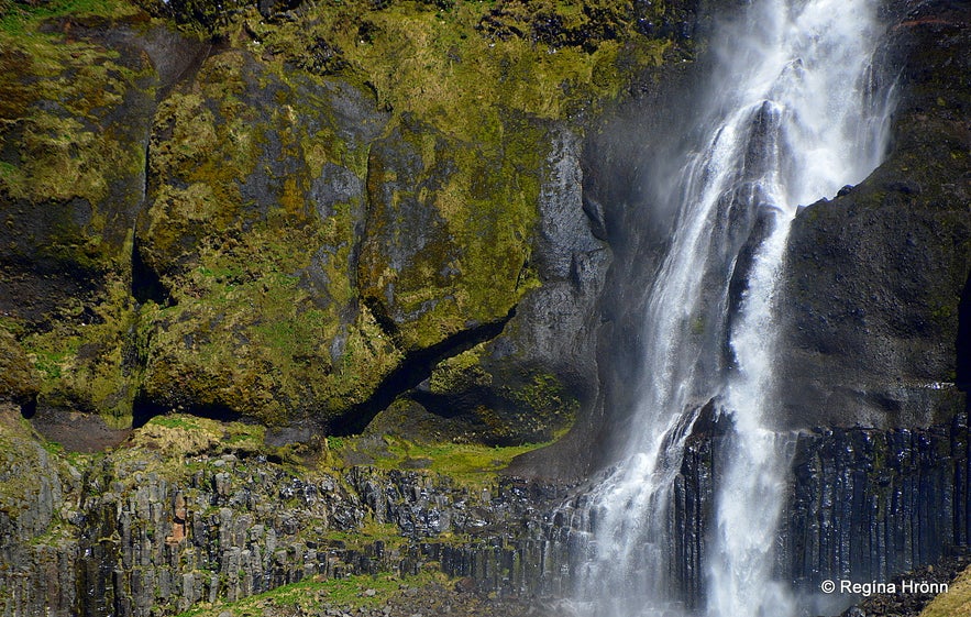 Bjarnarfoss waterfall
In 1870 a silver coin was found in Landakotsgil beneath Bjarnarfoss, but it was faded so we have no idea where it might have come from Fornleif.is - page 57.
If you want to see the Bjarnarfoss waterfall up close, there is a road leading up to the farm. The waterfall is on private property, but a parking lot has now been added for those of us who want to hike up to the waterfall.
I have never hiked up to the waterfall, but I think it is lovely to admire Bjarnarfoss at a distance.
I have heard that there is a fjallkona - the Queen of the Mountains formation in the waterfall. They say it looks like there are mist veils falling on her shoulders and bosom. She can best be seen from the road leading down to Búðir and from Fróðárheiði heath. Some say that she is an elf-lady.
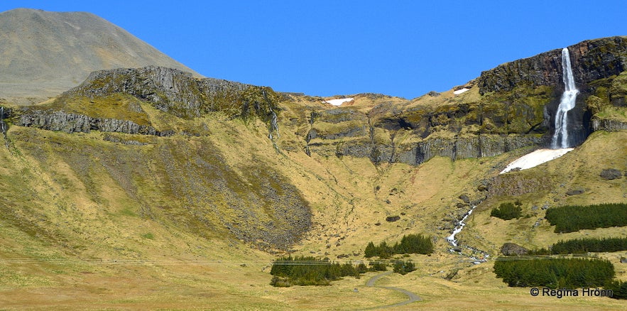 Bjarnarfoss waterfall as seen from afar
Now we are at crossroads, but there is no doubt in my mind about where to go next - to the beautiful and romantic Búðir. Take road 574, Útnesvegur road, to the left which will take you around the peninsula.
If you carry on driving on the main road 54, Snæfellsnesvegur road, it will take you across Fróðárheiði heath and straight to Ólafsvík village. But we are going on a tour around the peninsula.
Búðir and Búðahraun lava field
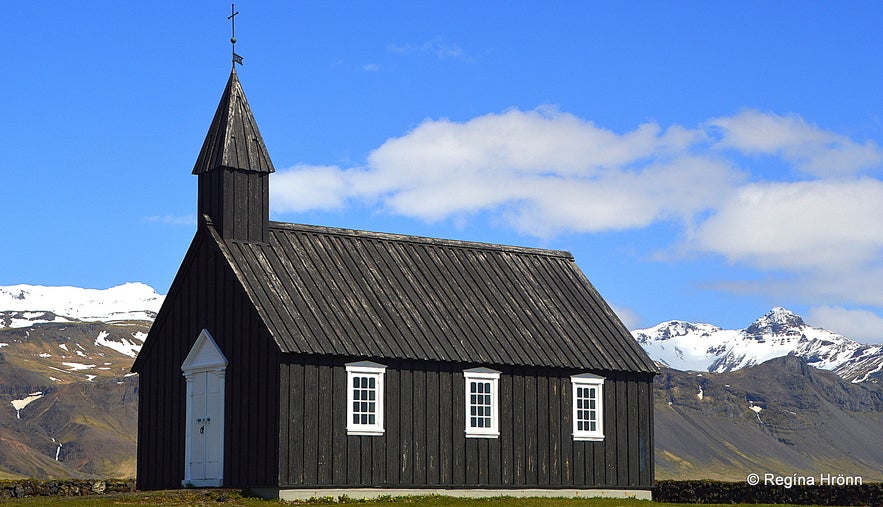 Búðakirkja church at Búðir
Very shortly after turning onto road 574 take a left turn for Búðir on Búðavegur road. This is such a lovely place to visit and in my mind also a very romantic spot. A white hotel and a small black church can be seen from the distance as you drive down this road.
There is an old, black-painted timber church, Búðakirkja church, and a graveyard at Búðir. It is the only reminder of a vibrant fishing village once located at Búðir until the 19th century. It is hard to imagine now that Búðir was once one of the main trading centres in the west, but as you travel further along the peninsula, you will see remnants of fishing stations in many places.
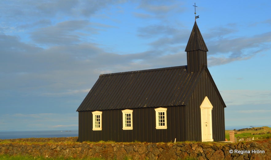 Búðakirkja church at Búðir in the evening sun
The first church which was built at Búðir dates back to 1703 and became an annexe church from Staðastaður, but churches have been rebuilt here several times.
In 1816 Búðakirkja was even shut down, but rebuilt in 1848 with permission from the Danish King. The current church was consecrated in 1987, and rebuilt to the liking of the original church.
Búðakirkja church is very popular with photographers as it is so scenic.
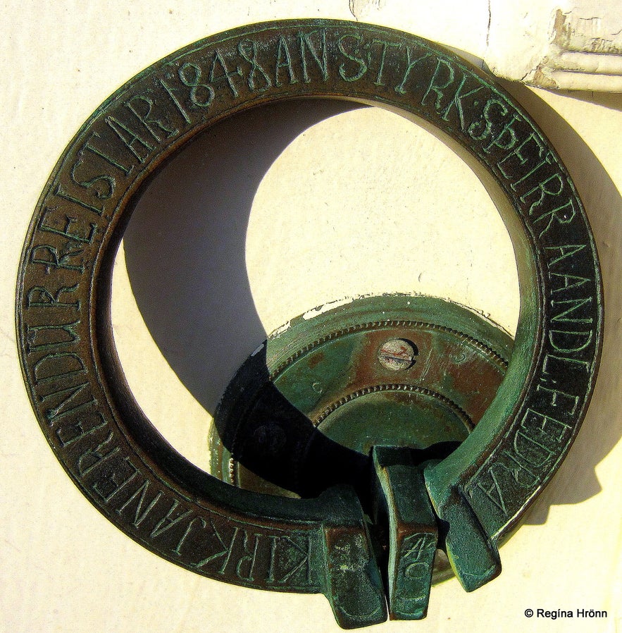 The church-door ring at Búðakirkja church at Búðir.
I have an old painting of Búðakirkja church hanging on the wall in my dining room, painted by one of our noted painters. In the painting the church is white, so the former church must have been white. But I like the black painted current church, it is so beautiful with the white window cases and the white-painted door.
There are very old (by Iceland's standard) artifacts in the church, for example, an altarpiece that dates back to 1750. And a clock that dates back to 1672.
When I have visited this church has always been locked, and most of Iceland's churches are locked now due to robbery and vandalism in our churches :(
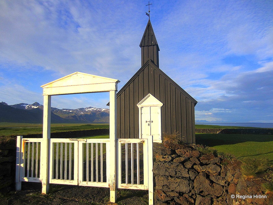 Búðakirkja church
Isn't this sad, how a handful of dishonest people can ruin it for the rest of us, who come here to enjoy the history and beauty of Iceland?
I visit every church in Iceland on my travels around my country and seeing that most of our churches are closed now due to vandalism, theft, and general disrespect, then I am having a difficult time getting into the churches in Iceland and am always on the hunt for the person holding the key to the church.
There is a hotel, Hotel Búðir, very close to the Búðakirkja church. They offer wedding ceremonies at Búðir, where you can get married in the lovely little church, on the pink beach, or even on the black lava field, Búðahraun, with Snæfellsjökull glacier in the background.
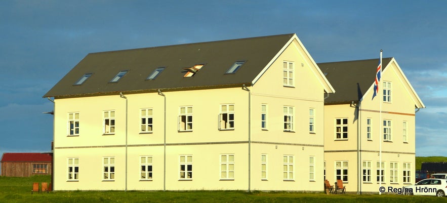 Hotel Búðir in the evening sun
I think this must be a beautiful, romantic setting for a wedding ceremony. Especially on a sunny day. The photos I have added here are taken in July at 9:30 pm and the light was extraordinary as it cast an orange hue on the beautiful landscape, the church, and the hotel.
The first hotel was built in 1947 here at Búðir, but a fire started back in 1999 which burnt the hotel to the ground. It was so sad as this hotel was so iconic for Búðir. Fortunately, a new hotel, the spitting image of the old hotel, was built shortly after.
The same thing happened at Þingvellir national park when the iconic Hotel Valhöll burnt to the ground in 2009 - we Icelanders were devastated when this happened as the hotel was not rebuilt.
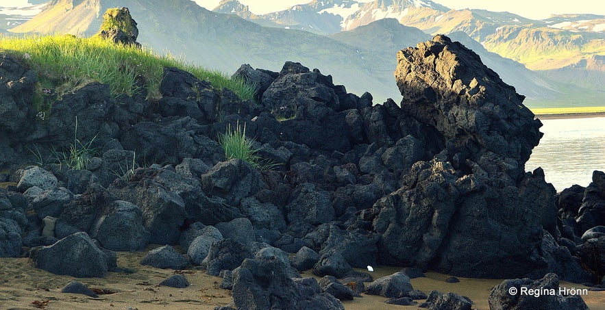 Lava on the beach by Búðir
Búðahraun lava field is vast, some 915 hectares, and 5,000-8,000 years old. The area here is so beautiful, and the pitch-black lava stretches down to the pink and golden beaches, creating a striking contrast.
A crater in the middle of the lava field is called Búðaklettur or the Búðaklettur Rock. This is an extraordinary lava field because there is so much vegetation here and a lot of ferns.
You can follow a path leading through the lava, do stick to the path as this is a dangerous area, like all lava fields, as there are fissures and holes all around, some visible and others covered in vegetation or moss.
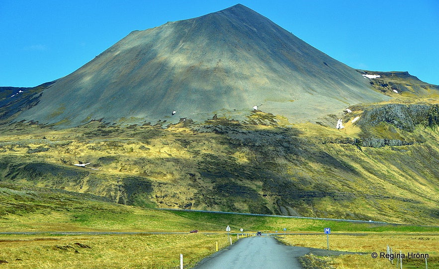 The view from Búðir - Mt. Mælifell
Búðahraun lava field has been a protected area since 1977.
Here you can see where Búðir is located on the map. Now let's drive back to road 574 and turn left.
Mt. Knarrarfjall - beautiful Rhyolite mountains
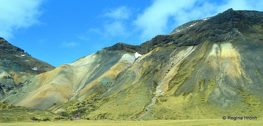 Mt. Knarrarfjall
There are some beautiful rhyolite mountains on the Snæfellsnes peninsula. One of them is Mt. Knarrarfjall. After visiting Búðir turn left on Útnesvegur road 574 which takes you around the peninsula.
All of a sudden the landscape changes and this beautiful mountain opens up to you.
The rhyolite mountain is just by the road so one can just pull over and take a photo of it. Beneath the mountain is a farm, so that road is closed, but this mountain is so close to the road that it can be admired from afar.
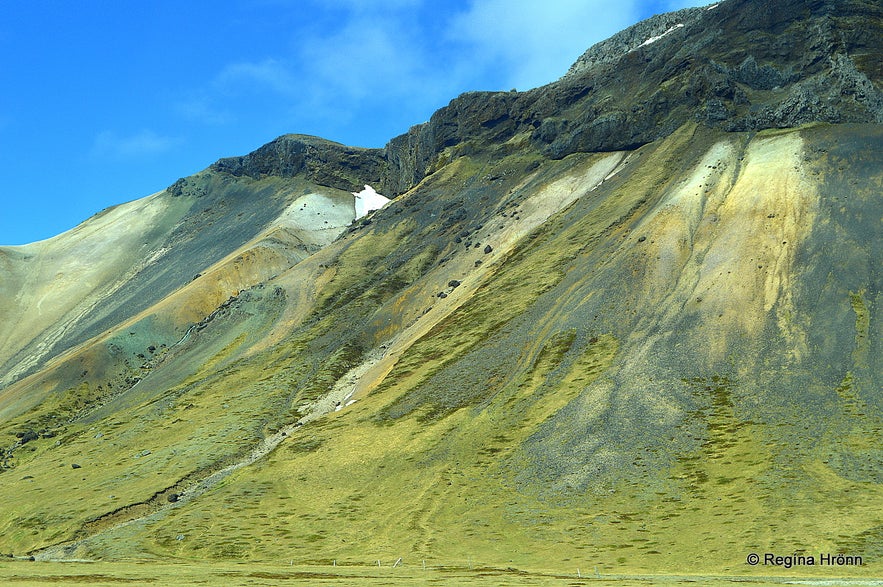 Mt. Knarrarfjall
I hope you like this mountain as much as I do, I thought of adding it to my list as I always stop by it. There are also rhyolite mountains on the northern side of Snæfellsnes, the beautiful Mt. Drápuhlíðarfjall.
Here is the location of the mountains on the map.
Rauðfeldsgjá gorge
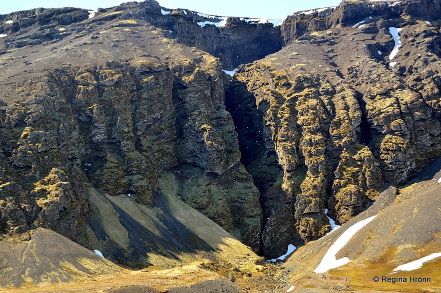 Rauðfeldsgjá gorge
Rauðfeldsgjá gorge is a magnificent gorge by Breiðavík cove, cutting into Mt. Botnsfjall. I think it looks like something out of a fairy tale; it is so majestic.
I could picture this gorge as being the backdrop of a scene in the Game of Throne series or the Lord of the Rings. Don't you agree with me? I am always in awe of the rugged beauty of Rauðfeldsgjá when I visit Snæfellsnes.
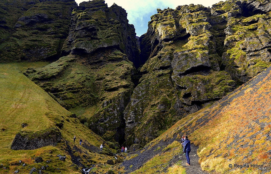 Hiking up to Rauðfeldsgjá gorge
Rauðfeldsgjá gorge can easily be seen from the road on your right-hand side. You can hike up to it and have a look inside. There is a short uphill hike to the gorge from the parking lot.
Inside the gorge, you will find a creek and by stepping on the stones in the creek you can have a look further inside the gorge.
If you follow the creek by stepping on stones in the creek you will eventually reach a waterfall - that is high on my list of things to do, and I never seem to get around to it. I have even bought new Wellingtons for this hike, so I don't get wet feet when wading in the creek. Waterproof clothes are also needed for this hike.
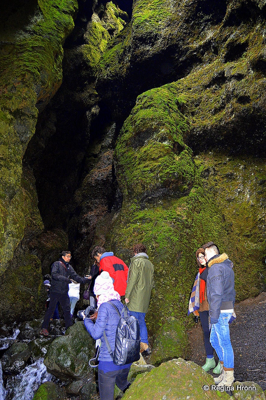 Rauðfeldsgjá gorge
It is a narrow gorge, but fun just having a look into it. There is a natural platform inside the gorge where you can stand and ponder on whether to venture further on.
Rauðfeldsgjá gorge or Rauðfeldargjá, as it is also called depending on the declension of the male name Rauðfeldur and the name preferred by the locals, got its name from a tragedy that happened here on the south side of the peninsula. This story can be found in the Saga of Bárður Snæfellsás, which is the story of the first settlers of this area.
Cousins were playing on the beach and one of them, Rauðfeldur, pushed his cousin, Helga, onto an iceberg which then drifted away with her to Greenland, but she was not harmed.
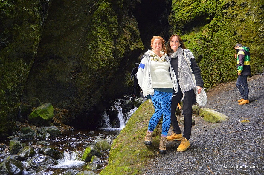 Inside Rauðfeldsgjá gorge with Nanna, a fellow travel writer back in 2015
Helga's father, Bárður Snæfellsás, who is said to have been half a man and half a troll, got so angry at his nephew Rauðfeldur that he threw him into the gorge. Thus the name. After killing Rauðfeldur, Bárður also killed his other nephew, Sölvi, at Sölvahamar cliff by Arnarstapi. After this family tragedy, Bárður disappeared into the Snæfellsjökull glacier.
I have told you the story of Bárður Snæfellsás in another travel-blog where I show you the places on the south side of the Snæfellsnes peninsula, which are mentioned in this very interesting Saga. Bárður has ever since been the Protector of the Snæfellsnes peninsula.
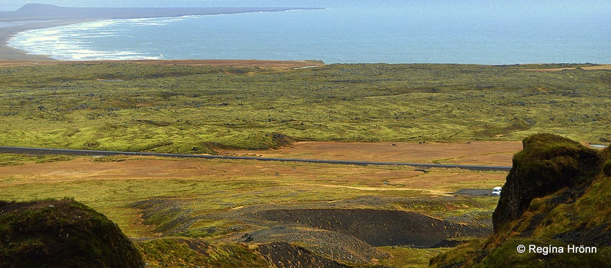 The view from the Rauðfeldsgjá gorge
There is a beautiful view of Breiðavík cove and Klifhraun lava field from Rauðfeldsgjá, as you can see in my photo above.
We are now some 213 km from the capital city Reykjavík - here you can see the exact location of the gorge on the map. The next stop will be at one of the main attractions of Snæfellsnes peninsula, Arnarstapi, but I just want to give you a little peek into one of the caves, Sönghellir or the Singing Cave, on the side road 570, just before we reach Arnarstapi.
Sönghellir cave
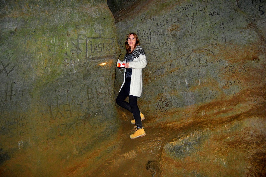 Sönghellir cave
Sönghellir - the Singing Cave or the Cave of Song is a well-known cave on the Snæfellsnes peninsula, and the echo or acoustics in this small cave is excellent.
There are several caves in Iceland named Sönghellir, but the Sönghellir cave on the Snæfellsnes peninsula was named by the settler and Protector of Snæfellsnes, Bárður Snæfellsás, and is believed to be the first cave in Iceland with this name.
According to the Saga of Bárður Snæfellsás, he stayed in this cave with his men while he was building the farm at Laugarbrekka where he later settled.
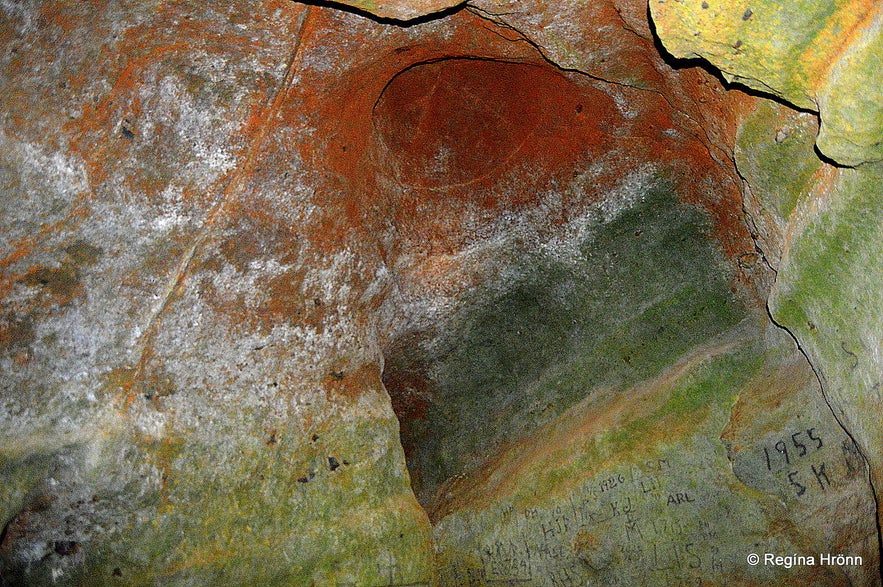 Sönghellir cave
If you are interested in caves in Iceland, then I have written another travel-blog just about caves: A Local's Favourite Caves in Iceland.
Here you can see the location of Sönghellir cave on the map. Now let's go back to Útnesvegur road number 574.
Mt. Stapafell
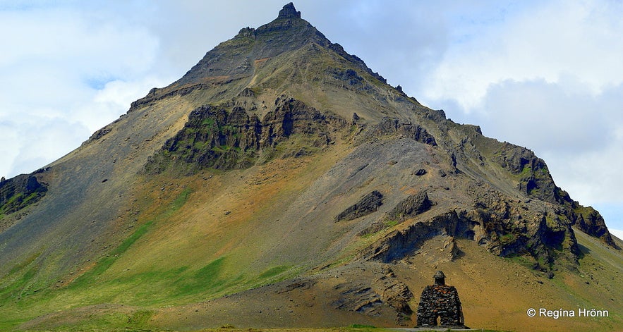 Mt. Stapafell
Mt. Stapafell is a peculiar 526 m high palagonite volcano next to the Snæfellsjökull glacier.
It is shaped like a pyramid if you look at it from Arnarstapi (my photo above) and if you drive up road 570 (Jökulhálsleið) on the east side of the mountain and look at it from above, as you can see in my photo below.
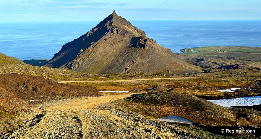 Mt. Stapafell as seen from above
But if you look at it from the side it loses its pyramid shape. So the best photo angles are from below and above Mt. Stapafell.
These two volcanoes, Snæfellsjökull glacier, and Mt. Stapafell make an out-of-this-world pair. There seem to be some supernatural forces at work here, and many people can sense these energies at work when they are close to these two volcanoes.
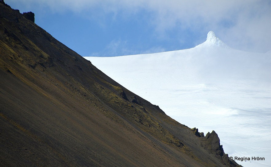 Mt. Stapafell and Snæfellsjökull glacier
Mt. Stapafell is also said to be the home of elves, which makes sense as a little bit further on at Lóndrangar, you will find their church and their library.
On top of Mt. Stapafell, there is a rock called Fellskross, which is a Viking sign of holy powers. I have not been on top of Mt. Stapafell, so I have never seen this Fellskross, I would love to though.
Arnarstapi
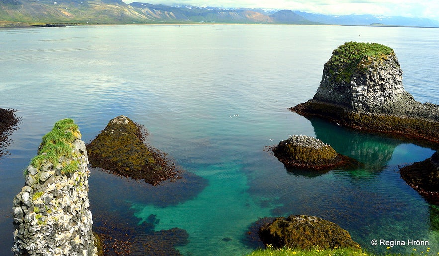 Arnarstapi
Now we take a left turn on Arnarstapavegur road which leads to one of my favourite places on the south side of the Snæfellsnes peninsula, the beautiful Arnarstapi.
One of Iceland's most beautiful natural harbours can be found at Arnarstapi, and the extraordinary columnar basalt and cliff formations here look like artwork.
I would describe Arnarstapi as a beautiful artwork of nature :)
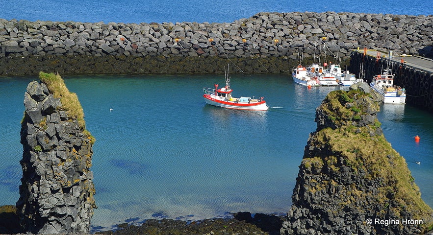 Arnarstapi
In former times Arnarstapi was a vibrant community. The photo below is one of the best-known photo angles from Arnarstapi, with Mt. Stapafell and the white house, and the cliffs in the foreground.
I think everybody takes a photo like this, but I have written an additional travel-blog about Arnarstapi and Hellnar, where I show you more beautiful photo opportunities of Mt. Stapafell at Arnarstapi.
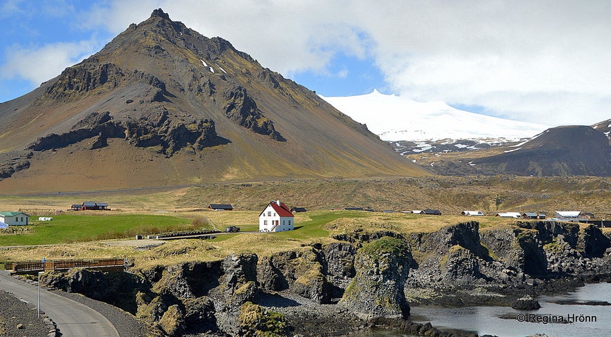 Mt. Stapafell and Arnarstapi
Arnarstapi has also got its share of elf stories, which you can read about in my side-blog about this area.
When you take a walk around the harbour and the sea cliffs during the breeding season of the birds, you will hear and see a myriad of birds squawking, mostly kittiwakes, fulmars, gulls, and the Arctic tern.
I have told you before that I sometimes feel like I have stepped into a magical world on my travels in my country and Arnarstapi is for sure one of these magical places.
Now take a look at the photo below. This is a hole in the middle of the ground, so let's be careful while visiting Arnarstapi!
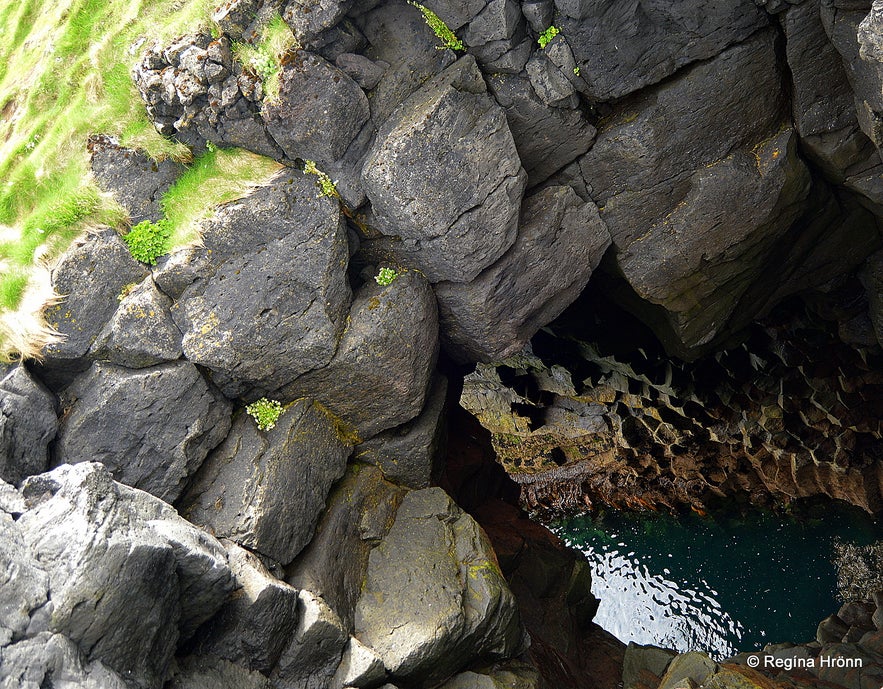
Be careful here
There are some great photo opportunities at Arnarstapi. I especially like the photo below. It is not as dangerous as it looks though, this stone bridge is wide, but then stone bridges have been known to collapse!
Anyhow, this stone bridge is close to the white-coloured Arnarstapaviti lighthouse, which is only 3 meters high.
When visiting this small lighthouse you can walk straight from it to this stone bridge. Beware though as if this stone bridge collapses the fall is high and straight into the sea, so that would be fatal.
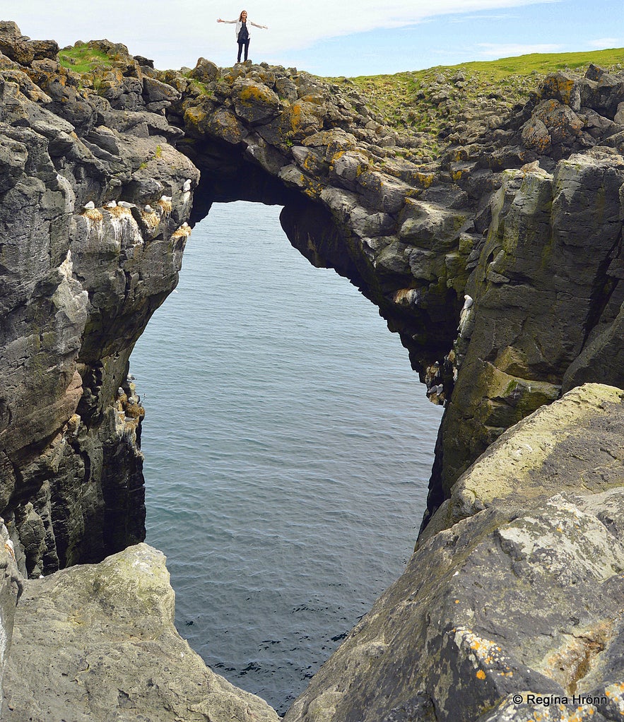
Be careful here
The coastline at Arnarstapi is dotted with beautiful basalt pillars, and it is possible to walk along/above the coastline from the small harbour.
There is also a parking lot by the big stone structure of Bárður Snæfellsás, where you can leave your car and walk to an observation platform above the beautiful Gatklettur - Arch Rock at Arnarstapi.
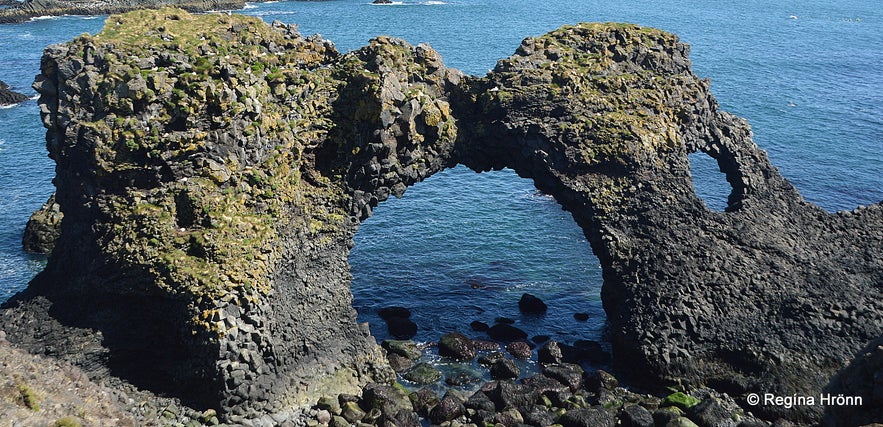 Gatklettur at Arnarstapi
From the observation platform, you will also see such lovely basalt columns, which reach inside a beautiful cave. I am totally in love with basalt columns and think they are the ultimate artwork of nature.
They are ever so beautiful and look like they have been sculptured by an artist, which of course they have been, the creator of all.
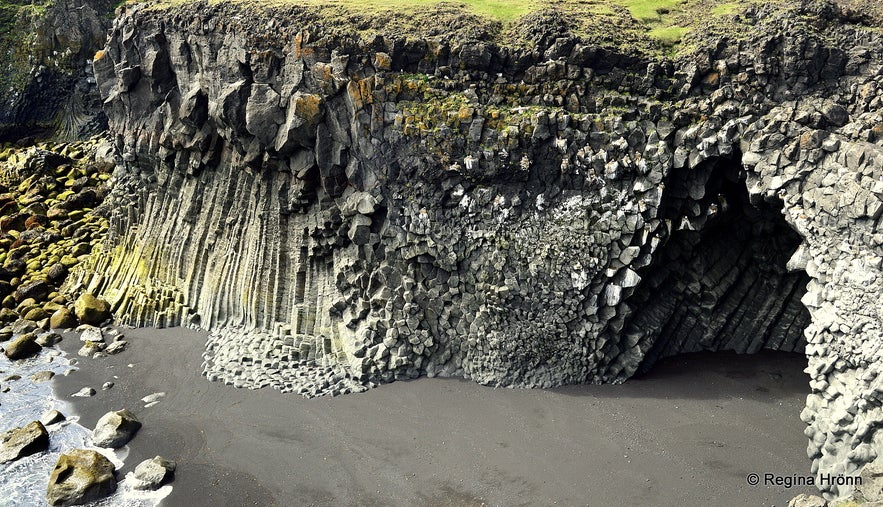 Beautiful basalt columns and a basalt column cave at Arnarstapi
You remember Bárður Snæfellsás, the Protector of the Snæfellsnes Peninsula. I have mentioned him in several travel-blogs as there are so many places in this area, which bear his name.
Bárður Snæfellsás was the settler of this area, half a troll, and half a man, but his mother was human. He came to Iceland in the 9th century and gave the peninsula its name, Snjófellsnes peninsula, but both words "snær" and "snjór" mean snow in Icelandic.
The big stone structure of Bárður Snæfellsás at Arnarstapi was made by the Icelandic sculptor, Ragnar Kjartansson, but you can see his work in other places on the peninsula. It was unveiled on Iceland's national day; the 17th of June 1985.
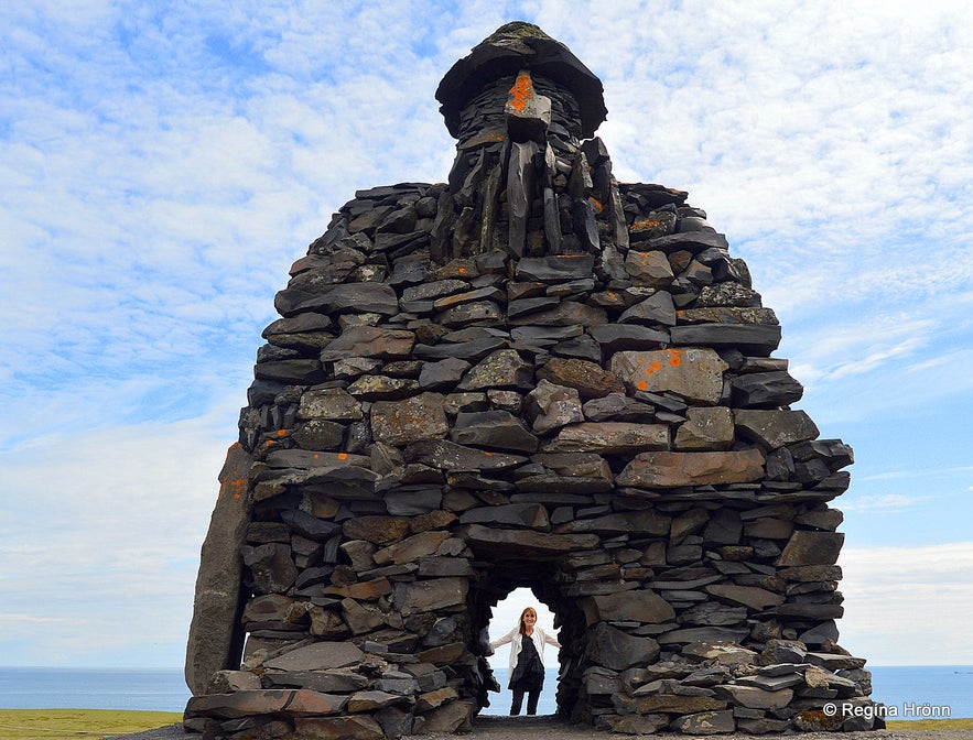 By the huge statue of Bárður Snæfellsás at Arnarstapi
Arnarstapi is one place on the Snæfellsnes peninsula that should not be missed!
A 2.5 km long hiking trail leads through the lava field between Arnarstapi and Hellnar, the next place of interest. But we are going to drive there, so let's drive back to Útnesvegur road number 574, and have a look at Hellnar.
It is a very short drive as you can see from the hike between these two places which is only 2.5 km. Turn left on Hellnavegur road and drive down to the parking lot overlooking the sea.
Hellnar
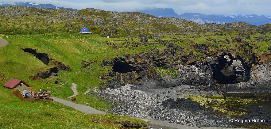 At Hellnar - Fjöruhúsið café
Hellnar used to be one of the biggest fishing stations in Snæfellsnes with the oldest documented information about Hellnar being a fishing village dating back to 1560. According to a census, 194 people were living here in the year 1703, plus all the people who were doing seasonal work at Hellnar.
All in all, there were 38 buildings of some sort at Hellnar with various functions; farms, lodgings for the seasonal workers, and fish-related structures.
Times have for sure changed at Hellnar - now there is even a hotel at Hellnar and a popular little café, Fjöruhúsið café, down by the sea. Plus many more activities.
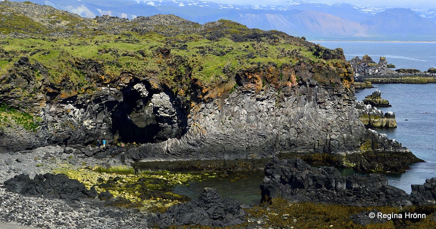 At Hellnar- Baðstofuhellir is somewhere around here
There are such beautiful rock formations down by the sea and a protruding rock, Valasnös, with a huge opening. It is possible to walk right up to the opening. A cave called Baðstofuhellir is to be found inside the cliff, but I have never managed to see it.
You will see and smell a lot of fulmars in the cliffs and whales are often seen in the sea outside of Hellnar. My great-grandmother, Ingibjörg Guðmundsdóttir, was born and raised at Arnarstapi and Hellnar so I have special ties to this beautiful place. She then moved to a very remote location in the Westfjords of Iceland, Ingjaldssandur.
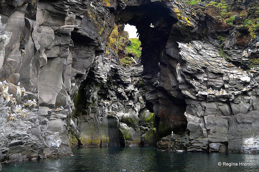 At Hellnar
The lovely little café Fjöruhúsið opened in 1997 and is ever so popular amongst us Icelanders. The café cannot be seen from the road as it is well hidden away until you reach the top of the hill.
The location is fantastic, and it is ever so lovely drinking coffee (or whatever) on the veranda right by the sea and the majestic cliffs. I visit this café every time I am in the area. It is a small café, not a restaurant, but you can buy light meals here.
The 2.5 km hike from Hellnar to Arnarstapi starts here by Fjöruhúsið on the right-hand side. And if you walk a bit further up behind the café and turn left you will find a statue of the Virgin Mary by holy spring water.
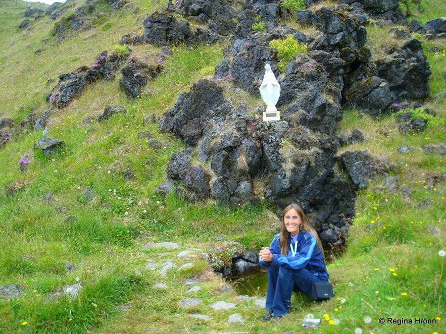 Praying by the holy spring and the statue of the Virgin Mary in July 2008 when my father was ill
Not many people know about this holy spring, but I come here to pray when there are difficulties in my family.
According to legend (not documented), Guðmundur góði biskup - Bishop Guðmundur the Good at Hólar, had a vision in the year 1230 at Hellnar of a woman accompanied by three angels.
She bade him consecrate the spring, which he did. You will find more information on this holy spring in my additional travel-blog about Arnarstapi and Hellnar.
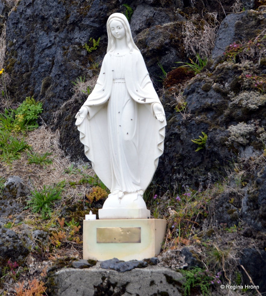 The statue of the Virgin Mary at Hellnar
The coast between Arnarstapi and Hellnar is a nature reserve as it is so beautiful and unique. Let's treat it as such and stay on the trails and within the boundaries and as always leave no litter, especially cigarette stubs, behind.
It always makes me both sad and mad when I visit beautiful nature, and somebody has left litter behind :(
Here you can find the location of Hellnar on the map. Now let's drive up the Hellnavegur road again and stop by Bárðarlaug pool, which is on the left-hand side of this road.
Bárðarlaug pool
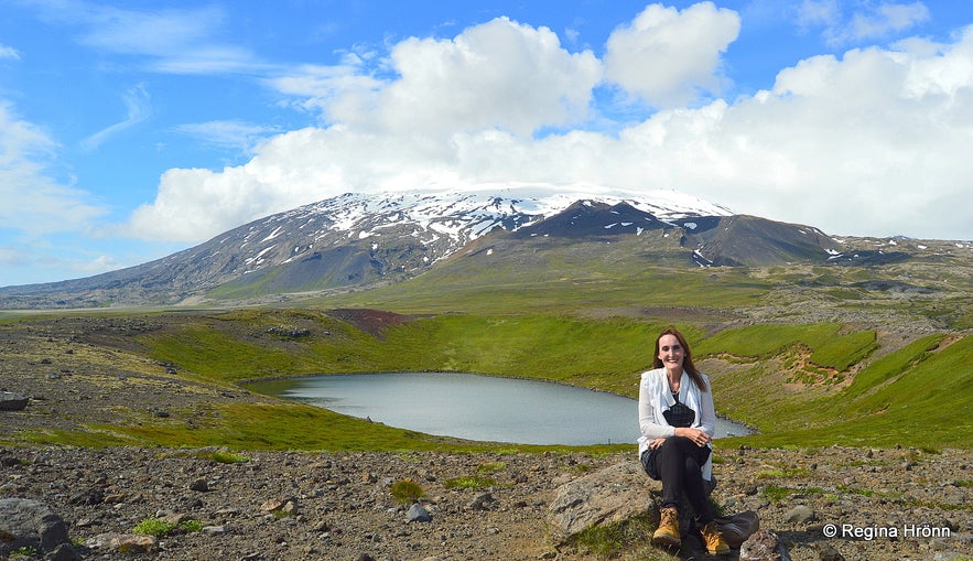 Bárðarlaug pool
Bárðarlaug pool was the bathing pool of Bárður Snæfellsás, the settler, and Protector of the Snæfellsnes peninsula. Bárður had a farm at Laugarbrekka close by and used this lake inside an explosive crater to bathe in.
The explosive crater is from the close of the last glacial epoch, and it seems fitting that the half-troll - half-human used an explosive crater in which to bathe. Just imagine him chilling in Bárðarlaug pool with this beautiful view of Snæfellsjökull glacier.
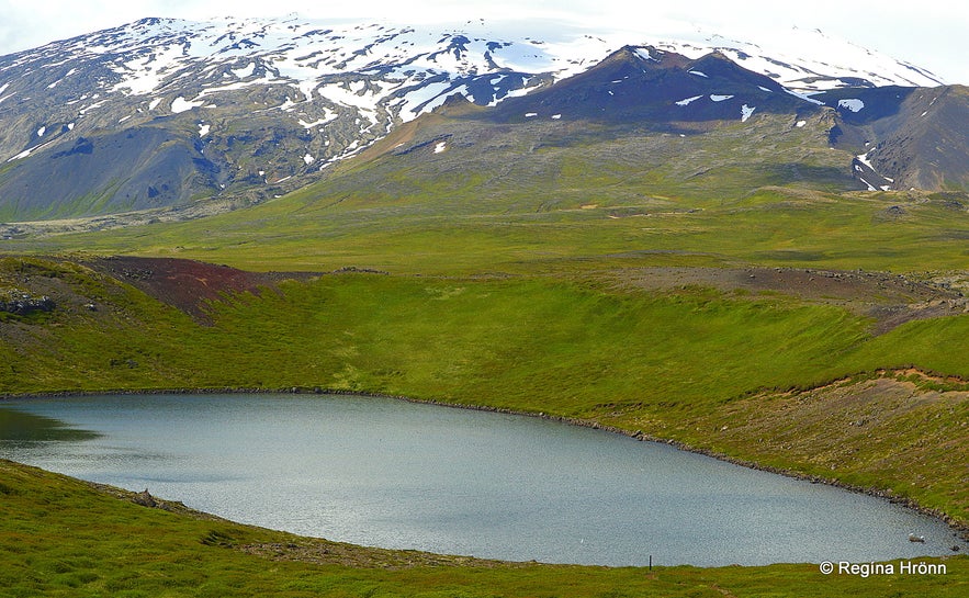 Bárðarlaug
After pushing his nephew into the Rauðfeldsgjá gorge, Bárður disappeared into the Snæfellsjökull glacier and is said to be protecting the peninsula from the glacier.
You will find an information sign by the road and parking. There is a short, easy 10-minute hike from the road if you want to have a look at this lake-filled crater. The once warm water is now cold, so don't bathe in it - the pool is a protected natural monument. You can see Bárðarlaug pool here on the map.
The serial killer Axlar-Björn
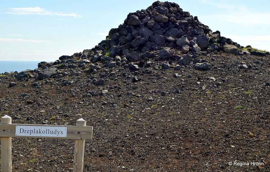 Dreplakolludys burial mound
You will notice a cairn (stone pile) by the parking for the Bárðarlaug pool. Customary cairns were stacked to show the way here in Iceland, but this cairn is actually one of the burial spots of the most notorious serial killer in the history of Iceland, Axlar-Björn.
He murdered around 9-18 people, mainly people travelling in the vicinity of his farm, Öxl. He took their possessions and threw the bodies into a pond on his land, Íglutjörn. Several more dead bodies were discovered in the lava, but Axlar-Björn claimed that he had found them dead on his land.
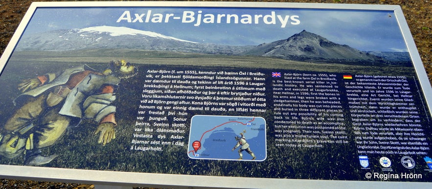 The information sign tells us about Axlar-Björn, the serial killer
I have written a side-blog about Iceland's most infamous serial killer if you want to get better acquainted with his bloody story.
Now let's do something more fun than talking about serial killers! Now we return to Útnesvegur road number 574 and drive for a short distance to Laugarbrekka, which is on your left-hand side.
Laugarbrekka
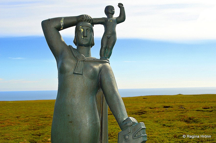 The statue of Guðríður Þorbjarnardóttir and her son Snorri - stolen in April 2022 and returned a couple of days later.
Laugarbrekka is a well-known stop here on the south side of the peninsula as here Bárður Snæfellsás, the settler of this area, built his farm and from here he walked up to Bárðarlaug pool, where he bathed.
Bárður lived at Laugarbrekka until he disappeared into Snæfellsjökull glacier after the incident at Rauðfeldsgjá, which I told you about earlier in this travel-blog.
Axlar-Björn was also executed at Laugarbrekka as this was the meeting place for the local assembly, but we are not going to talk about him anymore.
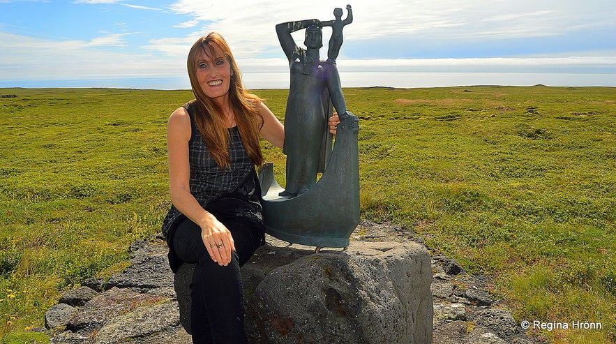 I bet you thought this statue was bigger, right? ;)
An extraordinary woman, Guðríður Þorbjarnardóttir (980-1050), was born in 980 at Laugarbrekka. Guðríður is believed to have been the most widely travelled woman of the Middle Ages, and she managed to go on 8 sea voyages and travelled twice over the whole of Europe!!
She visited America long before Christopher Columbus did and gave birth to a son there, Snorri, who is most likely the first Caucasian child born in America.
If you want to know more about Laugarbrekka and the story of this adventurous woman, then I have written a side-blog about Guðríður :)
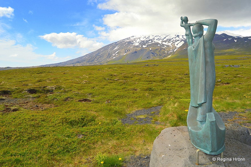 Guðríður Þorbjarnardóttir and Snæfellsjökull glacier
Here you can see the location of Laugarbrekka on the map.
Now, let's return to road 574 and drive just a short distance to two magnificent volcanic plugs called Lóndrangar, which I am going to tell you about in my next travel-blog the Magical Snæfellsnes Peninsula in West Iceland - Part II along with many, many more interesting places to visit on the Snæfellsnes peninsula.
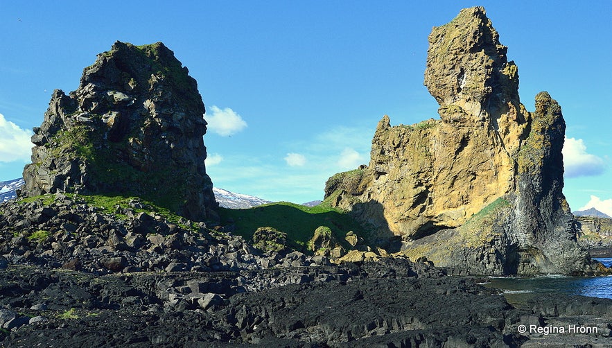 Lóndrangar volcanic plugs - also believed to be the library and the cathedral of the elves
You can rent a car in Reykjavík and drive up to the peninsula in a couple of hours.
If you don't want to drive around the peninsula by yourself, then you can join one of the guided tours around Snæfellsnes:
All the Guided Tours to the Snæfellsnes peninsula
I joined two guided tours of Snæfellsnes to show you what they are like. The Snæfellsnes minibus expedition with Tröll Expeditions, is an excellent guided tour in a small group. And the Snæfellsnes National Park small group tour with Nicetravel was also excellent.
 I created a map with the locations I have shown you in this travel-blog to make it easier for you to visit or skip individual locations.
Here are my Snæfellsnes travel-blogs in the right order, if you want to follow my Snæfellsnes guide in chronological order:
The Magical Snæfellsnes peninsula - part I
The Magical Snæfellsnes peninsula - part II
The Magical Snæfellsnes peninsula - part III
The Magical Snæfellsnes peninsula - part IV
The Magical Snæfellsnes peninsula - part V
The Magical Snæfellsnes peninsula - Arnarstapi and Hellnar
I hope you are going to enjoy travelling around the Snæfellsnes peninsula with me :)
Читать другие блоги
Загадка отеля Radisson 1919
Из истории славного города Рейкьявика Каждый умный человек знает, что свастика, как древний положительный символ движения, благоденствия, солнцеворота, не имеет ничего общего с преступным нацистскимЧитать далееАвтобусы в Рейкьявике и Исландии
Привет, ребята Сейчас очень быстро, без лирических отступлений, расскажу вам об общественном транспорте Рейкьявика - автобусах Stræto. Эти знания вам очень пригодятся, если, приехав в Рейкьявик, выЧитать далееКак Исландия вдохновила легендарных рокеров
Рассказ о том, как песня об Исландии стала классикой рока. Я очень люблю музыку. А музыка - это одна из причин, почему я люблю Исландию. Но история эта не про исландскую группу, а про легенд рок-нЧитать далее

Загрузите приложение крупнейшего туристического портала Исландии на свой телефон, чтобы управлять всей поездкой в одном месте.
Отсканируйте этот QR-код с помощью камеры телефона и нажмите на появившуюся ссылку, чтобы всегда иметь доступ к крупнейшему туристическому порталу Исландии в своем кармане. Введите свой номер телефона или адрес электронной почты, чтобы получить SMS или электронное письмо со ссылкой на скачивание.

