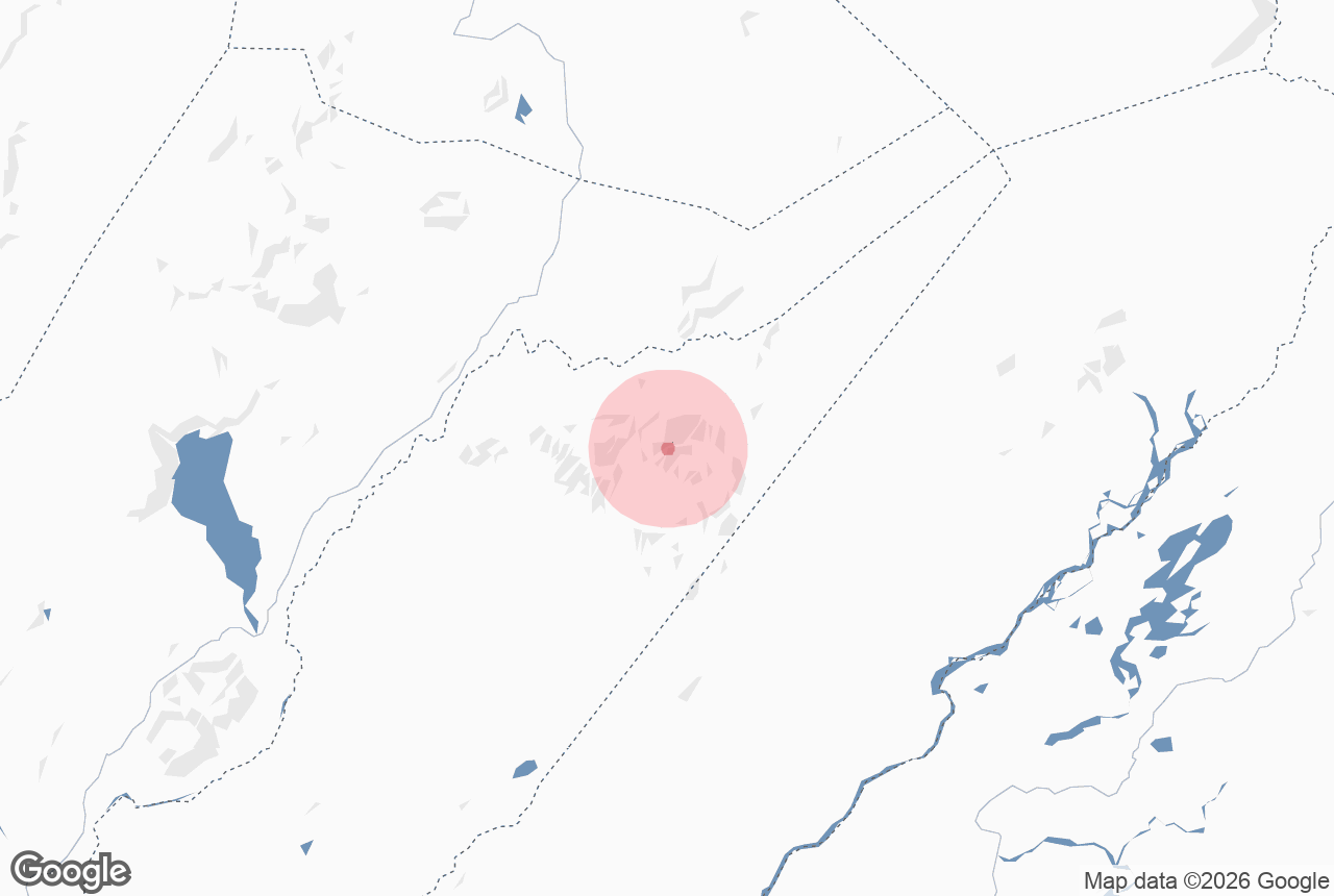
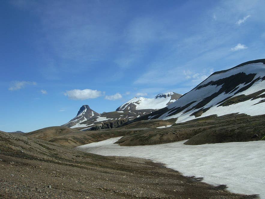
Eastern peaks of Kerlingarfjöll. Photo: Krator, CC BY-SA 3.0
Fannborg is one of the main summits of the Kerlingarfjöll mountain range in the central highlands of Iceland, standing at roughly 1,430 to 1,460 meters (about 4,750 feet) above sea level, depending on the source.
The Icelandic name is usually read as "snow fortress" (fönn, a snowdrift; borg, a fortress or rock citadel), and the mountain lives up to it: it holds snow patches well into summer and small glaciers remain on the high ground of the eastern mountains.
Fannborg sits immediately west of Snækollur, the highest peak of Kerlingarfjöll, and the two are usually climbed together from the Keis car park on the F347 road, a short drive above the Highland Base at Ásgarður.
Key Takeaways About Fannborg
- Rhyolite summit of about 1,430-1,460 m in Kerlingarfjöll, immediately west of Snækollur, the range's highest peak
- Climbed from the Keis car park on the F347 (4x4 only) above the Highland Base at Ásgarður
- Fannborg-Snækollur loop about 6-9 km, 500-650 m ascent, 4-6 hours; route is not waymarked
- Safe window mid-July to mid-September; snowfields and fog earlier in summer
- Reykjavík about 200 km, roughly 3.5-4 hours via Gullfoss and the Kjölur road (Route 35)

Why visit Fannborg
Kerlingarfjöll is a rhyolite volcanic massif on the edge of the Hofsjökull volcanic system, between 68,000 and 350,000 years old, and its pale yellow, red and orange rock is unlike the dark basalt of most Icelandic mountains.
Fannborg is the first big summit on the ridge that runs east to Snækollur, so climbing it puts you on the high rim above the Hveradalir geothermal valleys, where steam rises from fumaroles and hot streams below.
Kerlingarfjöll lies very nearly at the geographical center of Iceland, and from the Fannborg–Snækollur ridge you look out over the Hofsjökull ice cap to the north-east, the Langjökull ice cap to the west, and on a clear day far across the interior. Few day hikes in Iceland give a comparable all-round view.
The climb itself is a classic highland walk: a steep, stony ascent over loose rhyolite scree and firm snowfields, then a broad ridge. Published heights for Fannborg range from 1,428 m to 1,458 m (the Environment Agency of Iceland gives 1,458 m); neighbouring Snækollur is about 1,480 m.
Kerlingarfjöll was home to a summer ski school from 1961 until 2000, on the snowfields below these peaks. The area, roughly 350 square kilometers (official figures range from 344 to 367 km²), was protected as a landscape protection area in 2020.

Kerlingarfjöll's glaciated eastern peaks. Photo: DR, CC BY-SA 3.0
How to get to Fannborg
Fannborg is reached only in summer and only by a highland road.
From Reykjavík, follow Route 1 and Route 35 past the Geysir hot springs and Gullfoss waterfall, then continue on Route 35, the Kjölur highland road, which runs north between Langjökull and Hofsjökull.
From Gullfoss, count on 1 to 1.5 hours over about 65 km of gravel to the Kerlingarfjöll junction, passing Hvítárvatn lake.
At the junction turn east onto the F347 to Kerlingarfjöll, about 10 km (roughly 15 minutes) past Gýgjarfoss waterfall. The F347 is an F-road and legally requires a four-wheel-drive vehicle. The first stop is the Highland Base at Ásgarður (the old Kerlingarfjöll resort). The drive from Reykjavík is about 200 km and typically takes 3.5 to 4 hours one way.
For the summit hike, continue past Ásgarður on the F347 towards Hveradalir. The route to Fannborg and Snækollur, which is not waymarked, starts at the small parking area at Keis (N 64° 39.073', W 19° 15.295'), by the shed called Kastali, at the end of a 0.7 km side track off the Hveradalir road before the main Hveradalir car park.

Kerlingarfjöll peaks around 1900. Photo: Frederick W. W. Howell, public domain
Best time to visit
The Kjölur road normally opens between late May and mid-June, and the F347 somewhat later, usually in the second half of June, depending on snowmelt; both close with the first autumn snow in September or early October.
For the summit the safe window is narrower: hiking guides recommend mid-July to mid-September, when the snowfields on the ridge have consolidated and the path is easiest to follow. In June and early July large snowfields still cover the route and visibility is often poor.
Safety and practical tips
- Route and time. The standard loop over Fannborg and Snækollur is about 6 to 9 km with 500 to 650 m of total ascent and takes 4 to 6 hours, depending on conditions and how many summits you add. The Environment Agency of Iceland grades the longer ridge route over the peaks Fannborg, Vesturgnýpa, Snækollur, Snót and Loðmundur as black, a demanding unmarked walk of around 9 km with about 650 m of ascent and 5 to 6 hours, with the final climb of Loðmundur not suitable for anyone with a fear of heights.
- Footing. Expect loose rhyolite scree, steep gravel slopes and snowfields. Hiking poles are useful; sturdy boots with ankle support are essential.
- Weather. Even in July the summit is often only a few degrees above freezing and the ridge is fully exposed. Fog can arrive quickly and the route is not marked, so carry a map, GPS track and warm, windproof layers even on a sunny morning.
- Facilities. A restaurant, accommodation, a campsite and geothermal baths are at the Highland Base at Ásgarður. There is no fee to hike; the area is a protected landscape area, so keep to existing paths where they exist and leave the rhyolite and vegetation undisturbed.
- Mobile coverage is patchy. Check road.is and vedur.is before you leave Gullfoss, and leave a travel plan at safetravel.is.
Nearby attractions
- Snækollur – the highest peak of Kerlingarfjöll, 0.6 km east along the same ridge
- Loðmundur – the pointed peak of about 1,430 m with an exposed final climb, 1.9 km
- Hveradalir Geothermal Area – the steaming valleys below the summits, 2.2 km
- Kerlingarfjöll Mountain Range – overview of the whole massif, 4.3 km
- Ásgarður (Kerlingarfjöll) – the Highland Base and old ski resort, 5.3 km
- Gýgjarfoss waterfall – on the F347 just off the Kjölur road, 10 km
Tours that visit Fannborg
- Kerlingarfjoll Hiking Tour in the Icelandic Highlands with Reykjavik Transfers – a full-day guided hike (11 to 12 hours) from Reykjavík, or with a Gullfoss pickup, with highland transport included; it first walks about 2 km in the Hveradalir geothermal valley and then climbs Fannborg and Snækollur, about 6 km, for roughly 8 km and 500 m of ascent in all. Minimum age 10.
