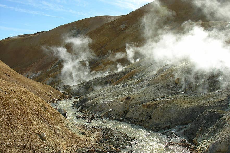
Steaming slopes in Kerlingarfjöll. Photo: Petr Kraumann, CC BY 3.0
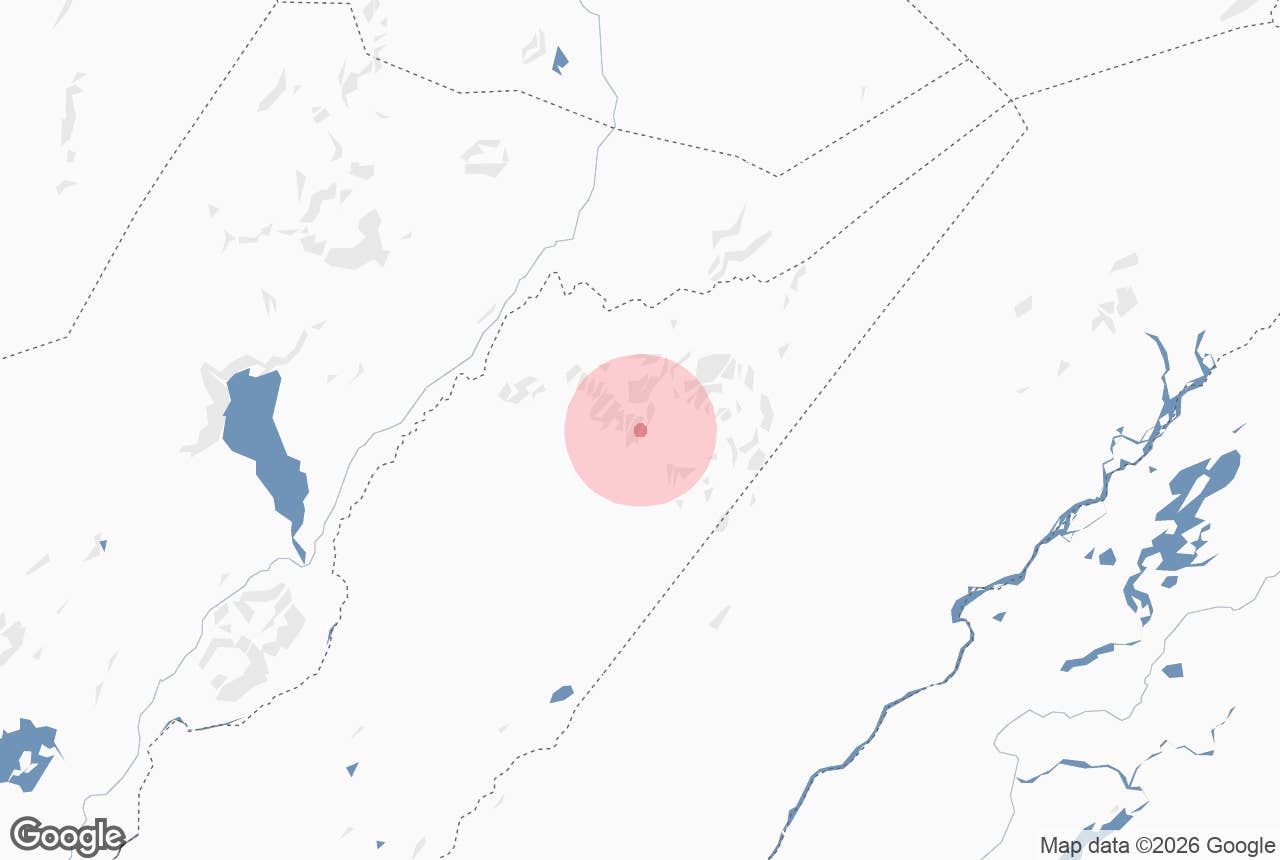
Hverabotn is a high-temperature geothermal area in the Kerlingarfjöll mountains in the central Highlands of Iceland, about 2.5 km south-west of the better-known Hveradalir hot-spring valley.
The name means "hot-spring hollow" (hver = hot spring, botn = the closed head of a valley); tour texts also use the plural Hverabotnar.
Hverabotn sits at the head of Kerlingardalur, under the small glacier Mænisjökull and the peaks Höttur and Ögmundur, and is one of three high-temperature fields in Kerlingarfjöll, much quieter than Hveradalir.
Key Takeaways About Hverabotn
- One of three high-temperature geothermal fields in Kerlingarfjöll, about 2.5 km south-west of Hveradalir at the head of Kerlingardalur below Mænisjökull.
- No road: reached on Highland Base's guided hike from the Hveradalir car park (about 9 km, 100–300 m ascent, 5 hours, age 12+) or by helicopter from Reykjavík.
- Access via Route 35 (Kjölur, signed F35) and F347 to Highland Base at Ásgarður, about 200 km and 3.5–4 hours from Reykjavík; 4x4 required.
- Season usually late June to mid-September; the guided hike is offered 15 June to 30 September when roads allow.
- Boiling springs and thin crust: stay on firm ground; no bathing here, baths are at Highland Base.

Why visit Hverabotn
Kerlingarfjöll is a volcanic massif rising to 1,488 m at Snækollur between the Langjökull and Hofsjökull ice caps, built largely of rhyolite erupted between roughly 70,000 and 350,000 years ago. The rhyolite weathers into red, yellow and ochre slopes, and minerals from the hot springs add greens and whites.
Hveradalir, with its car park and marked paths, gets most visitors. Hverabotn has the same ingredients, hot springs, mud pots, fumaroles and steaming ground in a snow-streaked basin, but far fewer people and no boardwalk.
Highland Base, the resort that runs guided tours in the area, describes Hverabotn as one of three high-temperature geothermal fields in Kerlingarfjöll, with "many mighty hot springs, mud pots and fumaroles".
Their guided Hverabotn hike climbs from the Hveradalir car park toward Mænisjökull to the highest point of Hverabotn, about 9 km in total with 100 to 300 m of ascent, and takes around five hours.
The whole Kerlingarfjöll area, 344 square kilometres, was protected as a nature reserve in 2020. The mountains take their name from Kerling ("old woman"), a tuff rock pillar beside the peak Kerlingartindur; the helicopter tour calls the range the Witches Mountains after stories in Icelandic folklore. A summer ski school operated here from 1961 until 2000.
How to get to Hverabotn
Hverabotn is in the Highlands and is only accessible in summer. From Reykjavík, drive the Golden Circle road past Gullfoss, where Route 35 continues as the Kjölur highland road (Kjalvegur, signed F35). After about 60 km of gravel, turn east onto F347 (Kerlingarfjallavegur), which leads in about 10 km to Highland Base at Ásgarður.
Highland Base gives the drive as about 200 km and 3.5 hours in summer conditions; allow four. A 4x4 with good clearance is required on F347 and strongly recommended on the Kjölur gravel; rental companies forbid two-wheel-drive cars on F-roads.
From Highland Base, a rough mountain track (Hveradalavegur, also numbered F347) continues up to the Hveradalir car park, about 6 km. There is no road to Hverabotn itself.
The guided Hverabotn hike starts at the Hveradalir car park, so the walk is about 4.5 km each way over loose rhyolite and snow patches.
Hiking independently is possible for experienced walkers with a map and GPS, but the route is unmarked and the ground around the springs is hazardous.
The helicopter tour listed below lasts 2.5 to 3 hours from Reykjavík in all and lands in Hverabotn (Hverabotnar) for about 15 minutes.
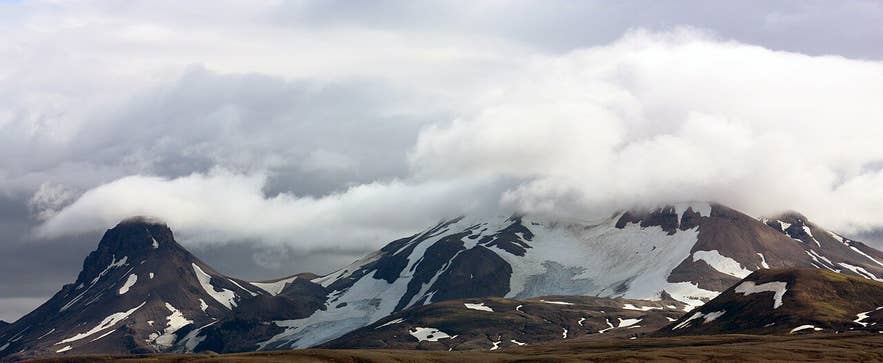
Kerlingarfjöll from the Kjölur road. Photo: DR, CC BY-SA 3.0
Best time to visit
Usually late June to mid-September, when the F-roads are open. Highland Base offers the Hverabotn hike from 15 June to 30 September, but the Kjölur road and F347 often open only in late June and close with the first autumn snow; check road.is.
July and August give the most reliable weather and the most colour, because the snow has melted off the rhyolite. Early-season visits mean more snow in the basin, which hides some springs but makes the steam more dramatic.
Safety and practical tips
- Geothermal ground can be thin and the water in the springs is near boiling. Keep to firm ground and tracks, never step on pale or wet crust, and keep children close.
- Weather at this altitude changes fast; expect wind, fog and snow in any month. Bring full waterproofs, warm layers, gloves and sturdy boots.
- There are no facilities at Hverabotn. Toilets, food, a hotel, huts, a campsite and baths are at Highland Base in Ásgarður, 7 km away.
- The guided hike is rated for beginners but is 9 km with scree and snow; minimum age 12. Check conditions and book at highlandbase.is.
- Phone signal is patchy. Tell someone your route if walking independently.
- There is no entry fee to the nature reserve. Guided hikes and the baths at Highland Base are paid.
Nearby attractions
- Hveradalir Geothermal Area - 2.6 km. The main hot-spring valley of Kerlingarfjöll with a car park and marked paths.
- Kerlingarfjoll Mountain Range - 5 km. The rhyolite massif that contains Hverabotn.
- Snækollur - 5 km. The highest peak in Kerlingarfjöll at 1,488 m.
- Loðmundur - 6 km. Distinctive peak on the north-east side of the range.
- Highland Base at Kerlingarfjöll - 7 km. Hotel, huts, campsite, baths and the start of all guided hikes.
- Gýgjarfoss waterfall - 10 km. Waterfall near F347 on the way in to Kerlingarfjöll.
Tours that visit Hverabotn
- 2.5-Hour Helicopter Tour to Kerlingarfjoll in the Icelandic Highlands with two Landings - departs Reykjavík Domestic Airport, lands first at Hvítárvatn and then for about 15 minutes at Hverabotnar.
