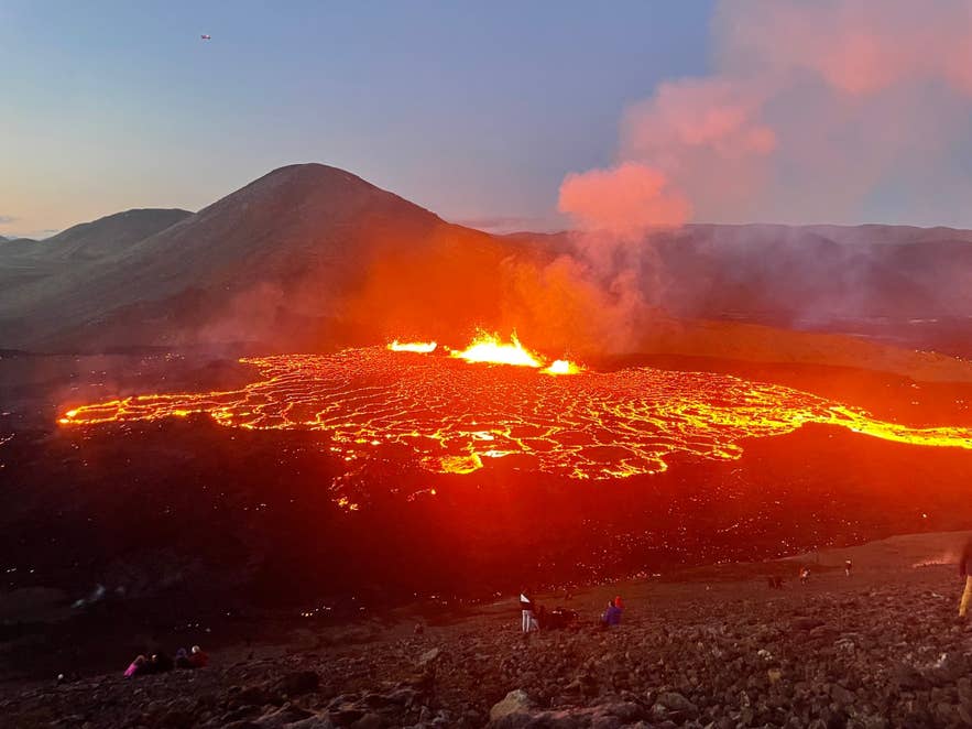
Meradalir fissure eruption, August 2022. Photo: Drumstick21, CC BY-SA 4.0
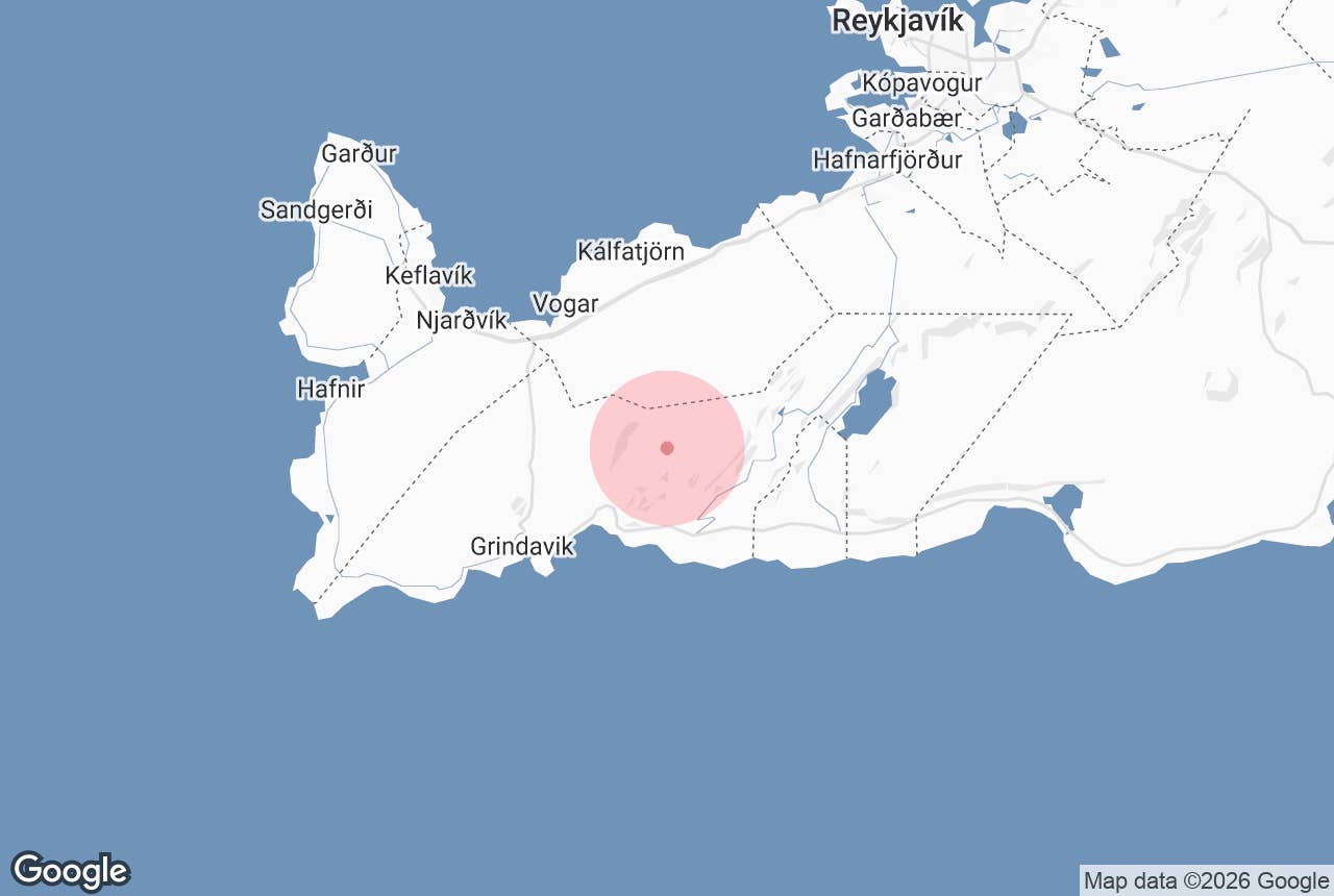
Meradalir (Icelandic: Meradalir, "the mares' valleys") is a group of shallow valleys on the east side of Fagradalsfjall mountain on the Reykjanes peninsula, about an hour's drive south-west of Reykjavík.
It is where Iceland's second Reykjanes eruption of the 2020s took place: on 3 August 2022 a fissure about 360 m long opened in the valley floor and for 18 days poured out lava on top of the flows from the 2021 Geldingadalir eruption.
Today the fissure is quiet, the lava has cooled to a black, ropey crust, and Meradalir is a popular hiking destination for anyone who wants to stand beside ground younger than they are.
Key Takeaways About Meradalir
- Site of the 3–21 August 2022 fissure eruption, on top of lava from the 2021 Geldingadalir eruption
- About 12 million m³ of new lava in 18 days; the fissure is now quiet and the lava has cooled
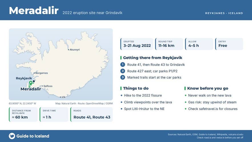
- Reached on foot from car parks on Route 427 east of Grindavík; a long, hilly walk of roughly 11–16 km round trip
- No 4x4 needed, but the area has been closed at short notice since 2023; check safetravel.is first
- Never walk on the new lava: thin crust over hot or hollow ground, and possible volcanic gas
Why visit Meradalir
Meradalir lets you see three recent eruptions in one place. The valley filled first with lava from the 2021 eruption, which started in Geldingadalir on 19 March 2021 and ran until September, spilling east into Meradalir in April when new vents opened.
The 2022 eruption then broke out along the northern edge of that lava, producing around 12 million cubic metres of new lava over roughly 1.25 km² in under three weeks; early on it was flowing at over 30 cubic metres per second, with fountains tens of metres high and a gas-and-steam plume 500–1,000 m tall.
A year later, in July 2023, a third eruption opened about 3 km to the north-east at the hill Litli-Hrútur, visible across the valley from the Meradalir viewpoints.
What you see on the ground:
- A wide, black lava plain with ropy pāhoehoe surfaces, pressure ridges and collapsed crust, still warm in places and venting thin steam from cracks.
- The 2022 spatter cone and fissure line at the northern end of the valley, with red and yellow oxidised rock around the vents.
- The surrounding hills of Fagradalsfjall (a flat-topped tuya formed under Ice Age ice, with its highest point Langhóll at 385 m), Stóri-Hrútur and Meradalahnúkar, which give elevated views across the whole lava field.
- Evidence of how fast Reykjanes has changed: after almost 800 years without eruptions, the peninsula has had a series of them since 2021, and Meradalir is one of the most accessible places to see that story.
How to get to Meradalir
Meradalir is reached on foot from car parks on Route 427 (Suðurstrandarvegur), east of Grindavík.
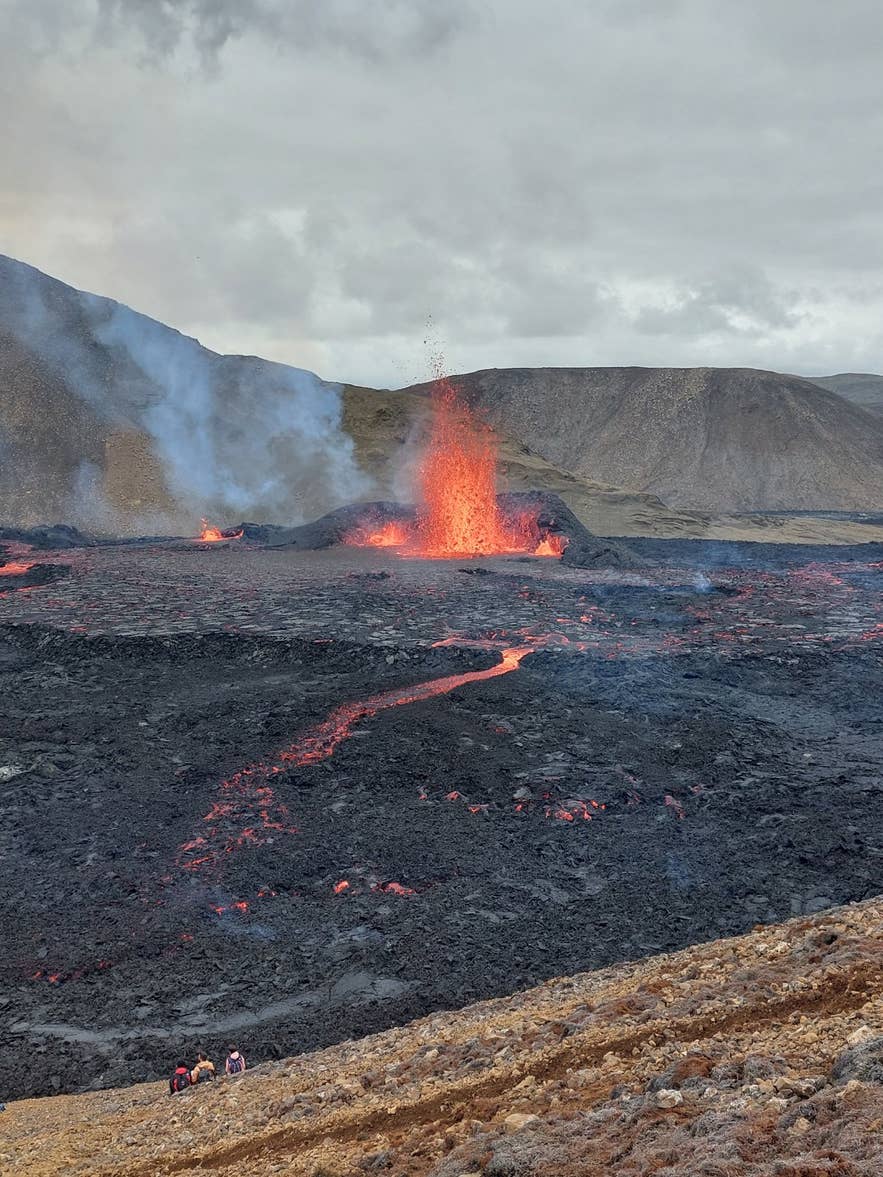
Lava fountain in Meradalir, 2022. Photo: Berserkur, CC BY-SA 4.0
- From Reykjavík (about 1 hour, roughly 60 km): take Route 41 toward Keflavík, turn onto Route 43 toward Grindavík, then Route 427 east. The eruption-site car parks (signposted P1 and P2) are on Route 427 east of Grindavík.
- From Keflavík Airport: about 40–45 minutes via Route 43 and 427.
- Parking: the car parks are run through Parka (parka.is); the landowners' fee for a passenger car was 1,000 ISK per day in 2026, paid by card online, and number plates are registered by camera. You can pay before or within 24 hours of your visit, but mobile signal is patchy in the valley, so paying before you set off is simplest.
- The walk: the marked trails to the 2021 and 2022 eruption sites start from the car parks. The full walk to the Meradalir fissure is a long one. Published figures range from about 11 to 16 km for the round trip depending on the route and viewpoint chosen (Visit Reykjanes gives 6–8 km each way for Path A), across hilly ground and old lava, so allow 4–5 hours with stops. Shorter options climb to viewpoints over the lava without descending into the valley. The ground is rough and rocky, with 200–300 m of total ascent.
- No 4x4 is needed in summer. In winter the car parks and trails can be icy and the roads on Reykjanes are exposed to strong winds.
Access to this part of Reykjanes has changed repeatedly since late 2023 because of the Sundhnúkur crater-row eruptions and the evacuation of Grindavík. Closures of Route 43, Route 427 and the eruption-site car parks have been imposed and lifted at short notice. Always check safetravel.is and visitreykjanes.is for the current status before setting out.
Best time to visit
Meradalir can be walked year-round, but late May to September is the easiest: trails are free of ice, daylight is long and the car parks are reliably open. In summer, a late-afternoon or evening walk gives softer light on the black lava and fewer people.
From October to April, go in daylight, carry crampons or microspikes, and check the wind forecast; the trails cross open hillsides with nowhere to shelter. On clear, dark winter nights the area is a good northern-lights spot, which is why several operators combine the hike with an aurora hunt.
Safety and practical tips
- Do not walk on the new lava. The crust can be thin over hot or hollow ground, and it collapses without warning. Stay on the marked path and on the older, solid ground around the edges.
- Volcanic gas (sulphur dioxide and others) can still seep from cracks, especially in still weather. Stay upwind of steaming areas and leave if you feel irritation in your eyes or throat. Children, older people and anyone with breathing difficulties should be especially careful.
- Wear sturdy hiking boots with good grip; the trails are loose gravel and sharp lava. Bring wind- and waterproof layers, water, snacks and a headlamp outside midsummer.
- There are no toilets, water or shelter on the trails. Use the facilities in Grindavík or at the Blue Lagoon before you set out.
- The Icelandic Meteorological Office (vedur.is) publishes gas-dispersion forecasts and seismic updates for Reykjanes. If a new eruption begins on the peninsula, expect the area to be closed at short notice.
- Drones are often restricted around active sites; check current rules before flying.
Nearby attractions
- Fagradalsfjall – about 1.4 km
- Geldingadalir – about 1.8 km
- Litli-Hrútur Eruption 2023 – about 2.8 km
- Nátthagi Valley – about 4 km
- Sundhnukagigar Volcano – about 8 km
- Seltún Geothermal Area – about 9.4 km
- Blue Lagoon – about 10.1 km
Tours that visit Meradalir
- Small Group 5-Day Iceland Tour with Golden Circle, South Coast, & Volcano Hike
- Day Hike to the Recent Eruption Site of Fagradalsfjall Volcano from Reykjavik
- Combo Tour of Meradalir Volcanic Area & Northern Lights Hunt from Reykjavik
- Combo Tour of Fagradalsfjall Volcano and Sky Lagoon from Reykjavik
- Private 8-Hour Reykjanes Peninsula Tour in Super Jeep with Volcano Hike and Blue Lagoon
- Exhilarating 35-Minute Helicopter Tour to the Volcano Area from Reykjavik (overflight of the Reykjanes eruption sites rather than a landing at Meradalir)
