
The Sundhnukagigar Volcano System has had regular eruptions since 2023. In the years since, it’s put on a fiery show with lava fountains spraying over 150 feet (45.72 meters) high, most recently in July 2025. What can we say? That’s why they call this nation the land of fire and ice.
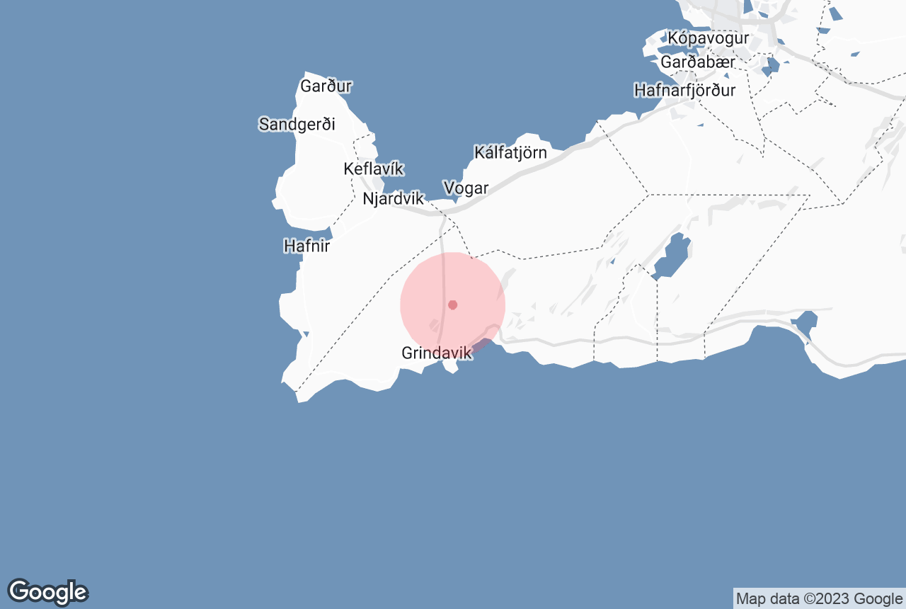
Sundhnukagigar is a row of craters just outside the small fishing town of Grindavik, which sits on the Reykjanes Peninsula in Southwest Iceland. It's the site of some of the most exciting volcano tours in Iceland.
Why You Can Trust Our Content
Guide to Iceland is the most trusted travel platform in Iceland, helping millions of visitors each year. All our content is written and reviewed by local experts who are deeply familiar with Iceland. You can count on us for accurate, up-to-date, and trustworthy travel advice.
Sundhnukagigar Volcano is not the same as the Fagradalsfjall Volcano, which erupted in 2021 and 2022. Sundhnukagigar is part of the ongoing volcanic eruptions on the Reykjanes Peninsula.
The newest eruption of Sundhnukagigar Craters started in the early hours of July 16th, 2025, and lasted for almost a month. It marked the 9th Sundhnukagigar eruption since late 2023, and the 12th eruption on the Reykjanes Peninsula since 2021.
These eruptions have not had any effect on travel in Iceland, and daily life goes on as normal for locals.
One of the best ways to experience the Sundhnukagigar Craters is with a volcano helicopter tour, and as of July 2025, a hiking path has been opened to the eruption site. You can also book a volcano shuttle to see the different Reykjanes volcanoes up close, skipping the hike.
Authorities have closed parts of the site to the public to ensure visitor safety. Newly formed lava fields are unstable and emit hazardous gases. It's crucial to respect these closures and avoid attempting to enter the area on foot until authorities deem it safe to do so.
Key Takeaways
-
Earth's Crust in Action: The Sundhnukagigar eruptions are the dramatic result of Iceland's position on the Mid-Atlantic Ridge, creating a fiery display every few centuries.
-
From Tourist Attraction to Hazard Zone: While earlier eruptions like Fagradalsfjall drew crowds, the Sundhnukagigar events became increasingly intense and dangerous. They led to evacuations, infrastructure damage, and a shift away from sightseeing to careful monitoring.
-
Science Prevails: Iceland's sophisticated monitoring system of seismometers, GPS, and satellites allows scientists to predict eruptions and keep people safe. It showcases the power of technology in managing natural disasters.
How to Visit Sundhnukagigar Volcano
 Though experts are still monitoring the Sundhnukagigar Craters and the Reykjanes Peninsula for volcanic activity, the region offers exciting activities.
New Hiking Trail & Volcano Shuttle to Sundhnukagigar in 2025
Exploring the Sundhnukagigar eruption site is now easier than ever, thanks to a new hiking trail that opened in July 2025. This path gives visitors the chance to get even closer to the area. It provides unique views of the lava fields and a better sense of the power and scale of the recent volcanic activity. You can learn more about the latest trail updates by checking the VisitReykjanes website.
For those planning to hike, consider joining a guided hiking tour to the volcano that includes expert guidance, safety equipment, and the most up-to-date information about conditions on the trail. But if you prefer to hike independently, make sure to wear proper hiking gear, and it's recommended to carry a gas mask, as volcanic gases can accumulate in low-lying areas even when no eruption is visible.
Before heading out, always check the Loftgaedi website for air quality conditions and the SafeTravel website for the latest safety updates.
 Aside from hiking, you can now take advantage of a new shuttle service that brings visitors directly to several volcano viewpoints. It’s perfect for those with limited time or who prefer a relaxed way to explore. For a more dramatic perspective, you can also join a helicopter tour to see the vast lava fields from the sky.
Check out our complete guide to the Sundhnukagigar volcanic eruptions for everything you need to know about the ongoing activity in Reykjanes.
Volcano Helicopter Tours
Helicopter tours fly travelers over recent disruption sites to provide views of the craters, lava fields, and geological formations from above. You can get a peek at this livestream of the eruption site.
-
Scenic 1-Hour Helicopter Tour by the Latest Volcanic Fields in the Reykjanes Peninsula
-
30-Minute Sightseeing Helicopter Tour by Lava Formations in the Reykjanes Area
Geological Background

Photo from Wikimedia, Creative Commons, by TommyBee. The area in 2022. The Capital Area and lava from the Fagradallsfjall eruptions are in the top right, and Grindavik to the bottom left. The old Sundhnukagigar craters are the dark crack in the middle of the peninsula, above the right edge of Grindavik.
The Sundhnukar Crater Row is part of the Reykjanes Peninsula’s volcanic system. This relatively young geological feature lies within the Svartsengi Volcanic System. This region is part of the larger Mid-Atlantic Ridge, where the Eurasian and North American tectonic plates are actively spreading apart, leading to frequent volcanic and seismic activity.
As the tectonic plates drift farther apart, they create “rift zones” that produce basaltic lava flows. Icelandic volcanoes produce a distinct type of highly fluid lava that can spread over large areas and form extensive lava fields.
The Reykjanes Peninsula experiences eruptive cycles approximately every 800–1,000 years. Before becoming active in 2021, the most recent eruption occurred over 800 years ago. This region is home to the Svartsengi Power Station, which heats the famous Blue Lagoon.
Sundhnukagigar Crater Row Activity
The Sundhnukagigar Crater Row has experienced a series of volcanic eruptions beginning in December 2023. Below is a timeline of these events:
December 18–21, 2023

The 2023 Sundhnukagigar fissure seen from a helicopter on the first night of the eruption.
The first of the most recent Sundhnukagigar eruptions started on December 18th near Hagafell, northeast of Grindavik. Lava sprays reached a height of over 328 feet (100 meters).
The lava flowed much faster than previous disruptions, covering 1.86 miles (3 kilometers) within one hour, reaching the outskirts of Grindavik. Over the first two days, the lava field surrounding Sundhnukagigar reached 4 square miles (10 square kilometers).
January 14–16, 2024
 A second eruption began early January 14th by Hagafell Mountain near the Sundhnukagigar Craters. It damaged three houses on Grindavik's edge, but the rest of the town remained unharmed. This marked the start of the 2024 Sundhnukagigar eruptions.
February 8–9, 2024

The start of the 2024 February eruption of Sundhnukagigar craters.
The February 8th eruption started less than a mile (1 kilometer) north of Grindavik, in the same area as the December eruption. It impacted roads and hot water supply infrastructure.
March 16–May 9, 2024

The lava of the 2024 March eruption flowed toward the Grindavik barriers and the Grindavikurvegur road.
The fourth eruption began on March 16th, northeast of Hagafell. Initially presenting as a row of fissures, the activity later concentrated into a single crater. This eruption became the longest in the series, concluding on May 9th.
May 29–June 22, 2024

The fifth eruption started on May 29th following intense seismic activity. It featured a 2.1-mile (3.4-kilometer) long fissure, with lava flows impacting Grindavik and Nesvegur Roads.
August 22–September 5, 2024
 The sixth eruption began on August 22nd, north of previous eruption sites. It was the largest in the series.
November 20–December 9, 2024
 The seventh eruption began on November 20th and lasted until December 9. It caused damage to the parking area of the Blue Lagoon, but other infrastructure was safe behind protective barriers.
April 1, 2025
 The eighth eruption in the Sundhnukagigar eruptions series started on the morning of April 1st, 2025. This 8th eruption started with an unusual number of small earthquakes that could be felt throughout Grindavik, with some being felt in the Capital Area.
Lava broke through the surface around 9:30 AM, emerging from the same area as previous Sundhnukagigar eruptions. For a time, there were concerns it might reach Grindavik, but the eruption quickly lost intensity. By the following day, activity had largely subsided, and no damage to infrastructure was reported.
Despite the eruption calming, the region continued to experience minor earthquakes, sparking speculation about the potential for renewed volcanic activity. While no further eruptions have occurred so far, magma continues to accumulate underground, suggesting that future eruptions remain likely.
Travel in Iceland remains unaffected, and Keflavik International Airport continues to operate normally.
July 16-August 5, 2025
 On July 16th, the ninth eruption at Sundhnuksgigar began, marking the twelfth eruption on Iceland’s Reykjanes Peninsula since 2021. A new fissure opened southeast of Litla-Skogfell Mountain, with lava flowing away from populated areas. Precautionary evacuations occurred near the Blue Lagoon spa.
The eruption was preceded by seismic activity and ground deformation, similar to past events. Although the eruption posed little risk to towns, sulfur dioxide gas was a concern in the closest vicinity, and residents were advised to monitor air quality.
This eruption lasted for almost a month, coming to a close on August 5th.
Authorities continue to monitor the situation, restricting access to safe viewing areas. The Reykjanes Peninsula remains volcanically active, with more eruptions expected.
Impact of the Sundhnukagigar Eruptions
 The Sundhnukagigar eruptions have covered over 12 square miles (31 square kilometers) in fresh lava. Infrastructure damage in Grindavik has been severe, with residents forced to evacuate. However, nature is very skilled at healing itself over time. As lava reshapes the landscape, it eventually breaks down and creates new soil for plant life and moss to grow.
With Iceland's world-class monitoring systems and quick-response infrastructure, visitors are kept well-informed and safe. That means you can still enjoy the beauty and magic of Iceland, with only the immediate surrounding area of the Sundhnukagigar Craters temporarily off-limits.
Evacuations and Infrastructure Damage

The February 2024 Sundhnukagigar eruption seen from a safe distance. Photo from Wikimedia, Creative Commons, by Steinninn.
Thanks to the signals from seismic activity, scientists are able to predict when an eruption will take place, though the notice period tends to be different with each eruption.
In previous events, the lava has flown over roads leading in and out of Grindavik. Some homes and buildings sustained damage. The famous Blue Lagoon Geothermal Spa is usually closed temporarily for each eruption.
Many were concerned about the Svartsengi Geothermal Power Plant, a major power and heating facility supplying Reykjavik and the peninsula. However, protective barriers have been set up, and lava has never reached the plant.
Impact on Grindavik and Recovery Efforts

Lava flow from the February 2024 Sundhnukagigar eruption reached the Grindavik road and the main Reykjanes hot water pipe.
In the aftermath of the Sundhnukagigar eruptions, more than 60 buildings have been deemed uninhabitable. These include parts of a nursing home, an elementary school, and a gymnasium, all compromised by ground fissures.
Efforts to restore Grindavik have involved mobilizing dozens of electricians and plumbers to conduct critical repairs. Specialized teams addressed ground fissures and filled cracks to stabilize the area.
The Icelandic government and major banks offered financial relief, including:
-
Waiving interest on housing loans
-
Providing wage assistance to local businesses
Grindavik Reopens (With Restrictions)
 In October 2024, Grindavik was officially reopened to the public, though certain hazardous zones remained restricted. However, the town may be temporarily closed again when eruptions start, until it can be deemed safe to enter again.
Today, authorities still monitor seismic activity and ground deformation to anticipate future disruptions.
Previous Eruptions on the Reykjanes Peninsula
 The eruptions in the Sundhnukagigar Crater Row are a part of an ongoing volcanic event on the Reykjanes Peninsula, which started in 2021. Although activity has been concentrated around Sundhnukagigar Craters since 2023, earlier eruptions within the same volcanic system occurred in the surrounding area, beginning with Fagradalsfjall Mountain.
Fagradalsfjall Eruption (March 2021–September 2021)
The Fagradalsfjall eruption of 2021 began on March 19, 2021, in the Geldingadalur Valley. It was the first eruption on the Reykjanes Peninsula since the 13th century. The eruption produced slow-moving lava flows that did not threaten nearby infrastructure. It became a major tourist attraction and a hot spot for volcano tours.
Second Fagradalsfjall Eruption (August 2022)
 While the first eruption lasted six months, the 2022 eruption of Fagradalsfjall lasted under three weeks. It occurred within the same volcanic system, but in the Meradalir Valley, near the original eruption site. The flow of lava was more intense in this eruption, supporting the idea that the Reykjanes Peninsula had entered a new volcanic cycle.
Thousands of tourists came to see the lava flow, and there were no significant disruptions to towns or roads. After the flow halted, seismic activity remained high, predicting future disruptions in the coming years.
Litli-Hrutur Eruption (July 2023)
 The third eruption on the Reykjanes Peninsula lasted about a month and occurred north of the previous eruptions. The lava flow was much more intense. In its first 48 hours, it produced more lava than the 2021 eruption produced in its entire first month.
Though no infrastructure was affected, Icelandic authorities began issuing warnings of dangerous gases and unpredictable lava flows. Seismic activity remained high after the new lava flows stopped, signaling that magma was still building up underground.
Predicting Eruptions in Iceland
 Volcanic eruptions do not happen out of nowhere. They occur due to the accumulation of magma underground. This accumulation of magma produces earthquakes that tell experts what to expect and when.
Organizations like the Icelandic Meteorological Office (IMO) and others track this activity to provide early warnings and lower the risk of its effects. Learn more about earthquakes in Iceland in our guide.
Key Methods for Predicting Eruptions
There are various methods for predicting volcanic eruptions and activity. By combining data from different monitoring methods, scientists can develop models to forecast the likelihood and timing of volcanic eruptions and provide warnings to communities at risk. However, predicting volcanic eruptions remains challenging, and no method is 100% accurate.

Photo from Regína Hrönn Ragnarsdóttir. An old seismometer at the Earthquake Center in Kopasker Town.
Seismometers (Earthquake Monitoring)
-
Detect earthquakes and magma movement
-
Before an eruption, earthquakes become stronger, more frequent, and shallower
-
Thousands of small, shallow quakes often signal that magma is rising
GPS Stations (Ground Deformation Tracking)
-
Measure tiny shifts in the landscape
-
Rapid uplift (as seen near Grindavik before the Sundhnukagigar eruptions) indicates magma intrusion
Satellite Radar Imaging
-
Tracks large-scale ground movements
-
Before-and-after radar images map magma buildup and predict lava paths
Infrared Cameras (Heat Detection)
-
Detect heat changes underground to trace magma flow
-
A sudden temperature increase near a fissure can signal an imminent eruption
Water System Changes
-
Hot springs warming up, wells drying, and glacial melting can indicate magma movement
This combination of technology, planning, expertise, and dedication has resulted in a solid emergency-ready infrastructure. Iceland’s scientists and authorities monitor the situation to keep people safe, monitor gas levels, and protect infrastructure.
What To See Near the Sundhnukagigar Crater
 Here are the attractions you can visit near the Sundhnukagigar Craters.
-
Blue Lagoon: This renowned geothermal spa remains a major highlight, providing a unique bathing experience in mineral-rich, warm waters.
-
Gunnuhver Hot Springs: Located nearby, these geothermal hot springs offer a glimpse into Iceland’s geothermal activity, with bubbling mud pools and steam vents.
-
Hiking Opportunities: Though the surrounding area of the Sundhnukagigar Craters is closed, the Reykjanes Peninsula boasts numerous trails for hiking, allowing visitors to explore the rugged beauty of the region. The trails to the Fagradalsfjall Mountain and those surrounding Lake Kleifarvatn are especially popular.
-
The Bridge Between Continents: You can see where the North American and Eurasian tectonic plates are diverging at the Bridge Between the Continents, just a short drive from the Sundhnukagigar Crater Row. The trails here weave through the crater row and adjacent lava fields.
The closest town to the Sundhnukagigar eruption site is Grindavik, but staying there is currently not recommended. After your Reykjanes exploration, consider spending the night in one of the best hotels in Reykjavik or in Keflavik accommodations, a town that's just 14 miles (23 kilometers) away from Grindavik.
Learn More About Volcanoes in Iceland
 The Sundhnukagigar eruptions serve as a powerful reminder of Iceland's dynamic landscape. While the area remains under careful observation due to ongoing activity, the broader Reykjanes Peninsula offers a fascinating glimpse into the forces shaping our planet.
Join helicopter tours, hike the surrounding areas, or visit nearby attractions like the Blue Lagoon to experience the awe-inspiring power of Iceland's volcanoes. To learn about other top volcanic activities and sites across the country, be sure to check out our article on the top volcanic activities in Iceland.


