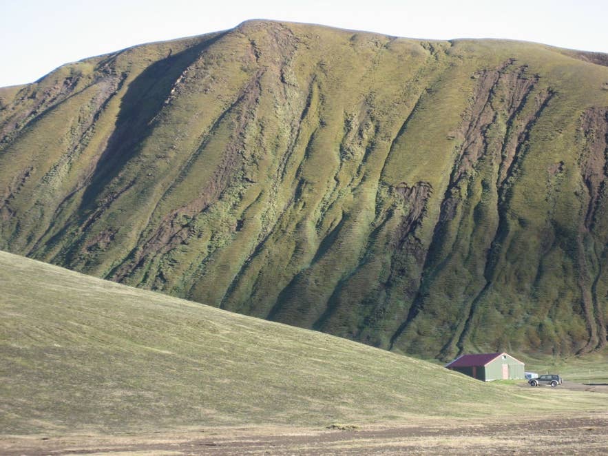
Hellisfjall above Landmannahellir. Photo: Reen Eversdijk, CC BY 2.0
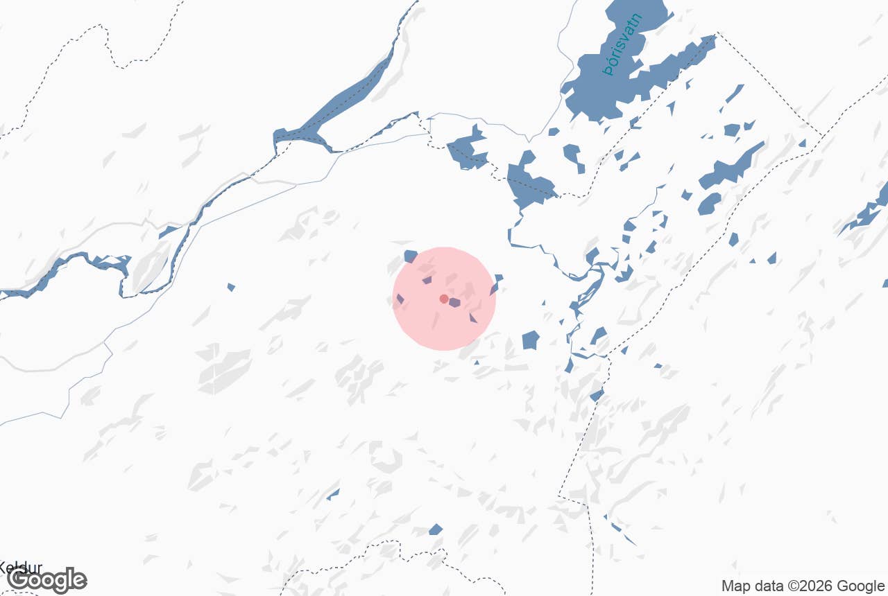
Hellisfjall ("cave mountain") is a 699-meter hyaloclastite hill in the Fjallabak Nature Reserve in Iceland's southern highlands, some 11 km west of Landmannalaugar as the crow flies (about 20 km by road). It takes its name from Landmannahellir, the small cave in its southern foot that sheltered sheep-gathering men on the Landmannaafréttur pasture for centuries.
Today the cave mouth is the centre of a cluster of mountain huts and a campsite, and the mountain itself is an easy evening walk with views over Löðmundarvatn lake, the dark bulk of the mountain Löðmundur and, on a clear day, the volcano Hekla to the west.
Key Takeaways About Hellisfjall
- Hellisfjall ('cave mountain') is a 699 m hyaloclastite ridge; Landmannahellir, the sheep round-up cave, is in its southern foot.
- Easy 1 to 2 hour walk from the huts to the top, with views of Löðmundarvatn, Löðmundur and Hekla.
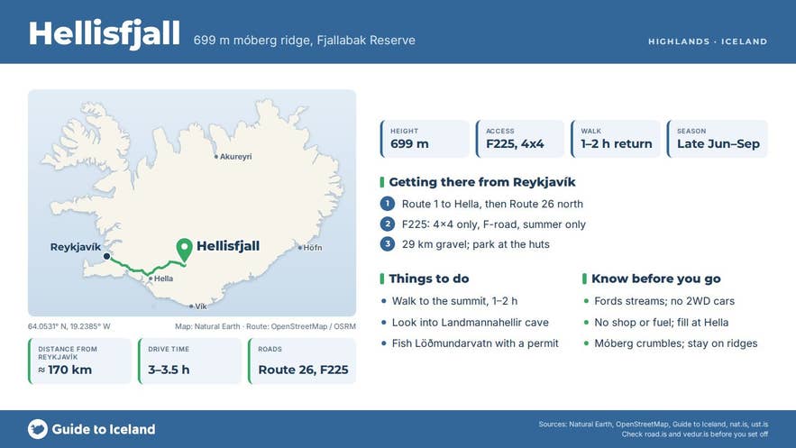
- Access is by the F225 (Landmannaleið) from Route 26: 4x4 only, unbridged streams, usually open from around mid to late June until the first autumn snow.
- About 3 to 3.5 hours from Reykjavík via Hella; nearest services at Leirubakki (50 km), nearest fuel at Hella (92 km).
- Huts, campsite and fishing permits at Landmannahellir, open mid-June into September.
Why visit Hellisfjall
Hellisfjall is not a dramatic summit. Its appeal is the setting and the story. The mountain is a móberg (hyaloclastite) ridge, formed when eruptions under Ice Age glaciers quenched into glassy, crumbly rock.
Rain and meltwater have cut the brown tuff into deep parallel gullies, and in summer the slopes are covered in thick grey-green moss. Small caves and overhangs pock the rock, and poking around them is one of the listed pastimes at the huts.
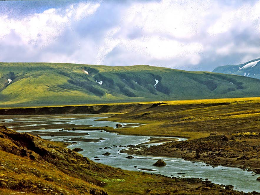
Stream at the foot of Hellisfjall. Photo: Wilford Peloquin, CC BY 2.0
The cave at its foot is modest: about 4 m high, 8 m wide and 14 m deep. For generations it was the base for the autumn sheep round-up on the western part of the Landmannaafréttur pasture.
The regional history Sunnlenskar byggðir records that the cave itself was once used as a horse shelter, holding about 70 horses, or 80 "if need be", while the men sometimes slept in a side chamber or, for a time, in a small hut by the entrance.
In 1907 the state treasury paid for a proper gangnamannahús, a round-up men's hut, west of the cave; it still stands and is used for evening sing-songs. East of the cave are three stone sheep shelters, in use since the livestock losses of 1882. The round-up men still spend several nights here each autumn.
Hellisfjall also sits in a rich volcanic neighbourhood. To the north-east rises Löðmundur, a massive flat-topped móberg mountain over 1,000 m high.
Löðmundarvatn, 0.75 km² in area and 590 m above sea level, lies just east of the huts; the Helliskvísl stream drains it and then vanishes into the lava.
The whole area lies inside the Fjallabak Nature Reserve, protected in 1979 and covering 44,633 hectares, all of it above 500 m.
How to get to Hellisfjall
Landmannahellir and Hellisfjall are reached by the F225, Landmannaleið (also called Dómadalsleið), a mountain road that requires a 4x4 and crosses unbridged streams.
- From Reykjavík: take Route 1 east to Hella (about 95 km), then Route 26 north past Leirubakki and Hekla to the F225 junction at Vegamót. From there it is 29 km of gravel to Landmannahellir. Allow about 3 to 3.5 hours in total; the F225 stretch alone takes roughly an hour.
- From the north: the F208 (Fjallabaksleið nyrðri) junction at Sigalda is about 27 km away. Landmannalaugar is about 20 km by the F225 and F208.
- The nearest services are at the Leirubakki hotel, 50 km away on Route 26; the nearest fuel is at Hella, 92 km.
- Highland roads normally open around mid to late June and close with the first autumn snow, often in September or October; the dates differ every year. Check umferdin.is (Vegagerðin) before setting out.
- Parking is at the huts beside the cave. The mountain starts right behind them, so the walk begins at the car. Allow 1 to 2 hours for the climb and return.
On foot, Landmannahellir is a stage on the marked Hellismannaleið trail, about 55 km in three days from Rjúpnavellir via Áfangagil to Landmannalaugar, and on the Landmannaleið horse route across the highlands.
Best time to visit
Late June to early September, while the F225 is open and the huts are staffed. July and August are the most reliable for dry ground on the móberg; the gullies turn slick after rain.
The autumn sheep round-up, usually in September, is when the huts are full of farmers and the area is lively but busy. Outside summer the road is closed and the area is only reached by super-jeep or ski.
Safety and practical tips
- The F225 fords several streams. Do not attempt it in a two-wheel-drive car; rental contracts forbid it, and insurance will not cover river damage.
- Móberg crumbles. Stay on the firm ridges, avoid the gully edges after rain, and watch children near the small caves.
- Weather at 600 m is colder and windier than in the lowlands; the average July temperature in the reserve is only 7 to 8 °C. Bring warm layers and rain gear even on a sunny day.
- Facilities: the hut operator at Landmannahellir has sleeping-bag accommodation in nine heated huts for about 100 guests, with running water, kitchens and toilets, plus a campsite for tents and campervans, small cabins with washrooms, an outdoor grill and a fishing-licence sales point. It is open from mid-June into September. Booking is advised in July and August.
- There is no shop or fuel. Fill up at Hella before heading in.
- Off-road driving is illegal everywhere in the reserve, and the ground is especially sensitive.
- Fishing in Löðmundarvatn and the other lakes south of Tungnaá needs a permit, sold at the huts.
Nearby attractions
- Landmannahellir Cave, at the foot of the mountain, 0.5 km
- Landmannahellir, the hut area and surroundings, 3 km
- Rauðfoss waterfall, the red waterfall in Rauðfossafjöll, 5 km
- Dómadalur, the valley on the F225, 5 km
- Friðland að Fjallabaki, the nature reserve, 8 km to the marker
- Frostastaðavatn, 9 km
- Bláhylur (Hnausapollur) crater lake, 10 km
- Landmannalaugar, 11 km
Tours that visit Hellisfjall
- Thrilling 4-Day Hiking Tour in Fjallabak Nature Reserve from Reykjavik: the group sleeps three nights in the Landmannahellir mountain hut, at the small cave at the foot of Hellisfjall, and makes day hikes to Landmannalaugar, up Löðmundur and towards Sigalda.
