
Beschreibung
Zusammenfassung
Beschreibung
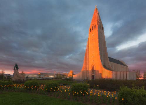
Erlebe das ultimative Sommerabenteuer rund um Islands atemberaubende Ringstraße und die Snaefellsnes-Halbinsel mit diesem umfassenden 10-tägigen Reisepaket. Dieses von lokalen Experten sorgfältig zusammengestellte Urlaubspaket beinhaltet Besuche der schönsten Sehenswürdigkeiten, versteckten Juwelen und unvergesslichen Aktivitäten – ganz ohne Planungsstress.
Reisende entscheiden sich für dieses Paket, weil es eine unvergleichliche Gelegenheit bietet, Islands reiche Geschichte, lokale Kultur und beeindruckende Natur entlang der legendären Ringstraße zu entdecken – die perfekte Wahl für einen unvergesslichen Island-Urlaub.
Vor deiner Ankunft werden alle Unterkünfte, Transfers und Aktivitäten für dich organisiert, sodass du dich einfach zurücklehnen und die Reise genießen kannst. Freu dich auf die besten Touren und Erlebnisse zu unschlagbaren Preisen, die dir Geld sparen und eine perfekte Reiseroute garantieren.
Du erlebst ein Minibus-Abenteuer in einer kleinen Gruppe rund um das Land und hast freie Zeit in Islands Hauptstadt Reykjavik, mit vielen optionalen Aktivitäten, um deine Reise individuell zu gestalten. Die Route ist so konzipiert, dass du die schönsten und einzigartigsten Orte Islands entdeckst.
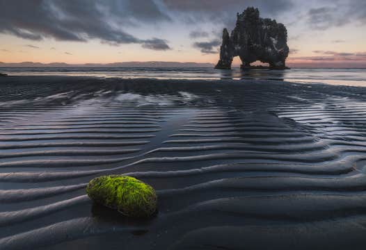
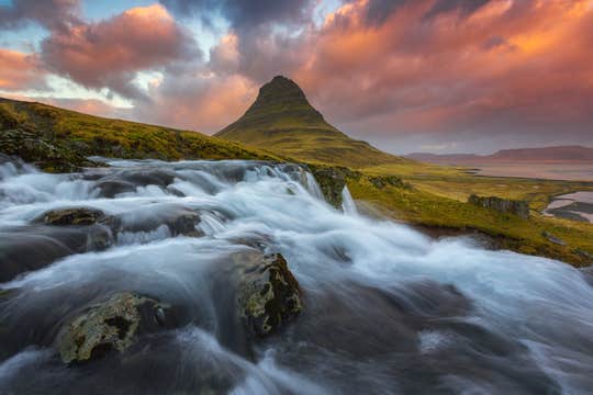
Reise entlang der Ringstraße und umrunde Island komplett – von der weltberühmten Blauen Lagune und dem Goldenen Kreis bis hin zu weiter entfernten und spektakulären Orten wie der Gletscherlagune Jökulsarlon, dem Wasserfall Dettifoss und dem schwarzen Sandstrand Reynisfjara.
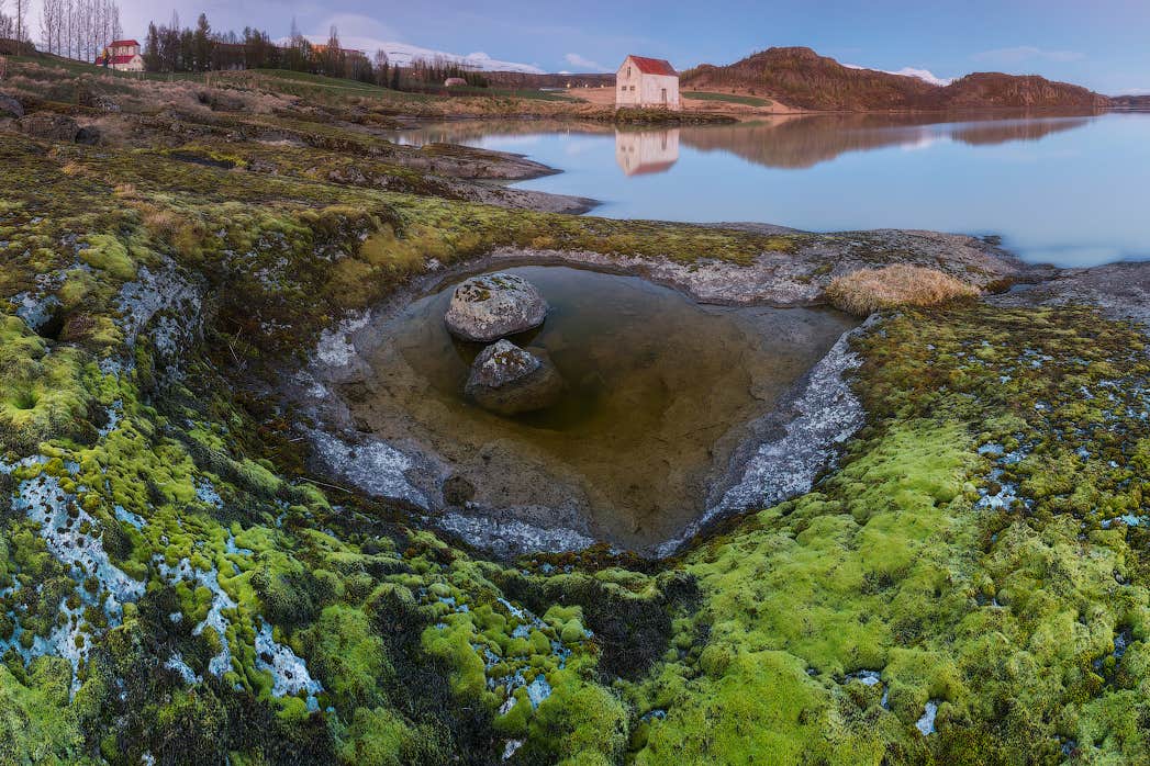
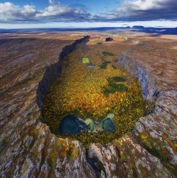
Zu den Highlights dieser faszinierenden Reise zählen der Besuch weitläufiger Lavafelder, die Erkundung der abgelegenen Ostfjorde und das Durchqueren der malerischen Snaefellsnes-Halbinsel. Während du entlang der Südküste und in den Norden reist, erwarten dich Ausblicke auf grüne Farmlandschaften, die jeweils ihren ganz eigenen Charme bieten.
Du hast außerdem die Möglichkeit, einige der spannendsten Wildtiere Islands entlang der Ringstraße zu beobachten – darunter Wale, Delfine und Robben. Die Landschaften – ob Gletscher, raue Küsten oder Berggipfel – werden dich noch lange in Staunen versetzen.
Du kannst an der berühmten Bootstour auf der Gletscherlagune Jökulsarlon teilnehmen, von Akureyri aus Wale beobachten, im natürlichen Geothermalbad Vök-Bad entspannen oder beim Katla-Eishöhlenabenteuer die funkelnden weißen Hallen eines Gletschers erkunden. Jede dieser Aktivitäten sorgt für unvergessliche Erlebnisse im Land aus Feuer und Eis.
Diese Aktivitäten sind ein Grund, warum diese geführte Tour so beliebt ist und hervorragende Bewertungen erhält. Je nach gewählten Zusatzleistungen ist sie auch familienfreundlich und somit ideal für Gäste jeden Alters.
An jedem Tag deines Ringstraßen-Abenteuers übernachtest du in sorgfältig ausgewählten Hotels, die individuell an deine Wünsche angepasst werden können. Sieben Übernachtungen beinhalten Frühstück und ein privates Bad. Deine zwei Nächte in Reykjavik können – je nach gewählter Unterkunft – mit oder ohne Frühstück gebucht werden.
Während der gesamten Reise wirst du bestens betreut und kannst dich von der Ankunft bis zur Abreise rundum wohlfühlen. Das Paket beinhaltet einen persönlichen Reiseberater, den du jederzeit, sieben Tage die Woche, kontaktieren kannst. Die gesamte Reiseroute kann nach der Buchung gemeinsam mit deinem Reiseberater angepasst werden – für ein reibungsloses und sorgenfreies Reiseerlebnis.
Kostenlose Stornierungen und volle Rückerstattung sind inklusive, sodass du maximale Flexibilität und Sicherheit während deiner Reise genießt! Handle schnell und sichere dir deinen Platz, um das Beste von Island auf dieser spannenden 10-tägigen Tour zu erleben. Buche jetzt und prüfe die Verfügbarkeit, indem du ein Datum auswählst – solange noch Plätze frei sind!


