

Beschreibung
Zusammenfassung
Beschreibung
Starte zu einem unvergesslichen Sommer-Roadtrip durch Islands atemberaubende Landschaften mit dieser 11-tägigen Mietwagenreise entlang der Ringstraße und in die abgelegenen Ostfjorde. Dieses Reiseprogramm ist perfekt für alle, die jede Ecke Islands entdecken möchten – von berühmten Highlights bis zu den stillen Schönheiten und versteckten Schätzen der einsamen Ostfjorde.
Spar dir den Aufwand, Routen, Unterkünfte und Aktivitäten selbst zu planen – dieses Paket deckt alles ab. So sparst du Zeit und Geld und kannst deinen Islandurlaub einfach genießen, während wir uns um alle Details kümmern.
Das Beste an dieser 11-tägigen Mietwagenreise: Du hast die volle Kontrolle. Du entscheidest, wohin du fährst und wie lange du an jedem Ort bleibst. Nimm dir Zeit für ein paar Extra-Stopps, tolle Fotos oder eine gemütliche Kaffeepause.
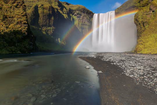
Dein Roadtrip führt dich entgegen dem Uhrzeigersinn rund um Island und startet mit dem berühmten Goldenen Kreis. Entdecke den Thingvellir-Nationalpark, das Geysir-Geothermalgebiet und den Gullfoss-Wasserfall – drei der bekanntesten Sehenswürdigkeiten Islands.
Du kannst dein Erlebnis mit einem Bad in der Secret Lagoon, einer der ältesten heißen Quellen Islands, oder im Laugarvatn Fontana Spa mit Dampfbädern und mineralreichen Pools noch aufwerten.
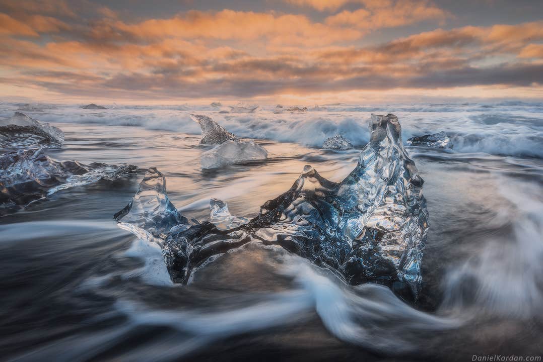
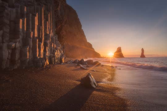
Danach geht es entlang der Südküste, die für ihre dramatischen Naturwunder berühmt ist: Der Skogafoss-Wasserfall, der schwarze Sandstrand Reynisfjara und die Gletscherlagune Jökulsarlon warten auf dich. Optional kannst du dein Abenteuer mit einer Eishöhlentour, einer Gletscherwanderung oder einem Ausritt durch Islands spektakuläre Landschaften ergänzen.
Im Osten erreichst du die abgelegenen und wilden Ostfjorde, wo mächtige Berge direkt ins Meer abfallen. Statte Seydisfjördur einen Besuch ab, einem charmanten Ort mit bunten Häusern und künstlerischem Flair, oder entdecke Djupivogur, ein historisches Fischerdorf. Im Sommer lohnt sich ein Abstecher nach Borgarfjördur Eystri – einem der besten Orte Islands, um Papageientaucher zu beobachten.
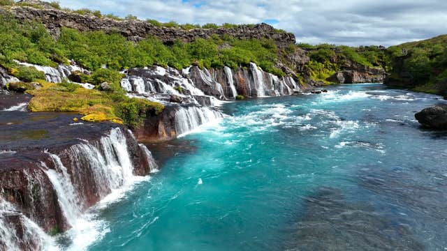
Im Norden Islands erwarten dich vielfältige Landschaften und geologische Wunder. Ein Highlight ist der Myvatn-See, ein geothermisches Paradies, umgeben von Lavafeldern, dampfenden Quellen und Vulkankratern. Entdecke den „Wasserfall der Götter“ – Godafoss – und Dettifoss, Europas mächtigsten Wasserfall. Ganz in der Nähe kannst du das Geothermalgebiet Hverir, die dramatischen Lavaformationen von Dimmuborgir und die Lavahöhle Grjotagja erkunden.
Anschließend erreichst du Akureyri, die Hauptstadt des Nordens, und Husavík, Islands Hochburg für Walbeobachtungen. Optional kannst du hier an einer Walbeobachtungstour teilnehmen, in der Earth Lagoon, der Forest Lagoon oder im GeoSea entspannen oder die Umgebung auf dem Pferderücken erkunden.
Mit diesem Paket hast du die volle Freiheit. Wähle aus einer sorgfältig zusammengestellten Auswahl an Unterkünften entlang deiner Route und stelle dir deine Wunschaktivitäten aus zahlreichen optionalen Touren selbst zusammen.
Die Auswahl an Abenteuern ist riesig: Schnorchle im glasklaren Wasser der Silfra-Spalte, fahre mit dem Schneemobil über den Langjökull-Gletscher, steige in die Magmakammer eines Vulkans hinab oder entdecke eine Eishöhle mitten im Gletscher.
Entspanne in den warmen Gewässern der Sky Lagoon, gleite per Boot zwischen den Eisbergen der Gletscherlagune Jökulsarlon hindurch oder wandere über den Skaftafellsjökull-Gletscher. Auch ein Ausritt durch die Landschaften Nordislands oder eine Walbeobachtungstour ab Husavík – Europas Walbeobachtungshauptstadt – sind möglich.
Nach der Buchung erhältst du dein individuelles Reiseprogramm, das genau auf deine Wünsche abgestimmt ist.
Von der Ankunft bis zur Abreise ist alles organisiert, damit du deine Reise sorgenfrei genießen kannst. Unsere lokalen Reiseexperten sind während deines gesamten Aufenthalts rund um die Uhr für dich da.
Freu dich auf maximale Flexibilität: Du kannst bis zu 24 Stunden vor Reisebeginn kostenlos stornieren und bekommst dein Geld zurück – so planst du ganz entspannt.
Buche jetzt deine 11-tägige Mietwagenreise durch Island und starte das Abenteuer deines Lebens! Wähle einfach dein Wunschdatum aus und sichere dir deinen Platz.


