Explore the Hverir Geothermal Area and experience one of North Iceland’s most dramatic landscapes, shaped by bubbling mud pools, steaming vents, and vivid mineral colors. Plan your visit with this travel guide, which explains what to see, how to get there, when to go, and how to explore Hverir safely.
The Hverir Geothermal Area is one of the most striking geothermal sites in Iceland, drawing visitors with its bubbling mud pools, powerful steam vents, and vividly colored mineral ground. The site can be visited on exciting self-drive tours around North Iceland or on Diamond Circle tours, making it an accessible stop for both independent travelers renting a car and joining guided tours.
Set beside the Ring Road near Lake Myvatn, Hverir offers close-up views of active geothermal features in an open, barren landscape, with steam constantly rising and shifting across the area. The geothermal activity is concentrated in a compact space, allowing you to experience the site without a long walk.
Why You Can Trust Our Content
Guide to Iceland is the most trusted travel platform in Iceland, helping millions of visitors each year. All our content is written and reviewed by local experts who are deeply familiar with Iceland. You can count on us for accurate, up-to-date, and trustworthy travel advice.
From the marked paths, you can see thick mud boiling at the surface, hear steam hissing from vents, and observe bright yellow, red, and orange mineral deposits spread across the ground. The lack of vegetation and the constant movement of steam give Hverir a raw, exposed feel that clearly shows the volcanic forces shaping the region.
This guide explains what you can expect to see at Hverir, how to reach the site, how much time to plan for your visit, and how to explore the geothermal area safely and responsibly. Hverir fits easily into a drive through the Myvatn region or a broader North Iceland itinerary, offering a short but memorable look at Iceland’s geothermal landscape.
Key Takeaways
-
Hverir is one of North Iceland’s most dramatic geothermal sites, featuring boiling mud pools, steaming fumaroles, and colorful mineral landscapes just off the Ring Road near Lake Myvatn.
-
The geothermal area is extremely easy to visit, located directly beside Route 1 and accessible on both self-drive itineraries and Diamond Circle tours.
-
Marked walking paths make the site safe to explore, offering close-up views of mud pots and steam vents. Just stay on designated trails due to unstable, superheated ground.
-
Most travelers spend 15–30 minutes at Hverir, though you can extend your visit with the scenic hike up Namafjall for panoramic views of the geothermal landscape.
-
Parking is available on-site for a small fee, with limited facilities (paid toilets only).
-
Hverir fits naturally into a Lake Myvatn or North Iceland itinerary, with nearby attractions including Krafla, Viti crater, Dimmuborgir, and the Myvatn Nature Baths.
-
Guided tours are available for travelers who prefer transportation and expert commentary, including Diamond Circle and Myvatn-focused day tours.
Hverir Geothermal Mud Pools and Steam Vents
 The Hverir Geothermal Area is a compact geothermal site with active mud pools and steam vents, located a short walk from the parking area. The landscape is mostly barren, with steam rising from the ground and mineral-stained soil marking areas of geothermal activity.
The mud pools at Hverir contain thick grey and brown mud that bubbles as hot gases escape from below the surface. Activity varies between pools, with some bubbling gently and others more vigorously. Mineral deposits around the pools create visible patches of yellow, red, and orange across the ground.
Steam vents, also known as fumaroles, release hot steam and volcanic gases into the air throughout the area. These vents can produce hissing or roaring sounds, depending on underground pressure and weather conditions. A strong sulfur smell is often noticeable, particularly on calm days with little wind.
A marked gravel path guides visitors through the most active section of Hverir, allowing close observation of the mud pools and steam vents from a safe distance.
Where the Hverir Geothermal Area Is Located
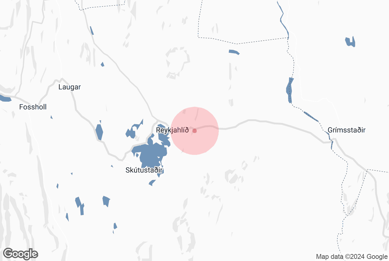
 The Hverir Geothermal Area is located in North Iceland, near Lake Myvatn, one of the region’s must-see attractions. It sits along Route 1 (the Ring Road), making it easy to reach for travelers driving through the Myvatn area or between eastern and northern Iceland.
Hverir lies at the Namaskard Mountain Pass, at the base of Namafjall, a geothermal mountain known for its active landscape. Because of this location, Hverir is sometimes referred to as Namaskard or described as part of the Namafjall Geothermal Area, though Hverir itself refers specifically to the mud pools and steam vents found beside the road.
Getting to the Hverir Geothermal Area
 The Hverir Geothermal Area is located in North Iceland, just off Route 1 (the Ring Road) near Lake Myvatn. Because it sits directly beside the main road, it is easy to reach by car from all directions and fits well into a self-drive itinerary around the Myvatn region.
If you are staying near Lake Myvatn or Reykjahlid, Hverir is about 4 miles (6 kilometers) east of the lake. It takes around 10 minutes to reach by car when driving along Route 1 toward Namaskard. Steam from the geothermal area is often visible from the road as you approach.
If you are driving from the popular whale watching town, Husavik, follow Route 87 south until it connects with Route 1, then continue east toward Myvatn. The drive takes about 30 minutes and covers roughly 16 miles (25 kilometers).
From Akureyri, the drive along the Ring Road is approximately 55 miles (89 kilometers) and usually takes around 1 hour and 15 minutes, depending on road and weather conditions.
The Hverir Area is accessible with a standard two-wheel-drive car, but weather conditions can affect driving in winter, so checking road conditions before setting out is recommended.
If you prefer not to drive, Hverir can also be visited on a Diamond Circle tour from Akureyri, which includes transport and stops at other natural attractions in North Iceland, or on multiple Myvatn tours.
Parking and Facilities at the Hverir Geothermal Area
 Parking for the Hverir Geothermal Area is available in a designated lot directly beside Route 1 (the Ring Road), next to the geothermal site. A parking fee applies, and you are required to pay before entering the walking paths. Payment is made at the parking machine on site, following the instructions provided there.
From the parking area, a short and clearly marked path leads directly into the geothermal area. The parking lot provides convenient access, but it does not include additional services beyond parking.
There are paid toilets at Hverir, but other than that, there are no additional facilities on site. You will not find cafes, visitor centers, or drinking water on site. Because of this, it is important to plan ahead and use facilities elsewhere in the Lake Myvatn area before stopping at Hverir.
There are also no trash bins at the site. You should take all waste with you when you leave to help keep the geothermal area clean and undisturbed.
How Much Time to Spend at Hverir

Steaming fumarole at the Hverir Geothermal Area. Photo by fry_theonly – Hverir, CC BY-SA 2.0, Wikimedia Commons. No edits made.
The Hverir Geothermal Area is a compact site, and most people spend 15 to 30 minutes walking along the marked paths, observing the bubbling mud pools and steam vents, and taking photos. The geothermal features are located close together and near the parking area, so you can see the main highlights without a long walk.
If you prefer to move slowly, watch the geothermal activity, or take more photos, you may want to allow a little extra time. In most cases, however, around 30 minutes is enough to experience Hverir itself without feeling rushed.
If you also choose to include the hike above Hverir, which leads up the slopes of Namafjall, you should plan for up to two hours in total. This includes time to walk the trail, reach viewpoints above the geothermal area, and return to the parking area. The hike adds elevation and distance and significantly extends the visit compared to viewing Hverir alone.
Best Time to Visit Hverir Geothermal Area
 The Hverir Geothermal Area is accessible year-round and can be visited in any season, as the main walking paths and viewing areas remain open regardless of weather. The site offers a unique experience in both summer and winter, and there is no official closing time, so you can plan your visit at a time that fits your itinerary.
Seasonally, summer (June through September) is the most popular time to visit because the weather is milder and the Ring Road and local roads are generally clear and easy to drive all day. Longer daylight hours in summer also make it easier to explore Hverir in combination with other nearby attractions without time pressure.
Winter visits (October through April) are also possible and offer a very different experience. Snow and ice can cover the surrounding landscape, making the steam plumes and colorful mineral deposits stand out against the white background. Roads to the site are usually maintained in winter, but conditions can change quickly, so checking weather and road reports before you set out is important.
For time of day, early morning and late afternoon to evening are particularly good for photography and fewer crowds. At these times, light conditions tend to be softer, and the steam from the fumaroles and mud pools can be more visually striking against the sky. Visiting outside peak midday hours also helps reduce encounters with larger tour groups.
Things to See Near the Hverir Geothermal Area
 The Hverir Geothermal Area is located in the heart of the Lake Myvatn region, making it easy to combine with several nearby natural attractions during the same drive. Most of these sites are within a short distance and can be visited in any order, depending on your route.
Lake Myvatn lies just a few minutes west of Hverir and is known for its volcanic landscapes, wetlands, and birdlife. The lake area includes several viewpoints and walking paths, as well as nearby geothermal features and lava formations that reflect the region’s volcanic history.
The Krafla Volcanic Area, located east of Hverir, is another major highlight. This area includes volcanic craters, lava fields, and geothermal power facilities, offering a broader look at the forces shaping North Iceland. The nearby Viti Crater is often included as part of a visit to Krafla.
Dimmuborgir, a large lava field west of Lake Myvatn, is known for its unusual rock formations and short walking trails. The area is easy to explore and contrasts clearly with the open geothermal landscape at Hverir.
A short drive north brings you to Husavik, a coastal town known for whale watching tours and harbor views. Many visitors include Husavik as part of a longer day trip when exploring the region.
Because these attractions are spread out around Lake Myvatn and connected by well-maintained roads, Hverir fits naturally into a wider itinerary through North Iceland without requiring major detours.
Visiting the Hverir Geothermal Area Responsibly
 The Hverir Geothermal Area offers a close look at Iceland’s geothermal activity, and it is important to treat the site with care. By staying on the marked paths and following posted signs, you help protect both yourself and the fragile landscape.
The ground around the mud pools and steam vents can be extremely hot and unstable, even when it appears solid. Keep a safe distance from the geothermal features and supervise children closely to avoid accidents.
When you leave, take everything with you and avoid disturbing the ground or removing natural materials. There are no waste facilities on site, so planning ahead helps keep the area clean and undamaged.
Respecting these guidelines ensures that Hverir remains safe, accessible, and well-preserved for future visits, allowing you and others to experience this unique geothermal landscape responsibly.


