Katla Volcano and Kötlutangi Spit - the Southernmost Point of the Mainland of Iceland
I have been writing about the historical Hjörleifshöfði promontory in South Iceland in my last 2 travel-blogs.
Now I want to tell you about the dreaded volcano Katla in South Iceland, which Icelanders have been brought up to fear as the Katla eruptions are amongst the biggest cataclysms in Iceland.
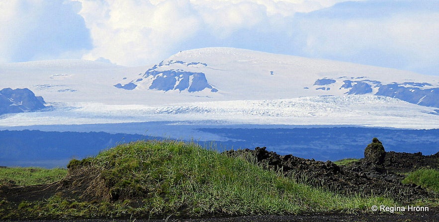
Top photo: Mýrdalsjökull glacier and Katla volcano
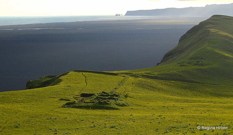
The view from the top of the Hjörleifshöfði cape
North of Hjörleifshöfði the infamous volcano Mt. Katla is lurking beneath the 590 sq.km ice cap of Mýrdalsjökull glacier, waiting to spew out its molten lava and ash clouds.
South of Hjörleifshöfði promontory you will find Kötlutangi - the Katla spit, which is the southernmost point of the mainland of Iceland, created in the catastrophic Katla eruption in 1918. Previously Dyrhólaey held this record: Cape Dyrhólaey in South Iceland - the One with the big Arch.
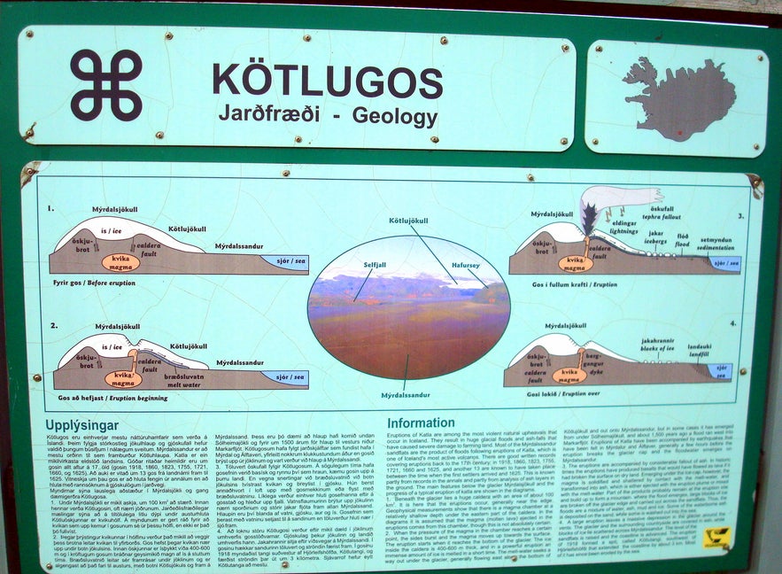
The information sign in Katla Geopark
There are several recorded eruptions in Katla from 1625, 1660, 1721, 1755, 1823, 1860 and 1918... we also know of 13 Katla eruptions since the Settlement of Iceland until 1625 (according to the information sign).
You can read about the Sturluhlaup glacial flood, which followed the Katla eruption in 1311, a little bit further on in my travel-blog.
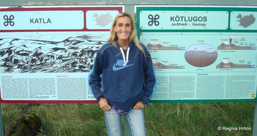 The information signs tell us about the eruptions and the sorceress Katla
There were several other Katla eruptions in the following centuries so you can see that the notorious Katla has erupted quite a few times since the Settlement of Iceland until 1918 when it last erupted for 23 days.
In 1918 the Katla eruption tephra layer was the biggest one since Askja erupted back in 1875, but that volcanic eruption is believed to have produced the largest amount of ash in the history of Iceland.
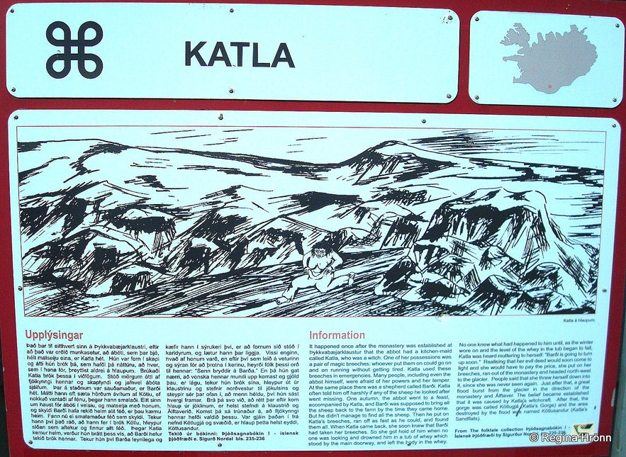 You can read about the sorceress Katla in my travel-blog: The infamous Katla Volcano is named after a Sorceress.
The ice that melts in the Mýrdalsjökull glacier due to the volcanic eruptions in Katla collects in the middle of the glacier, like in a bowl; the caldera is approx. 100 sq.km.
The volcanic eruption heats the glacial water until it starts to boil and creates enough pressure for it to burst through the 400-600 metre thick Mýrdalsjökull glacier, which covers the caldera - and a roaring glacial flood rushes at great speed in the direction of the sea.
When Katla volcano erupts there is a massive glacial outburst with immense glacial floods carrying huge icebergs which then end up in the sea south of Hjörleifshöfði, or on the sand.
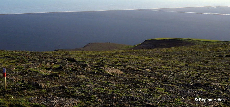
Kötlutangi spit as seen from Hjörleifshöfði
These floods are so massive that the shoreline can extend several kilometres! Kötlutangi spit was formed in the Katla eruption in 1918 when the shoreline extended approximately 3-4 kilometres!
There was a fjord, Kerlingarfjörður fjord, by Hjörleifshöfði until the 14th century when the glacial floods from Katla extended the shoreline.
And the major part of the huge Mýrdalssandur sand plains was created when Katla has erupted.
Just to show you how massive this glacial outburst was then the depth of the sea here, where there is sand now, was 20 fathoms!

Hjörleifshöfði as seen from Kötlutangi spit
When the glacial flood reaches the sea a tsunami-like phenomenon occurs and the sea bounces back and crashes onto the coastline. I always think about this when I visit this area, what extraordinary forces of nature there are at work here.
I would not want to be anywhere close when/if this happens again. But people have been close by and witnessed this massive glacial flood.
Kjartan Leifur Markússon (1895-1964), the father of the owners of Hjörleifshöfði (until 2020), lived on the promontory from 1895-1920. He was on top of Hjörleifshöfði on the day Katla erupted on the 12th of October 1918 and witnessed the roaring glacial flood passing Hjörleifshöfði at a great speed.
What a frightening sight this must have been!
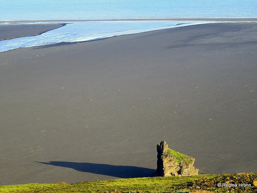
Kötlutangi spit as seen from Hjörleifshöfði
Kjartan said that there were earthquakes for one hour followed by a steam cloud over Mýrdalsjökull glacier and then a massive glacial flood rushed down to the sea carrying with it huge icebergs which then covered the sea with ice.
Some of the icebergs which were left ashore, stuck in the sand, were larger than 20 metres!
Kjartan witnessed when the flood and icebergs hit the promontory with great force, creating waves of glacial water and crumbled into smaller pieces with ice flying up high in the air. Just imagine the great racket when these icebergs tumbled in this massive flood and hit the promontory!
Kjartan witnessed this from above standing on top of Hjörleifshöfði. What an impact this must have had on this 23-year-old man to be so close to these great forces of nature!
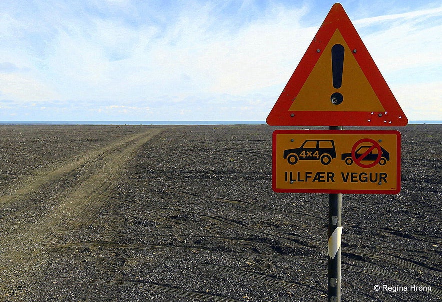
The warning sign by Kötlutangi spit
Those who have witnessed eruptions in the notorious Katla have talked about deafening thunders and lighting and such thick volcanic ash that there was total darkness.
I think most of us remember the ash cloud from Eyjafjallajökull volcano back in 2010 - this is much worse!
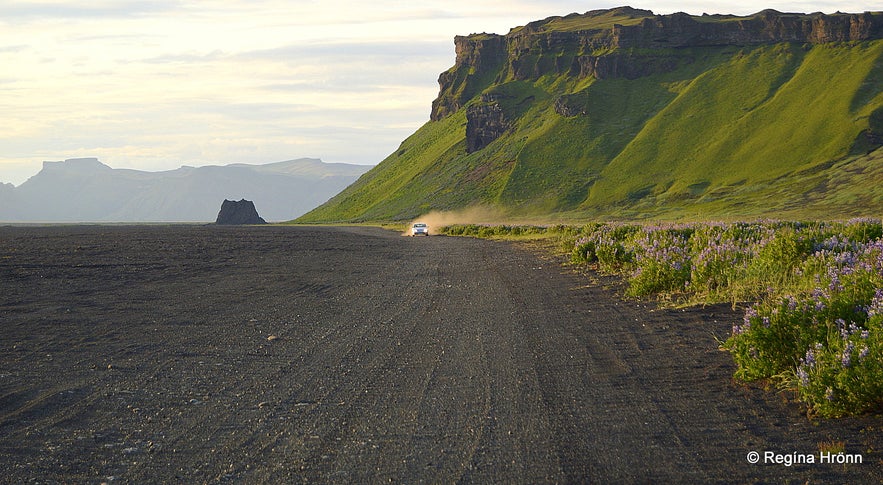
It is possible to drive down to Kötlutangi spit, but it is a difficult road as you can see on the sign above - "illfær vegur" in Icelandic means a difficult road, so a 4x4 is needed. Mainly as the sand can get wet and you can get stuck.
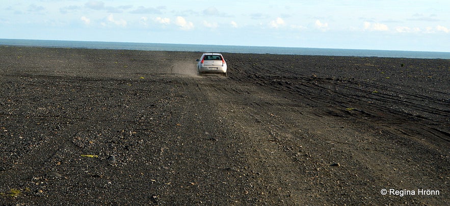
Kötlutangi spit
My husband drove down to the southernmost part of the mainland of Iceland, while I stayed behind and had a closer look at the pillars of rocks on the sand in front of Hjörleifshöfði promontory.
I, later on, visited Kötlutangi on a guided tour after visiting the Katla ice cave for the second time.
It is believed that the sea erodes Kötlutangi spit by some 10 metres every year and thus 100 metres in a decade. Satellite imagery from 2003 shows that back then Kötlutangi was still 500 metres further south than Dyrhólaey.
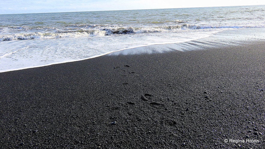
Kötlutangi spit
If the sea erodes Kötlutangi by 100 metres in a decade then Kötlutangi still has the upper hand for more than 4 decades. We will see how far it will reach in the next Katla eruption and the floods that will follow. I.e. if Katla will erupt again.
The Iceland GeoSurvey (Íslenskar orkurannsóknir) surveys Kötlutangi regularly by GPS to know the status of the southernmost part of the mainland of Iceland. In 2013 approximately 2.8 km had eroded from Kötlutangi since the eruption in 1918.
A couple of years ago I heard that Kötlutangi spit was no longer the southernmost point of Iceland, but couldn't find any sources for this change. So I contacted Katla Geopark and they told me that it was a rumour, but that they would contact Landmælingar Íslands - the National Land Survey of Iceland which I had also done.
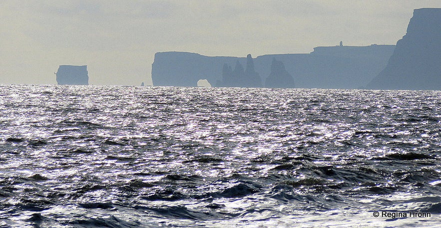
Dyrhólaey and Reynisdrangar sea stacks
Katla Geopark sent me coordinates from 2017 for both Kötlutangi and Dyrhólaey while we were waiting for the answer:
63.394652, -18.720228 (63° 23.679'N, 18° 43.214'W - Kötlutangi
63.398192, -19.127411 (63° 23.891'N, 19° 7.645'W - Dyrhólaey
The following day we got an answer from Guðmundur Þór Valsson at the National Land Survey of Iceland, who told us that according to the latest accurate satellite image of this area from 2019, Kötlutangi spit is still the southernmost point of the mainland of Iceland. The difference was 350-400 metres which is similar to comparable photos taken in 2008.
I also contacted Þórir Kjartansson, the son of the abovementioned Kjartan Leifur, and he went to check out the landmark and tidemark rock between Höfðabrekka and Hjörleifshöfði cape. He measured the length of the beach from the rock to the sea and found out that there are still 200 metres from the landmark rock to the sea.
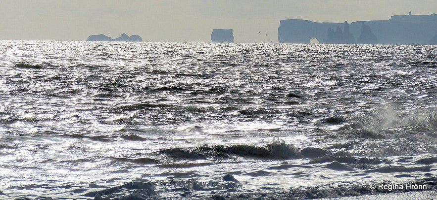
Dyrhólaey and Reynisdrangar as seen from Kötlutangi
In some of my photos, you can see Dyrhólaey, which was the southernmost point of the mainland of Iceland from the Settlement of Iceland until the Kötlutangi spit was created in the Katla eruption in 1918. Not that anybody was measuring such things back then.
When standing on Kötlutangi you have a good view of Dyrhólaey.
Dyrhólaey, being as it is, a steady rock and not made of volcanic sand, doesn't change its position like Kötlutangi spit, or at least we hope it won't ;)
In front of Dyrhólaey in my photo, you will see Reynisdrangar pillars of rock by the village Vík. This area is so ruggedly beautiful.
See also:
Extremely dangerous Waves by Reynisfjara and Kirkjufjara black Beaches in South Iceland!
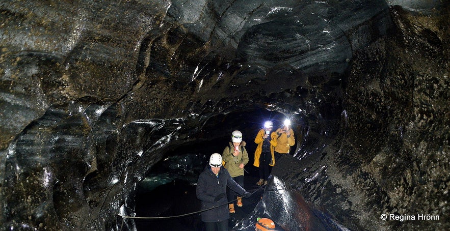
Inside Kötlujökull - the Katla glacier!
It is believed that the lava sand plains, the volcanic glacial outwash, now surrounding Hjörleifshöfði had, before the glacial floods in 1721 in Katla, been covered by grass, but that these massive glacial floods destroyed the meadows.
According to Þjóðsögur Jóns Árnasonar - the Collection of Folklore of Jón Árnason, which I often refer to in my travel-blogs, as I love folklore, the Katla volcano got its name from a sorceress called Katla. She was the cook at Þykkvabæjarklaustur monastery, which was built in 1169.
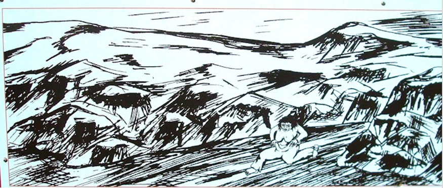
This folklore explains to us why this notorious volcano is called Katla. I translated this folklore into English and wrote a new travel-blog about it as it explains how Katla is to blame for the glacier bursts:
The infamous Katla Volcano is named after a Sorceress.
Sturluhlaup - the Glacial flood of Sturla
Driving by Hjörleifshöfði cape
There are several accounts of people being in grave danger when Katla erupted through the centuries.
This account can be found in Markús Loftsson's Eldrit, but Markús lived on Hjörleifshöfði and I have told you about him in my travel-blog:
The historical Hjörleifshöfði Promontory - the Hike and the Inhabitants
One of the glacial floods has been called Sturluhlaup or the Glacial flood of Sturla. This flood happened in 1311 when one of the most catastrophic and virulent volcanic eruptions in Katla took place. At that time the farmer Sturla Arngrímsson lived at Láguey.
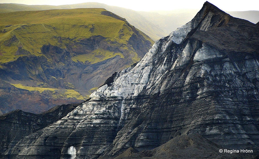
Driving towards Katla
On the first Sunday after Christmas in the year 1311, Katla erupted and a massive glacial flood followed. On this particular day, Sturla went out of the farm and up to the wall around the farm. From there he noticed the water torrent rushing down this area heading for the farm.
Sturla ran into the farm and grabbed his newborn baby from the arms of his wife, who was lying in bed. He asked God to help the other people inside the farm. As soon as he got out of the farm the glacial flood reached the farm and destroyed it.
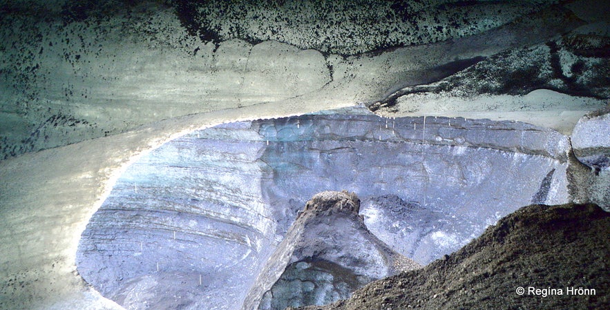
Inside the Katla ice cave
In 1311 Mýrdalssandur sand plains had many farms, but all of them were destroyed in this glacial flood.
The glacial flood carried with it a massive iceberg and Sturla managed to get on top of the iceberg with the baby. They were carried out to sea on the iceberg and on shore again at Meðallandsfjörur 5 weeks later!
As Sturla had no provisions on the iceberg and had to keep his baby alive - he cut his nipples and had the baby suck blood from them, thus his baby survived.
Sturla was a strong and healthy man and this ordeal didn't seem to have harmed him much.
---------------------
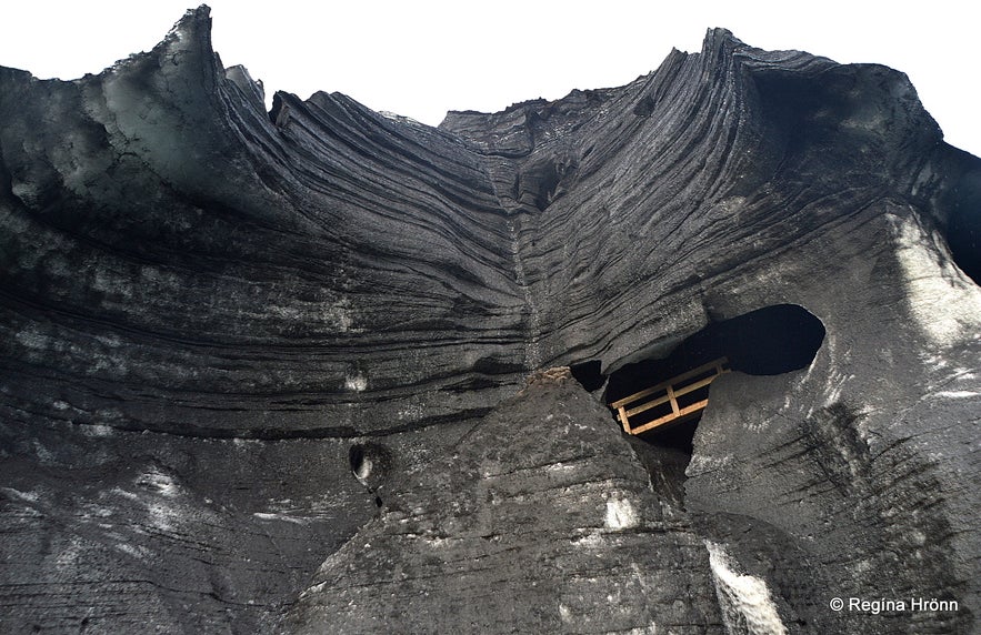
The Katla ice cave back in 2018
A farm by the name of Lambey in this area was destroyed in the Sturluhlaup glacial flood along with the other farms in this area.
The destruction was total and there were no signs left that people had ever lived in this area, everything was covered in sand and pumice.
The next spring some men were riding through the sand where Lambey had stood before the flood.
One of the horses stuck its foot in the sand leaving a big hole in the sand. They heard a dog barking from the hole underneath their feet.
They started digging and found a storehouse where fish and butter had been stored in Lambey.
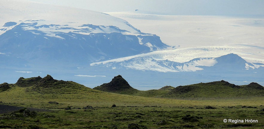
The massive glacier
They found a girl in the storehouse and a dog. She had been sent to the storehouse to get fish and butter for the household and the dog had accompanied her. She was carrying a light with her as it had been dark outside.
She had been inside the storehouse when the glacial flood rushed down and had been stuck inside the storehouse ever since. She and the dog had kept themselves alive by eating the fish and the butter, but these provisions had almost run out.
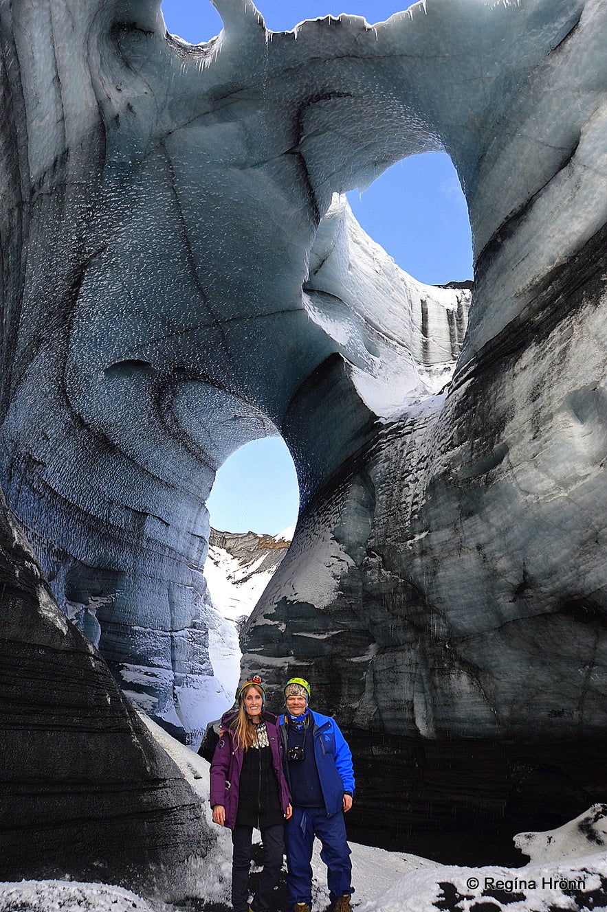
Inside Katla ice cave in 2021 in a new location
Fortunately, she was carrying the light and had been able to keep the light alive by using the butter and her torn up clothes.
She was fully alert and knew exactly what day it was. She said that the companionship she got from the dog had kept her from going insane.
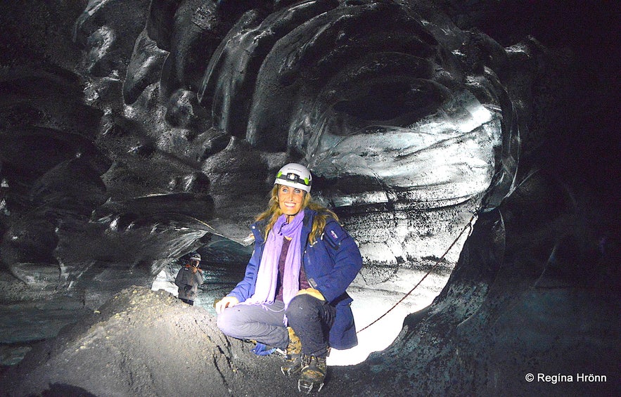 Inside the Katla icecave
This glacial flood, Sturluhlaup, happened so quickly that the daughter of a minister was found dead by Dýralækur with her comb in her head, but she had been combing her hair at the time of the glacial flood reaching the rectory.
The Glacial flood in 1721
Hjörleifshöfði
There is one account from the Katla eruption in 1721 which destroyed the farm by Hjörleifshöfði promontory.
At the time of the glacial flood the farmer at Hjörleifshöfði, Ólafur Ólafsson, was at the church in Höfðabrekka (close by), but his wife, Sigríður Jónsdóttir, was at home with their baby and the shepherd, who was in his teens.
The shepherd had walked out of the farm and seen the roaring glacial flood heading for the farm. He immediately went inside the farm and quickly warned the lady of the house.
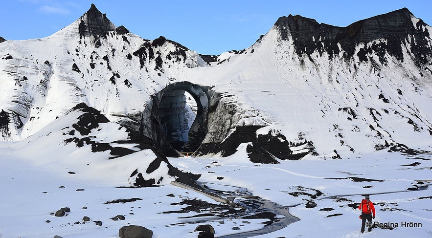
Katla ice cave in 2021
She told the shepherd to take the baby in the crib and she grabbed butter and fish and some linen and hurried outside.
They managed to escape into a cave called Kálfaból. After this flood, the farm, which had stood at Bæjarstæði, where Hjörleifur had built his farm, was moved up onto Hjörleifshöfði.
This account is found in Eldrit from 1880, written by Markús Loftsson.
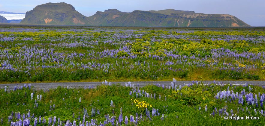
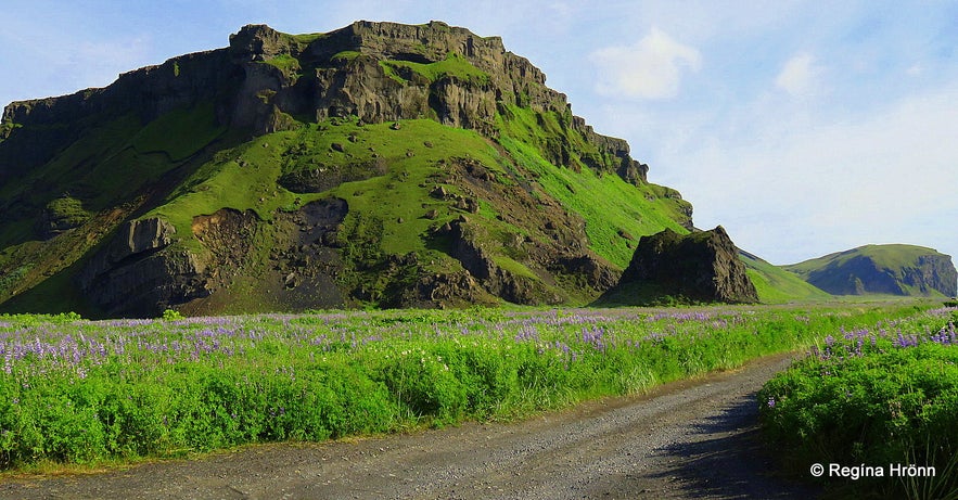
Blossoming lupines and Hafursey
When I was younger and until maybe a decade ago there were huge black sand plains on the south coast, but it looks very different now after the State Soil Conservation Service and the Icelandic Road Administration joined hands and started planting lupine to prevent sandstorms in this area.
Now we have stretches of violet lupine in places where there was only black lava sand. I love this change as I was always afraid while driving through the vast sand plains.
The lupine then turns green and it looks so thick, like a beautiful thick blanket covering the black sand beneath.
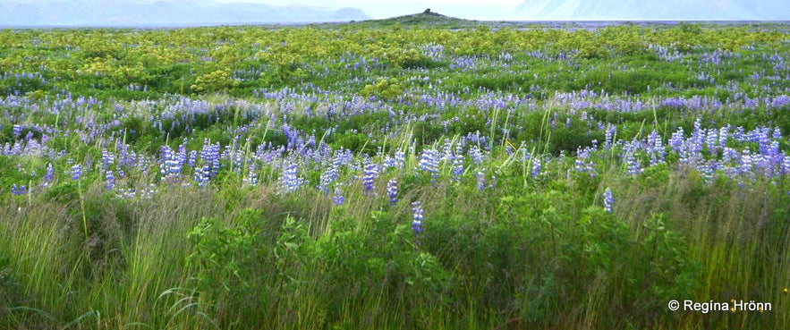
Lupines instead of black sand
These black sand plains, which are glacial outwash, were, and still are in some places, a great hindrance and in heavy winds, one could expect dreadful sandstorms in this area.
These sandstorms would be so thick, as it were, that you could not pass through them and had to stop the car in the middle of ring-road 1 if you were caught in a sandstorm in this area.
Several times ring road 1 was impassable because of these sandstorms.
I was once caught in a sandstorm in this area at Sólheimasandur and it was really scary. It ruins the paint on the car and that is why special car insurance is offered when you drive through the sand plains in South Iceland.
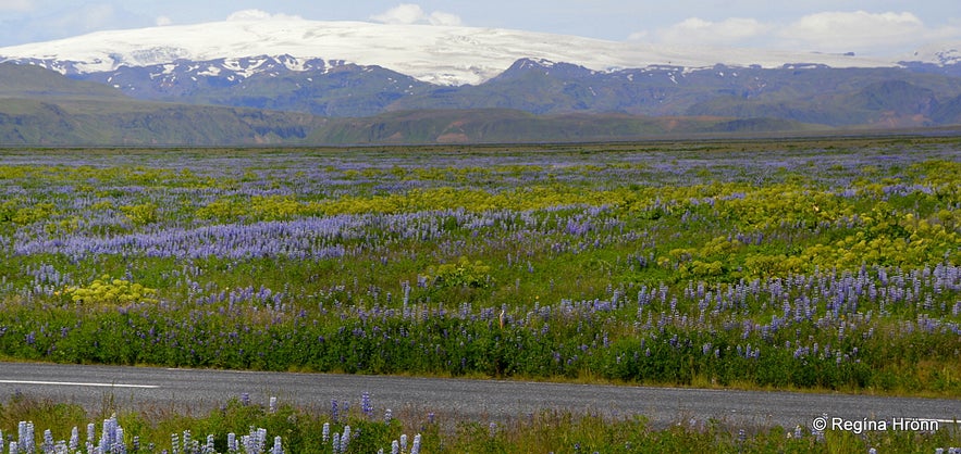
Lupines and angelica where earlier on there was just black sand
I was travelling with my girlfriend at the time and all traffic stopped, but fortunately, we could seek shelter next to a big bus. But I can tell you that we were very scared. And the paint on her car got badly damaged.
This was back in 1990 and since then the sand plains in this area have been revegetated with lupine to stop these sandstorms.
The only places where I have seen sandstorms now are further south by the sea.
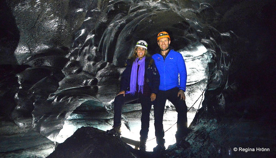 Iniside the Katla icecave
Now we are waiting for Katla to erupt again as it hasn't erupted since 1918. I hope the glacial floods won't ruin the revegetation in this area, but that is to be expected.
Kötlutangi is on the coast of South Iceland, on Mýrdalssandur beach, just east of the village of Vík. From Vík, drive along ring-road 1, then turn onto the road marked Hjörleifshöfði.
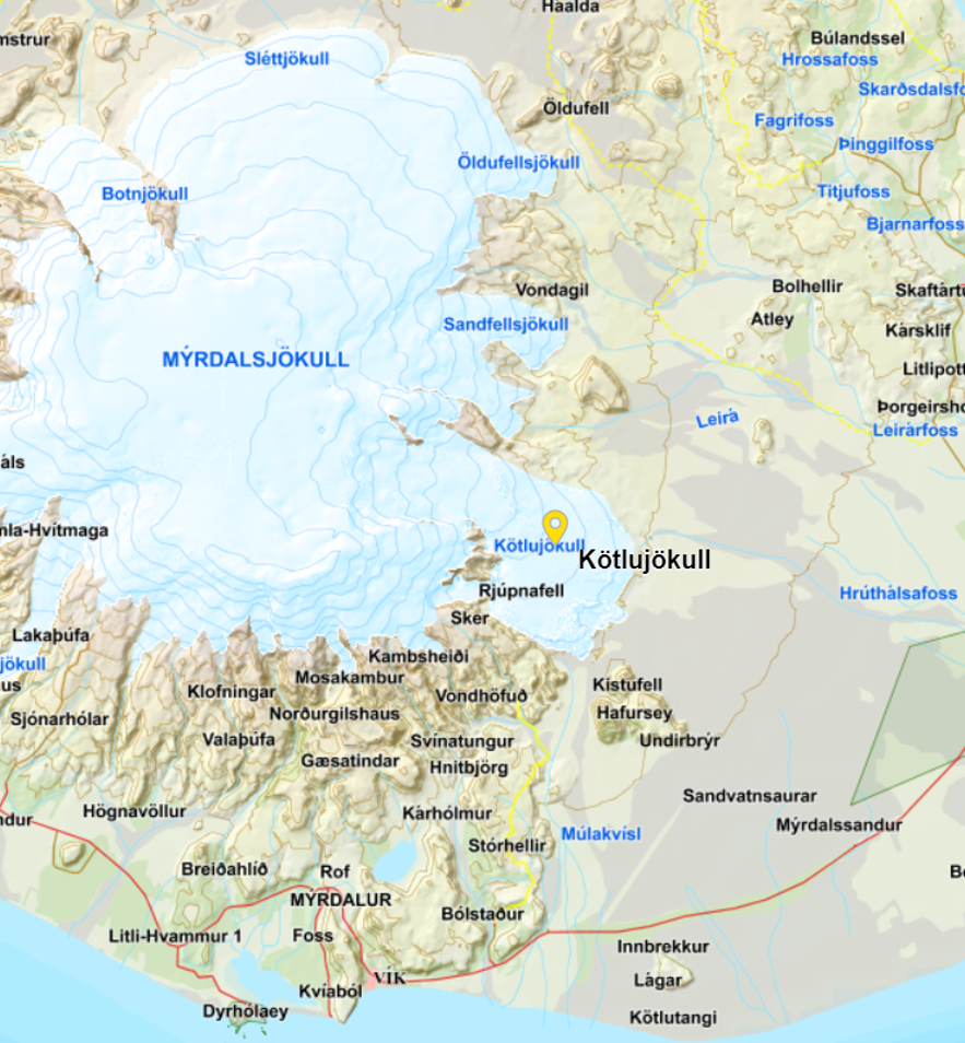
Here is the location of Kötlutangi on Google Maps. And on the map below you will see how far the glacial floods travel from the Kötlujökull glacier.
Map from the National Land Survey
This is a very popular route with lots of beautiful attractions nearby f.ex. glaciers and beautiful waterfalls:
The beautiful Waterfalls of South Iceland; Seljalandsfoss, Skógafoss & Gljúfrabúi
Glacier Hike & Ice Climbing on Sólheimajökull glacier in South Iceland
The Wreck of the Abandoned Plane on Sólheimasandur has become a Landmark in South Iceland
Have a lovely time in South Iceland, but be on the lookout for Katla!
기타 흥미로운 블로그
요쿨살론부터 비크까지, 꽃보다 청춘 5화
드디어 하늘씨과 쓰리스톤즈가 합류했는데요! 설원을 달리는 모습에 저도 아이슬란드가 엄청 그리워졌답니다. 빙하와 빛나는 요쿨살론 첫번째로 향한 요쿨살론(Jokulsarlon)은 아이슬란드의 대표적인 명소 중 하나랍니다. 영어로 Glacier lagoon 이라고도 하는데요. 방송에 나온 것처럼 눈 앞에 보이는 빙하는 빙하수가 흘러서 녹았다 얼었다를더 보기스코가포스 폭포부터 오로라까지, 꽃보다청춘 4화를 따라서
여행 5일째, 포스톤즈가 처음으로 향한 곳은 아이슬란드 남부에 있는 스코가포스 폭포(skogasfoss)입니다. 아이슬란드 남부의 대표적인 폭포 중 하나에요. 방송에서는 들르지 않았지만 스코가포스 거의 바로 옆에 위치한 셀리야란드스포스(seljalandsfoss) 폭포와 함께 같이 들르곤 한답니다. 스코가포스 폭포는 폭포의 물줄기 끝까지 올라갈 수 있단더 보기꽃청춘을 따라서
요즘 인기리에 방영되고 있는 꽃보다 청춘 아이슬란드편! 저도 매주 빼놓지 않고 시청하고 있습니다. 많은 분들께서 포스톤즈의 발랄한 매력과 아이슬란드의 놀라운 경치에 빠져드셨을 것 같습니다! 이번에는 꽃보다 청춘을 따라서 아이슬란드를 한번 가보도록 해요! 사실 아이슬란드가 한국에서 그렇게 가기 쉬운 나라는 아닙니다. 거리도 멀고 항공권도 비싸고! 우더 보기

아이슬란드 최대의 여행 마켓플레이스를 전화에 다운로드하여 전체 여행을 한 곳에서 관리하세요
전화 카메라로 이 QR 코드를 스캔하고 표시되는 링크를 누르면 아이슬란드 최대의 여행 마켓플레이스를 주머니에 넣을 수 있답니다. 다운로드 링크가 포함된 SMS 또는 이메일을 받으려면 전화번호 또는 이메일 주소를 추가하세요.

