
The Myrdalsjokull Glacier is a highlight of Iceland’s South Coast. It serves as the gateway to unforgettable adventures, including the stunning Katla Ice Cave and exhilarating glacier hiking tours on Solheimajokull, an outlet glacier of Myrdalsjokull.
Whether you're seeking raw volcanic landscapes or guided ice exploration, Myrdalsjokull offers some of Iceland’s most thrilling outdoor experiences.
Why You Can Trust Our Content
Guide to Iceland is the most trusted travel platform in Iceland, helping millions of visitors each year. All our content is written and reviewed by local experts who are deeply familiar with Iceland. You can count on us for accurate, up-to-date, and trustworthy travel advice.
Many travelers discover Myrdalsjokull as part of day trips, especially on popular South Coast tours. You can also rent a car for more flexibility and drive along Route 1, where the glacier is clearly visible north of the village of Vik. From here, you can venture closer to the glacier or join local tours to experience its stunning icy landscapes and volcanic power firsthand.
Ready to uncover the secrets of one of Iceland’s most thrilling natural wonders? Keep reading to learn everything you need to know about visiting Myrdalsjokull—glaciers, volcanoes, ice caves, and more await!
Key Takeaways about the Myrdalsjokull Glacier
-
Notable feature: Covers Katla, one of Iceland’s most famous volcanoes
-
Location: South Iceland, near the town of Vik
-
Access: You can get close to the glacier with 4x4 vehicles and guided tours
-
Activities: Glacier hiking, ice caving, snowmobiling
-
Size: Around 232 miles² (600 kilometers²)
-
Elevation: Peaks up to 4,757 feet (1,450 meters) above sea level
Physical Features of the Myrdalsjokull Glacier
 Photo by Ruslan Valeev
Myrdalsjokull is an expansive ice cap covering nearly 232 square miles (600 square kilometers) in Iceland’s southern highlands. Towering at 4,757 feet (1,450 meters) at its highest peak, this vast glacier averages 738 feet (225 meters) thick, with ice reaching depths of over 2,297 feet (700 meters) in some areas.
It feeds several outlet glaciers, including the Solheimajokull, which is a very popular location for glacier tours. This area is a favorite for guided hikes, ice climbing, and cave exploration. Every tour reveals a new side of the glacier. It’s a must-see for adventure seekers and geology lovers alike.
Myrdalsjokull Glacier sits atop the active Katla Volcano, and its surface is constantly reshaped by volcanic heat and Iceland’s extreme weather. These forces create dramatic crevasses, striking blue ice caves, and ash-streaked ridges, making it one of the most dynamic and visually stunning glaciers in the country.
Top Things To Do in Myrdalsjokull
Myrdalsjokull is one of the most accessible glaciers in Iceland for adventure seekers. From glacier hikes to ice caves and snowmobile tours, the area offers unforgettable experiences in every season. Whether you're based in Reykjavik or Vik, you'll find a wide range of glacier tours in Iceland that explore this powerful ice cap and the mighty Katla volcano beneath it.
Here are some of the best things to do in Myrdalsjokull:
-
Katla ice cave tour from Vik: Explore one of Iceland’s only natural ice cave tour available year-round. Venture into ancient volcanic ice beneath Myrdalsjokull on a guided super jeep tour.
-
Askur ice cave tour with a mountain truck at Myrdalsjokull Glacier near Vik: Reach the remote Askur ice cave with a powerful glacier truck and explore less-traveled parts of Myrdalsjokull in style.
-
Glacier snowmobiling tour on Myrdalsjokull Glacier near Vik: Perfect for thrill-seekers, this guided ride lets you zoom across icy plains with views of volcanoes and distant coastlines.
-
ATV tour to the plane wreck on the South Coast from Myrdalsjokull Glacier: Ride across volcanic black sand with glacier views to the DC-3 Plane Wreck with this adrenaline-filled ATV tour.
Top South Coast Self-Drive Tours
 Exploring Iceland’s South Coast through self-drive tours offers the freedom to visit iconic landmarks and uncover hidden gems at your own pace, including the Myrdalsjokull Glacier. These tours are perfect for travelers who value flexibility, comfort, and adventure without the constraints of a group itinerary.
Here are some of the best South Coast self-drive options that include stops near Myrdalsjokull Glacier:
-
7-day northern lights self-drive tour of South Iceland, the Golden Circle & Snaefellsnes Peninsula: Chase the aurora along Iceland’s South Coast while visiting waterfalls, glaciers, and black sand beaches. A winter favorite for scenic drives and northern lights photography.
-
10-day self-drive tour of the complete Ring Road of Iceland with top attractions & Snaefellsnes: Circle the entire country, including the South Coast and Myrdalsjokull region. Ideal for travelers wanting to explore Iceland’s diverse landscapes in depth.
-
1-week summer self-drive tour of the Ring Road of Iceland & Golden Circle: A perfect balance of adventure and sightseeing. This route includes the South Coast, Myrdalsjokull, the East Fjords, and the Golden Circle.
Katla Volcano and Eruptions Beneath Myrdalsjokull
 Myrdalsjokull sits atop Katla, one of Iceland’s most active and explosive volcanoes. Katla erupts every few decades. Its last eruption was in 1918. These eruptions rapidly melt glacier ice, causing dangerous floods known internationally by the Icelandic name jökulhlaups. These floods have reshaped the landscape and disrupted local communities.
Katla is currently dormant but is closely monitored by scientists due to its unpredictability. When Katla erupts, it can cause massive flooding and ashfall. These eruptions also change the glacier’s structure. This powerful mix of ice and fire makes Myrdalsjokull a unique natural wonder.
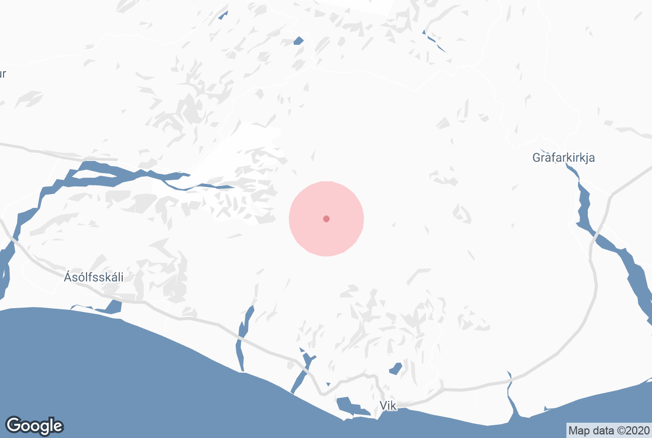
Where is the Myrdalsjokull Glacier Located?
 Situated in southern Iceland, Myrdalsjokull lies just north of Vik, Iceland’s southernmost village on Route 1 (Ring Road). The glacier dominates the skyline and is part of the larger volcanic and glacial landscape that defines Iceland’s south coast. The surrounding area includes other natural landmarks such as Eyjafjallajokull Volcano and the scenic Thorsmork valley.
How Can I Get To Myrdalsjokull?
 Getting to Myrdalsjokull Glacier is an adventure in itself, whether you’re driving at your own pace or joining a guided tour. Located just north of the village of Vik, the glacier is accessible via the famous Ring Road and nearby rugged mountain roads.
Although you can drive to the area, it's important to never venture onto the glacier without a qualified guide familiar with the terrain, as it can be extremely dangerous.
Here’s how you can reach this stunning natural wonder safely and conveniently.
Visiting Myrdalsjokull Glacier From Reykjavik:
-
From Reykjavik, drive southeast along Route 1 (the Ring Road) for about 118 miles (190 km), approximately 2.5-3 hours, towards Vik.
-
From Vik, Myrdalsjokull can be seen directly to the north. To get close to the glacier itself, you’ll need a 4x4 vehicle to navigate the rough gravel roads, or better yet, join Vik tours that include transport.
Visiting Myrdalsjokull Glacier From Vik:
-
The glacier is about 18 miles north of Vik (30 kilometers).
-
Taking Route 1 east from Vik, turn onto gravel F-roads (such as F210 or F249) that lead closer to the glacier’s edges, though these roads are only suitable for super jeep tours or experienced 4x4 drivers in the summer months.
-
Many visitors choose to join a tour from Vik for safety and convenience, especially since F-roads in Iceland can be challenging and sometimes closed due to weather.
Where To Stay Near Myrdalsjokull Glacier
 Visitors often base themselves in Vik, which offers a range of accommodations from guesthouses and hotels to hostels. Staying in Vik provides easy access to the glacier tours, great South Coast restaurants, and other natural attractions nearby.
Popular places to stay include:
-
Hotel Katla by Keahotels: Located about 3 miles (5 km) east of Vik, Hotel Katla offers spacious rooms, an outdoor hot tub, sauna, and beautiful glacier views. It’s a popular base for glacier hikes and snowmobiling tours on Myrdalsjokull.
-
Hotel Vik i Myrdal: Centrally located in Vik, this modern hotel features comfortable rooms, excellent views, and easy access to attractions like Reynisfjara and Myrdalsjokull Glacier.
-
Black Beach Suites: Just outside Vik, these stylish apartments feature private patios, kitchenettes, and sweeping views—perfect for travelers seeking comfort and independence near the glacier.
Attractions Near Myrdalsjokull Glacier
 The area surrounding Myrdalsjokull is packed with stunning natural attractions that showcase Iceland’s dramatic landscapes. Whether you're into hiking, geology, or coastal scenery, these nearby sites are perfect additions to your South Coast itinerary.
-
Solheimajokull Glacier: An easily accessible outlet of Myrdalsjokull, Solheimajokull is one of the top spots in Iceland for glacier hiking and ice climbing. Its crevassed surface and ice formations offer unforgettable adventure experiences with expert guides.
-
Eyjafjallajokull Volcano: This glacier-capped volcano gained global attention during its 2010 eruption, which disrupted air travel across Europe. Today, it stands as a striking landmark and reminder of Iceland’s volatile geology.
-
Thorsmork Valley: Nestled between Myrdalsjokull, Eyjafjallajokull, and Tindfjallajokull glaciers, Thorsmork is a lush, green valley with rivers, birch forests, and world-class hiking trails. It’s a must-visit for nature lovers and trekking enthusiasts, and it’s a popular location for guided hiking tours.
-
Reynisfjara Black Sand Beach: Located just south of Vik, Reynisfjara is famous for its dramatic black sand, towering basalt columns, and the sea stacks of Reynisdrangar. A breathtaking coastal stop just a short drive from the glacier.
Final Thoughts
 Myrdalsjokull is a truly remarkable natural wonder where the forces of ice and fire collide. Whether you’re drawn by the thrill of glacier hiking, the mystery of Katla’s volcanic power, or the breathtaking landscapes of South Iceland, this glacier offers an unforgettable experience. For a safe and rewarding visit, plan ahead, join guided tours, and be prepared for the dynamic Icelandic weather.


